Australian Satellite/Lightning

Australia Satellite Notes
Cloud over northern NSW and southern QLD in a trough is triggering showers and storms. Cloud stretching over WA, SA and the NT with a separate trough is generating areas of light rain. Cloud over the NT's Top End in a region of low pressure is producing the odd thundery shower.
About Weatherzone Satellite
The colours and symbols used on the radar and satellite maps are described on our legend page. View legend »
-
Display your Local Weather here
automatically each time you visit us:
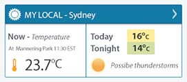
Rotates through Temperature,
Wind, Humidity and RainUse the Search Bar above
to find your Local, and go to the Local page
Click "Set My Local"
button next to the location name


Weather News
Smashing avocados and Lego: Townsville Cyclone Testing Station puts household objects to the test
14:02 EDT
Researchers at a Cyclone Testing Station in north Queensland have been busy creating smashed avocado, and it is not the type that goes on toast.
Flooding lingers in NSW
12:00 EDT
Parts of western and southern New South Wales are still underwater, despite rain easing across most of the state in recent weeks.
Flooding Murray River forces houseboats to the Darling
07:41 EDT
Mildura houseboat operators are moving their fleets off the Murray River to the Darling River because of rising water levels, faster flows, and increased debris.