E-nav – the race is on.
GPS has held pole position but this may change…
GPS is now the bread and butter of positioning systems. However, it is about to face some stiff competition as new Global Navigational Satellite Systems (GNSS) emerge on the horizon.
We tend to think that electronic positioning is new, but in fact it has been around for years.
Before we look to the future let's ‘re-position' ourselves in the not-too distant past and take a look at e-nav over the last few decades.
Looking back
Radio Direction Finders (RDF) were the norm 30 - 40 years ago. They tuned into a Morse signal coming from a charted radio transmitter to get an electronic bearing line. With luck, you'd get two or more transmitters for a fix or just the one position line to clarify an EP.
VHF radio lighthouses around the coast emitted a series of beeps on a VHF channel. The number of beeps received denoted the tabulated lighthouse bearing to plot.
Decca and Loran revolutionised position fixing as the position was given in latitude and longitude on small boats. Decca was first used at the end of World War II and survived until the mid-1990s. It used a chain of land based stations to construct a position. Accuracy was predicted at 50-250m during the day and 200–1000m at night.
For offshore boaters, if funds allowed, early Satnav using the TRANSIT system, worked with only a handful of satellites to give a fix every couple of hours – if you were lucky...
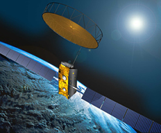
Today's NAVSTAR GPS is run by NASA and emerged in the late 1980s. Originally, positional accuracy was downgraded for civilian use to about 100m. On the 1st May 2000 however, US President Clinton ordered the cessation of this downgrading allowing GPS to fulfil its 5-15m accuracy promise.
The race is on
GPS has held pole position but this may change as there are a host of other GNSS providers jockeying for position.
Global Navigation Satellite System (GLONASS)
GLONASS is the Russian navigation satellite system. First started in the early 1980s it fell into difficulty during the 1990s due to lack of funds. However, in 2000, Vladimir Putin made GLONASS the country's top priority and there are now 23 satellites operational, with the final one planned for this year (2011).
European Satellite Navigation System (GALILEO)
GALILEO is run by the European Space Agency for the European Commission. Intended to be Europe's worldwide system it has been slow to gain momentum. This year the first two operational satellite launches are planned, to be followed by an operational system of thirty satellites by 2014.
COMPASS/BeiDou
Chinas COMPASS/BeiDou System comprises of five geostationary and 30 orbiting satellites. Eight satellites have been launched with a further eight planned before the end of 2012 to give Asia Pacific coverage. Future planned launches will take it to global coverage.
Global Indian Navigation System (GINS)
The Indian Government is planning seven satellites by 2014 to establish a regional navigational system. The plan is to then increase the number to 30 and roll it out as the Global Indian Navigation System.
GNSS Compatibility
There are some differences in GNSS signals, but the key players are working towards interoperability, so a receiver picks up all signals and chooses the best. There are already receiver chipsets are on the market which they claim are GPS, Galileo, COMPASS and GLONASS compatible.
So there are interesting times ahead. Next month we'll see if all these GNSS systems bring benefits or problems and what else is on the positioning horizon.
Simon Jinks, RYA Yachtmaster Examiner and journalist
Contact UsArticle Published: July 05, 2011 13:03
Article Updated: July 07, 2011 11:30