Imray
Imray C1 Thames Estuary Chart
Imray C charts offer coverage for cruising yachtsmen on larger size sheets. They are suitable for offshore passage making and the medium scales chosen also allow safe inshore navigation. Tilbury to North Foreland and Orfordness. (This chart includes the New Sunk TSS off Harwich)
Imray C10 Western English Channel
Imray C charts offer coverage for cruising yachtsmen on larger size sheets. They are suitable for offshore passage making and the medium scales chosen also allow safe inshore navigation.
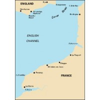
Imray C12 Eastern English Channel
Imray C charts offer coverage for cruising yachtsmen on larger size sheets. They are suitable for offshore passage making and the medium scales chosen also allow safe inshore navigation. Passage Chart. Inset: Dover Strait. Radiobeacons, Lights, Tides
Imray C2 The River Thames Chart
Imray C charts offer coverage for cruising yachtsmen on larger size sheets. They are suitable for offshore passage making and the medium scales chosen also allow safe inshore navigation. Teddington to Southend in three panels. Teddington to Vauxhall 1:13,600. Vauxhall to Barking 1:15,200. Barking to Southend 1:40,400. Plans St Katherine Haven, South Dock Marina, Limehouse Basin, Gallions Point...
Imray C28 Harwich to Wells-next-the-Sea
Imray C charts offer coverage for cruising yachtsmen on larger size sheets. They are suitable for offshore passage making and the medium scales chosen also allow safe inshore navigation. Plans River Deben, Rivers Ore and Alde, Southwold Harbour, Lowestoft Harbour, Lowestoft Approaches, Great Yarmouth Haven, Blakeney Harbour, Wells-next-the-Sea
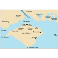
Imray C3 Isle of Wight Chart
Imray C charts offer coverage for cruising yachtsmen on larger size sheets. They are suitable for offshore passage making and the medium scales chosen also allow safe inshore navigation. Covers the Isle of Wight and Solent. Plans: Continuation of Southampton Water, River Hamble, Lymington River, Bembridge Harbour
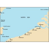
Imray C30 Harwich to Hoek van Holland and Dover Strait
Imray C charts offer coverage for cruising yachtsmen on larger size sheets. They are suitable for offshore passage making and the medium scales chosen also allow safe inshore navigation. Plans included: Dunkerque Oostende Zeebrugge Vlissingen Nieuwpoort Breskens Blankenberge NEW EDITION FOR 2008 Includes the Maas, N Hinder & Sandettie Bank TSS revisions, as well as the latest...
Imray C31 Dover Strait to Le Havre
Imray C charts offer coverage for cruising yachtsmen on larger size sheets. They are suitable for offshore passage making and the medium scales chosen also allow safe inshore navigation. Plans Dieppe, Fécamp, St-Valéry en Caux, Le Havre Yacht Harbour, Approaches to Le Havre and River Seine, Le Tréport, Boulogne-sur-Mer, Sovereign Harbour.
Imray C32 Baie de Seine
Imray C charts offer coverage for cruising yachtsmen on larger size sheets. They are suitable for offshore passage making and the medium scales chosen also allow safe inshore navigation. C32 Baie de Seine 1:155,000 WGS 84 By: Imray Le Havre to Cherbourg Plans Ouistreham, Cherbourg, St-Vaast-la-Hougue, Courseulles-sur-Mer, Port-en-Bessin, Trouville/Deauville, Barfleur, Baie du Grand Vey,...
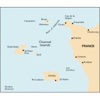
Imray C33A Channel Islands (North)
Imray C charts offer coverage for cruising yachtsmen on larger size sheets. They are suitable for offshore passage making and the medium scales chosen also allow safe inshore navigation. C33A Channel Islands (North) 1:120,000 WGS 84 By: Imray Plans St Peter Port, Beaucette Marina, St Sampson Harbour, Alderney Harbour, Omonville, Goury, Dielette, Carteret, Portbail, Creux Harbour Approaches,...
Imray C33B Channel Islands (South)
Imray C charts offer coverage for cruising yachtsmen on larger size sheets. They are suitable for offshore passage making and the medium scales chosen also allow safe inshore navigation. C33B Channel Islands (South) 1:120,000 WGS 84 By: Imray Plans St Helier Approaches, St Helier Harbour, St Malo Approaches, St-Malo, Granville, Erquy, Dahout, Binic, St-Quay-Portrieux, Port du Legue
Imray C34 Cap d'Erquy to Ile de Batz
Imray C charts offer coverage for cruising yachtsmen on larger size sheets. They are suitable for offshore passage making and the medium scales chosen also allow safe inshore navigation. C34 Cap d'Erquy to Ile de Batz 1:110,000 WGS 84 By: Imray Plans Primel, R. Le Leguer, Trebeurden, Ploumanac'h, Anse de Perros, Perros-Guirec, Port Blanc, R. de Treguier, R. de Trieux and Paimpol, Lezardrieux,...
Imray C35 Baie de Morlaix to L'Aber-Ildut
Imray C charts offer coverage for cruising yachtsmen on larger size sheets. They are suitable for offshore passage making and the medium scales chosen also allow safe inshore navigation. C35 Baie de Morlaix to L'Aber-Ildut 1:75,000 WGS 84 By: Imray Plans included: L'Aber-Ildut Argenton Portsall Approaches to L'Aber Wrac'h and L'Aber Benoit Port du Pontusval Mogueriec Roscoff...
Imray C4 Needles Channel to Bill of Portland
Imray C charts offer coverage for cruising yachtsmen on larger size sheets. They are suitable for offshore passage making and the medium scales chosen also allow safe inshore navigation. Plans Weymouth Harbour, Lulworth Cove, Worbarrow Bay, Swanage, Studland Bay, Christchurch, River Stour
Imray C5 Bill of Portland to Salcombe Harbour Chart
Imray C charts offer coverage for cruising yachtsmen on larger size sheets. They are suitable for offshore passage making and the medium scales chosen also allow safe inshore navigation. Plans include: Bridport Harbour Lyme Regis Exmouth Tor Bay Teignmouth Harbour Torquay Harbour Brixham Harbour Dartmouth
Imray C51 Cardigan Bay
Imray C charts offer coverage for cruising yachtsmen on larger size sheets. They are suitable for offshore passage making and the medium scales chosen also allow safe inshore navigation. C51 Cardigan Bay 1:140,800 WGS 84 By: Imray Milford Haven to Tremadoc Bay Plans Pwllheli, Aberdovey, Fishguard, Aberystwyth, Cardigan, Aberaeron, New Quay Bay, Newport Bay, Aberporth, Milford Haven Entrance....
Imray C58 Trevose Head to Bull Point
Imray C charts offer coverage for cruising yachtsmen on larger size sheets. They are suitable for offshore passage making and the medium scales chosen also allow safe inshore navigation. C58 Trevose Head to Bull Point 1:131,300 WGS 84 By: Imray Plans include Barnstaple and Bideford, River Camel, Ilfracombe, Bude Haven, Port Isaac & Port Gaverne, Lundy, Padstow Harbour 2013 EDITION - Fully...
Imray C59 Bristol Channel
Imray C charts offer coverage for cruising yachtsmen on larger size sheets. They are suitable for offshore passage making and the medium scales chosen also allow safe inshore navigation. C59 Bristol Channel 1:115,000 WGS 84 By: Imray Worms Head and Bull Point to Sharpness Plans Porthcawl, The Mumbles, Avonmouth, Bridgwater Bay & Burnham-on-Sea, Watchet, Minehead, Swansea Marina, Penarth...
Imray C6 Salcombe to Lizard Point
Imray C charts offer coverage for cruising yachtsmen on larger size sheets. They are suitable for offshore passage making and the medium scales chosen also allow safe inshore navigation. Plans: Plymouth Sound, Salcombe, Looe, Fowey Harbour & Approaches, Charlestown Harbour, Mevagissey Harbour, Polperro Harbour, Falmouth Harbour
Imray C60 Gower Peninsula to Cardigan
Imray C charts offer coverage for cruising yachtsmen on larger size sheets. They are suitable for offshore passage making and the medium scales chosen also allow safe inshore navigation. C60 Gower Peninsula to Cardigan 1:130,000 WGS 84 By: Imray Plans Jack Sound, Milford Haven, Ramsey Sound, Tenby & Caldey Islands, Fishguard, Broad Haven and Little Haven, Solva Harbour and Approaches. ...
Imray C7 Falmouth to Isles of Scilly & Trevose Head
Imray C charts offer coverage for cruising yachtsmen on larger size sheets. They are suitable for offshore passage making and the medium scales chosen also allow safe inshore navigation. NEW EDITION - Coverage has been extended eastwards to include Trevose Head on the north coast of Cornwall. Plans : Newquay Bay St Mary's Road Saint Ives Mousehole Penzance Newlyn Harbour Porthleven...
Imray C8 Dover Strait Chart
Imray C charts offer coverage for cruising yachtsmen on larger size sheets. They are suitable for offshore passage making and the medium scales chosen also allow safe inshore navigation. North Foreland to Beachy Head and Boulogne Plans Pegwell Bay, Sovereign Harbour, Ramsgate, Dover, Folkestone, Rye Harbour, Calais, Boulogne-sur-Mer.
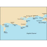
Imray C9 Beachy Head to Isle of Wight
Imray C charts offer coverage for cruising yachtsmen on larger size sheets. They are suitable for offshore passage making and the medium scales chosen also allow safe inshore navigation. Plans Newhaven, Shoreham, Littlehampton, Brighton Marina, Portsmouth, Langstone and Chichester Harbours, Sovereign Harbour
Imray Digital Chart ID40 - Atlantic France & Iberia
Imray Digital Chart ID40 - Atlantic France & Iberia By: Imray This digital chart covers the following chart areas: C6, C7, C18, C19, C35, C36, C37, C38, C39, C40, C41, C48, C49, C50, 2400.6, 2400.11, 2400.12, 2400.13. Imray Digital Charts feature: High resolution images of Imray charts. Full chart plotting software allows route planning using waypoints interfaced with GPS. Clear and simple...
Imray Meridian Digital Chart ID10 - North Sea - South and East
Meridian Digital Chart Pack ID10 folio covers the North Sea - South and East.It includesCharts Charts C1, C8, C23, C24, C25, C26, C27, C28, C29,C30, C68, Y9, Y16, Y17, Y18, 2000.3, 2000.6, 2000.7, 2100.2, 2100.4, 2100.6Chart plotter for both passage planning and navigation12 months subscription to the Meridian Chartware Update Service12 months tidal data including ports and streamsEuropean wreck database12...
Imray Meridian Digital Chart ID20 - English Channel
Meridian Digital Chart Pack ID20 folio covers the English ChannelIt includesCharts C1, C3, C4, C5, C6, C7, C8, C9, C10, C12, C15, C31, C32, C33A, C33B, C34, C35, C36, Y23, 2200.4, 2200.5, 2400.6, 2400.11, 2400.12, 2400.13Chart plotter for both passage planning and navigation12 months subscription to the Meridian Chartware Update Service12 months tidal data including ports and streamsEuropean wreck...
Imray Meridian Digital Chart ID30 - West Coast of Britain and Ireland
Meridian Digital Chart Pack ID30 folio covers the West Coast of Britain and IrelandIt includesCharts C6, C7, C51, C52, C53, C54, C55, C56, C57, C58, C59, C60, C61, C62, C63, C64, C65, C66, C67, C68, C69, C180, Y70, 2400.6, 2400.11, 2400.12, 2400.13,2800.2, 2800.3, 2800.4, 2800.5, 2800.6, 2800.7, 2900.2, 2900.3, 2900.4, 2900.5.Chart plotter for both passage planning and navigation12 months subscription...
Imray The Cruising Almanac 2014
The Cruising Almanac is an annual publication. Compiled by The Cruising Association and Imray, it covers Northwest Europe from the Shetlands and southern Norway to Gibraltar and West Ireland to the Baltic. In this edition the fully revised and correcte
Imray Navigators Logbook
A replaceable rule pad, landscape format 250 x 150mm in hard plastic covered covers with brass screw binding and pencil.
Imray Refills for Log Book
Refill pad for the Imray Navigators log book - 50 pages
Costas del Sol and Blanca
This new edition of the RCC PF's well known guide to the long Spanish Mediterranean coast between Gibraltar and Denia has been compiled by Graham Hutt who suceeds John Marchment as editor. This is an important pilot for yachts coming to and from Northwest Europe and the Atlantic from the Balearic Islands and more distant parts of the Mediterranean. The clear sailing directions provide all the essential...
Hidden Harbours of Southwest Britain
Author: Dag Pike Publisher: Imray Format: Full colour, 250mm x 210mm, PB 80 pp A tour of over 30 minor harbours around the southwest coasts of the British Isles. Illustrated with evocative colour photography, Dag Pike’s narrative brings to life a contrasting collection of small historic harbours which although infrequently visited have a fascinating story to tell. Full colour. 250mm x 210mm....
Imray Crossing the Thames Estuary
Crossing the Thames Estuary by Roger Gaspar A new and indispensable companion for planning Thames Estuary passages. This set of tables enables navigators to select the best routes according to tide times. A set of tide tables, Imray charts, East Coast Pil
Imray Cruising Guide to the Netherlands 5th Edition
Cruising Guide to the Netherlands
Brian Navin
This is the fifth editon of 'Cruising Guide to the Netherlands' which was first published in 1988. It is regarded as the authoritative companion for anyone cruising the Netherlands using fixed mast routes. Brian Navin's guide is based on popular selected routes which offer an opportunity to visit most of the regions of the Netherlands from the estuary...
Imray East Coast Pilot - Lowestoft - Ramsgate
East Coast Pilot - Lowestoft - Ramsgate Since its launch East Coast Pilot has become the most popular pilot book for the creeks, harbours and rivers between Lowestoft and Ramsgate, providing clear and concise sailing directions for visitors and regular East Coast cruising yachtsmen alike. For clarity and ease of reference, the pilotage information is arranged in sequence on double page spreads to...
Imray Greek Waters Pilot
A yachtsman's guide to the Ionian and Aegean coasts and islands of Greece Greek Waters Pilot is the definitive cruising guide to the coasts and islands of Greece. It covers the entire area from the Ionian Islands to the Aegean, Rhodes and Crete and includes details of over 450 harbours in a single volume. Greek Waters Pilot has been painstakingly compiled from the author’s own survey work and the...
Imray Islas Baleares - Mediterranean Spain 9th Edition
The third book in the Mediterranean Spain series, this is to the same format - full colour throughout, detailed port plans of every deserving harbour and superb aerial photographs in support. This is the only fully comprehensive pilot guide in English to Spain's Balearic Islands. this new edition of Islas Baleares - Ibiza, Formentera, Mallorca, Cabrera and Menorca - has been thoroughly revised...
Imray Mediterranean France and Corsica Pilot
This is a comprehensive companion to the long coastline that ranges from Spain and the edge of the Pyrenees to the Alpes Maritimes and Italy. It covers the flat country of Languedoc-Roussillon, the coast of the Golfe du Lion, the Rhône delta and the Ca
Imray Mediterranean Spain Costas Del Azahar Dorada & Brava
This 6th edition of 'Mediterranean Spain - Costas del Azahar, Dorada and Brava' has been updated. Whilst developments since the last edition have generally been minor, there have been changes throughout the text and plans. Here and there new photographs have been added and amongst the plans which have been updated are Valencia, Castellon and Barcelona'Costas del Azahar, Dorada and Brava' remains the...
Imray Shell Channel Pilot 7th Edition
The Shell Channel Pilot remains the ultimate authority on cruising both sides of the English Channel. Ever since the 1930s, when Adlard Coles published the original version, this seminal work has been steadily upgraded and updated. The three compilers who
Imray The River Thames Book
The River Thames Book
Including the River Wey, Basingstoke Canal and Kennet and Avon Canal
by Chris Cove-Smith
'The River Thames Book', now in its fifth edition, is the best-selling guide to the non-tidal Thames from Teddington to it's source in Gloucestershire. This complete guide covers the Barrier to Cricklade with the River Wey, Basingstoke Canal and the Kennet & Avon Canal to Great Bedwyn....
Imray West Aegean
West Aegean
by Rod Heikell Ed
Rod Heikell's 'West Aegean' is a cruising guide to the Attic coast, Eastern Peloponnese, Western Cyclades and Northern Sporades. It is the ideal companion for charterers and flotilla sailors providing not only clear pilotage but also background information on visiting Greece, notes on history, food and wine and places to visit on the coast and inland.
It runs...
Inland Waterways of France
The standard guide to the French canals and navigable rivers includes maps and distance tables for each waterway, giving the user a general view of the geography of each waterway as well as a detailed cockpit reference. The introduction forms a comprehensive general guide to the French waterways, including distances and overall dimensions, formalities, navigation regulations and up-to-date list of...
Inland Waterways of Great Britain 8TH Edition
The standard reference to the waterways of England, Wales and Scotland has been completely revised. The 8th edition retains the format of previous editions but, throughout, details are updated and the work has been widened in its scope to appeal not only to navigators but to all users of the waterways. Full colour througout.
Map of the Inland Waterways of Great Britain
The revised edition covers changes to the restored Droitwich Canal, Fenland waterways, Norfolk Broads and the Wey and Arun Canal which is undergoing restoration. The inset plan of the London area has been extended eastwards to show the location of the Olympic Park and rivers around it.
North Sea Passage Pilot
The author's well established guide to the East Coast of England from Great Yarmouth to Dover and corresponding continental coasts between Calais and Den Helder has undergone a major revision for this sixth edition. Throughout, the text and charts have been fully updated. This new edition records many changes and provides details of the extensive new wind farms in the Thames Estuary, and amended traffic...
South Biscay
This seventh edition of the RCC's South Biscay pilot covers the coasts of France and Spain from the Gironde to A Coruña in Galicia. This edition has been completely revised and updated. In line with other recent RCC editions, waypoints have been introduced to assist navigation. With new photographs by the author and up-to-date aerials by Patrick Roach, South Biscay is the complete reference for...
The Shell Channel Pilot
When all the websites and the almanacs have come and gone, The Shell Channel Pilot remains the ultimate authority on cruising both sides of the English Channel. Ever since the 1930s, when Adlard Coles published the original version, this seminal work has been steadily upgraded and updated. The three compilers who have looked after it since its inception have never tired. Under the Imray / Cunliffe...


