|
Question
|
Answer
|
|
Where do I get iNavX™?
|
iNavX in the iTunes App Store
|
|
Is there a charge for the NOAA US waters marine charts?
|
No.
|
|
Is there a charge for the marine charts and maps from X-Traverse?
|
Yes. Visit x-traverse for more details.
Note: In addition to being able to using charts and maps from X-Traverse with iNavX, most may also be used with Fugawi or MacENC or GPSNavX charting software.
|
|
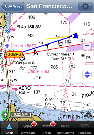
What areas do the marine charts and maps include?
|
iNavX™ provides access to the largest chart and map library.
Chart and Map Coverage.
|
|
Are the marine charts and maps the latest editions?
|
Yes since they download directly from an official chart server.
They can be updated at any time. X-Traverse users will be notified of any chart updates. |
|
Where can I learn more information about the NOAA US waters marine charts?
|
Here.
|
|
Are the marine charts and maps stored locally on my device?
|
Yes.
This means once they are downloaded an internet connection is not needed to use the charts or maps. |
|
How much storage space do the marine charts and maps take?
|
Depends on how many charts and maps have been downloaded. Individual charts and maps can be deleted. Typical chart or map takes under 1 MB of storage.
|
|
Does iNavX™ need a cell or wifi internet connection to use the marine charts or maps? |
No. Only an internet connection is needed to download selected charts and maps. Once charts and maps are downloaded they can be used at anytime regardless of internet connectivity. Note: The charts do not expire and can be used indefinitely.
|
| What devices is iNavX™compatible with? |
| |
Location Services
|
Compass |
High Resolution Retina Display |
Fast App Switching & Background Track Recording |
Printing |
Video Mirroring |
| Compatible Device |
|
|
|
|
|
|
|
|
| iPhone 3GS |
|
|
|
|
|
|
|
|
| iPhone 4 |
|
|
|
|
|
|
|
|
| iPhone 4S |
|
|
|
|
|
|
|
|
| iPhone 5 |
|
|
|
|
|
|
|
|
| iPad |
|
|
|
|
|
|
|
|
| iPad 3G |
|
|
|
|
|
|
|
|
| iPad 2 |
|
|
|
|
|
|
|
|
| iPad 2 3G |
|
|
|
|
|
|
|
|
| iPad HD |
|
|
|
|
|
|
|
|
| iPad HD 4G |
|
|
|
|
|
|
|
|
| iPad Mini |
|
|
|
|
|
|
|
|
| iPad Mini 3G |
|
|
|
|
|
|
|
|
| iPod touch |
|
|
|
|
|
|
|
|
| |
 Indicates compatibility Indicates compatibility |
|
|
Does iNavX™ support the device compass?
|
Yes. The compass will be used to orient the position icon on the chart including course up, the compass banner and the "HDG:" in the Instruments view.
Course over ground can also be used. |
| I have more than one device, can iNavX™ be installed on all devices? |
Yes. When you sync any device with your PC or Mac, all apps purchased from the iTunes app store will be installed. This means you purchase an app once and install on all your devices. |
Does iNavX™ support external GPS receivers for devices without a built in GPS?
|
|
|
What version of the iOS does iNavX™ require? |
iOS 4.3 or later |
|
Does iNavX™ work in places there is not marine chart or map coverage?
|
Yes. There is a basic low scale world chart included and the instrument and waypoints functionality is not dependent on available or loaded charts.
|
|
Does iNavX™ work with the NOAA ENC vector charts?
|
No. The NOAA ENC vector chart coverage is incomplete and the NOAA ENC vector charts do not have the look of traditional paper charts. More Info.
|
|
I have charts on my PC or Mac, can I use those with iNavX™?
|
No. iNavX™ downloads charts directly from a chart server, however many of the charts and maps available at x-traverse can also be used on a PC or Mac.
|
|
What is the current version of iNavX™?
|
3.6.7 |
|
How much are iNavX™ updates?
|
No additional charge and all iNavX™ updates will arrive via the Apple iPhone app store. On the device, Select "App Store", then select "Updates".
|
|
How does iNavX™ compare with the MacENC or GPSNavX feature set?
|
Comparison Table.
|
| Does iNavX have analog graphics for instrument data? |
Yes, tap on any instrument value and an analog graphic is available (speed, course, wind, satellites, route, depth).
|
|
Does iNavX™ support AIS receivers and transponders?
Does iNavX™ support NMEA data? |
Yes via TCP/IP. Targets are plotted on the chart with real-world scaling. An AIS Transponder can be used to provide own position, speed and course to iNavX™. SART and NavAids are supported.
|
| I don't have an AIS receiver or transponder, is there another way to get AIS data into iNavX? |
Yes, in selected locals the SiiTech AIS server can be used. The SiiTech AIS server provides AIS targets within 30 NM of device position or any selected waypoint. More details |
|
I have waypoints, routes, or tracks, how do I transfer those to/from iNavX™?
|
iNavX™ can import and export waypoints, routes and tracks via x-traverse
iNavX™ can import and export waypoints, routes and tracks via email. This includes sending to MotionX and Google Earth apps.
iNavX™ can import and export waypoints, routes and tracks via iTunes. |
|
Can I upload my track to Google Earth?
|
iNavX™ can export the track via x-traverse or via email
|
|
Can I share my track and waypoints with Facebook?
|
iNavX™ can export the track and waypoints via x-traverse and share them on Facebook
|
|
Does iNavX™ support GRIB weather forecasts?
|
| iNavX™ can import and display GRIBs via: |
|
Wind, Pressure, Wave Height, Current, Precipitation Rate and Air/Sea Temperature forecasts are available. Both GFS and high resolution COAMPS models available.
iNavX™ supports high resolution weather from Theyr via x-traverse
Wind, Pressure, Wave Height, Current, Precipitation Rate and Air/Sea Temperature forecasts are available. |
| Is there a Full Screen mode in iNavX™? |
Yes, with the tap of the screen the chart can be expanded to fill the entire view.
|
|
What measurement units does iNavX™ support?
|
Nautical miles, statute miles, kilometers, yards, and meters, true and magnetic bearings, degrees and fractional minutes and degrees minutes and seconds. All distance and bearing measurements are computed using Great Circle routing.
|
|
Is there a user's guide for iNavX™?
|
Yes. Guide
|
| Is there a tutorial for iNavX™? |
Yes. Tutorial |
| Is there a user's forum for iNavX™? |
Yes. Forum |
|
Is there a trial or demo version of iNavX™?
|
No. Apple's official policy is not to allow trial or demo versions of apps.
|
| Does iNavX™ include any AdWare? |
No. It is our policy not to include any advertisements in our software. |
|
What languages is iNavX™ localized in?
|
English, Dutch, French, German, Italian, Spanish, Swedish
|