
Your web browser is no longer supported. To improve your experience update it here
Australian weather forecast
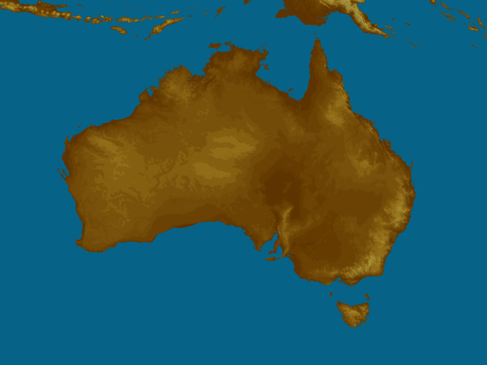
National weather
Rain Radar map
12:45 AEST12:50 AEST12:55 AEST13:00 AEST13:05 AEST13:10 AEST13:15 AEST

Weather Satellite
11:50 AEST12:00 AEST12:10 AEST12:20 AEST12:30 AEST12:50 AEST13:00 AEST


Synoptic weather chart
View national synoptic
Saturday 01:05 EST
Humid easterly winds will persist & be unstable over eastern states, causing rain & storms, heaviest over NSW, mainly the SE. Showers & storms over SW WA's will clear early as a front slips south. Moist onshore winds & showers about the QLD coast & the NT's far northeast.
Issued Friday 02:05 EST
Weather warnings
Moderate Flood Warning For The Eyre Creek
Australian Government Bureau of Meteorology, Queensland Moderate Flood Warning For The Eyre Creek Issued at 12:44 PM EST on Friday 10 May 2024 Flood Warning Number: 58 MODERATE FLOODING CONTINUING ALONG THE EYRE CREEK AT GLENGYLE Moderate flooding continues along the Eyre Creek at Glengyle. Scattered rainfall has been recorded, with an isolated higher total of 30 mm at Bedourie in the 24 hours to 9 am Friday. This rainfall is not expected to cause renewed flooding, although the situation will continue to be monitored and updated warnings will be issued as required. Eyre Creek: Moderate flooding is continuing along the Eyre Creek. The Eyre Creek at Glengyle is currently at 3.09 metres and steady above the moderate flood level (3.0 m) The Eyre Creek at Glengyle is likely to remain around the moderate flood level (3.00 m) during Friday. The river level may fall below the moderate flood level (3.00 m) over the weekend. Eyre Creek at Bedourie: Cancellation Flood Safety Advice: Remember: If it's flooded, forget it. For flood emergency assistance contact the SES on 132 500. For life threatening emergencies, call Triple Zero (000) immediately.} Current emergency information is available at www.qld.gov.au/alerts Next issue: The next warning will be issued by 02:00 pm EST on Monday 13 May 2024. Latest River Heights: Georgina R at Roxborough Downs TM,2.16,Steady,11:00 AM FRI 10/05/24 Burke R at Boulia TM,1.35,Steady,11:00 AM FRI 10/05/24 Eyre Ck at Glengyle,3.09,Steady,11:00 AM FRI 10/05/24 This advice is also available by dialling 1300 659 210. Warning, rainfall and river information are available at www.bom.gov.au/qld/flood. The latest weather forecast is available at www.bom.gov.au/qld/forecasts.Moderate Flood Warning For The Warrego River (Nsw)
Australian Government Bureau of Meteorology, New South Wales Moderate Flood Warning For The Warrego River (Nsw) Issued at 12:37 PM EST on Friday 10 May 2024 Flood Warning Number: 22 MODERATE FLOODING CONTINUING AT FORDS BRIDGE BYWASH The main flood peak along the Warrego River (NSW) passed Fords Bridge Bywash. Moderate flooding continues at Fords Bridge Bywash as river levels continue to ease. Warrego River (NSW): Moderate flooding is occurring along the Warrego River (NSW) at Fords Bridge Bywash. The Warrego River at Fords Bridge Bywash is currently at 2.34 metres and falling slowly, with moderate flooding. The Warrego River at Fords Bridge Bywash is likely to fall below the moderate flood level (2.30 m) over the weekend. Flood Safety Advice: In life threatening emergencies, call 000 (triple zero) immediately. If you require rescue, assistance to evacuate or other emergency help, ring NSW SES on 132 500. * Avoid drowning. Stay out of rising water, seek refuge in the highest available place. * Prevent damage to your vehicle. Move it under cover, away from areas likely to flood. * Avoid being swept away. Stay out of fast-flowing creeks and storm drains. * Never drive, ride or walk through flood water. Flood water can be deceptive and dangerous.} For more emergency information, advice, and access to the latest river heights and rainfall observations and forecasts: * NSW SES: www.ses.nsw.gov.au * RMS Live Traffic: www.livetraffic.com * Latest River Heights and Rainfall Observations: www.bom.gov.au/nsw/flood/outerwest.shtml * Latest NSW Warnings: www.bom.gov.au/nsw/warnings/ * Rainfall Forecasts: www.bom.gov.au/australia/meteye/ * BOM NSW Twitter: www.twitter.com/BOM_NSW Next issue: The next warning will be issued by 01:00 pm EST on Monday 13 May 2024. Latest River Heights: Warrego River at Barringun No. 2,1.52,Steady,12:00 PM FRI 10/05/24 Warrego River at Fords Bridge Bywash,2.34,Falling,12:00 PM FRI 10/05/24 This advice is also available by dialling 1300 659 210. Warning, rainfall and river information are available at www.bom.gov.au/nsw/flood. The latest weather forecast is available at www.bom.gov.au/nsw/forecasts.Strong Wind Warning for Bunbury Geographe, Leeuwin and Albany coasts
Australian Government Bureau of Meteorology Western Australia Marine Wind Warning Summary for Western Australia Issued at 10:00 AM WST on Friday 10 May 2024 for the period until midnight WST Saturday 11 May 2024 Wind Warnings for Friday 10 May Strong Wind Warning for the following areas: Bunbury Geographe Coast, Leeuwin Coast and Albany Coast Wind Warnings for Saturday 11 May Strong Wind Warning for the following areas: Leeuwin Coast and Albany Coast The next marine wind warning summary will be issued by 4:00 pm WST Friday. ================================================================================ Check the latest Coastal Waters Forecast or Local Waters Forecast at http://www.bom.gov.au/wa/forecasts/map.shtml for information on wind, wave and weather conditions for these coastal zones. ================================================================================Severe Weather Warning (Heavy Rainfall) for parts of Illawarra, South Coast, Southern Tablelands and Snowy Mountains
Australian Government Bureau of Meteorology New South Wales TOP PRIORITY FOR IMMEDIATE BROADCAST Severe Weather Warning for Heavy Rainfall for parts of Illawarra, South Coast, Southern Tablelands and Snowy Mountains Forecast Districts. Issued at 10:49 am Friday, 10 May 2024. Localised heavy rainfall possible on the South Coast and Illawarra during the weekend. Weather Situation A coastal trough about the southeast coast is forecast to deepen into a coastal low in response to an upper low over central parts of the state this weekend. HEAVY RAINFALL for the following areas: Illawarra, South Coast, Southern Tablelands and Snowy Mountains HEAVY RAINFALL which may lead to FLASH FLOODING may develop over northern parts of the South Coast, southern parts of the Illawarra and eastern parts of the Southern Tablelands from Saturday morning and persist into Sunday. Six-hourly rainfall totals between 70 and 90 mm, with isolated 120 mm are possible. 24-hourly totals between 70 to 100 mm are likely and isolated falls up to 200 mm are possible in the ranges. HEAVY RAINFALL is forecast to ease during Sunday afternoon. Locations which may be affected include Batemans Bay, Moruya Heads, Ulladulla and Araluen. The State Emergency Service advises that people should: * Don't drive, ride or walk through flood water. * Keep clear of creeks and storm drains. * If you are trapped by flash flooding, seek refuge in the highest available place and ring 000 if you need rescue. * Be aware that run-off from rainfall in fire affected areas may behave differently and be more rapid. It may also contain debris such as ash, soil, trees and rocks. * After bushfires, heavy rain and the loss of foliage can make the ground soft and heavy, leading to a greater chance of landslides. * Stay vigilant and monitor conditions. Note that the landscape may have changed following bushfires. * For emergency help in floods and storms, ring your local SES Unit on 132 500. The next Severe Weather Warning will be issued by 5:00 pm AEST Friday. Warnings are also available through TV and Radio broadcasts, the Bureau's website at www.bom.gov.au or call 1300 659 210. The Bureau and State Emergency Service would appreciate warnings being broadcast regularly.Severe Weather Warning (Heavy Rainfall) for parts of Illawarra, South Coast, Southern Tablelands and Snowy Mountains
Australian Government Bureau of Meteorology New South Wales TOP PRIORITY FOR IMMEDIATE BROADCAST Severe Weather Warning for Heavy Rainfall for parts of Illawarra, South Coast, Southern Tablelands and Snowy Mountains Forecast Districts. Issued at 10:49 am Friday, 10 May 2024. Localised heavy rainfall possible on the South Coast and Illawarra during the weekend. Weather Situation A coastal trough about the southeast coast is forecast to deepen into a coastal low in response to an upper low over central parts of the state this weekend. HEAVY RAINFALL for the following areas: Illawarra, South Coast, Southern Tablelands and Snowy Mountains HEAVY RAINFALL which may lead to FLASH FLOODING may develop over northern parts of the South Coast, southern parts of the Illawarra and eastern parts of the Southern Tablelands from Saturday morning and persist into Sunday. Six-hourly rainfall totals between 70 and 90 mm, with isolated 120 mm are possible. 24-hourly totals between 70 to 100 mm are likely and isolated falls up to 200 mm are possible in the ranges. HEAVY RAINFALL is forecast to ease during Sunday afternoon. Locations which may be affected include Batemans Bay, Moruya Heads, Ulladulla and Araluen. The State Emergency Service advises that people should: * Don't drive, ride or walk through flood water. * Keep clear of creeks and storm drains. * If you are trapped by flash flooding, seek refuge in the highest available place and ring 000 if you need rescue. * Be aware that run-off from rainfall in fire affected areas may behave differently and be more rapid. It may also contain debris such as ash, soil, trees and rocks. * After bushfires, heavy rain and the loss of foliage can make the ground soft and heavy, leading to a greater chance of landslides. * Stay vigilant and monitor conditions. Note that the landscape may have changed following bushfires. * For emergency help in floods and storms, ring your local SES Unit on 132 500. The next Severe Weather Warning will be issued by 5:00 pm AEST Friday. Warnings are also available through TV and Radio broadcasts, the Bureau's website at www.bom.gov.au or call 1300 659 210. The Bureau and State Emergency Service would appreciate warnings being broadcast regularly.Final Flood Warning For Tuggerah Lake
Australian Government Bureau of Meteorology, New South Wales Final Flood Warning For Tuggerah Lake Issued at 10:47 AM EST on Friday 10 May 2024 Flood Warning Number: 11 FLOODING IS NO LONGER OCCURRING AT LONG JETTY Tuggerah Lake levels at Long Jetty fell below the minor flood level early Friday morning. Further rainfall is forecast throughout Friday and over the weekend. This may result in renewed river and lake level rises in the Wyong River and Tuggerah Lake catchment. The situation is being closely monitored and a warning will be issued if required. Tuggerah Lake: Flooding is no longer occurring in Tuggerah Lake. The Tuggerah Lake at Long Jetty is currently at 0.82 metres and falling, below the minor flood level (0.90 metres). Flood Safety Advice: In life threatening emergencies, call 000 (triple zero) immediately. If you require rescue, assistance to evacuate or other emergency help, ring NSW SES on 132 500. * Avoid drowning. Stay out of rising water, seek refuge in the highest available place. * Prevent damage to your vehicle. Move it under cover, away from areas likely to flood. * Avoid being swept away. Stay out of fast-flowing creeks and storm drains. * Never drive, ride or walk through flood water. Flood water can be deceptive and dangerous.} For more emergency information, advice, and access to the latest river heights and rainfall observations and forecasts: * NSW SES: www.ses.nsw.gov.au * RMS Live Traffic: www.livetraffic.com * Latest River Heights and Rainfall Observations: http://www.bom.gov.au/nsw/flood/greatersydney.shtml * Latest NSW Warnings: www.bom.gov.au/nsw/warnings/ * Rainfall Forecasts: www.bom.gov.au/australia/meteye/ * BOM NSW Twitter: www.twitter.com/BOM_NSW Next issue: This is a final warning, no further warnings will be issued for this event. Latest River Heights: Jilliby Creek at Jilliby,1.02,Steady,10:00 AM FRI 10/05/24 Tuggerah Lake at Long Jetty,0.82,Steady,10:15 AM FRI 10/05/24 Tuggerah Lake at The Entrance,0.80,Steady,10:15 AM FRI 10/05/24 This advice is also available by dialling 1300 659 210. Warning, rainfall and river information are available at www.bom.gov.au/nsw/flood. The latest weather forecast is available at www.bom.gov.au/nsw/forecasts.Sheep Graziers Warning for Snowy Mountains. Cancellation of Sheep Graziers Warning for Southern Tablelands and Riverina
Australian Government Bureau of Meteorology New South Wales Warning to Sheep Graziers for Snowy Mountains forecast district Issued at 10:46 AM EST on Friday 10 May 2024 Warning to Sheep Graziers for the following areas: Snowy Mountains forecast district Sheep graziers are warned that cold temperatures, rain and southeasterly winds are expected during Saturday. Areas likely to be affected include parts of the Snowy Mountains forecast district. There is a risk of losses of lambs and sheep exposed to these conditions. Cancellation of Warning to Sheep Graziers for the following areas: Southern Tablelands and Riverina forecast districts The Warning to Sheep Graziers for the Southern Tablelands and Riverina forecast districts has been cancelled. The next warning will be issued by 5:00 pm EST Friday.Cancellation Of Severe Thunderstorm Warning for South West district
Australian Government Bureau of Meteorology Western Australia TOP PRIORITY FOR IMMEDIATE BROADCAST Cancellation Of Severe Thunderstorm Warning for South West district. Issued at 8:39 am Friday, 10 May 2024. Severe storms have eased in the southwest of the state for now, but remain possible throughout the day. cancellation of severe thunderstorm warning for the following areas: South West The immediate threat of severe thunderstorms has passed, but the situation will continue to be monitored and further warnings will be issued if necessary. The Department of Fire and Emergency Services advises that people should: * Keep away from flooded drains, rivers, streams and waterways. * Be careful of fallen trees, damaged buildings and debris. * Be careful of fallen power lines. They are dangerous and should always be treated as live. * Assess your home, car and property for damage. * If damage has occurred take photos and contact your insurance company to organise permanent repairs. * If your home or property has significant damage, like a badly damaged roof or flooding, call the SES on 132 500. No further warnings will be issued for this event. Warnings are also available through TV and Radio broadcasts, the Bureau's website at www.bom.gov.au or call 1300 659 210. The Bureau and Department of Fire and Emergency Services would appreciate warnings being broadcast regularly.Cancellation Of Severe Thunderstorm Warning for South West district
Australian Government Bureau of Meteorology Western Australia TOP PRIORITY FOR IMMEDIATE BROADCAST Cancellation Of Severe Thunderstorm Warning for South West district. Issued at 8:39 am Friday, 10 May 2024. Severe storms have eased in the southwest of the state for now, but remain possible throughout the day. cancellation of severe thunderstorm warning for the following areas: South West The immediate threat of severe thunderstorms has passed, but the situation will continue to be monitored and further warnings will be issued if necessary. The Department of Fire and Emergency Services advises that people should: * Keep away from flooded drains, rivers, streams and waterways. * Be careful of fallen trees, damaged buildings and debris. * Be careful of fallen power lines. They are dangerous and should always be treated as live. * Assess your home, car and property for damage. * If damage has occurred take photos and contact your insurance company to organise permanent repairs. * If your home or property has significant damage, like a badly damaged roof or flooding, call the SES on 132 500. No further warnings will be issued for this event. Warnings are also available through TV and Radio broadcasts, the Bureau's website at www.bom.gov.au or call 1300 659 210. The Bureau and Department of Fire and Emergency Services would appreciate warnings being broadcast regularly.Strong Wind Warning for Saturday for Far North West Coast
Australian Government Bureau of Meteorology Tasmania Marine Wind Warning Summary for Tasmania Issued at 10:21 AM EST on Friday 10 May 2024 for the period until midnight EST Saturday 11 May 2024 Wind Warnings for Saturday 11 May Strong Wind Warning for the following areas: Far North West Coast The next marine wind warning summary will be issued by 4:05 pm EST Friday. ================================================================================ Check the latest Coastal Waters Forecast or Local Waters Forecast at http://www.bom.gov.au/tas/forecasts/map.shtml for information on wind, wave and weather conditions for these coastal zones. ================================================================================Strong Wind Warning for Saturday for West and Central coasts
Australian Government Bureau of Meteorology Victoria Marine Wind Warning Summary for Victoria Issued at 10:18 AM EST on Friday 10 May 2024 for the period until midnight EST Saturday 11 May 2024 Wind Warnings for Saturday 11 May Strong Wind Warning for the following areas: West Coast and Central Coast The next marine wind warning summary will be issued by 4:40 pm EST Friday. ================================================================================ Check the latest Coastal Waters Forecast or Local Waters Forecast at http://www.bom.gov.au/vic/forecasts/map.shtml for information on wind, wave and weather conditions for these coastal zones. ================================================================================Gale Warning For Southern Area
Australian Government Bureau of Meteorology Head Office (Bureau National Operations Centre) Gale Warning For Southern Area Issued at 10:00 AM EST on Friday 10 May 2024 ================================================================================ Please be aware Wind and wave forecasts are averages. Wind gusts can be 40 per cent stronger than the forecast, and stronger still in squalls and thunderstorms. Maximum waves can be twice the forecast height. ================================================================================ Weather Situation Vigorous easterly flow developing associated with a low to the west of the area. 0700 UTC 10 May 2024Gale Warning For Southern And Western Area
Australian Government Bureau of Meteorology Head Office (Bureau National Operations Centre) Gale Warning For Southern And Western Area Issued at 10:00 AM EST on Friday 10 May 2024 ================================================================================ Please be aware Wind and wave forecasts are averages. Wind gusts can be 40 per cent stronger than the forecast, and stronger still in squalls and thunderstorms. Maximum waves can be twice the forecast height. ================================================================================ Weather Situation Vigorous northwesterly flow developing. 0700 UTC 10 May 2024Strong Wind Warning for Saturday for Peninsula and Cooktown coasts
Australian Government Bureau of Meteorology Queensland Marine Wind Warning Summary for Queensland Issued at 10:00 AM EST on Friday 10 May 2024 for the period until midnight EST Saturday 11 May 2024 Wind Warnings for Saturday 11 May Strong Wind Warning for the following areas: Peninsula Coast and Cooktown Coast The next marine wind warning summary will be issued by 3:50 pm EST Friday. ================================================================================ Check the latest Coastal Waters Forecast or Local Waters Forecast at http://www.bom.gov.au/qld/forecasts/map.shtml for information on wind, wave and weather conditions for these coastal zones. ================================================================================Hazardous Surf Warning for Saturday for Macquarie, Hunter, Sydney and Illawarra coasts
Australian Government Bureau of Meteorology New South Wales Hazardous Surf Warning for New South Wales Issued at 04:20 AM EST on Friday 10 May 2024 Weather Situation Surf and swell conditions are expected to be hazardous for coastal activities such as rock fishing, boating, and swimming in the following areas. Warnings for Saturday 11 May Hazardous Surf Warning for the following areas: Macquarie Coast, Hunter Coast, Sydney Coast and Illawarra Coast NSW Police Force, Marine Area Command advise that: People should consider staying out of the water and avoid walking near surf-exposed areas. Rock fishers should avoid coastal rock platforms exposed to the ocean and seek a safe location that is sheltered from the surf. Boaters planning to cross shallow water and ocean bars should consider changing or delaying their voyage. Boaters already on the water should carry the appropriate safety equipment and wear a lifejacket. Boaters should remember to log on with their local Marine Rescue radio base, via VHF Radio or the Marine Rescue APP, and consider their safety management plan. The next warning will be issued by 5:00 pm EST Friday. ================================================================================ Check the Coastal Waters Forecast for information on wind, wave and weather conditions for these areas at http://www.bom.gov.au/nsw/ or on marine radio. ================================================================================
Weather Articles

Data supplied byWeather Zone
News Just In

NRL premiership winner cleared of groping woman

Rat parts found in sliced white bread, sparking recall

Former AFL star found dead at 29

Traveller fined thousands over pigeon eggs at Melbourne Airport

Popular gym item pulled from stores after users injured

Warragamba Dam at 99 per cent capacity, close to spilling

Pope Francis officially proclaims 2025 a 'Holy Year'

Big W store opens in Sydney's north-west

Putin warns West during sacred military day
