Long Lane Post Office – Heald Green

Screen Shot 2018-05-30 at 14.09.16

190 Wilmslow Rd, Heald Green, Cheadle SK8 3BH

The original Long Lane Post Office is still there but not here:

40249

However – I digress.

One fine day, some time ago there popped into my consciousness a Sixties retail mosaic in the Heald Green area – I tracked down its precise whereabouts online, in the modern manner.

Thinks – one fine day, just you wait and see I’ll pay a visit to the Heald Green area.

So today I did, it started off fine and finished up less so.

Jumped the 368 from Stockport Bus Station alighted at The Griffin.

Walked aways up the road and there it was, almost intact – it’s original name obliterated with lilac exterior emulsion – did it once read healds?

Why of course it did – the local dairy and retailers were the shop’s original owners.

il_570xN.1484313889_n91e

A few tesserae are missing otherwise the piece is as was – a wobbly jumble of text, shape and colour.

Self service – at your service.

P1250715

P1250711

P1250712

P1250713

P1250714


P1250717

P1250718

P1250719

P1250720

P1250721

P1250722

P1250723

P1250724

P1250725


Ford Lane – Northenden

And so our journey continues, leaving behind the semi-detached haven of East Didsbury.

Once again graciously greeting Mr Henry Simon and his wondrous footbridge across the Mersey – the greenest of structures on the greyest of days.

No more fords and/or ferries, say goodbye to wet feet.

webmedia-12.php

We are down by the river, a place of pleasure and practical workaday goings on – on our way to Northenden.

Northenden was mentioned as Norwordine in the Domesday Book of 1086; its name came from Anglo-Saxon Norþ-worþign – north enclosure. It was then a small farming community with a manor house and woodland.

Northenden is on a major crossing place of the Mersey on the salt road from Cheshire to Manchester. The ford was an important way into and out of and into Manchester, in 1745 Bonnie Prince Charlie’s army built a troop-bridge out of big poplar tree trunks where the B5095 now crosses the Mersey, south of Didsbury, in his abortive attempt to seize the crown of England.

The Northenden ford was unusual because its northern and southern ends were not opposite each other, but people using the ford had to wade about 500 feet along the riverbed. The Simon’s Bridge was built at the ford in 1901 to help access to Poor’s Field, and the rent from this field was used by the church to buy blankets and clothes for the needy.

webmedia-9.php

Little is known of Northenden’s Saxon origins other than that it was one of the few disembarkation points on the Mersey flood plain between Stockport and Stretford. A church was recorded here in the Domesday book of 1086. The village has grown in importance since 1641, when a ferry boat for crossing the River Mersey was installed. In 1642 a ford was also constructed, hence the names Boat Lane and Ford Lane. There was a water mill and, it is rumoured, a public house. The plan form of the village was established with properties being built along the two lanes, which intersected near the church.

webmedia-8.php

Little change occurred for the next two centuries until, by the mid 19th century, market gardens in and around the village supplied food for the rapidly expanding population of Manchester. The only routes to the City were via the ferry boat or the ford until, in 1862, Palatine Road was opened and provided a bridge crossing. Northenden was still a rural village and, towards the turn of the century, good quality semi-detached houses were built for clerks and managers who were able to commute to Manchester on the horse-drawn bus and the tram.

In the 1940s the new suburb of Wythenshawe was largely completed, and by then Northenden’s rural character had gone. Palatine Road was developed for shopping and other commercial uses, and slum clearance removed many of the village’s early cottages around the church.

The water mill, which had provided a flour-milling service for a wide area, survived until the 1950s. It was situated on the banks of the Mersey where the weir, to create the change in water level and power the machinery, is still in existence.

Northenden Conservation Area

Ford Lane affords a rural route twixt suburban settlements, tree lined and river-run.

Once the province of pleasure gardens, cruisers, boaters.

And wrestlers.

webmedia-10.php

webmedia-7.php

manchester-northenden-1901-old-antique-vintage-print-picture-MHNWCF

The lane is home to several listed buildings – the most prominent being St Wilfrids – the oldest part of the church is the tower, the rest having been rebuilt in 1873–76 by J. S. Crowther. The new part of the church is built in sandstone from Alderley Edge, with slate roofs, and is in Perpendicular style.

church

The Old Rectory and Northern House both mid to late 18th century, form a group of notable homes clustered around St Wilfrids.

webmedia-5.php

webmedia-6.php

webmedia-2.php

webmedia-13-php.jpeg

Also in close proximity were a number of public houses – most notably The Tatton Arms.

Built in 1873 by the Tatton family and originally known as The Boat House.

webmedia.php copy

webmedia-2.php copy

s-l1600

Closed in 2007 and still standing, still awaiting proposed redevelopment into an apartment complex.

1908

The Church Inn built in 1897 closed in 2006 – burnt out left for dead eventually refurbished into flats.

Spread Eagle Royle

The Spread Eagle built to replace an old pub of the same name, the Spread Eagle was the second estate-style boozer on Royle Green Road, and it outlasted the Jolly Carter by almost a decade – long gone, following a shooting in 2008, the site now developed as housing.

Happily The Crown is still standing and still serving – cyclists and walkers welcome!

Screen Shot 2018-05-29 at 08.12.25

This was once my way to work, Stockport to Northenden each and every day, the river on occasion liable to flood  – foolishly I cycled the Mersey in Spate, against the current clinging to the handrail, up to my axles in the raging torrent.

ManMerseyFlood0Y06

I lived to tell the tale.

Photographs from the Manchester Local Image Collection


Macclesfield Railway Station

Where the Victorians modelled their stations on cathedrals, temples and palaces.

Modern Man models his on shopping centre and office blocks.

Richards and MacKenzie – The Railway Station

Though it seems to me that Macclesfield Station, in its earlier and current states, refuses to dovetail neatly into either of these sloppy binary paradigms.

macclesfield_central_1900.s

The former – single storey buildings, fitting unostentatiously into the topographic and practical constraints of the site. A neat, tightly packed rhythm of brick arches with a compact and bijou porch welcoming the expectant traveller.

P1250546

The latter a functionalist block, fully utilitarian crossings with lift access columns, embodying a particularly industrial demeanour.

From the golden age of steam to the moribund years of diesel, Macclesfield sits comfortably somewhere, betwixt and between ugly duckling and fully fledged swan.

Nestled in the lea of the East Cheshire Highlands, offering practical everyday transport solutions to the beleaguered commuter.

No frills, no thrills.

macclesfield(harden4.1954)centrall_old4

c964acf720e0b759fda2f4788256c528

The London and North Western Railway opened the line between Manchester and Macclesfield on 19 June 1849 – Macclesfield Central was born. Later it would become a key station on the Stafford branch of the West Coast Main Line, remodelled in 1960 and rebranded as the much snappier Macclesfield Station.

Which it proudly announces topically and typographically to the world.

P1250547

Welcome to Macclesfield a town that is clearly going places, and so are you.

The station won the Best Kept Station in Cheshire Award for 2007, but was reported in summer 2011 to be distinctly shabby, with peeling paintwork.

And yet there is something in the constituent Platonic steel, glass and concrete forms that never ceases to amuse and amaze me, this is Brutalism on a human and provincial scale.

The raw concrete softened with three or four shades of grey, as a concession to the delicate suburban sensibilities of this once silk-fuelled town.

Take a trip with me – join the Cheshire train set.

P1250548

P1250549

P1250550

P1250551

P1250552

P1250553

P1250554

P1250555

P1250557

P1250558

P1250560

P1250564

P1250565

P1250566


Ford Lane Didsbury – Manchester

Screen Shot 2018-05-27 at 06.28.11

This a tale of a lane, a shady lane in south Manchester.

This is a tale of several Manchesters, layer upon layer of history.

Shady history.

Screen Shot 2018-05-27 at 06.12.50

Ford Bank House occupied much of what is now the Ford Bank Estate and prior to that it was believed to be farm land. Ford Bank House, probably the largest house erected in Didsbury was built in about 1823 by Joseph Birley a cotton manufacturer. The extended Birley family had a widespread influence on Manchester history even going back to the Peterloo massacre where one of the Birley ancestors led a contingent of the mounted soldiers who attacked what was a peaceful protest gathering. 

Ford Bank Residents

A tale of emergent capital and political control, rendered corporeal in brick, stone, wood, glass and slate. A cotton-rich mercantile class seeking to suppress the democratic demands of a burgeoning proletariat.

Ford Bank House was sold to Thomas Ashton in 1858, when he died in 1898. In 1919 the remaining estate was sold to Dr Herbert Levinstien who worked on mustard gas research during the first world war. In 1934 the estate was sold to Ford Bank Estates Limited who developed and built what is now the Ford Bank Estate.

A tale of a growing and aspirational professional middle class, seeking inter-war semis in a leafy Didsbury glade – and the timely response of speculative builders.

Looking cheekily over the hedge in search of a monkey puzzle.

Screen Shot 2018-05-27 at 06.12.10

Screen Shot 2018-05-27 at 06.12.31

webmedia-14.php

The ford of Ford Lane crosses the nearby River Mersey – thought to be the route of retreating Royalists following the siege of Wythenshawe Hall in 1644.

webmedia.php

In 1901 a bridge was opened at the behest of local emigres engineer and social benefactor Henry Simon – a German born engineer who revolutionised Great Britain’s flour milling industry and in 1878 founded the engineering companies Henry Simon Ltd and Simon Carves.

He and his family were a serious reforming political force in the area – instrumental in the founding and development of the Halle Orchestra, Wythenshawe Park and housing estate.

webmedia-1.php

For many years this was my route to work – cycling from Stockport to Northenden, each and every day forever. Witnessing the rise and fall of the river and the vacillating  fortunes of Manchester’s economic regeneration.

This is south Manchester where the years of austerity, central government fiscal prudence and free-market economics, have had a far from adverse effect.

In stark contrast to the malaise of the north and east of the city, here we see a constant parade of skips and scaffold, free from the fickle trick of trickle down. As extensions and mortgages are extended at an alarming rate.

The round windowed gaze of the asymmetric homes, seem endlessly surprised at the good fortune that has befallen the residents of Ford Lane.

Owner occupiers preoccupied with owning.

Semi-detached.

P1250526

P1250527

P1250528

P1250529

P1250530

P1250531

P1250532

P1250533

P1250534


Walton’s – Ashton Under Lyne

William Walton’s and Sons – 152 Stamford Street, Ashton-under-Lyne, OL6 6AD

Stamford-Street-Ashton-under-Lyne

Founded in 1832 – when Stamford Street looked a lot like this.

Much has changed during the ensuing years, Walton’s it seems has not.

On Monday 24th October 2011 I had the privilege of meeting current owners Marilyn and Dave, spending time chatting and taking photographs.

Thank you.

They tell their own tale – take a look.

DSC_0013

DSC_0015

DSC_0018

DSC_0020

DSC_0023

DSC_0026

DSC_0027

DSC_0028

DSC_0029

DSC_0035

DSC_0036

DSC_0037

DSC_0038

DSC_0039

DSC_0041

DSC_0042

DSC_0043

DSC_0045

DSC_0047

DSC_0049

DSC_0050

DSC_0051

DSC_0052

DSC_0053

DSC_0055

DSC_0056

DSC_0058

DSC_0060

DSC_0067

DSC_0069

DSC_0072

DSC_0076

DSC_0077

DSC_0078

DSC_0079

DSC_0082

DSC_0087

DSC_0088

DSC_0089

DSC_0090

DSC_0092

DSC_0093

DSC_0095

DSC_0096

DSC_0097

DSC_0098

DSC_0099

DSC_0101

DSC_0103

DSC_0104

DSC_0105

DSC_0107

DSC_0108

DSC_0113

DSC_0114

DSC_0115

Heaton Mersey Vale – Stockport

A mighty river valley was formed in the second Ice Age, as the glaciers receded and rushed seaward.

The mighty River Mersey was formed on the eastern edge of Stockport, at the confluence of the Tame and Goyt/Etherow rivers.

Thousands of years in the making, as the water-powered mills of the adjacent Pennine Hills migrate to the lower reaches of the towns, in search of water, workers and steam, the full force of the Industrial Revolution takes shape in the west.

The mixed farming of the alluvial valley, which opens up onto the Lancashire and Cheshire Plains, meets and greets the incursion of dye and brick works, mills and manufacturing.

31891

Fred Schofield’s farm 1930

1963

View towards Stockport from Heaton Mersey Park

Serviced by a complex and competing rail system based around Heaton Mersey Shed.

edgeley2016-11

Opened in 1889 and served until May 1968 operating steam locomotives to the end -Coded 9F.

Heaton_Mersey rail map

Here we were at the centre of a rail hub spreading out in all directions, to and from the ports, cities and resources of the country and beyond.

Great movements of steel, cotton, coal, people and manufactured goods.

Screen Shot 2018-05-16 at 19.27.37

38106

Fireman Eddy “Ned” Kelly

heaton(nigel_bruce7.1965)mersey_old7

Heaton Mersey railway station was opened on 1 January 1880 by the Midland Railway and lay on the newly opened line which ran from Heaton Mersey East Junction to Chorlton Junction and on to Manchester Central station.

The station was situated at the southern end of Station Road which still exists. The station was later operated by the London Midland and Scottish Railway and was closed by the London Midland Region of British Railways on 3 July 1961.

The area was criss-crossed by railways – its bridges traversing the roads, fields and river, dominating the landscape in a wild flurry of steam and smoke.

2633

32822

32625936_2079214925657568_2140863625928114176_o

HeatonMerseyHLBridge3

Screen Shot 2018-05-16 at 10.04.03

Further photographs from Grip 99

Crossing the Mersey – the link between Gorsey Bank and the Shed

10220

Surviving until 2007

screen-shot-2018-05-16-at-10-17-14.png

B&W photographs Stockport Image Archive

The end of steam – as drivers, fireman and staff were transferred to Newton Heath, was followed by the slow demise of the rail network, freight moved to road and passengers purchasing their first cars and a passport to illusory freedom.

The mighty Mersey is now flanked by newer neighbours, a shiny blue administrative pyramid, business park, car showrooms and nature reserve, the only certainty is change.

Screen Shot 2018-05-16 at 10.19.19

P1220916 copy

P1220917 copy

Great volumes of earth are moved to from a new topography a topography of leisure – the gentle stroll, jog and cycle replaces the clank of fire doors and shovel on coal.

NEW-GWEB

But take a look around you and you will see the remnants of the industrial age, shrouded in fresh hawthorn and enshrined in birch and beech.

P1250163

P1250164

P1250169

P1250178

P1250179

P1250180

P1250182

P1250185

P1250186

P1250187

To walk this landscape is to traverse geological, agrarian, industrial and post-industrial time – they all coexist and coalesce. Have an eye, ear and heart open to their resonance and presence, transcend time and space in the Mersey Valley today, you’re part of the leisured generation.


Marland Bricks

What’s in a name?

That which we call a brick, by any other name would smell as sweet.

Chancing across a written reference to the Marland Brick in the book The Trains Now Departed, I was slightly taken aback – from wither and whence it came and went.

I was aware of the my patronymic local connection:

This most interesting surname is of Anglo-Saxon origin, and is a locational name from Marland, a minor place in the parish of Rochdale, in Lancashire. The placename itself is composed of the Olde English elements “mere”, a lake, pool, and “land”, land.

However:

There are also places called Peters Marland in Devon, recorded as “Merland” in the Domesday Book of 1086 (the site of a church dedicated to St. Peter), and Marlands in Somerset.

So our southern cousins were clay-mongers, manufacturers of fine bricks to boot.

Marland Cream brickwork is a feature of North Devon. The hard cream bricks were made at Marland Moor by a succession of companies using stoneware ball clays dug from the Petrockstowe Basin. 

3895334_94deff16

3895347_4854f4c8

Between Great Torrington and Hatherleigh, in north Devon, lie alluvial deposits of ball clay, a particularly useful clay which first found use for pottery and clay pipes in the seventeenth century. However the remoteness of the location prevented the growth of the industry and by the nineteenth century it only met local needs for pottery and bricks.

The impetus for the industry came, perhaps, with the opening of the London & South Western Railway to Torrington in 1872 for a few years later the owner of Clay Moor, William A. B. Wren, started to exploit his land. By 1877 he had sunk several pits and erected at the Marland Brick & Clay Works kilns, cottages and stables. Clay was being taken to Torrington station behind a traction engine but over six or so miles of poor quality roads this was not very efficient.

North_Devon_and_Cornwall_Junction_Light_Railway_map

With the coming of the railway to Torrington, in 1881 a private mineral line was built to connect to the Marland area. This led to a great increase in production and was a factor in the opening in 1925 of the North Devon & Cornwall Junction Light railway, between Torrington and Halwill Junction, which superceded the mineral line. Closing to passengers in 1965, the section between Meeth and Barnstable remained open for freight, but by the 1980’s was moribund.

1bdagjs_3380_l

1ooak62_32b4_l


There are still remnants of the Marland Works Branch visible to this day.

17582047479_7ca9f17a00_b

fowler diesel

Ruston Diesel

Images from 28 days later

One of our famed family brick built achievements is the Chelfham Viaduct:

A railway viaduct built in 1896-97 to carry the Lynton and Barnstaple Railway across the Stoke Rivers valley. Designed by L&B engineer, FW Chanter, and containing over a quarter of a million Marland bricks, its eight arches – each 42 feet wide and 70 feet high – meaning that the 132-yard long viaduct is the largest narrow gauge railway structure in England.

94_image_7

image5

Im20101212-Chelfham2

The L&BR’s peak period came between 1902 and1913 when it carried almost 97,000 passengers a year. Yet the considerable endeavour invested in the railway was not enough to save it; as traffic dwindled, the line succumbed to closure by Southern Railways on 29th September 1935. Most of the trackbed and buildings were sold at auction in 1938. Although Chelfham Viaduct was retained, its parapets were taken down to about one foot above ballast level. In 1943, it featured in a film, The Flemish Farm, representing the Franco-Belgian border.

The structure was granted a Grade II listing on 25th February 1965. In 2000, in partnership with the Railway Heritage Trust and the Lynton & Barnstaple Railway Trust, British Railways Board completed a programme of remedial works.

Then later today, casting my mind back to my 2105 cycle tour from Weston Super Mare via Ilfracombe and  Plymouth and onward to Hastings, I remembered a former chance encounter.

P1010238 copy

I had been here before, blissfully unaware of the local family connections along the Tarka Trail – thick as a Devon cream-tea coloured brick.

So when I eventually return to the area to fully explore our family heritage, I shall be sure to doff my cycling cap and smile whilst passing the warm cream expanses of Marland Brick.


Farewell Grand Central – Stockport

O day and night, but this is wondrous strange!

And therefore as a stranger give it welcome.
There are more things in heaven and hell, Horatio,
Than are dreamt of in your philosophy.

We have seen things come and go in, on and around Stockport Station’s little acre.

From coal drops to tear drops.

1921

Before

32150409_10211361729907095_2053268313387040768_n

During

32151652_10211361731187127_591730808444682240_n

32169802_10211361731267129_7236074038882205696_n

32266781_10211361732587162_1190410895449128960_n

Archive photographs courtesy of John Eaton

After

The post-industrial leisure complex has come almost full circle – overwritten by the complex needs of the modern day service-worker –  Holiday Inn, Espresso Bar and Mini-mart complement the hot-desked, twenty-four hour online access all areas open-plan office operative.

Gone now the Laser Quest, Super Bowl, Multiplex, Theme Pub days of old.


50807

53566

53567

53568

53569

53570

Photographs from Stockport Image Archive

Time has been called on the post-modern film-set, cast and clad in plastic, brick, steel and concrete.

The future is here today and it means business.

P1240988

P1240991

P1240993

P1240995

P1240996

P1240997

P1240998

P1240999

P1250001

P1250002

P1250003

P1250005

P1250006

P1250008

P1250009


The Happy Prospect – Reading

image014

The Happy Prospect, 50 Coronation Square, Reading RG30 3QN

I came here by chance researching Manchester’s Estate Pubs for my blog when up pops The Happy Prospect – what a pleasant surprise!

Having never really visited Reading, this is very much a virtual cut and paste journey through time and space – so apologies in advance for any unforeseen errors.

So let’s see how we got here:

The area was sparsely populated until after the Second World War, though excavations have revealed evidence of Paleolithic and Iron Age activity in Southcote, as well as Roman and Saxon habitation. By the time William the Conqueror undertook the Domesday Survey in 1086, Southcote was sufficiently established to warrant a Lord of the Manor, who at that time was William de Braose. From the 16th century onwards, Southcote Manor was owned by the Blagrave family, who sold the manor house in the 1920s. The area was subsequently developed into housing: much of the land changed from agricultural to residential.

s1309809

cropped-wolseley-street-war-time1

Bucolic scenes of small intimate streets and agrarian activity.

By the advent of World War II, Southcote had begun to experience urban sprawl from Reading and the land bordering the Great Western Railway had begun to be used for housing. Following the war, Denton’s Field on the Bath Road in Southcote was used for celebratory events; Battle of Britain commemorative fêtes were held in September 1949 and 1950, and featured a performance by three Alsatians – Rocky, Lindy and Irma to recognise their work in the war.

Dragged into the ferment of Mid-Century Modernism with the development of new housing, churches and schools.

In the 1950s, a huge building project centred around Coronation Square, named for the 1953 Coronation of Queen Elizabeth II – with hundreds of council houses built to satisfy post-war demand. The residents of many of these had moved from houses in central and East Reading that fell short of sanitation requirements of the Public Health Act 1875, these were compulsorily purchased and later demolished.

s1009857

s1309154

s13081034

s1108309

All that was missing was a pub – and so happily the local brewery Simonds built The Happy Prospect.

s1309225

Architecturally very much in the à la mode manner of the Modernist estate pub, plain well-lit brick, tile and concrete volumes, replete with a low perimeter wall and ample car parking space.

Thanks to Boak&Bailey for the background info.

s1009102

Opening in October 1958 – this photograph was taken for the Berkshire Chronicle but was not published.

Archival material from Reading Museums.

And so for many years the pub prospered – sadly along with so many others of its ilk, the pressures and constraints of social change and economic decline forced closure and demolition despite the protestations of the local community, who fought for its life.

Beverley Doyle, who lives in Southcote, said: “We don’t see the old people anymore because there’s nowhere for them to meet up.They used to be able to come here and play cribbage and cards.There was also Christmas parties and kids’ parties so people could get together and we need something like that again. It was a good pub and we want it back to how it was.”

Campaigner Bobbie Richardson said: “Once you get this place boarded up you wonder what’s going to be next in the community. It starts to look run down and we want to let the owners know Southcote is not a ghetto.”

Inevitably a once fine social asset is no more, even the somewhat ill-advised reinvention as the Happy Pea failed to save this once Happy Prospect.

reading_happyprospect

Coronation_Square,_Southcote-1

pub-happy-pea-2009-underwood-roadJPG


photo[1]


A Short History Of The World – In Several Pairs Of Jeans

This a tale of times long long ago – in the land that Levi Strauss forgot.

Of British boys and girls with – denim set on destruction.

Born in 1955 I was hurled into the turmoil of the Swinging Sixties, with little or no idea concerning style or fashion. Clothes were hand me down, home made accessories to a guileless life of pre-teen, jean-less hi-jinx.

The Beat Boom, that raging torrent that swamped the North West of England in a swirling vortex of raw R’n’B and indigo trousers changed all that forever.

I have no idea just here they came from, or any idea or where they eventually went, but my first pairs of jeans were Tek Sac and/or Jet.

1960s-vintage-jeans-tek-sac-blue-denim-label

77482939_o2

1960s-70s-vintage-jeans-jet-blue-denim-label

A thin copy of their American cousins, cut and stitched with a casual carelessness from the pale blue gossamer that was Empire Brand cotton, they were pre-worn out,  threadbare before you had actually worn them out. Designed to induce a distressed look in the wearer, years before the coming of the distressed look.

Screen Shot 2018-05-07 at 17.26.24

Jet seemed to have survived into the 70s – rich in Disco Chic, even warranting their own TV ad – get into Jet Jeans get into Jet.

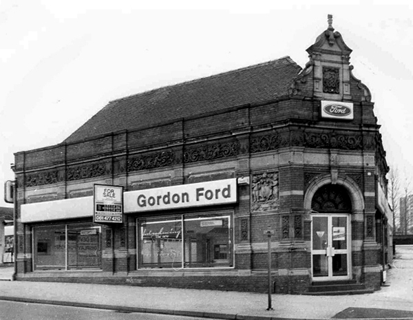
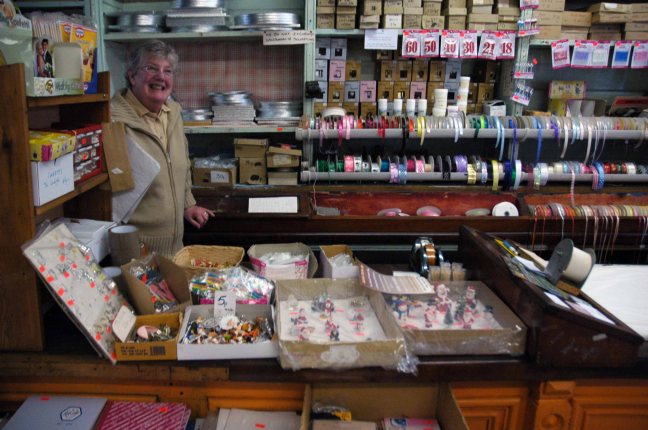
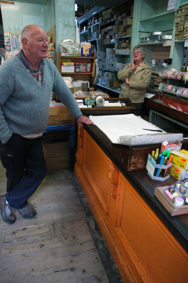
As I remember the first pair of serious branded jeans were local – for famous local people – they were Liverpool made Lybro of Mount Vernon. A slightly heavier denim, styled to suit and fit the lower half of the upwardly-mobile, mobile teenage tearaway.


a81867


In 1963, a Liverpool jeans company, Lybro Limited, asked if The Beatles would advertise their jeans. The request may either have come through the group’s manager, Brian Epstein – or through their friend at the Cavern Club, DJ Bob Wooler. The advertising agency behind the campaign was Millican Advertising Limited, operating from Liverpool 3.

The original photos came to light in 2004, when photographer Richard Cooper unearthed the pictures in an old file and remembered the shoot on which he worked as a young 20-year-old apprentice at a photo studio in Liverpool’s African Chambers.

The photos formed the basis of drawings used on the final advertisements.

Screen Shot 2018-05-07 at 12.33.12

helfigur2_photoshopped

Lybro Jeans Shoot

merkelapp

Then along came came Brutus – possibly the first homegrown denim to challenge the American imports for distinctive style and quality.

18_1380547680_5666_300_300

dsc_1061_2

brutus-shirts-1.jpeg

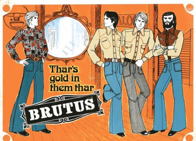
By now flares had flared up like an unwanted rash on the face of the mid-seventies, whilst I remained in a parallel omniverse – constant and true to the parallel cut.

Beloved of the boot-boy and rampaging teenage togger hooligan alike, Skinners ran counter to the ever widening gulf between toe cap and jean hem. I had several pairs in the Seventies, indigo, white and corduroy – we were out, straight and proud.

f9e3bc61ab8102c9a1ac4b0eeace18ef

1.Skinners - braces

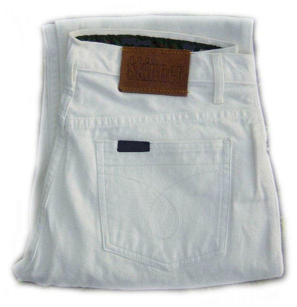
Less enlightened times produced a rash of Skinner clad misdemeanours on the streets and terraces of this fair Isle.

aug 74 cardiff

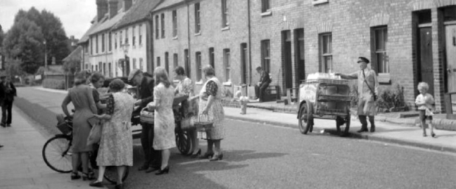
Manchester United fans in Cardiff 1974

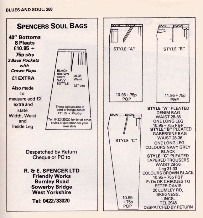
As the Seventies began to collide with the Eighties the upper half of the UK embraced the widest and wildest styles they could find, the northern soul danced to Northern Soul, as jeans, skirts and trousers wrapped and embraced their flailing all-night limbs.

08fc925fa81d9158e8010492e0524e89

bulmer 77

John Bulmer – Manchester 1974

M63 copy

Blues & Soul August 1976

M63

Blues & Soul January 1979

It couldn’t last, we had to take a narrower view in our strides.

The onset of Punk Rock heralded the inception of the skinnier jean – despatching the Hippy flare and Soul Boy bag, indigo to the bargain bins of history.

I then began to buy mine from Crazy Face – brainchild of Joe Moss, he had series of Stockport shops on Mealhouse Brow, Lower Hillgate and Tiviot Dale along with Chapel Walks in Manchester – Joe would later find fame managing Manchester pop sensations The Smiths.

stuart-lee.png

Stuart Lee of Stockport County at Mealhose Brow

For years I would wear a wide variety of wide and not so narrow Crazy Face denim – served by fresh-faced, soon to be superstar DJ Jason Boardman.

ef122dda680a31d22103fdd1903c2994--s-ads-retro-ads

Nothing last forever and my love affair with home grown denim eventually came to an end, Joe Bloggs, Hooch and Bench largely passed me by.

And so our story ends – a Storm Rider in a turn up, I began wearing Lee Jeans and I’ve never looked back, owning several pairs in various states of wash and wear loved, they are now no longer made.

So some ways down the line I’ll have to take a look at what’s shaking – shake down a pair of eBay Tek Sacs and start all over again.

Screen Shot 2018-05-07 at 12.54.20

Screen Shot 2018-05-07 at 12.53.14


52 Wellington Road North – Stockport

Screen Shot 2018-05-07 at 07.25.27

Commercial premises or showroom. Dated 1889. Red brick with stone dressings and terracotta decorative details, tiled roof. Rectangular building of 4 x 3 bays with canted corner entrance. Jacobean style. Single storey articulated by pilasters supporting a sculptured frieze. Doorway with arched head and fanlight. One, two and three-light mullion and transom windows to the Parsonage Street front. The Wellington Road front has two large plateglass windows divided by paired pilasters. The windows have removed two pilasters. Cornice, panelled parapet, aedicule with console supporters, swan – neck pediment and date over the doorway. Tall hipped roof. Very prominently sited and under restoration at the time of inspection.

Grade: II listed: 23rd March 1987 – Historic England

20384

35147

35148

Stockport Image Archive

This is a building of some substance, decorated with terracotta work of the highest order, a striking yet diminutive landmark to the north of the town. Situated on a once busy commercial site, where it would have been surrounded by a plethora of retail, industrial and residential property.

My research has shown that its earliest recorded use was under the ownership of JE Jones manufacturing agent for ropes and cords, allied to the local hatting and cotton trades in 1907. Subsequently the base of John Roberts in 1910 – leather merchant, manufacturing  belts, strapping and laces – the company also had premises nearby at 138 Heaton Lane.

It has latterly been in use as Topp’s Tiles, Gordon Ford and Little Amigos Discount Nursery Store – it is currently empty, shuttered and unloved on off at a rent of £1,833 per calendar month from Rightmove.

Screen Shot 2018-05-07 at 08.03.22

As Stockport continues to invest in and develop its town centre, it remains a more than somewhat sorry beacon of decline, an indicator that all too often architecture of local and historic importance, seems to have little or no place, in this thrusting modern milieu.

If passing, pause and reflect on the sense of permanence that imbues this building, in an all too impermanent world.

P1210198

P1210199

P1210200

P1210201

P1210202

P1210203

P1210204

P1210205

P1210206

P1210208

P1210209

P1210210

P1210211

P1210212

P1210215

P1210216

P1210217

P1210218

P1210220

P1210221

Motorway Footbridge – Stockport

A Moebius Band of motorway formerly known as the M63 wraps and warps itself around the city, ever so conveniently linking the traffic of Greater Manchester with itself.

2000px-UK-Motorway-M63.svg

Ever so conveniently it passes through Stockport – only moments from my home.

M63

Screen Shot 2018-05-04 at 17.03.27

Before the white man came.

11993

11996

The view from Princes Street along Hatton Street – towards Heaton Norris Rec. 

19617

1945

50450

1960

A boon to the modern day motorist, though happily the modern day pedestrian is also catered for in the form of the Hatton Street Footbridge – linking Great Egerton Street below, with Heaton Norris Recreation ground above.

t-s-parkinson-81.jpg

88

821-e1525450826497.jpg

Images TS Parkinson –  Stockport Image Archive

For the past two years the footbridge has been inconveniently closed, during the development of the Redrock Leisure Facility, built on the site of the former car park, in the foreground of the image above. Thus prohibiting the passage from the Post Modern world of the big brash entertainment box, to the leafy cobbled street beyond.

The Hatton Street footbridge has two spans of in-situ u-section deck, is at ground level on the north side, but is reached by steps or ramp from Great Egerton Street on the south.

William B Ball

I’m ever so pleased that access has been reinstated, from me it is both fully functional yet imbued with an elegant concrete sculptural grace, worthy of Niemeyer or Lasdun.

So take a walk on the slightly higher side, either way you win.

P1240904

P1240906

P1240908

P1240909

P1240910

P1240912

P1240913

P1240919

P1240920

P1240922

P1240924

P1240925

P1240926

P1240927

P1240928

P1240929

P1240930

P1240931

P1240932

P1240933

P1240934

P1240935

P1240936

P1240938

P1240939

P1240942

P1240943

P1240948

P1240952