Association For Women Geoscientists – New Website!

The Association For Women Geoscientists (AWG) has migrated over to a new website! There are lots of new website features that will be rolling out over the next few months. Plus – we still have the standard AWG offerings listed on the new website such as awards/scholarships opportunities, job listings, resume review services, and mentoring connections. Link to the new website here: awg.org. Current AWG members – check your email for instructions on how to log-in and create your profile. Not a member? Join now!

Priabonian, late Eocene chronostratigraphy, depositional environment, and paleosol-trace fossil associations, Pipestone Springs, southwest Montana, USA

Ischyromys articulated skeleton from late Eocene strata, Pipestone locality, southwest Montana.

Finally – the work done by myself and my co-authors, Don Lofgren, Steve Hasiotis, and Bill McIntosh, is published in the new issue of Acta Palaeontologica Polonica 67 (1): 5–20. Our work combines chronostratigraphy with depositional environment interpretations and paleosol-trace fossil associations for a new view of a well-known Eocene vertebrate locality in southwest Montana. We had fun and learned much from integrating various aspects of Pipestone’s Eocene geology, vertebrate paleontology, ichnofossils, and radioisotopic age constraints to better understand this amazing locality.

Here’s the abstract:

Sanidine 40Ar/39Ar ages of lapilli tuffs and the mammalian fauna of Pipestone Springs strata provide a high-resolution chronostratigraphy for upper Eocene (Priabonian) rock units in southwestern Montana. Two felsic lapilli tuffs with weighted-mean 40Ar/39Ar single crystal sanidine ages of 37.50±0.02 Ma and 36.00±0.20 Ma both fall within the
Priabonian, late Eocene. These tuffs occur within the basal to upper part of the 55 m of exposed Pipestone Springs strata. The uppermost 15 m yield a diverse and abundant assemblage of mostly small-bodied middle Chadronian (Priabonian, late Eocene) mammals. The older lapilli tuff is an ashfall tuff, whereas the younger lapilli tuff exhibits minor aeolian reworking. The new 40Ar/39Ar age constraints significantly increase the age range of Pipestone Springs strata to include uppermost Duchesnean–lowermost Chadronian (Priabonian, upper Eocene) deposits in addition to its well-known middle
Chadronian vertebrate assemblage. These new 40Ar/39Ar ages combined with its mammalian fauna further support Pipestone Springs strata as age-correlative to the Flagstaff Rim section in central Wyoming, and provide a basis for better determining late Eocene mammalian paleogeography and regional paleolandscapes in the United States Rocky Mountain to Great Plains areas. Loessites intercalated with paleosols dominate Pipestone Springs deposits. The recognition of loessites comprising these strata is a new depositional interpretation of Pipestone Springs strata, making these loessites some of the oldest known aeolian Eocene strata in the Great Plains–Rocky Mountains region. Pipestone Springs paleosols developed on lapilli tuffs are vertisols. Alfisols and inceptisols, developed from a parent material of volcanic glass mixed
with non-volcanic grains, are the remaining paleosols within the loessite strata. Additionally, a new and important discovery in this project is the recognition that all paleosols are extensively bioturbated, containing trace fossils similar to Rebuffoichnus and newly identified trace fossils resembling Feoichnus, Eatonichnus, Fictovichnus, and Coprinisphaera.

Link to publication pdf: Pipestone_hanneman and others

Association for Women Geoscientists’ Annual Institution & Corporate Membership Drive

The Association for Women Geoscientists is gearing up for our annual institution and corporate membership drive. We believe that having these types of members makes our organization more diverse and as such, it strengthens our efforts in enhancing the quality and level of participation of women in geosciences. We encourage you to talk with your institutional departments and corporate representatives to urge them to become AWG members. Information about Institution/Corporate Membership costs and benefits is shown below and is also found on the AWG website at http://awg.org/membership. If you have questions regarding our membership drive, please contact Deb Hanneman, AWG President-Elect, at whgeol@gmail.com or Mona Scott at office@awg.org or via phone at 303.412.6219.

Institution Memberships $200/yr

Benefits:

  • Recognition of your membership at our professional meetings and in AWG’s publications, to showcase your support of women geoscientists.
  • Electronic subscriptions to AWG’s newsletters, Gaea (quarterly) and E-News (monthly).
  • Access to the Association’s membership directory.
  • One free ad in E-News, and 10% off future ads in Gaea, E-News, and on our website on Job Web.
  • One free professional membership for one employee of your institution.
  • 50% discounts to all students from your institution who apply for a student membership.

Corporate Memberships – Base level is $500/yr

Benefits:

  • Includes 5 individual memberships 
  • Recognition of your corporate membership at AWG’s professional meetings and in AWG publications, to show case your support.
  • Corporate logo and active web link on the AWG home page.
  • An electronic subscription to Gaea, the Association’s quarterly newsletter, the bi-weekly E-News, and any applicable chapter newsletters.
  • Free access to the Association’s membership directory.
  • Advertising rates are 20% lower than standard rates.

Flagstaff Rim, Wyoming – A Classic Area of Continental Eocene Tuffs and Fossil Vertebrates

Flagstaff Rim strata, in central Wyoming, contain numerous Eocene tuffs and fossil vertebrates.

The Flagstaff Rim area in central Wyoming contains a classic geological section of Tertiary continental rocks that, for the most part, range in age from approximately 37 million years to about 35 million years. These strata are then capped by gravels that may be late Tertiary in age (probably younger than 20 million years in age, although there are no age constraints on them). I became interested in this section because the 37-35 million year part of it has strong similarities in terms of age and fossil vertebrate assemblages with Eocene continental rocks at Pipestone Springs, southwestern Montana where I’ve been working.

Eocene rock section locations for Pipestone Springs, southwest Montana and for Flagstaff Rim, central Wyoming.

Much work has already been done at Flagstaff Rim for both fossil vertebrates and Tertiary tuff ages (see Emry 1973; Emry 1992; Emry and Korth 2012; Sahy et al. 2015 for some background). But – a group of us working on continental Tertiary strata in the US Great Plains-Rocky Mountains decided it was time to resample all the tuffs in the Flagstaff Rim section and do 40Ar/39Ar single crystal sanidine age analyses and high-precision U–Pb dating of zircon on these tuffs and several of the section’s detrital beds. Emmett Evanoff, now at the University of Northern Colorado, graciously arranged our field work/camping venue. Bill McIntosh, at the New Mexico Geochronology Lab, and Steve Hasiotis, at the University of Kansas Geology Department, were also a part of our field crew. Bob Emry, Smithsonian Institution emeritus, joined us for a day, and told us about his decades-long work with fossil vertebrates at Flagstaff Rim. We had a very productive field time – and all section tuffs as well as some detrital beds were sampled. A back-breaking, sample-hauling hike at times, but always an amazing place as shown by the numerous photos below.

A white-colored tuff from the lower Flagstaff Rim section crops out in the central part of the photo.
Sampling the lowermost tuff from the Flagstaff Rim section.
The basal part of the Flagstaff Rim section is a paleochannel complex, so needless to say, it contains coarse-grained deposits. Hard to find a prospective bed for sampling detrital sanidine, but we may have found one. We’ll see!
The upper part of the Flagstaff Rim Section containing tuffs G through J. The dark-colored beds at the section’s top are the overlying, later Tertiary gravels.
An Isolated channel tuff occurs in the upper part of the Flagstaff Rim section. No radioisotopic or zircon age exists for this tuff, so it will be good to add these to the tuff age database.
Tuff J-1 near the top of the Flagstaff Rim section must give off a lot of energy as our hardy field crew levitates above it at the end of the field day.

Background Reading:

Emry, R.J. 1973. Stratigraphy and preliminary biostratigraphy of the Flagstaff Rim area,

Natrona County, Wyoming. Smithsonian Contributions to Paleobiology 18: 48 pp.

Emry, R.J. 1992. Mammalian range zones in the Chadronian White River formation at

Flagstaff Rim, Wyoming. In: D.R. Prothero and W.A. Berggren (eds.), Eocene–

Oligocene Climatic and Biotic Evolution, 106–115, Princeton University Press. Princeton, New Jersey.

Emry, R.J. and Korth, W.W. 2012. Early Chadronian (late Eocene) rodents from the

Flagstaff Rim area, central Wyoming. Journal of Vertebrate Paleontology 32:

419–432.

Sahy, D., Condon, D.J., Terry, D.O., Fischer, A.U., and Kui­per, K.F. 2015. Synchronizing

terrestrial and marine records of environmental change across the Eocene–

Oligocene transition. Earth and Planetary Science Letters 427: 171–182.

Welcome To My 2021 Field Office

This is my summer receptionist… a Yellowstone 2020 wolf pup of the Junction Butte pack that roams mainly in the Lamar Valley of northern Yellowstone National Park.

My geological field work lately has taken me to several areas of western Montana, so I thought I’d do a visual collage of a few of the landscapes where I’ve been working. To start with, I’ve been spending time flying drones over Tertiary exposures in southwestern Montana, Great fun and good insight into Tertiary geology. Many of my flights are focused on Eocene strata at Pipestone Springs. Along with 3 co-authors (Don Lofgren, Stephen Hasiotis, and Bill McIntosh), we have a paper on Pipestone chronostratigraphy, trace fossils, and depositional environments that is now in review. Below are a couple of drone photos from Pipestone Springs.

Pipestone Springs Eocene strata with the basal lapilli tuff (37.5 million years in age) and the upper trace fossil bed (36 million years in age) indicated. Note the person standing on the surface of the upper trace fossil bed.
A somewhat closer drone view of the upper trace fossil bed with me as pilot standing off to the right side of the photo. My drone landing pad is my friend’s political campaign sign!

My travels through a part of northwestern Montana last week put me in a very different geologic setting from southwestern Montana. Proterozoic rocks are the mainstay in this area, and they make for some spectacular landscapes. So spectacular in fact, that I’ll just do a barrage of photos from the east side of Glacier National Park…

Chief Mountain, located a few miles north of Babb, Montana, is the iconic geologic view of major thrust fault where Proterozoic rocks (Chief Mountain rocks) are pushed over Cretaceous strata (green area of this photo).
No matter how much has changed in this past year because of the pandemic, it is just astounding to me to see a sign that says the Canadian border crossing is closed. It was a heavy mix of emotions being out in the early morning to view Chief Mountain, but then to see this sign and know that we’re still all in this even a year out. Whew…
Of course, no visit to Many Glacier is complete without marveling at Grinnell Point.
One of the positive aspects of getting up very early on a spring day is the sun rise near the Many Glacier Lodge. It didn’t last long as rain clouds pushed in but what a view for a time!
And another plus to being up early in the Many Glacier area is to watch a black bear amble down the road.
Coming back south, down the Front Range of the Rockies, we got out from under the rain clouds. Once again, geologically, the rocks that comprise Dancing Lady Mountain have been thrust over younger, Cretaceous strata (basically the area in green on the photo).

In summary, this is just a quick view of a couple western Montana areas where I’ve been recently. I have to say that I’m really looking forward to more amazing places to work this field season. I may swap out my office receptionist, though.

Linking One Woman’s Geoscience Career to Gender Equity

Coinciding with International Women’s Day and Women’s History month, I did a zoom meeting last week with students and faculty in the Earth and Atmospheric Sciences Seminar at the University of Northern Colorado. My zoom presentation was – “Linking One Woman’s Geoscience Career to Gender Equity Progress. Here’s the abstract of the Powerpoint slideshow that I presented (a pdf of the Powerpoint slideshow is available upon request):

My geoscience career encompasses the time period from the early 1970’s to the present and includes work in academia, government, and private sectors. As such, it becomes a good template to use in thinking about gender equity throughout that time. Data from a recent Pew Research Center Survey suggests that gender equity milestones of the last century include women’s right to vote (1920), the Equal Pay Act (1963), and the Family and Medical Leave Act (1993). In my opinion, the 1972 Equal Employment Opportunity Act and Title IX should also be included in these milestones. My career time line falls after the first two gender equity milestones and then continues through the enactment times of the other federal legislation cited above. Consequently, it’s instructive to review the various situations that I encountered both as a university student in undergraduate to graduate programs and then in the professional world, and to compare those circumstances to the present time. Data collected and summarized most recently by various organizations indicate that although gender equity progress has been made throughout the decades, it may currently be dramatically slowed or even stalled. Additionally, of significant concern now is “America’s First Female Recession” brought on by the loss of women in the workforce due to Covid-19 and its resulting effects on gender equity.

Drone Flying, Southwest Montana Style

Jeremy Crowley describes flight planning for UAS high accuracy photogrammetric data collection using a DJI Phantom 3 and Phantom 4 Pro version 2 at the Bluebird Mill mining ruins near Rocker, southwest Montana.

Last fall I decided that using UAS would really add to my geologic field work. That was the easy part. I did make the step to buy a drone and ended up with both a DJI Air Mavic 2 and a DJI Phantom 4 Pro version 2. Although it’s great fun just to fly a drone – and the camera resolutions are of amazing quality even on the little Air Mavic 2 – there is so much more to UAS flying and collecting visual data. Probably the best place to start is to understand that in flying a drone, one can either do flying as a hobbyist or take the next step, and get certified as a FAA Remote Pilot (Part 107). I hadn’t initially thought much about getting certified as a remote Pilot in Command (PIC), because I thought I’d basically use my drones for geologic photo/video purposes. But it turns out that in my quest for drone information, I came across Jeremy Crowley from the Montana Bureau of Mines and Geology in Butte, Montana, who is an extremely knowledgeable UAS person. In talking to Jeremy and reading about his drone workshops and research, I realized that I did need to learn much more about even FAA regulations regarding UAS. So I started on the path to get my FAA Remote Pilot (Part 107) certificate by taking Jeremy’s workshop. For anyone interested in UAS, it’s a very worthwhile workshop, and as summarized by Jeremy, it goes as follows:

“The FAA Part 107 Remote UAS pilot license is required for anyone flying UAS as part of work/business/commercial operations. This workshop will prepare attendees to pass the exam to obtain an FAA Remote Pilot License (Part 107). Attendees will also get hands-on training on using a UAV to conduct an automated photogrammetry survey, collect high accuracy (cm level) ground control points and check points, then post-process the control points and create a 3D model, digital surface model, and hillshade of the survey area”.

From Jeremy Crowley’s UAS 2021 Workshop description, Montana Bureau of Mines and Geology

At this time in my UAS learning curve, what I can say is that by delving into material covered by the FAA Part 107 Remote UAS pilot certification process, I’ve learned so much that is really helpful for being a proficient PIC. I strongly recommend going through the certification process to anyone who is serious about flying a drone. And, oh yeah, I did pass the FAA Part 107 Remote UAS pilot certification a couple days ago! So – I’m looking forward to many days of being a remote PIC!

Jeremy Crowley, Montana Bureau Mines and Geology, starts the set-up for our Global Navigation Satellite Survey (GNSS) that we’ll use in collecting ground control and quality control points for our high accuracy photogrammetry survey.

LATE EOCENE CHRONOSTRATIGRAPHY, DEPOSITIONAL ENVIRONMENT, AND PALEOSOL-TRACE FOSSIL ASSOCIATIONS, PIPESTONE SPRINGS, SOUTHWEST MONTANA

I just received notice from the Geological Society of America (GSA) that our abstract is now accepted for the GSA 2020 annual meeting. I was very much looking forward to going to Montreal for the meeting, but like much else, it will now be virtual. Our presentation is scheduled for the session titled “D23. Recent Advances in Understanding Environmental Changes and Their Effects on Sedimentation”, which will be on Monday, 26, October 2020, beginning at 1:30 PM. And I say our abstract, because my co-authors are: Steve Hasiotis (Department of Geology, University of Kansas, Lawrence, Kansas), Don Lofgren (Raymond M. Alf Museum of Paleontology, Claremont, California,) and Bill McIntosh (New Mexico Bureau of Mines and Mineral Resources, Socorro, New Mexico). We’re excited to get this abstract out in the public domain as it details the first single-crystal sanidine 40Ar/39Ar ages for the well-known vertebrate locality of Pipestone Springs in southwestern Montana. We also have other significant findings, such as newly-identified trace fossils and the presence of loessites in the Pipestone Springs section. Our paper on these findings is nearing completion, soon to be submitted to a peer-reviewed journal. Anyways, here’s our Pipestone Springs abstract:

Sanidine 40Ar/39Ar ages of lapilli tuffs and the mammalian fauna of Pipestone Springs Main Pocket provide a high-resolution chronostratigraphy of late Eocene strata in the Pipestone Springs area of southwestern Montana. Two felsic lapilli tuffs, with weighted-mean 40Ar/39Ar single crystal sanidine ages of 37.50 + 0.02 Ma and 36.00 + 0.20 Ma, occur within the basal to mid-section of the 55 m of exposed Pipestone Springs strata, whereas the upper 15 m yields a diverse and abundant assemblage of mostly small-bodied middle Chadronian mammals. The older lapilli tuff is an airfall tuff whereas the younger lapilli tuff exhibits some aeolian reworking. Loessites intercalated with paleosols dominate Pipestone Springs deposits. Andic paleosols are developed on the lapilli tuffs. Buried B cambic to weakly developed argillic horizons characterize the remaining paleosols that are also classified as andic because there is a significant component of volcanic grains mixed with identifiable non-volcanic grains in their parent material. All paleosols are extensively bioturbated, containing newly identified trace fossils likely constructed by dung beetles (Coleoptera) based on comparisons to modern and ancient traces attributed to this group. Close examination shows that the tracemakers built these structures in a helical pattern from the inside and outside by adding pelletized sediment from the base upward, such that the architectural elements resemble features of Rebuffoichnus, FeoichnusEatonichnus, and Coprinisphaera. The preserved forms likely reflect a continuum of state of completion by adults and usage by larvae and pupae, and final preservation in the paleosols. The new isotopic age constraints significantly increase the age range of the Pipestone Springs strata to include early Chadronian deposits in addition to its well-known middle Chadronian vertebrate assemblage. Recognition of loessites comprising these strata is also a new interpretation, making these deposits some of the oldest known aeolian Eocene strata in the Great Plains–Rocky Mountains region.

Pipestone Springs Main Pocket vertebrate locality (middle Chadronian).

Florence Bascom – Rock Star

Thinking about Florence Bascom immediately brings to mind an image of a pioneering woman geologist making pathways into earth science way before women could even vote in the USA. She was the second woman to earn a PhD in geology in the USA in 1893 and the first female geologist hired by the U.S Geological Survey in 1896. Bascom’s expertise was in crystallography, mineralogy, and petrography where she once again led in research efforts. She published over 40 professional papers and held various professional positions including associate editor of the American Geologist, joined the Bryn Mawr College faculty, where she founded the college’s geology department, and was the first woman elected to the Council of the Geological Society of America in 1924. A good summary of Bacom’s accomplishments was written by Jill Schneiderman and appeared in GSA Today, July 1997. Just recently, a short video was produced by the Florence Bascom Geoscience Center, which is a US Geological Survey science center recently renamed in honor of Bascom. This video is embedded below:

EOCENE AND OLIGOCENE MAMMALS FROM THE GRAVELLY RANGE OF SOUTHWEST MONTANA

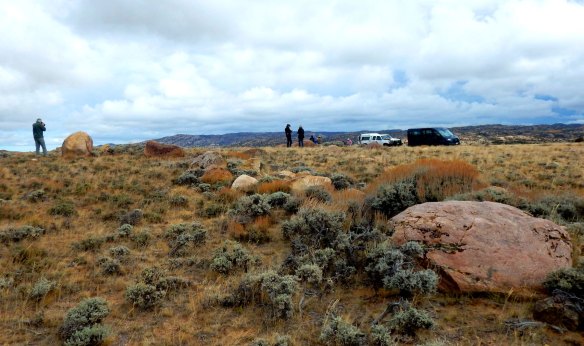
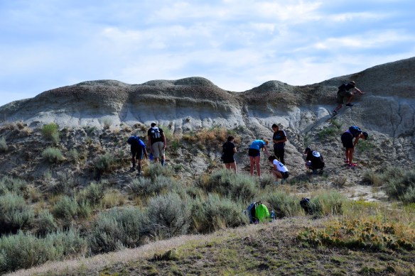
Our first paper on work that several of us are doing in the Gravelly Range, southwestern Montana, was just published in a special issue of Paludicola, Scientific Contributions of the Rochester Institute of Vertebrate Paleontology. This issue contains papers in honor of James Gilbert Honey, a paleontologist and stratigrapher who focused on the Cenozoic, particularly the paleontology/evolution of camels and the Paleocene’s Fort Union Formation geology and paleontology. We’re pleased to have our work included in this volume! You can find our entire paper at:

Rochester Institute of Vertebrate Paleontology – Paludicola:

Donald Lofgren, Debra Hanneman, Jackson Bibbens, Liam Gerken, Frank Hu, Anthony Runkel, Isabella Kong, Andrew Tarakji, Aspen Helgeson, Isabel Gerard, Ruoqi Li, Sihan Li, Zhihan Ji. 2020. Eocene and Oligocene mammals from the Gravelly Range of southwestern Montana. Paludicola 12: 263-297.

Our paper’s abstract is: High elevation outcrops of Tertiary strata in the Gravelly Range of southwest Montana yield late Uintan to Whitneyan vertebrates that comprise five mammalian assemblages; Rapamys Site, Black Butte Low, Teepee Mountain, Black Butte High, and Lion Mountain High. The Rapamys Site and Black Butte Low are late Uintan or early Duchesnean. Two new species are present at the Rapamys Site (the carnivore Lycophocyon tabrumi and the rodent Pareumys muffleri). Small mammalian assemblages from Teepee Mountain and Black Butte High are late Duchesnean-early Chadronian and Chadronian, respectively. The most diverse assemblage is from Lion Mountain High, which is correlative with Whitneyan faunas from Wyoming, Nebraska, and South Dakota. The Whitneyan age of the Lion Mountain High assemblage is further age constrained by an underlying tuff with a weighted mean 40Ar/39Ar age of 31.7 +- 0.02 Ma and an overlying basalt flow with a K/Ar age of 30.8 +- 0.7 Ma. Paleogeographic range extensions into Montana for Lion Mountain High taxa include Diceratherium tridactylum and Oxetocyon cuspidatus. The taxonomic composition of the combined Rapamys Site/Black Butte Low mammalian assemblage is most similar to those from southern California, rather than geographically closer assemblages found in Wyoming and Utah. Comparison of undescribed middle Eocene mammalian assemblages from southwest Montana to those from southern California will further elucidate the middle Eocene Montana-California paleobiogeographic affinity.

Our geology paper on this area is soon to follow….

Devil’s Slide and A Jumping Fox

Devil’s Slide, a part of Cinnabar Mountain, is located about 3 miles north of Yellowstone National Park’s northern boundary and about 7 miles northwest of Gardiner, Montana. The “slide” or red streak on Cinnabar Mountain is developed in Triassic red beds.

Whenever I drive to Yellowstone National Park’s northern gate, I pass by the Devil’s Slide. It seems that the slide is my gate keeper to the park, and it is always fun to see it in all our different seasons. And once again, during a chance conversation in the park, I was asked about the geology of Devil’s Slide. Because of that conversation, I thought that I’d spend some time blogging about the slide’s geology.

Devil’s Slide is a part of Cinnabar Mountain, which contains steeply-dipping to overturned Paleozoic and Mesozoic strata. Cinnabar Mountain is fault-bounded on its north side by the Gardiner Fault, a north to northeast dipping reverse fault zone. At Cinnabar Mountain’s north end, the Gardiner Fault juxtaposes Archean crystalline rock (now partly masked by Tertiary intrusive rocks and Quaternary glacial sediments as shown on geologic map snapshot below) on the fault’s northern, up-thrown side against Paleozoic strata on its down-thrown, southern side. The Paleozoic-Mesozoic strata in Cinnabar Mountain are contorted because of drag associated with the Gardiner Fault.

Cinnabar Mountain and Devil’s Slide area as a snapshot from the Geologic Map of the Gardiner 30’x60′ Quadrangle, South-Central Montana (Berg and others, 1999, Montana Bureau of Mines and Geology Open-File Report 387). Map symbols on Cinnabar Mountain are: Mm = Mississippian Madison Group, PMs = Permian-Mississippian rocks, Psh = Permian Shedhorn Sandstone, JTrs = Jurassic-Triassic rocks, Kk = Lower Cretaceous Kootenai Formation, Kmfr = Upper and Lower Cretaceous Mowry Shale through Fall River Sandstone.

According to Marius Campbell and others (1915, p. 92), “Cinnabar Mountain was named in the early days, when the bright-red streak that marks it from top to bottom was supposed to be due to the mineral cinnabar, a red ore of mercury.” (From: Guidebook of the Western United States: Part A – The Northern Pacific Route, With a Side Trip to Yellowstone Park, U.S. Geological Survey Bulletin 611). We now know that the bright red streak is not cinnabar (a brick-red form of mercury sulfide), but the area of red in Devil’s Slide is actually a set of Triassic age red beds that mark widespread continental deposition and limited marine incursions throughout the Rocky Mountain region. The red beds in this case get their color from the oxidation of iron-rich minerals contained within the rocks.

And now for the jumping fox and its association to my Devil’s Slide discussion – as I said previously in this blog, the conversation that I had with a fellow-park goer a few days ago brought about my blog on Devil’s Slide. My conversation about the slide happened while I was watching a fox hunt rodents in YNP’s Round Prairie, a gorgeous meadow near Pebble Creek Campground in the park’s northeastern area. The female fox hunted for hours that morning, and several photographers and myself were enthralled with her hunt. The light snowfall of the night before accentuated the bushy fall coat of the fox and gave the hunting scene great color contrast. Here are are few photos from the hunt:

Round Prairie fox with her gorgeous fall-winter coat.
Round Prairie fox on the hunt.
Round Prairie fox on her hunting jump.
Round Prairie fox finishing her hunting jump.

Fall Fieldwork in the Greater Yellowstone Area

Sheepeater Cliff area, Yellowstone National Park. This area is named in honor of the Shoshones who lived in this area, The name specifically comes from their use the big horn sheep – hence the name “sheepeater”. Note the columnar basalt in the cliff area which has an age of about 0.5 million years.

Doing geology field work in the greater Yellowstone area during the fall is always an adventure. This is the time that animals and birds are on the move, so it’s a good opportunity to have interesting chance encounters. In my quest to understand the Eocene thermal springs of the Gravelly Range in southwestern Montana, I’ve spent time in the Yellowstone area hiking around thermal areas. The Artists Paint Pots, located a few miles southwest of the Norris Geyser Basin, appear to be a likely analogy for the Gravelly Range thermal strata. Of particular interest is the red staining that occurs in many meters of Gravelly Range thermal deposit strata. The red stained rocks are ubiquitous in the Red Hill and Middle Springs areas.

Red Hill in the Gravelly Range, southwestern Montana, contains many meters of red-stained, thermally generated Eocene strata.
The Middle Springs area in the Gravelly Range also contains several meters of Eocene red-stained thermally-generated rocks. It’s extremely easy to confuse these rocks with the underlying red-colored Triassic Woodside Formation strata.
Red-stained thermal deposits at Artist Paint Pots.
Blood Geyser thermal pools at Artist Paint Pots, Yellowstone National Park.

The Artist Paint Pots, especially the Blood Geyser, are well known for red-colored rocks that are produced by iron oxides precipitating out of the thermal waters and staining the surrounding rocks.

As I said earlier in this blog, doing fall field work in the greater Yellowstone area usually means exciting chance encounters with various animals and birds. Some encounters are a bit more exhilarating than others, but I did manage to photo-document some in between finishing up field work for the season:

Young grizzly loading up with food (only caraway roots and mice!) in the Tom Miner Basin, Montana.

Bull moose eating on Cottonwood trees near Ennis, Montana.

Immature bald eagle near the Jefferson River, Montana.
Redtail Hawk on irrigation pipe, near Sheridan, Montana.
Trumpeter swan family resting at – ironically, Swan Lake Flats, Yellowstone National Park.
Great Horned owl giving me the evil eye…
Sandhill cranes in-flight near the Ruby Mountains, southwestern Montana.

Working On High Elevation Tertiary Strata, Southwestern Montana

Lion Mountain, south-central Gravelly Range in southwestern Montana, has about 300 m of Tertiary strata capped by basalt that is about 31 million years in age.

Working on Tertiary strata in the Gravelly Range, southwestern Montana, is sometime daunting to do. The Lion Mountain Tertiary section shown in the photo to the right is one of those places that makes for a grueling day or several days of field work. The Tertiary section unconformably overlies various Paleozoic units, such as Mississippian Madison Group carbonates, Pennsylvanian-Permian quartzite, and Triassic carbonates and red mudstone. And the ascent from these pre-Tertiary rocks to the top of the Tertiary section is worth it – for both vertebrate paleontology and sedimentary features. Current work status in the project that I’m working on with the Raymond M. Alf Museum, Claremont, CA, is that the section contains vertebrates ranging in age from about 40 million years to about 31 million years in age. A tuff unit near the top of the section that we collected has an Ar/Ar age of 31.4+- 0.7 million years. The capping basalt (the dark zone on the top of Lion Mountain) has a reported K-Ar age of 30.8 +- 0.7 million years. Sedimentary features include massive aeolian units and some channeling near the top of the section. A basal surge deposit occurs about 25 m below the capping basalt, signalling the initial pulse of extensive basaltic volcanism in the Lion Mountain locale. Several photos of my most recent Lion Mountain climb illustrate the section’s features and are shown below.

Channel complex near top of Lion Mountain comprised of Paleozoic rock clasts.
Basal surge deposit about 25 m from top of Lion Mountain. Embedded basalt clasts, sand waves, and plane parallel beds characterize this deposit.
Basalt bombs in channel near Lion Mountain crest have paleomag drill holes – a clear sign that someone else has made this climb!
A ladder stashed in the uppermost tree-area on the mountain which is left over from past paleontology expeditions.
The orange baked zone that underlies basalt is evident in this photo. Also note the channel lenses that outcrop randomly across the Tertiary stratal expanse.
About 5 km northwest of Lion Mountain sits the basalt plug of Black Butte. Previous reported isotopic ages range from 23-25 million years, but our preliminary data show an age of about 30 million years for this volcanic feature.
The most pleasant part of the hike in the Lion Mountain area is in the glaciated meadow that lies at the base of the mountain. We’re a little late for the wild flower bloom, but it still is a gorgeous area!

Archaeology Podcast Network Features Paleontologist Amy Atwater from Museum of the Rockies

Amy Atwater is the Paleontology Collections Manager/Registrar at the Museum of the Rockies in Bozeman, Montana – and more importantly, is an amazing scientist. Her discussion of archaeology/paleontology, deep time, stratigraphy, etc., with the “cowboys of science” in episode #5 of their Life In Ruins podcast series (embedded below) is a must listen! More information about Amy and her work is also available on the Archaeology Podcast Network’s website: Episode#5

Tolting Around Pseudocraters at Lake Myvatn, Iceland

The Lake Myvatn area, located in northeast Iceland, has an amazing, and truly beautiful, volcanic landscape. This area lies within Iceland’s North Volcanic Zone, which is a part of the Mid-Atlantic Ridge – the spreading rift between the Eurasian and North American plates that slices through Iceland. Lake Myvatn is the fourth largest lake in Iceland, and is quite shallow, with the deepest part being only about 4 meters. This area is also renown for its wetlands and birdlife, with the lake’s numerous bays and its outlet to the north-flowing river Laxa being host to a multitude of birds.

Lake Myvatn, viewed from the lake’s eastern side.
Basaltic landscape in the Hofdi area, on the southeast side of Lake Myvatn. Hofdi is a rocky promontory into Lake Myvatn that affords excellent bird watching.
Lava pillars in the Kálfastrandavogar area, southeastern Lake Myvatn.

My favorite experience at Lake Myvatn was riding an Icelandic horse around the pseudocraters in the Skútustaðagígar area of Lake Myvatn (southwestern part of the lake). Pseudocraters are unusual in that they are rootless volcanic cones that formed in this area about 2300 years ago when basaltic lava flowed over the water-logged lake sediment, resulting in the cones being built from steam exploding through the lava. So -not only did I want to see pseudocraters, but I also wanted to lean how to tolt because this is a natural gait exclusive to Icelandic horses. According to Riding-Iceland.com,

“the Tölt is a natural, fluid gait of the Icelandic Horse, during which at least one foot always touches the ground. Foals often tölt in pastures at an early age. The tölt is an extraordinarily smooth four-beat gait, which allows the rider an almost bounce-free ride, even at 32 kmh (20 mph). “

I contacted Safari Horse Rental (located just off the main road in the Skútustaðagígar area) and set up a two hour ride. Gilli was my guide, and he took me through mostly private land to both look at pseudocraters and to teach me how to tolt. It did take me awhile to understand how to let my horse know it was time to break into the tolting gait, but when we both got it figured out, wow! what a way to see pseudocraters! I’d urge anyone who loves to ride horses to try this!

The start of the pseudocrater exploration ride at Safari Horse Rentals!
A pseudocrater looms ahead of us. The pseudocraters are typically composed of tephra, scoria, and splatter that resulted from basaltic lava flowing over water-logged lake sediments forming steam eruptions that blast through the lava.
The remnants of a pseudocrater becomes a watering hole for the area sheep herds.
Basalt block fences are common on Icelandic farm lands.
This photo shows midges covering a part of a pseudocrater. The midges weren’t numerous when I was at Lake Myvatn, but they periodically emerge by the billions to cover the Lake Myvatn area. In fact, Lake Myvatn means “midge lake” in Icelandic. The midge populations are very closely tied to the Lake Myvatn fishery. Unfortunately, dredging in the lake during the 1960’s for a silicon mining operation has probably caused enough fluctuation in the midge populations to result in the collapse of the fishery. See the following publication for more information on this – High-amplitude fluctuations and alternative dynamical states of midges in Lake Myvatn.

Again – I’ll highly recommend that the best way to view Lake Myvatn’s pseudocraters is by tolting on an Icelandic horse!

An Icelandic Sedimentary Sequence – the Tjornes Pliocene Beds

While I am in awe of Iceland’s mid-Atlantic ridge system volcanics and its glacial geology, I still like to see sediments and fossils. So – as I was doing my pre-trip research into Icelandic geology, I found that there are about 500 meters of Pliocene strata exposed on the west coast of the Tjornes Peninsula in northern Iceland. Needless to say, the Tjornes Peninsula became part of my travels in Iceland. I’m so glad that my friend told me to have a look at an iceland car rental 4×4 to make it easier to get across the country and to see all these amazing places which has brilliant Icelandic geology. Who doesn’t love a good road trip? An old colleague of mine has actually just returned from a road trip around Iceland. It was a totally last-minute decision too. Within the space of a few days, her flights, and campervan rental from Rent.is were booked and she was on her way. I have always wanted to go to Iceland, so I was incredibly jealous at the time. You might even say that her antics inspired this trip of my own!

Anyway, the best way to access the Tjornes sequence is to go to the Tungulending Guesthouse, which is about 12 km north of Husavik. The turnoff for the guesthouse is just off Highway 85 and signed as shown by the photo below. Of course we missed it and kept driving a few km up the main road before we stopped to ask a local farmer. The farmer knew exactly where we wanted to go and sent us back down the road to Tungulending. Once we saw the Tungulending main sign and then passed the guesthouse gate, we knew we were headed in the right direction.

The Tjornes Pliocene strata contain both marine and continental deposits. The strata sit on the Kaldakvisl lavas while the Hoskuldsvik lavas cap the sedimentary sequence. The Tjornes Formation records a coastal environment that includes estuary-swamp, shallow marine-beach, and swamp-fluvial settings that existed in between the basaltic lava events (Simonarsson and Eriksson, 2008). These strata include a diverse mollusc fauna and recently the oldest marine vertebrate fossil in Iceland, a partial skull from a fossil whale (a large right whale), was also found within the Tjornes Formation (Field and others, 2017). Jonathon Hall, a Doctoral Researcher in the School of Geography, Earth and Environmental Sciences, University of Birmingham – UK, has put together a great leaflet on the geology of the Tjornes Peninsula, and the leaflet content can be found here: Geology of the Tjornes Peninsula.

The road leading down to the Tungulending Guesthouse cuts through the Tjornes sedimentary sequence. Note the car on the road near the guesthouse for scale.
The Tjornes Formation is well exposed in a drainage by the Tungulending Guesthouse.
Mollusc fossil fauna of the Tjornes Formation.
Shelly beds within the Tjornes Formation.
Cross-bedded strata with lenses of shelly beds within the Tjornes Formation.

Even if you are enthralled with Iceland’s volcanic and glacial geology, it is still well worth a look at the Tjornes Formation and a visit to the Tungulending Guesthouse for good conversation and food!

The Tungulending Guesthouse with the Pliocene Tjornes Formation in the background.

Iceland Geology – Snorkeling the Silfra Fissure, Thingvellir National Park

I did a snorkel tour of the Silfra fissure with Dive.is while I was in Iceland a couple weeks ago. That is a very impressive way to view part of the mid-Atlantic ridge system! Here’s what Dive.is says about Silfra that makes it so unique:

Snorkeling the Silfra Fissure in Iceland.

“Silfra is a fissure between the North American and Eurasian tectonic plates in Thingvellir National Park. The rift was formed in 1789 by the earthquakes accompanying the divergent movement of the two tectonic plates . The diving and snorkeling site at Silfra is right where the two continents meet and drift apart about 2 cm per year. Silfra is the only place in the world where you can dive or snorkel directly in a crack between two tectonic plates. The earthquakes of 1789 opened up several fissures in the Thingvellir area, but the Silfra fissure cut into the underground spring filled with glacial meltwater from the nearby Langjökull glacier.”

My Silfra snorkel group starting out in the fissure with our guide Jake from Dive.is.

There are 6 people to a group for the snorkel tour, with each group accompanied by a guide from Dive.is. Jake was our guide and he was great! The tour is simply snorkeling through basalt and more basalt, but with the water clarity, the colors are beautiful. There is also one place where you can stretch across the fissure and basically touch both plates.

The start of the snorkel tour where the entrance platform can be seen in the background.
The stretch between plates…
This is where basalt really looks grand!
Near the end of the snorkel tour, the fissure opens into a shallow lagoonal area.
The colors in the sandy lagoon are just as spectacular as elsewhere in the fissure. The exit platform can be seen in the distance.
The end of the snorkel tour – ours was a great weather day, so even though the fissure water is cold (we all wear dry suits with long underwear and two pairs of wool socks), I could have snorkeled around the lagoon for a long time.

I also took video while I was snorkeling, so am inserting a clip from the first part of the snorkel tour at the end of this blog. The video clip includes the time when we all get geared up, have our gear checked, and then flipper-walk down the entrance ramp, into the water. We all have to do a flip over to our back once we’re in the water, just to make sure we can maneuver once we’re in the water. The clip continues on as we snorkel through the first several minutes of exploring the fissure. At the end of the snorkel tour, we hike back to where the Dive.is vans/equipment are. After taking off our gear – which getting off the dry suit is somewhat of a challenge – we have hot chocolate and cookies. Because the weather was so nice, it was a pleasurable experience to stand around and feast. But – we were told that in the wintertime the guides take the hot water that is suppose to be used for the hot chocolate and it pour down the snorkelers’ necks so the dry suits can be pulled off. Glad I opted for late May to do this!

Yellowstone To Southwest Montana Autumn Field Photo Snaps

Montana’s autumn is my favorite time of the year to do field work. Daytime temperatures are usually cool enough to encourage one to keep moving and the lighting is simply gorgeous. It is also one of the best times to visit areas in and around Yellowstone National Park (YNP) because most of the tourists have gone home. So no huge bear traffic jams or jostling for parking spots at the better known thermal spots in YNP and surrounding environs – it’s just a wonderfully introspective time for field forays. What follows are several photos that chronicle some of my fall wanderings in the greater Yellowstone area, both in terms of wildlife and geology.

Some of my favorite sightings in YNP are bison at any time of the year. But the autumn snows bring on the bison’s technique of using its head to clear snow away from any vegetative food source. The result of their snow-clearing activity is a snow-masked face.

Snow-caked face of a bison in YNP portends the winter food retrieval.

Snow-masked bison near Soda Butte Creek, YNP.

And where the snow hasn’t stacked up much, the YNP bison calmly graze and occasionally congregate on a ridge line to watch what remains of the YNP visitor traffic.

YNP bison contemplating passing vehicles.

Geological features in YNP take on new dimensions with the golden low and slanting light of autumn. I’ve spent much time re-photographing geologic features at all scales that seem to glow in this season’s light.

Tertiary sediments and Quaternary sediments/basalts of “The Narrows” cliff face adjacent to the Yellowstone River, northern YNP. Columnar basalt capped by auto-brecciated basalt makes a morel-like image for these geological units.

An early morning at -7 F on the Lamar River with steam fog resulting from the fall’s chilled air moving over water still warmed from summer.

A rodent trackway disappears into microterracettes of Palette Springs, Mammoth Hot Springs, YNP.

Microbial growth near the proximal part of Mound Springs, Mammoth Hot Springs, YNP.

The proximal end of Mound Springs abounds in various colored microbial life. It’s hard to stop photographing these features because they are so intriguing!

The lipped margin of Mound Spring’s pond facies, Mammoth Hot Springs, YNP.

The fall staging areas of sandhill cranes in southwestern Montana are mesmerizing. Staging areas are those locations where cranes annually congregate during late September into October, spend several days foraging through fields for food, and eventually continue on their migration southward from Montana to Colorado and the southwestern U.S.. The staging area that I usually go to is near Dillon, Montana, where hundreds of cranes can be viewed.

Sandhill crane interaction during their fall staging near Dillon, Montana.

Sandhill cranes doing a dance routine in the Dillon, Montana staging area.

As I said initially, it’s hard to surpass a Montana/YNP autumn!

As Wildlands Fires Ravage Western U.S. – Is This The New Normal?

Over 100 wildlands fires are burning in the U.S., with most of them being in the western U.S. The California fires are exceedingly destructive, with Cal Fire officials calling this the new normal for the now extended and catastrophic fire seasons that we are experiencing. In the midst of all this, there’s a particularly good Ted talk on megafires done by Paul Hessburg at the TEDx event in Bend, Oregon, 2017. The video is well worth viewing:

Greater Yellowstone Area Eocene to Recent Hydrothermal Springs

The Gravelly Range spring deposits depicted in this photo are late Eocene (probably 34-36 million years in age).

Geologic field work is always fun, but especially so when it turns up something unexpected. Working on Eocene to Recent geology and vertebrate paleontology in the Gravelly Range, southwestern Montana promised to be enthralling because the volcanics, sedimentary units, and vertebrate fossils are at elevations of about 9,000 feet. But to come across extensive, unmapped calcareous spring deposits of probable Eocene age is topping off research efforts.

At this point, I’ll just say that our field team is still at work on the Tertiary spring deposits. We’ve found numerous leaf impressions including those of ginkgo, palm, metasequoia, Fagopsis (extinct member of Beech family), and alder – just to name a few. We’ve shown the plant assemblage collected to date to several paleobotanists, and, at least for age, their take is that the assemblage is probably latest Eocene in age, and bears many similarities to Florissant, Colorado fossil plant assemblages.

Palm frond impression from Gravelly Range spring deposit.

Ginkgo leaf impression from a Gravelly Range spring deposit.

Alnus cone from a Gravelly Range Spring deposit.

The spring deposits in the Gravelly Range are extensive, covering an area roughly 2 miles in length with deposits up to 120 feet in thickness. The springs are best characterized as travertine, although the spring systems’ edges contain clastic fluvial units and both the springs’ edges and pools have features such as plant impressions, root systems, and small travertine balls.

Gravelly Range Eocene spring deposit. Field backpacks in lower left corner for scale.

Because the Gravelly Range is so close to Yellowstone National Park, it is extremely interesting to compare its Eocene spring deposits to hydrothermal units at both the currently active Mammoth Hot Springs (which probably began its activity about 7,700 years ago), and to the fossil travertine found just north of Gardiner, Montana, that formed about 19.500 to 38,700 years ago (Fouke and Murphy, 2016: The Art of Yellowstone Science: Mammoth Hot Springs as a Window on the Universe).

The Gardiner travertine is fairly well exposed because it has been extensively quarried for several decades. Of interest for comparison are numerous plant impressions that occur within microterracettes. Fouke and Murphy (2016) suggest that these may be impressions of sage brush. A photo of the quarried wall with the plant impressions is shown below.

Plant impressions in Gardiner travertine. These impressions may be from sage brush. The travertine in this quarry face is estimated at about 30,000 years in age.

Other features in the Gardiner travertine, now partly covered by graffiti, include a quarry wall that shows terracettes and microterracettes that are outlined by darker lines within the travertine. These features are probably indicative of a proximal slope facies.

Gardiner travertine with its slope facies depicted well in smooth quarry face. The dark, irregular lines delineate terracettes and microterracettes.

Jumping forward in time to the extensive spring deposits of Mammoth Hot Springs (just within the northeast park boundary of Yellowstone National Park), is mind boggling. As in any comparison with rocks as old as Eocene to active deposition, one realizes how much detail is lost over time. But it is still worthwhile to try to compare spring features, so I’ll show a few photos of the Mammoth Hot Springs that may match up with various features of the fossil springs.

Branch and plant fragments in the process of becoming calcified at Mammoth Hot Springs – main terrace.

Calcified plant debris – Mammoth main terrace.

Terracettes – Mammoth main terrace, proximal slope facies.

Trees engulfed by prograding spring activity – Mammoth main terrace.

Travertine balls in small pond – Mammoth main terrace.

Suffice it to say, that the upcoming field season should be a good one, with more work to be done on the Gravelly Range spring deposits. And – it’s always fun to get a trip in to Yellowstone!

Tertiary geology and paleontology of the central Gravelly Range – a project update

The 2017 field crew working at Lazyman Hill. The strata are late Eocene (probably 34-36 million years in age) tufa deposits.

It’s time for our yearly update talk on field work and data compilation for the Tertiary geology and paleontology of the central Gravelly Range project in southwestern Montana. The Madison Ranger District in Ennis, Montana (5 Forest Service Road) will be hosting my talk on Monday, April 2nd at 10am in the Madison Ranger District conference room. We have a project permit from the US Forest Service because our project area lies within the Madison Ranger District – and the USFS District people have been really helpful with our project logistics. Thus, this is the perfect way to let them know what we did this past field season and how the whole project is coming together. The Madison District just sent their public announcement for the talk:

Dr. Hanneman and Dr. Don Lofgren, PhD (Director, Raymond M. Alf Museum of Paleontology, Claremont, CA 91711) and their team have been executing a multiyear study in the Gravelly Range near Black Butte resulting in many interesting paleontological findings right here in our own back yard.  Please join Dr. Hanneman and the Madison Ranger District for an update on this project and what they hope to unearth this year!

It’s a very intriguing project on high-elevation, mainly Eocene-Oligocene Tertiary geology and paleontology (mostly vertebrate and floral). So – anyone with an interest in this and who is in the geographic area, is welcome at the talk!

The Climate Change Factor in Extreme Weather Events

The 4 Mile Creek area near Boulder, Colorado, was devastated by an extreme rain/flood event in September 2013.

An op-ed in today’s New York Times, How We Know It Was Climate Change,  is well worth reading. The author of the op-ed, N.S. Diffenbaugh, lays out the rationale for a link between climate change and extreme weather events. Diffenbaugh’s op-ed is based on a journal article written by himself and others that was published in the Proceedings of the National Academy of Sciences (PNAS – 3/17), Quantifying the influence of global warming on unprecedented extreme climate events.

Both the op-ed and the PNAS article are essential reads for the new year.

Cuban Geology – An Updated Resource List

Vinales Valley in Cuba was designated a UNESCO World Heritage Site in 1999.

Within the last few weeks I’ve had several requests for available resources on Cuban geology. The requests, of course, have come from individuals outside of the U.S.A. Guess that they sense opportunities for working with and understanding Cuba’s geology that we are backing away from. In any case, I’ve sent the requests on to Manuel Iturralde-Vinet, the person who has worked and published an immense amount of information regarding Cuba’s geology. Manuel has now sent me back an updated list of resources and said:

You can advertise to all your friends and colleagues that a large
percentage of the geology, geography, paleontology, geophysics and
mining papers are free to be visited at
http://www.redciencia.cu/geobiblio/inicioEN.html

Other resources that are available include: http://www.redciencia.cu/cdorigen/arca/iturra.html

Field Trip Guides to Cuban Geology: 2001, IV Cuban Geological and Mining Congress: K-T Boundary of Western Cuba

— 2001, IV Cuban Geological and Mining Congress: Former Caribbean Plate Boundary, Camaguey, central Cuba

Compendio de Geología de Cuba y del Caribe. Segunda Edición 2012:
http://www.editorialcitmatel.cu/producto.php?producto=128

Videos de Viajes: http://www.youtube.com/user/IturraldeVinent2011#grid/user/A43949937C36E7BC

Videos de Geología y Naturaleza: http://www.youtube.com/user/IturraldeVinent2011#grid/user/DE8FDB5CE5960C19

Geological Society of America: The Geological Society’s (GSA) annual meeting in Denver, 2016, hosted a special session on the Geologic Evolution of Cuba. A link to session abstracts is: GSA Geologic Evolution of Cuba. The GSA Today October 2016 issue also highlighted Cuba Geology with the article “The geology of Cuba: A brief overview and synthesisauthored by Manuel Iturralde-Vinet and others.

Earth Magazine: Travels in Geology: Journeying Through Cuba’s Geology and Culture.


Irish Geo Travels – Northern Ireland

Traveling to Ireland has been something I’ve wanted to do. So, when the opportunity came up to go to Scotland, I couldn’t leave the general area without seeing at least some of both Northern Ireland and the Republic of Ireland. I only made it as far south as Dublin, but I guess on a positive side, that leaves many places that I need to visit on a future trip. I really wanted to go on a Cliffs of Moher Tour for example, as I’ve heard so many good things about them, but that’s one of the many things that will have to wait until next time unfortunately.

I flew from Glasgow into Dublin, rented a car, and first headed for Northern Ireland which is the subject of this blog. The causeway coastal route in Northern Ireland (from the North Channel coast eastward to the Irish Sea coastline) is a drive that I wanted to try. I ended up driving only about half of it – from Ballycastle east to Port Stewart because I spent so much time stopping to look at rocks and scenery.

The area that I drove through is a part of the Causeway coastline that cuts into the Antrim lava plateau. Beginning about 62 million years ago and continuing for several million years, extensive volcanic activity associated with the opening of the north Atlantic Ocean occurred here. In fact, igneous activity was so extensive in the nascent north Atlantic area, that the Antrim plateau basalts are only a small part of the North Atlantic Igneous Province, which is centered on Iceland. But – coming back more locally to the Antrim area, basaltic lava here intruded into Cretaceous marine strata, mainly chalk beds (which makes a striking visual contrast along the coastline). As noted on a Queen’s University Belfast website for the Giant’s Causeway:

The total area of these flows is now much reduced compared to their original extent, but they still constitute, at 3,800km2, Europe’s most extensive lava field. Traditionally the lavas of the Antrim Lava Group have been divided into three main phases of activity, separated by two extended periods of quiescence or limited, local activity.

The two areas that I spent most time at during my coastal causeway drive are the Carrick-a-rede Bridge and the Giant’s Causeway. These areas are developed within the Lower and Middle Basalts of the Antrim Lava Group and contain an Inter-basaltic Bed of reddish-weathered regolith and paleosols. A photo tour of the two areas are shown below –

Carrick-a-Rede Rope Bridge

A rope bridge connects the mainland with Carrick-a- Rede island. The first rope bridge was built in 1755 to facilitate fishing of Atlantic salmon. The salmon fishery has since died out, but the bridge is maintained as part of National Trust lands.

The Coastal Highway is cut into the Antrim Plateau where Paleocene basalt overlies Cretaceous chalk strata. The Lower and Middle Basalts of the Antrim Lava Group are in this area separated by a reddish-colored paleosol zone.

The hike to the Carrick-a-Rede Bridge goes over Paleocene basalt of the Antrim Lava Group.

A closer view of bridge – not too much wind when I visited, so it was a pleasant walk across the bridge.

Giant’s Causeway:

The Giant’s Causeway is a UNESCO World Heritage Site. As noted on its UNESCO website:

The Giant’s Causeway lies at the foot of the basalt cliffs along the sea coast on the edge of the Antrim plateau in Northern Ireland. It is made up of some 40,000 massive black basalt columns sticking out of the sea. The dramatic sight has inspired legends of giants striding over the sea to Scotland.

UNESCO World Heritage Site signage at the entrance to the Giant’s Causeway.

A Giant’s Causeway marker – This area was inscribed as a World Heritage site in 1986.

The paleosol zone of the lower Inter-Basaltic Bed exposed on the road to the Giant’s Causeway.

The onion skin basalt rocks at Windy Gap, on the road to the Giant’s Causeway basalt columns. These rocks have undergone much spheroidal weathering.

Causeway basalt columns…

More columns…

…and more columns. Halfway up the far slope is the reddish-colored lower inter-Basaltic bed that separates the Lower Basalt from the Middle Basalt of the Antrim Lava Group.

A Second Warning – Forcing Earth’s Ecosystems Beyond Their Breaking Point

The Athabaska glacier in the Columbia Icefields, Alberta, Canada, has receded 1.5 km and lost over 50% of its volume during the last 125 years (Photo: D. Hanneman)

Twenty-five years after the Union of Concerned Scientists and over 1700 independent scientists published their “World Scientists’ Warning to Humanity”, a new group of scientists (bolstered by 15,364 scientist signatories from 184 countries) have again issued a warning that humanity has not made significant progress in mitigating environmental challenges.

The recently published viewpoint of these scientists and signatories appears in the 11/13/17 issue of BioScience and can be read on line at “World Scientists’ Warning to Humanity: A Second Notice”. The authors review the 1992 warning of major environmental challenges and our response to it by:

we look back at their warning
and evaluate the human response
by exploring available time series data as well as conducting time series analysis thereafter. Since 1992, with the exception
of stabilizing the stratospheric ozone
layer, humanity has failed to make
sufficient progress in generally solving
these foreseen environmental challenges,
and alarmingly, most of them
are getting far worse…

The newly published warning of our need to deal with these major challenges – catastrophic climate change, deforestation, agricultural production associated with farming ruminants for meat consumption, and a sixth mass extinction event (just to name a few of them) – makes the reading of this viewpoint critical. It takes less than 10 minutes to read this, and – if you are a scientist, then sign on to support it. More than signing, find a way to become active in really dealing with these challenges.

Siccar Point: A Day In The Field At Hutton’s Unconformity

Siccar Point – In June, 1778, James Hutton, John Playfair, and James Hall gazed on the rocks at Siccar Point and understood that an immense amount of geologic time was needed to produce the juxtaposition of underlying vertically-oriented (Silurian graywacke) bedded rocks with overlying near-horizontal (Devonian, Old Red Sandstone) rocks.

Siccar Point is unquestionably one of the most important geological sites in the understanding of geological time. It was here in 1778 that James Hutton, John Playfair, and James Hall contemplated the immensity of time needed to produce vertically oriented rocks overlain by gently-dipping rocks. The concept of geological time is so fundamental to the science of geology that I really wanted to explore the locality that gave rise to the idea of geological time. So I finally made the trip to Scotland and Siccar Point a couple weeks ago. Wow – what an amazing country! It was a fantastic trip, but for this blog, I’ll just post a few photos of Siccar Point – just enough, perhaps, to encourage geologic time enthusiasts to also make the trip.

Siccar Point is located on Scotland’s Berwickshire coast, about 40 km southeast of Edinburgh. It is not difficult to get there from Edinburgh for a beautiful day in any walking holidays in Scotland if you’re willing to drive a few back roads, and also drive on the left side of the road – which for me was somewhat of an initial challenge (going left on the roundabouts was mind boggling to begin with!). The best directions that I found for getting to Siccar Point are given by Angus Miller, who also runs field trips there. Angus’s directions to Siccar Point and his contact information are found at his Geowalks website.

The gate into the fields for the hike to Siccar Point.

The pull-off for the hike to Siccar Point is well marked by signage. All that one needs to do is walk through the gate and then follow the fence lines south to the Siccar Point locality. There is a small sign on the entrance gate that advises you to beware of the bull. We happened to meet up with a local person while we were hiking through the fields to Siccar Point and she told us that the land owner posted the sign mainly because he’s at war with the hordes of people that tromp through his fields to get to Siccar Point (in Scotland there is the “right to roam”, so one can hike across private property). She also assured us that at the time we were there, the cows were off in another field, so not to worry about the bull. We then just followed the hiking instructions on the sign at the gate entrance, and found that it’s an easy walk to Siccar Point.

The entrance sign to Siccar Point with hiking instructions.

The ruins of the St. Helen’s Chapel are found near the start of the hike to Siccar Point.

Much of the hike to Siccar Point is at field edges, near the sea cliffs.

The fence lines finally give way to the rock promontory that is Siccar Point.

Once one arrives at the rock promontory that is Siccar Point, it is an amazing view looking down the cliff face. The vertical beds of Silurian graywacke outcrop beautifully below Devonian Old Red Sandstone. The “Hutton Unconformity” here marks an approximately 80 million year hiatus. Again, there is also good signage present at the promontory for an explanation of the unconformity.

Siccar Point – the rock promontory that contains Hutton’s Unconformity.

Signage at Siccar Point well explains Hutton’s Unconformity.

A view to the south of Siccar Point where the underlying vertical beds of Silurian graywacke snake along the coast line, under the more gently dipping beds of the Devonian Old Red Sandstone.


A rope is attached to the fence at the promontory to help the climber down the cliff face. As it was a muddy and slick climb down to the North Sea, I was very glad to use the rope! Much thanks to whoever put the rope there!

Roping down the cliff face was a welcome way to get to the rocks below.

The rope climb back up Siccar Point – once again, I was very appreciative of the rope being there!

It was fun to investigate the unconformity at the sea’s edge. The base of the Old Red Sandstone contained lags from the graywacke, some of which are cobble size.

A closer view of Hutton’s Unconformity with the Old Red Sandstone atop the Silurian graywacke.

A layer of lag clasts at the base of the Old Red Sandstone. The vertically-oriented beds of the Silurian graywacke can be seen beneath the Old Red Sandstone.

A view back up the cliff face gives a good visual of the gently dipping Devonian Old Red Sandstone overlying the vertical beds of Silurian graywacke.

I know that we were very lucky to have good weather for our Siccar Point excursion, but I would have gone there whatever the weather. It is really one of the great geologic sites and well worth traveling part way around the world to see. For a drone view of Siccar Point, take a look at the video done by the British Geological Survey which is posted in an earlier Geopostings blog: Siccar Point from a drone’s view.


Central California Tectonics Field Trip

Deformation associated with the San Andreas Fault along Highway 14, near Palmdale, California. The strata in the roadcut are lower to middle Pliocene  gypsiferous, lacustrine rocks of the Anaverde Formation (a sag-pond deposit). Undeformed Pleistocene gravel unconformably overlies the Anaverde Formation.


I took part in a  central California tectonics field trip a few weeks ago that the Association for Women Geoscientists (AWG) sponsored. Tanya Atwater and Art Sylvester, professors emeriti at the University of California Santa Barbara, Department of Earth Sciences, led the field trip. During the field trip, we made numerous stops between Los Angeles and Hollister at areas where the San Andreas Fault bounds the North American/Pacific plates. Interspersed with fault-specific localities, we explored associated geology such as turbidites around Point Lobos, marine terraces in the Morro Bay area, and pillow/flow basalt at Port San Luis. The final stop on the field trip was an overlook on Santa Barbara geology at La Cumbre Peak with Tanya’s explanation on the tectonic evolution of the Transverse Ranges. If you are not familiar with the tectonic history of this general area, go to Tanya’s web site (http://emvc.geol.ucsb.edu/) and download her visualizations on global/regional tectonics. There are also visualization downloads on ice-age earth and sea level changes, so treat yourself to some very worthwhile earth science information by downloading these visualizations, too.

The following photos are from what I think are field trip highlights, including a brief caption regarding the geology shown in each photo. More information on many of the photo localities can be found in “Roadside Geology of Southern California“, 2016, by Art Sylvester and Elizabeth Gans.

Pallet Creek trench site, near Juniper Creek, consists of sag pond deposits that developed atop the San Andreas fault during the past 2000 years. These strata now underlie a terrace adjacent to Pallet Creek. In the late 1970’s, Kerry Sieh pioneered the idea of trenching strata along a fault to determine age constraints on fault movement at this locality.

On Tejon Pass, near Gorman, CA, it’s possible to place your feet on both the Pacific and the North American plates with little stretching effort. In this locality, the Pacific plate consists of quartz monzonite that is separated from the sandstone-silt strata of the North American plate by a zone of black-colored gouge developed along the San Andreas Fault.

Wallace Creek, a drainage from the Tremblor Range of the North American plate, takes a right-angle bend where it crosses the San Andreas Fault and enters the Pacific plate, The current offset is approximately 100 yards. Check out the aerial photo at http://epod.usra.edu/blog/2006/12/aerial-photo-of-wallace-creek-and-san-andreas-fault.html for a great view of the offset.

Cholame Creek near Parkfield, CA, delineates the trace of the San Andreas Fault. The plate boundary is well marked here and a similar sign is placed where one goes from the North American back to the Pacific plate.

The Parkfield Experiment is an earthquake research project focused on the San Andreas Fault. The USGS and the State of California are the primary agencies involved in this project. For more info on the project, go to https://earthquake.usgs.gov/research/parkfield/index.php.

Late Mesozoic Franciscan rocks along the Parkfield Grade are a chaotic assemblage of blocks of pillow basalt, chert, blue schist in a graywacke matrix. Note the scattered blocks of these rocks on the hillside and the blue schist block downslope in the foreground of this photo.

Pinnacles National Park contains remnants of the approximately 23 million-year old Neenach Volcanics. This volcanic area developed atop the San Andreas Fault system, and some Neenach rocks are now displaced northward on the west side of the San Andreas Fault system about 320 km.

In Old Town Hollister, CA, near Park Hill, a street curb is offset along the Calaveras fault.

Creep is occurring along the Calaveras fault in Old Town Hollister.

A building at the DeRose Vineyards near Hollister exhibits buckling due to movement along the San Andreas Fault.

A concrete drain ditch at DeRose Vineyards shows about 1 meter offset along the San Andreas Fault.

The San Juan Bautista mission west of Hollister is built adjacent to a straight hillside which is the San Andreas Fault scarp (located downslope from the white fence in the photo).

The Weston Beach area at Point Lobos, Monterrey Peninsula, has turbidite strata (the Paleocene Carmello Formation) that are contained within a submarine canyon that is cut into Silurian granitodiorite.

The Paleocene strata at Weston Beach are well know for their trace fossil assemblage. One of the more interesting, Hillichnus (shown in the central part of this photo), probably represents a feeding trace of a deposit-feeding bivalve.

The Tertiary volcanic rocks on Pinnacles National Park’s west side are also part of the Neenach volcanics originally located further south near Lancaster, CA. As noted above, the volcanics in Pinnacles National Park have been displaced about 320 km northwards along the San Andreas Fault system.

The Balconies Cave is a talus cave developed within the Tertiary volcanics on the west side of Pinnacles National Park.

Morro Rock is part of the Morro Rock-Islay Hill Complex. The complex is a series of 27-23 million-year old volcanic plugs that stretch for 29 km southeast of Morro Rock.

We stopped at the Montana de Oro State Park beach to see marine terraces (there are 6 terrace levels here). Unfortunately, because of the incoming marine layer, it was hard to see anything except an outcrop of the Miocene Monterrey Formation topped by Quaternary sediment.

Pillow basalt (23 million years in age) occurs at Port San Luis.

Pillow basalt is surrounded by shattered glass fragments at Port San Luis.

Pillow basalt is topped by ropy basalt flows at Port San Luis.

A view of Santa Barbara, CA, from La Cumbre Peak in the Transverse Ranges.  La Cumbre Peak tops out at 3,997 feet within the Santa Ynez Mountains north of Santa Barbara, California. The peak consists of  Eocene Matilija Sandstone. The existence of the Transverse Ranges is a topic that Tanya and her accompanying visualizations explain well. So once again – go to Tanya’s visualization web page and download her work on the Tranverse Ranges.

We are ready for the concert at La Cumbre Peak!! Great way to end a fantastic field trip.


Hiking to Glacier National Park’s Grinnell Glacier

A few days ago I did the hike to Grinnell Glacier, one of the iconic glaciers in Glacier National Park. The glacier lies within the Swiftcurrent drainage area, in the northeastern part of the park. The hike, at least the way I did it, is about 11.6 miles round trip. It is possible to catch a boat ride at the Lake Josephine Boat Dock by the Many Glacier Hotel, which cuts the hike down to about 7.5 miles round trip. But – the first boat goes out at about 8.30 am, and as I didn’t want to wait around for it, I decided that adding on the extra miles for a fairly level stretch around Swiftcurrent Lake and Josephine Lake would be easy to do. It is an easy hike around the lakes and a very good warm-up for the rest of the climb to Grinnell Glacier. But –  be aware that this area is known for grizzly bear activity as I found out when I met up with a grizzly on the trail. Because I’m writing about this encounter,  it obviously ended OK, although I was glad I had bear spray readily available.

The glacier is named after George Bird Grinnell, who first explored this area during the summer of 1885. Because of bad weather, he did not actually get to the glacier during his 1885 travels. However, during the late fall of 1887, he was able to pack most of the way into the glacier by mules, and then hike the remaining distance by foot.  Although he certainly was not the first person to see the glacier, the glacier does bear his name, presumably given it by a Lieutenant John H. Beacom of the United States Army, 3rd Infantry, who accompanied him on the 1887 trip to the glacier.

It’s fun to see ripple marks in the Proterozoic rocks that outcrop along the Grinnell Glacier trail (Grinnell Lake is in the photo’s background).

Back to the hike – after about a mile from the junction of the Swiftcurrent Lake Trail with the trail coming from the North Shore of Lake Josephine boat dock, Grinnell Lake comes into view. A little further along the trail one can see Grinnell Falls dropping several hundred feet down from the headwall behind Grinnell Lake.

Grinnell Falls drops several hundred feet down from the headwall to Grinnell Lake. The Salamander Glacier can be seen in the photo’s upper right-hand corner; Gem Glacier is in the upper left-hand corner of the photo.

And – even at this distance, Salamander and Gem glaciers pop into view in the distant cirque. The hike continues along beautiful alpine meadows and even through one waterfall that cascades down the cliff adjacent to the trail. There is a rest area with pit toilets right before hiking the final switchbacks that traverse the terminal moraine to the Grinnell Glacier Overlook.

The final part of the Grinnell Glacier trail traverses the glacier’s terminal moraine.

Large boulder (Elrod’s Rock) in the Grinnell Glacier’s terminal moraine. Note the marmot atop the boulder for scale. The glacier’s terminus is now about a mile away from this boulder.

The three glaciers that once comprised the Grinnell Glacier occupy parts of a cirque developed along the area called the Garden Wall.

The cirque of the Grinnell, Salamander, and Gem glaciers.

Grinnell Glacier is still the largest of the three ice fields and covers about 152 acres. Unfortunately, this glacier is receding rapidly as the U.S.Geological Survey notes that from 1966 to 2005 it lost about 40% of its acreage. At about 5 acres, the hanging glacier called Gem Glacier, is the smallest named glacier in the park. It sits in the notch on the cliff face above the Grinnell Glacier. This glacier lost about 30 percent of its acreage from 1966 to 2005. The Salamander Glacier covers about 57 acres on a ledge off to the east side of the Grinnell Glacier. It apparently separated from the Grinnell Glacier sometime before 1929 and has undergone a 23% size reduction from 1966 to 2005.

For those interested in viewing photographs of the Grinnell Glacier from various times and viewpoints, the U.S. Geological Survey’s Repeat Photography Project has many archived photographs. This project is a documentation of glacial decline through photography and it is well worth perusing through their photo archives. Two of the earlier photographs are shown below – one from the original 1887 trek and a later view of the glacier from 1940 just to pique one’s interest.

1887 photograph of the Grinnell Glacier taken from footbridge (Lieutenant Beacon, Glacier NP. Public domain).

1887 photograph of the Grinnell Glacier taken from footbridge (Lieutenant Beacom, Glacier NP. Public domain).

Grinnell Glacier from trail 1900; Credit: F.E. Matthes, Glacier NP. Public domain.

Tertiary Geology and Paleontology in the Gravelly Range, Southwestern Montana

Lion Mountain in the Gravelly Range of southwestern Montana. This area is federal land managed by the U.S. Forest Service.

A part of my recent geological field work includes working on high elevation Tertiary strata in the Gravelly Range, southwestern Montana. The Gravelly Range is located in southwest Montana, about 10 miles southwest of Ennis, Montana. For some background on this area and what my field work is about, see an older blog that I posted at Geopostings.

So – now that one field season is done and field data compiled, both my co-worker, Don Lofgren and myself have interpreted some of our data. We recently outlined our work at the Geological Society of America’s (GSA) Rocky Mountain section meeting in Calgary. Alberta. The abstract from our session is given below as well as the poster itself in both a jpeg format and as a link to our  GSA presentation.

“Tertiary strata exposed in four high elevation areas in the south-central
Gravelly Range yield significant assemblages of Late Eocene to Oligocene
mammals. The thickest stratigraphic sections of Tertiary strata are in the
Lion Mountain-Black Butte area. The Lion Mountain section age is based
primarily on American Museum of Natural History collections; the lower
part of this section is Duchesnean-Chadronian (39-33 Ma) and the
uppermost beds are Whitneyan (32-31 Ma). Age of the basal part of the
Black Butte section is Duchesnean-Chadronian based on Harvard Museum of Comparative Zoology collections. Recent collections that include Miohippus indicate a probable Orellan age for uppermost exposures. The Tepee Mountain section is notable for abundant brontothere remains and is probably Duchesnean-Chadronian (approx. 39-33 Ma). The Rapamys site is the oldest vertebrate locality and is late Uintan to early Duchesnean (42-38 Ma) based on recently recovered specimens of RapamysProtoreodon, and Lycophocyon.

The Tertiary strata in this part of the Gravelly Range include fluvial, aeolian, and tufa deposits that are most likely mainly associated with localized Oligocene volcanism. The Lion Mountain section is about 270 meters in thickness; the lower half of the section is largely aeolian, with fluvial units comprising much of the upper section. Based upon age data, the 140 meter Black Butte section correlates to the lower 50-70 meters of the Lion Mountain section. The basal 20 meters of the Black Butte section contain some fluvial features, but much of the remaining section is largely aeolian in origin. Paleosols and extensive burrowing also occur within the Black Butte section. Stratigraphic section thickness decreases rapidly away from the Black Butte-Lion Mountain area, with section thicknesses of about 20 meters for the largely aeolian Rapamys and Tepee Mountain sections. Tufa deposits are located along the west-central edge of the Gravelly Range where they are associated with previously mapped thrust faults. Leaf imprint assemblages of Eocene-Miocene age are contained within these tufas. Strata previously mapped as Upper Cretaceous-Paleocene Beaverhead Formation are now variously reassigned to the lower Cretaceous Kootenai Formation, southwestern Montana Cenozoic Sequence 2, and diverse Quaternary units.” From: Abstract from Geological Society of America Abstracts with Programs. Vol. 49, No. 5 doi: 10.1130/abs/2017RM-293156.

The poster presented at the 2017 Rocky Mountain GSA is available below as a jpeg and at GSA as a pdf.

Canadian Rockies – Alberta Badlands Geology Guidebook

The Canadian Rockies to Alberta Badlands geology guidebook is published by the Association for Women Geoscientists.

The Association for Women Geoscientists (AWG) published their first geology field trip guidebook in late 2016 and it is now available for sale to the general public. This guideboook is a collection of geology road logs, associated geological information, and local cultural history of areas within the Canadian Rockies and the Alberta Badlands. The following text is a brief summary of the guidebook:

“TECTONICS, CLIMATE CHANGE AND EVOLUTION – SOUTHERN CANADIAN CORDILLERA: Road Log and Accompanying Narratives From: Calgary – Lake Louise – Icefields – Field – Revelstoke – Fernie -Dinosaur Provincial Park – Calgary”, published by the Association for Women Geoscientists, 2016.

This field trip guidebook is written by Katherine J.E. Boggs and Debra L. Hanneman, and edited by Janet Wert Crampton and Stephanie Yager. It is the AWG’s first fully published field trip guidebook and is a field-tested guide from their two-week 2014 field trip through the Canadian Rockies and Alberta’s Badlands area.

The guidebook is a 209-page geology tour through many of the well-known parts of the Alberta Canadian Rockies, including the Front and Main Ranges of the Canadian Rockies and the Columbia Icefields. The Burgess Shale’s Walcott Quarry, the Okanagan Valley vineyards, and the Rocky Mountain Trench are trip highlights for geo-tours in British Columbia. The field trip guidebook ends with a geology tour of the Crowsnest Pass area on the British Columbia/Alberta border, and with field stops in Alberta’s Dinosaur Provincial Park and at the Royal Tyrrell Museum, Drumheller, Alberta.

The field guide is printed on double-sided 8.5″ x 11″ pages with the guide cover on 100 lb paper and the text on 80 lb paper. It has black wire-o binding and a clear acetate front and a black acetate backing for improved field durability. The guidebook’s cost is $55 USD (which includes shipping), and can be purchased at the AWG online store or by phoning the AWG main office at 303-412-6219.

Montana Writers Advocate For Protection of Our Public Lands

Lion Mountain in the Gravelly Range of southwestern Montana. This area is federal land managed by the U.S. Forest Service.

I love living in Montana, but some days are just better than other days. This is one of those “better” days. This morning I checked my media feeds to learn that more than forty Montana writers have come together to write about their support for protecting our public lands and to also endorse Montana’s Special Congressional election Democrat candidate Rob Quist’s position on this issue.

The push for the transfer/sale of public lands, particularly federal public lands, has reared its ugly head again in many forms across the western U.S.A.. This is an issue that needs to be met head on by all of us who value our public lands.

The 24-page tabloid writers’ anthology will be part of three Montana state newspapers this Sunday. Copies will also be handed out at this weekend’s Quist events with Sen. Bernie Sanders in Missoula and Bozeman. The anthology is also available as a pdf download at the “We Take Our Stand” website.

Dinosaur Mummy found in Alberta’s Oil Sands

A nodosaur, approximately 112-110 million years old, was found in the Alberta oil sands March 21, 2011. The dinosaur is basically a mummy, with fossilized skin and gut contents intact. Luckily, the heavy-equipment operator and his supervisor knew that what was being unearthed at Suncor’s Millennium Mine that amazing day in March was unusual. It was so remarkable a find that they notified the Royal Tyrrell Museum in Drumheller, Alberta, and museum workers quickly came up to the mine to collect it. After 6 years and over 7,000 hours of preparation work, the dinosaur is now on exhibit at the Royal Tyrell Museum in the newly opened Grounds For Discovery exhibit. For more information on the discovery, check out National Geographic’s article – The Amazing Dinosaur Found (Accidentally) by Miners in Canada.

Guatemalan volcanic eruption drone video

Scientists from the Universities of Bristol and Cambridge used a drone to video an eruption of one of Guatemala’s active stratovolcanoes, Volcan de Fuego. The volcano is part of the Central America volcano arc and is one of three large stratovolcanoes close to Guatemala’s former capital, Antigua. The drone flew 3,700 m over Volcan de Fuego to get the video footage.

Steelhead Fishing Along the Western Idaho Suture Zone

I took a break from writing a paper on Tertiary volcanic tuffs in southwestern Montana a few days ago to go on our yearly steelhead fishing trip on the South Fork of the Clearwater River in Idaho. Steelhead are amazing fish in that they are ocean-going rainbow trout that spend two years in the ocean, and then swim back into Idaho rivers like the Clearwater, Snake, and Salmon.  Eventually the steelhead reach these rivers’ upper stretches for their spawning grounds. On the South Fork, steelheads are considered as “B-runs”, which are a mix of both native and hatchery fish.

Extremely high water levels marked this year’s steelhead fishing trip. Rocks of a Jurassic-Cretaceous felsic pluton outcrop along the South Fork’s edge.

Steelhead are ocean -going rainbow trout that eventually migrate into the upper reaches of Idaho rivers such as the Clearwater, Snake and Salmon rivers, to spawn.

This year’s fishing adventure was marked by extremely high water levels. We usually fish at an area called the Hog Hole, a part of the South Fork that is armored by large boulders – and as an Idaho Fish and Game person told me – is an impressive velocity barrier to upstream fish migration. Fisherman typically occupy many large boulders that are scattered across the river at this location. That wasn’t possible during our fishing trip as the high water limited us to standing on only the rocks along the river’s banks.

The other impressive part of this annual fishing trip is that it takes place basically along the Western Idaho Suture Zone (WISZ). The WISZ, as noted by Fleck and Criss (2004)…

represents the boundary between crust overlying Proterozoic North American lithosphere and Late Paleozoic and Mesozoic intraoceanic crust accreted during Cretaceous time (Fleck and Criss, 2004).  

Map showing composite Blue Mountains terrane and geology of the suture zone and adjacent North American terranes (from Idaho Digital Atlas).

The Digital Atlas of Idaho gives a good overview of the WISZ and accreted terrains. For the South Fork of the Clearwater, the Digital Atlas also breaks down the Idaho geological map by county, with the stretch that we fish lying in Idaho County. According to the Idaho County geological map, the Hog Hole sits on the west side of the suture, in accreted terranes that are partially covered by Tertiary Columbia River basalts (17.5 million to 6 million years in age) and intruded by Jurassic to Cretaceous (160 million to 120 million years in age) felsic plutonic rocks. Glacial sediments overlie these older rocks, particularly in the upper part of the South Fork drainage. The juxtaposing of all the varied geology does add another level of enthusiasm for the annual fishing expedition!

A Columbia River basalt flow underlain by a red-colored paleosol,. The basalt-paleosol outcrop is alongside State Highway 13, on the grade up from the South Fork to Grangeville, Idaho.

Slumps were ubiquitous along both the Clearwater and the South Fork of the Clearwater rivers because of the large snowpack and the recent rain.


One Of The Largest Icebergs On Record In The Making

A very large crack is forming in the Larsen C Ice Shelf on the Antarctic Peninsula. The crack is up to 1,500 feet wide and will most likely generate one of the largest icebergs on record. Only 6.4 miles of ice are keeping the ice sheet from calving off an iceberg that is basically the size of Delaware. Researchers who have been studying the ice melt (Project MIDAS) estimate that although the exact timing of the calving event in unclear, it could occur easily within the next few months. In fact, scientists noted that the crack spread another approximately six miles during the second half of December 2016. From January 1st to January 19th, the crack expanded again, and now only 6.4 miles of unbroken ice remains. Once the calving event occurs, scientists are concerned that it will destabilize the Larsen C ice sheet to the point of its disintegration.

The current location of the rift on Larsen C, as of January 19, 2017. Labels highlight significant jumps. Tip positions are derived from Landsat (USGS) and Sentinel-1 InSAR (ESA) data. Background image blends BEDMAP2 Elevation (BAS) with MODIS MOA2009 Image mosaic (NSIDC). Other data from SCAR ADD and OSM (update on graphic from Freedman, based on Project MIDAS data).

British Antarctic Survey (BAS) recently captured the following video footage of the immense crack in the Larsen C Ice Shelf:

Are All World Maps Wrong?

Geoawesomeness got my attention today by featuring a You Tube video done by Vox folks a few months ago. The Vox video points out that basically all world maps are wrong in how projections of land masses are variously shown. Aleks Buczkowski from Geoawesomeness gave a lead-in to the Vox video in his posting on it by saying:

Projecting a round surface of the Earth on a flat surface is not an easy task. Scientists are trying to find an optimal way to do it for centuries. In fact the most common map projection that we use almost everyday in Google Maps and other mapping services, has been introduced in 1569 by Gerardus Mercator.

The video from Vox does help to explain the intricacies of map projections and is really worth watching:

Winter Trekking Through Yellowstone’s Thermal and Glacial Features

Cross country skiing in one of the glacial melt-water channels on the Blacktail Plateau.

Some winter days in Yellowstone National Park are so amazing with clear blue skies and sparkling snow that they just take your breathe away. Luckily enough, I just experienced several of these kinds of days which I packed full of cross country skiing, snowshoeing, and animal watching.

One of the groomed trails that held a good snow base until about early afternoon is the Blacktail Plateau Loop. The trail follows melt-water channels that are associated with “Retreat Lake”, which was formed by the Beartooth glacial ice mass blocking the lower end of the Grand Canyon of the Yellowstone during the Pleistocene.

Rounded cobbles and boulders left behind from melt-water flow sit on the volcanic bedrock in many areas along the trail. Ski tip in the lower right for scale.

Looking back to the northwest on the Blacktail Plateau ski trail. Notice the scoop-shape of the landscape which is the result of this area being part of a glacial melt-water channel.

Calcite Springs overlook is accessible during the winter via the Tower ski trail.

The Tower ski trail provides access to the Grand Canyon of the Yellowstone area. A favorite stop of mine is the Calcite Springs overlook where the thermal springs lie south of the overlook, on the west side of the Yellowstone River and Pliocene/Pleistocene sediment and basalt are on the Yellowstone River’s east side.


A groomed ski trail also accesses the Upper Terraces of Mammoth Hot Springs. However, after a few days of spring-like temperatures, the snow was so melted back that I just used my snowshoes to trek through the icy slush.  Some thermal features were still covered by snow and slush, but others appeared much more vibrant against the white snow/slush blanket.

One of the fissure ridges along the upper Terraces trail is called White Elephant Back Springs and Terrace.

Aphrodite Terraces lie a short way north of the White Elephant Back Springs:

My favorite thermal feature of the Upper Terraces is Orange Spring Mound. The spring is supported by a fissure ridge and is intermittently active. Because of its low water discharge and subsequent slow growth, it has built up a characteristic cone shape.

Orange Spring Mound of the Upper Terraces in Mammoth Hot Springs.

All in all, it was perfect wintertime fun trekking around in Yellowstone. Can’t wait to get back there when the bears come back out from hibernation!


Cenozoic Sequence Stratigraphy of Southwestern Montana

Much of my research has been focused on Cenozoic sequence stratigraphy of continental basin-fill in southwestern Montana. This approach to the stratigraphy of continental deposits has facilitated correlation of stratigraphic units both within and among the various basins of this area. I recently gave a talk about my work in this area at Montana Tech of the University of Montana. Here’s the You Tube version of my talk:

Global Earthquakes 2001 to 2015: NOAA Science on a Sphere Animation

NOAA’s SOS data center has a new earthquake data set animation for events that occurred from 2001 through 2015. The Science on a Sphere’s animation shown above is described on their web site as:

This animation shows every recorded earthquake in sequence as they occurred from January 1, 2001, through December 31, 2015, at a rate of 30 days per second. The earthquake hypocenters first appear as flashes then remain as colored circles before shrinking with time so as not to obscure subsequent earthquakes. The size of the circle represents the earthquake magnitude while the color represents its depth within the earth. At the end of the animation it will first show all quakes in this 15-year period. Next, it will show only those earthquakes greater than magnitude 6.5, the smallest earthquake size known to make a tsunami. Finally it will only show those earthquakes with magnitudes of magnitude 8.0 or larger, the “great” earthquakes most likely to pose a tsunami threat when they occur under the ocean or near a coastline and when they are shallow within the earth (less than 100 km or 60 mi. deep).


Odyssey to the Anthropocene

I came across a good posting on Carbon Brief that gives a succinct historical background for designating the new geological epoch, the Anthropocene, and thought I’d pass it on. As defined by the English Oxford Living Dictionaries, the Anthropocene is:

Relating to or denoting the current geological age, viewed as the period during which human activity has been the dominant influence on climate and the environment.

The Anthropocene is not a formal geologic time unit yet within the geologic time scale – that label will take awhile. But the Working Group on the Anthropocene (a part of the Subcommission on Quaternary Stratigraphy) gave their recommendation to formalize this time unit  to the 35th International Geological Congress in Cape Town, South Africa on August 29, 2016, so there is some progress. The working group suggested that there are options for marking the beginning of the epoch, such as c. 1800 CE, around the beginning of the Industrial Revolution in Europe or about 1950, where the boundary

…was likely to be defined by the radioactive elements dispersed across the planet by nuclear bomb tests, although an array of other signals, including plastic pollution, soot from power stations, concrete, and even the bones left by the global proliferation of the domestic chicken were now under consideration.  From The Guardian, 8/29/2016.

Anyways, it’s worth reading the posting on Carbon Brief by Sophie Yeo about the Anthropocene, and I’ve included one of the posting’s infographics below to peak a reader’s interest.

Infographic: The Anthropocene. By Rosamund Pearce for Carbon Brief.

Infographic: The Anthropocene. By Rosamund Pearce for Carbon Brief.

Tertiary Paleovalleys in the Laramie Mountains, Wyoming

The Laramie Mountains are part of the central Rocky Mountains in southeastern Wyoming. Archean and Proterozoic rocks form the bulk of the mountain range due to late Cretaceous–early Eocene (Laramide) basement-involved uplift. Hogbacks made of Paleozoic to Mesozoic age rocks flank much of the

The Laramie Mountains of southeastern Wyoming contain Proterozoic and Archean rocks that are now exposed by a late Cretaceous –early Eocene (Laramide) basement-involved uplift.

The Laramie Mountains of southeastern Wyoming contain Proterozoic and Archean rocks that are now exposed by a late Cretaceous–early Eocene (Laramide) basement-involved uplift. The Precambrian rocks are flanked by hogbacks of Paleozoic to Mesozoic age rocks as seen in the above photo.

Precambrian cored mountain areas. But what sets the Laramie Mountains apart from the adjoining Colorado Front Range and even the western Great Plains is that upper Eocene to Miocene strata are preserved within the Laramie Mountains and on its sides as paleovalley fill. The reasons for this unusual paleovalley fill preservation can probably be tied to the Laramie Mountains being much lower in elevation than the adjoining Colorado Front Range and that they were not glaciated during the Pleistocene.

I went on a field trip a few days ago specifically to look at the Laramie Mountains Tertiary paleovalleys. It was a really good trip. Emmett Evanoff led the trip and because he’s spent so much time working in the area, he had much info and insight on the paleovalleys. What follows are a few photos from the trip:

High Plains escarpment of Tertiary rocks on the eastern flank of the Laramie Mountains near Chugwater Creek. Eocene White River mudstone and siltstone, beds are capped by coarse sandstone beds. An overlying gravelly sandstone unit, probably of the upper Oligocene Arikaree Formation lies above the White River beds. The Miocene Ogallala Formation of stacked conglomerate sheets caps the entire section.

High Plains escarpment of Tertiary rocks on the eastern flank of the Laramie Mountains near Chugwater Creek. Eocene White River mudstone and siltstone beds are capped by coarse sandstone beds. An overlying gravelly sandstone unit, probably of the upper Oligocene Arikaree Formation lies above the White River beds. The Miocene Ogallala Formation containing stacked conglomerate sheets caps the entire section.

The walls to the Tertiary paleovalleys near Chugwater Creek are hogbacks of overturned rocks ranging from Pennsylvanian to Cretaceous in age.

The walls to the Tertiary paleovalleys near Chugwater Creek are hogbacks of overturned rocks ranging in age from Pennsylvanian to Cretaceous.

Daemonelix burrow in Arikareean strata. The burrow is a corkscrew shaped burrow made by the ground beaver Palaeocastor.

We found a Daemonelix burrow in Arikareean strata. The burrow is corkscrew shaped and was probably made by the ground beaver Palaeocastor.

foodtruck

Pat’s food truck was a welcome sight during the field trip. As she said – good food and good rocks – what’s better than that?


Large boulders occur at the base of White River Formation in the Toltec Tertiary paleovalley. The Toltec paleovalley is on the west side of the Laramie Mountains where basal Tertiary strata are exposed at and close to the range margins.

Large boulders occur at the base of the White River Formation in the Toltec Tertiary paleovalley. The Toltec paleovalley is on the west side of the Laramie Mountains where basal Tertiary strata are exposed at and close to the range margins.

Polished boulders of Precambrian granite are found in the Garrett paleovalley which now lies in the drainage area of the North Laramie River. Wyoming is known for wind and these boulders certainly attest to that.

Polished boulders of Precambrian granite are found in the Garrett paleovalley which now lies in the drainage area of the North Laramie River. Wyoming is well known for wind and these boulders certainly attest to that.


The Field Season Is Going Strong in Southwestern Montana

My field season is in full swing. I recently spent time with students from the Webb Schools in Claremont, CA, during their annual sojourn to southwestern Montana. We prospected a few Tertiary localities, with the students making some good fossil mammal and fossil invertebrate finds. We were also extremely lucky to have a southwest Montana landowner give us a tour of a buffalo jump that is on his land. The following photos are from our various fossil site and buffalo jump field adventures.

woodin-snails

Tertiary fossil snails (about 25 My in age) at one locality captured the interest of students. Once one snail was found, everyone was intent on finding more.

Bob Haseman talks about a buffalo jump in the Toston Valley. He is standing by one of the many tepee rings associated with the jump site.

Bob Haseman talks about a buffalo jump in the Toston Valley of southwestern Montana. He is standing by one of the many tepee rings associated with the jump site. The small boulders on the surface between Bob and the students are part of a tepee ring.

Webb School students hiking up to the "Looking-Out" site associated with the buffalo jump. A eagle catchment area is immediately below the highest point of the "Looking-Out" site.

Webb School students hiked up to the “Looking-Out” site associated with the buffalo jump. A eagle catchment area is immediately below the highest point of the “Looking-Out” site.

eagle-catchment

The eagle catchment area is a shallow depression where a person would hide beneath brush awaiting the approach of an eagle. A nearby animal carcass would aid the quest to capture a eagle which was then used for its feathers.

Chadronian (about 36 Ma) age rocks yielded a few brontothere teeth and bone fragments.

Chadronian (about 36 My in age) rocks near Three Forks, Montana yielded a few brontothere teeth and bone fragments for the curious students.

Chadronian strata in this area contain brown to reddish, popcorn textured floodplain deposits and whitish-colored fine-sand channel deposits.

Chadronian strata in this area consist of brown to reddish popcorn-textured floodplain deposits that contain paleosols and whitish-colored fine-sand channel deposits.


The Yellowstone Volcanics

Caldera boundaries of Yellowstone area eruptions over the past 2.1 million years (U.S. Geological Survey - http://pubs.usgs.gov/fs/2005/3024/)

Caldera boundaries of Yellowstone area eruptions over the past 2.1 million years (U.S. Geological Survey – http://pubs.usgs.gov/fs/2005/3024/)

Volcanic stratigraphy is hard to ignore when touring through the Teton to Yellowstone National Parks (YNP) area. Three major volcanic eruption cycles occurred during the last 2.1 million years and resulted in hundreds of feet of volcanic rock. The eruption cycles make a good basis for separating the volcanic rock units and consequently there are three major volcanic stratigraphic units. These major units consist of ash-flow tuffs that erupted at the peak of each cycle and include the Huckleberry Ridge Tuff with an age of 2.1 million years, the Mesa Falls Tuff with an age of 1.3 million years, and the Lava Creek Tuff with an age of 0.64 million years.

The type section of the Huckleberry Ridge Tuff is at the head of a landslide scarp on the Flagg Ranch, about 2 miles northeast of a bridge across the Snake River.

The type section of the Huckleberry Ridge Tuff is at the head of a landslide scarp on the Flagg Ranch, about 1 mile northeast of a bridge across the Snake River.

The type sections of the Huckleberry Ridge Tuff and the Mesa Falls Tuff are fairly accessible. The Huckleberry Ridge Tuff type section sits at the head of a large landslide about 1.5 miles south of the YNP’s south gate and 1 mile northeast of the Snake River Bridge. It’s a big landslide, so it’s easy to spot from the highway. The type section mainly contains welded rhyolitic ash-flow tuff. This huge eruptive event (one of the five largest individual volcanic eruptions worldwide) associated with the Huckleberry Ridge Tuff formed a caldera more than 60 miles across.

The type section of the Mesa Falls Tuff is a road cut along Highway 20, about 3 miles north of Ashton, Idaho.

The type section of the Mesa Falls Tuff is a road cut along Highway 20, about 3 miles north of Ashton, Idaho.

The Mesa Falls Tuff type section is really accessible as it is alongside Highway 20, about 3 miles north of Ashton, Idaho. The type section consists of airfall tuff, partially welded tuff that has an agglomeratic base. The eruption associated with the Mesa Falls Tuff formed the Henrys Fork Caldera which is in the Island Park area west of YNP.

A more detailed view of the Mesa Falls Tuff with its airfall ash overlain by partially welded rhyolitic tuff that has an agglomeratic base.

A more detailed view of the Mesa Falls Tuff with its airfall ash overlain by partially welded rhyolitic tuff that has an agglomeratic base.

Roaring Mountain lies within the Lava Falls Tuff area (photo from NPS/Peaco - https://www.nps.gov/yell/planyourvisit/norrisplan.htm).

Roaring Mountain lies within the Lava Creek Tuff outcropping area in YNP (photo from NPS/Peaco – https://www.nps.gov/yell/planyourvisit/norrisplan.htm).

The Lava Creek Tuff type section is much more difficult to access as its type section in the upper canyon of Lava Creek, about 8 miles into the backcountry of YNP. There are a couple reference sections that are easier to reach, and one is in Sheepeater’s Canyon, about 0.5 miles northeast of Osprey Falls. The Lava Creek Tuff is also readily seen in the south-facing cliffs along much of the Gibbon River. The eruption associated with the Lava Creek Tuff created the Yellowstone Caldera, the 35-mile-wide, 50-mile-long volcanic depression that dominates the present YNP landscape.

There are many more volcanic units associated with the three major eruptive cycles. But spending time looking at the major ash-flow tuff units is a good way to begin to delve into Yellowstone geology.

North Carolina Sandhills and Weymouth Woods

A pine needle-sand trail in the Sandhills at Weymouth Woods Sandhills Nature Preserve in Southern Pines, North Carolina.

A pine needle-sand trail in the Sandhills at Weymouth Woods Sandhills Nature Preserve in Southern Pines, North Carolina.

My first trek into the Carolina Sandhills began with a visit a couple days ago to Weymouth Woods Sandhills Nature Preserve in Southern Pines, North Carolina. Weymouth Woods is a great place not only to hike through part of the Sandhills, but to also see the longleaf pine forest that readily grows on the sands. The land for the preserve was donated to the North Carolina Division of Parks and Recreation in 1963 by Mrs. James Boyd. Her father bought the land in 1903 so that a part of the region’s original longleaf pine forest would survive. In fact, there are old-growth 400 to 500 year-old longleaf pines still flourishing near the Weymouth Center.

Pileated woodpeckers are a common sight on hikes through the Weymouth Woods Sandhills Naure Preserve. The woods are also home the endangered species of the red-cockaded woodpecker. This woodpecker (which I did see while I was there!) is an indicator species for the overall health of the longleaf pine ecosystem.

Pileated woodpeckers are a common sight on hikes through the Weymouth Woods Sandhills Nature Preserve. The woods are also home to the red-cockaded woodpecker – an endangered species that is an indicator species for the overall health of the longleaf pine ecosystem. This pileated woodpecker was at the feeders in back of the visitor center. I did see 2 red-cockaded woodpeckers at the same feeders, but, unfortunately, I didn’t get any photos of them.

Back to Sandhills geology – the Sandhills are a Quaternary aeolian blanket of sands and dunes that cover part of the Coastal Plain of the Carolinas. That the sands exist in the Coastal Plains uplands of the Carolinas has been known for some time, but recently Moore and Brooks used LIDAR data to show an extensive Upper and Middle Coastal Plain upland aeolian landscape. Moore and Brooks describe their findings as:

“Although primarily an Upper Coastal Plain/Sandhills phenomena, these large-scale eolian features are also present in parts of the dissected uplands in the Middle Coastal Plain immediately east of the Orangeburg Scarp in South Carolina and in the Middle Coastal Plain portions of North Carolina. While the timing is likely related to riverine source-bordering eolian dunes, the sand source for many of these upland eolian deposits appears to be derived from upland incisement and erosion by primarily 1st order streams. In fact, many sources appear to originate from the incised borders of broad dissected coastal uplands with numerous small feeder streams and streamhead sources. In other words, the downcutting and incisement events appear correlated with dune and eolian sand-sheet formation in the uplands where extensive erosion would have provided a plentiful sand source for remobilization as eolian dunes. Although the timing of upland incisement is not clear, it likely occurred most recently during or sometime just after the last glacial maximum when large river systems in the Southeast were transitioning from braided to meandering and incised fluvial systems.”

In the Southern Pines area, these aeolian deposits that comprise the Sandhills are a part of the Upper Coastal Plain Pinehurst Formation, as redefined by Bartlett (1967) in the North Carolina Sandhills.

In the Southern Pines area, the aeolian deposits that comprise the Sandhills are a part of the Upper Coastal Plain Pinehurst Formation as redefined by Bartlett (1967: Geology of the Southern Pines Quadrangle, North Carolina, [M.S. thesis]: Chapel Hill, University of North Carolina, 101 p).

This is defintely different geology from the Montana Cenozoic continental basins than I’m used to. So it was a great change and fun geology to think about. And – if a hike through Sandhills country is on your list, a visit to Weymouth Woods is in order. I used the trails at both the main Weymouth Woods acreage that are by the visitor’s center and also hiked the Paint Hill trails that are also on State Park lands. The Paint Hill trails are a part of the Weymouth Woods Sandhills Nature Preserve, but are located about a mile southwest of the main woods. Both areas are amazing!


Machu Picchu – The Geological Landscape

Machu Picchu is located in the central Peruvian Andes at an elevation of about 8,000 feet. Huayna Picchu, the closest peak to the ruins, is a favorite hiking area for many visitors amongst whom machu picchu tours are also popular for their spectacular views of this wondrous location.

Much has been written about Machu Picchu since its rediscovery in 1911 by Hiram Bingham and his expedition crew. And although I was truly amazed at the ruins of Machu Picchu when I hiked around it a few months ago, I was mesmerized by the area geology as soon as I got off the train at Aguas Calientes – the town at the base of Machu Picchu. Consequently, it’s the geology of Machu Picchu that I’ll talk about in this blog rather than the ruins. But – for those who would still like to read more background information on Machu Picchu, the Library of Congress has a good online bibliography site for a starting point- Machu Picchu: A Brief Bibliography.

The geographic setting of Machu Picchu –

Map location of Machu Picchu (from Machu Picchu - the lost city).

Map location of Machu Picchu (from Machu Picchu – the lost city).

Machu Picchu lies in the south-central Cordillera of the Peruvian Andes, known as the Cordillera de Vilcambamba. Cusco, the nearest major city, lies about 50 miles southeast of Machu Picchu. Most sojourners like myself access Machu Picchu via the Sacred Valley either by train or by walking the Inca Trail, and stay in Aguas Calientes during their time exploring Machu Picchu.

The geologic setting of Machu Picchu –

Remnant exfoliation sheets on Piticusi Mountain which sits east of Machu Picchu, by Aguas Calientes.

Remnant exfoliation sheets are developed in the granitoid rocks of Piticusi Mountain. Piticusi lies about 0.75 miles east of Machu Picchu and about 0.6 miles southwest of Aguas Calientes.

As soon as I got off the train at Aguas Calientes, I could see that it was a granitic dominated geology. Large remnant exfoliation sheets, typical features of granitic landscapes, cling to the mountainsides in every direction that I looked. Canitu and others (2009, p.250) describe the geology of the the Machu Picchu site as:

“The bedrock of the Inca citadel of Machu Picchu is
mainly composed by granite and subordinately granodiorite.
This is mainly located in the lower part of
the slopes (magmatic layering at the top). Locally,
dikes of serpentine and peridotite are outcropping in
two main levels; the former is located along the Inca
trail, near Cerro Machu Picchu (vertically dipping),
the latter is located along the path toward ‘‘Templo de
la Luna’’ in Huayna Picchu relief.”

Bedrock geology and mass movement areas of Machu Picchu (from Canitu and others, 2009).

Bedrock geology, mass movement areas, and anthropic fill/andenes (agricultural terraces) of Machu Picchu (from Canitu and others, 2009).

The granitoid pluton of Machu Picchu is part of the larger “Quillabamba granite”, which is a magmatic complex now exposed in the eastern Cordillera of central Peru. The Machu Picchu pluton, along with numerous other areal plutons of this magmatic complex, were intruded into an axial zone of a Permo-early Jurassic rift system. Isotopic age data that more tightly constrain this magmatic activity include a (U–Pb) age of 257 +3 My for the Quillabamba granite and a biotite Rb-Sr age of 246 + 10 My for the Machu Picchu pluton (from Lancelot and others, 1978: U/Pb radiochronology of two granitic plutons from the eastern Cordillera (Peru) — Extent of Permian magmatic activity and consequences. Int. Journal of Earth Sciences, 67(1), 236–243). The current exposure of the Machu Picchu pluton at such a high elevation is due to a tectonic inversion of the rift system’s axial zone. The inversion is a result of Andean convergent deformation that occurred largely during the Eocene (Sempere and others (2002) cited in: Mazzoli and others, 2009).

The Macchu Picchu citadel ruins sits within a graben (base image from Google Earth, extracted 6/13/2016).

The Machu Picchu citadel ruins sit within a graben (base image from Google Earth, extracted 6/13/2016).

The site-specific geologic structural setting of Machu Picchu is that the citadel ruins lie within a northeast-trending graben. The graben is delineated by two normal faults with the upthrown side on the northwest including Huayna Picchu and the upthrown side on the southeast being the block that contains Machu Picchu Cerro. As an aside, there are great 1-3 hour hikes that can be done, both to Huayna Picchu and to Machu Picchu Cerro. I did the hike to

The hike up Huayna Picchu is well worth the effort - especially if it's done with a group from the University of Montana.

The hike up Huayna Picchu is well worth the effort – especially if it’s done with a group of people from the University of Montana.

Huayna Picchu with a great group of people, so it was a fun hike made even better by spectacular views from the top of Huayna Picchu.

Building stone of Machu Picchu –

Machu Picchu stone-work construction also incorporated in-place granitoid rock.

Lastly, because the ashlar method of stone block construction (a method where stone blocks are dry fit together so well that it is impossible to slide a piece of paper between the blocks) used in Inca architecture is so fascinating, I’ll include a few words about the stone used in this method at Machu Picchu.

The Temple of Three Windows well illustrates the ashlar building technique used by Inca builders - precisely cut stone blocks (in this case granitoid blocks) that fit so well with adjoining blocks that no mortar is needed.

The Temple of Three Windows well illustrates the ashlar building technique used by Inca builders – precisely cut stone blocks (in this case granitoid blocks) that fit so well with adjoining blocks that no mortar is needed.

The building stone of the Machu Picchu citadel ruins was quarried from the area granitoid rocks. Canuti and others (2009, p. 256) in their study of Machu Picchu slope instability note that:

“As historical consideration, the data collected
suggest the possibility that the site of Machu Picchu
could have been selected by Incas also because of
the availability of two large block deposits, useful
for constructions: one on the so called ‘‘cantera’’
and the second in the paleo-landslide recently
discovered.”

The on-site rock quarry used during the building of Machu Picchu lies near the Sacred Plaza. It is probably often overlooked by visitors because it looks more like just a rocky, chaotic space rather than a worked quarry.

The “cantera” mentioned above is the quarry that was used during the original construction of Machu Picchu. It is located between the Sacred Plaza and the Temple of the Sun at Machu Picchu. It looks like just a chaotic pile of rocks, so is probably not a point of interest for most visitors. The paleo-landslide also mentioned above as a potential source for granitic building material is an area located on the northeast flank of the Machu Picchu citadel ruins. Canuti and others (2009) suggest that it is probably some tens of meters thick and luckily their deformation monitoring did not detect mass movement.

And so ends my 5-part blog series on my adventures in Peru. All I can say is – go there if you get a chance. It is an amazing place!

Peru’s Sacred Valley- Andean Culture With Some Geologic Context

The town of Urubamba is nestled in the Sacred Valley, about 33 miles northwest of Cusco.

The town of Urubamba is nestled in the Sacred Valley, about 33 miles northwest of Cusco.

Most people traverse Peru’s Sacred Valley quickly on their way from Cusco to Machu Picchu. But this stretch of countryside is an area well worth staying around in for awhile, both for getting to know Andean culture and understanding some of its history.

Farming methods in the Sacred Valley are still non-mechanized.

Farming methods in the Sacred Valley are still non-mechanized. Eight varieties of corn are grown in the Sacred Valley, several of which are shown above, on the drying tarps.

The Sacred Valley is considered the heartland of the Inca Empire (1438 to 1533 CE), linking Cusco, the once capital of the Inca Empire, to the world renowned ruins of Machu Picchu. The rich history of this area is evidenced by numerous archaeological sites and a multitude of agricultural terraces that date back to the Inca era. But the region is also a place where contemporary culture mixes with tradition. Quechua-speaking people still farm using non-mechanized techniques and Quecha is often overheard at the numerous markets in the valley’s villages. Yet it is not unusual to see a market vendor using a cell phone or hear someone talking about cable TV.

Hats are a good seller at the Pisac market.

Hats are a good seller at the Pisac market.

Sacred Valley Markets and the Chinchero Weaving Co-op

– Pisac

Village markets in the Sacred Valley are really a treat. One of the largest markets is in downtown Pisac. It is a daily market, with the busier days typically being Tuesdays, Thursdays, and Sundays. The market vendors sell all kinds of items ranging from handmade goods to traditional Peruvian foods.

My guides, Teddy and Ayul, and even I couldn’t pass up buying a hat at the Pisac market!

Textile colors at the Pisac market are amazing.

Textile colors at the Pisac market are amazing.

Chinchero Market and Textile Center

The Chinchero market, with a vendor selling produce and flowers.

The Chinchero market, with a vendor selling produce and flowers.

The market at Chinchero is smaller that the Pisac market, but it is still worth a visit. Although it is typically a daily market, the busiest day is Sunday. But by far the most interesting place to visit in Chinchero is the Textile Center where traditional weaving demonstrations are on-going throughout the day. The weavers use alpaca and sheep wool in their textiles. The demonstrations include much of the textile-making process from wool dyeing to the actual weaving.

Several natural ingredients are used for dyeing wools at the Chincheros weaving co-op.

Several local, natural ingredients are used for dyeing wools at the Chincheros weaving co-op.

The preservation of traditional weaving using alpaca and sheep wool is the focus of the Chinchero weaving co-op.

The preservation of traditional weaving using alpaca and sheep wool is the focus of the Chinchero weaving co-op.

Ruins and Their Geologic Context

The archaeological sites in the Sacred Valley are so numerous (and many are so well known) that I’ll just highlight a few that have some interesting geologic context.

The Maras salt pans have been used for salt production since at least the Inca era.

The Maras salt pans have been used for salt production since at least the Inca era.

— Maras Salt Pans

The Maras salt pans are located less than a mile west of the town of Maras (Maras itself is about 25 miles north of Cusco). The salt pans have been used for salt production since at least Inca times. Maturrano and others (2006) note:

“Maras salterns are located over the Maras Formation in the Cusco Department (13°18′10″S, 72°09′21″W) in southern Peru at an altitude of 3,380 m in the Andes, and they are 1,000 km from the coast. These salterns have been used for salt production since the time of the Incas. Salt is produced mostly during the dry season from May to November. The salterns consist of more than 3,000 small shallow ponds which are not interconnected, so there is no spatial salinity gradient as there is in multipond marine solar salterns. Each pond is filled with hypersaline water from a spring feeding the saltern and empties after salt precipitation, so the ponds act directly as crystallizers. …The origin could be related to the presence in the Maras Formation of underground halite deposits dating to 110 million years ago.”

maras-salt-pack

The salt pans are available to anyone from the community to use for salt production. Once salt is collected, it is physically packed up-slope several hundred feet where it then is distributed to market.

 — Moray

Moray is comprised of concentric agricultural terraces that are built in a carbonate sink hole (doline).

Moray is comprised of concentric agricultural terraces that are built in a carbonate sink hole (doline).

The concentric terraces at the Moray archaeological site are of Inca construction. The terraces are thought to have been built as an agricultural experiment site with each level corresponding to a different microclimate. The hottest microclimate occurs in the deepest part of the terrace construction and temperatures on the terraces decrease upwards. Interestingly, the agricultural terraces are built in a sink hole  (doline) that developed in the area’s carbonate rocks.  Satukunas and others (2002)  say:

“…where the rings of Inca and pre-Inca terraces (the Incas agricultural experiment) are constructed in a karstic doline of some 150 m depth. Active landslide destroyed rings of the 7th-8th terraces and these are currently under reconstruction. The site demonstrates excellent Inca knowledge of management of dolines. ” 

— Ollantaytambo

Terraces and stairways that climb the ruins of Ollantaytambo.

Terraces and stairways that climb the ruins of Ollantaytambo.

Ollantaytambo (located about 37 miles northwest of Cusco) is both an archaeological ruins site and a town. The area was a royal estate of Inca Pachacuti and is also a ceremonial site where Incas resisted Spanish conquest. Of interest to me is that Ollantaytambo contains stone from multiple quarries (Protzen, 1985; Hunt, 1990; Tipcevich, N and Vaughn, K.J., eds., 2012, Mining and Quarrying in the Ancient Andes). It appears that the various successions of builders had their own stone preference ranging from biotite andesite, to granitoid rocks, to the youngest construction phase by Inca Pachacuti of arkose from the nearby Ollantaytambo Formation.

In summary, the Sacred Valley is an area not to be skipped through quickly on the way to Machu Picchu!

Wildlands Wildfire – Getting Ready for the Fire Season at the McCall, Idaho Smokejumper Base

The entrance to the smokejumper ready room at the McCall, ID, smokejumper base.

The entrance to the smokejumper ready room at the McCall, ID, smokejumper base. The tower for hanging parachutes is the tall structure attached to the ready room.

The McCall Smokejumper Base, in west-central Idaho, has 70 wildland firefighters on staff. McCall’s Smokejumper program was established in 1943, and since then has continually provided fire management personnel to wildland fires throughout the nation. As noted on the McCall Smokejumper website:

“Today, the McCall Smokejumper Unit is an interagency resource providing highly trained, experienced firefighters and leadership for quick, wide-ranging, self-sufficient initial attack, extended attack, Incident Command System (ICS) fire teams, and prescribed fire operations throughout the country. Three Twin Otters comprise the fixed-wing aircraft fleet which enables this unit to provide firefighters, paracargo, and supplies to literally anywhere in the country.”  

McCall smokejumpers doing a refresher jump from a Sherpa aircraft.

McCall smokejumpers doing a refresher jump from a Sherpa aircraft.

Almost down and ready for the ground roll. Note the yellow and pink crepe streamers in the trees in the background. Typically 2 sets of streamers are dropped prior to the jumps so that the pilot and spotter can determine wind speed and direction.

Almost down and ready for the ground roll. Note the yellow and pink crepe streamers in the trees in the background. Typically 2 sets of streamers are dropped prior to the jumps so that the pilot and spotter can determine wind speed and direction.

I visited the McCall Smokejumper Base a few days ago and was lucky enough to not only have a detailed base tour, but to watch some of the refresher jump training for the experienced smokejumpers. The jumps that I saw were made both from a Shorts Sherpa C-23 (which flew down from the Missoula, Montana smokejumper base for the refresher training) and from a Twin Otter, which is an aircraft in the McCall base fleet. The ground crew for the jumps gave me a detailed explanation of the drop procedures as they monitored the jumps via radio and video. The refresher jumps are critiqued for each person. The exit door on each plane has a video device to capture aircraft exiting procedures and the ground crew video parachute maneuvering, parachute landing rolls and talk with each stick of two jumpers to make sure jump communications were good. I even was able to watch a couple cargo drops and a drill of emergency medical procedures.

The parachute tower where chutes are dried and inspected for damage.

The parachute tower where chutes are dried and inspected for damage.

The base tour included being able to see the parachute loft tower (where parachutes are hoisted up in order to dry them and inspect them), the sewing repair room, the parachute folding room, and the ready room. Because this is the start of the season and the refresher jump training time, it was a very busy place.

The parachute folding room. It takes experienced folders from 45 minutes to an hour to fold a chute.

The parachute folding room. It takes experienced folders from 45 minutes to an hour to fold a chute.

Smokejumpers hang their jumpsuit gear on speed racks in the ready room so they can quickly suit up for fire deployment.

Smokejumpers hang their jumpsuit gear on speed racks in the ready room so they can quickly suit up for fire deployment.


To get a better idea of what it’s like to be a smokejumper at the McCall Base, watch the following Youtube video that was done by a group of McCall smokejumpers:

Cusco, Peru – Markets, Ruins, and a Geologic Puzzle

During the 14th century, the Inca ruler Inca Pachacuteq (Tito Cusi Inca Yupanqui) transformed the central Andean area of present-day Cusco, Peru into a major urban center. The city became the capital of the Inca empire, containing religious and administrative areas that were surrounded by fertile agricultural expanses. In the 16th century, the Spanish conquered Cusco, building their Baroque churches and palaces atop the remnants of the Inca city. Today about half a million people live in Cusco. The city is now known for its amazing indigenous population and as a mecca for tourists that travel on to the Sacred Valley and Machu Picchu.

The Plaza de Armas in the UNESCO World Heritage site of Cusco. Our guide told me that there is a celebration in the square 360 days of each year!

The Plaza de Armas in the UNESCO World Heritage site of Cusco. Our guide told me that there is a celebration in the square 360 days of each year! I actually saw three different events there during my first afternoon in Cusco, so needless to say, the Plaza de Armas is a busy place.

Cusco Historic District

Cusco was declared a UNESCO World Heritage site in 1983 and the boundary for the site is mostly what is known as the Historic District (link here for a map of the UNESCO inscribed property). I did tour some of the buildings within the Historic District, my favorite being the Convent of Santo Domingo. The Spanish built this church on the remains of Qurikancha, a revered Incan temple for the Sun God Inti. The Inca stonework is the foundation for the cathedral and it is truly enthralling to see. Interestingly, numerous earthquakes have extensively damaged the cathedral, but the Inca stone walls still stand largely undamaged.

Convent of Santo Domingo built over the Qurikancha.

My guide, Ayul Acuna Cardenas, explaining the Incan stonework.

My guide, Ayul Acuna Cardenas, explaining the Incan stonework that was part of Qurikancha and now forms the foundation for the Convent of Santo Domingo.

The trapezoid-shaped windows that are characteristic of Inca architecture.

The trapezoidal windows that are characteristic of Inca architecture.


vinoa

All kinds of goods are sold at the Vino Canchón market!

vino8

The chili selection at Vino Canchón is simply superb.

vino9

Vino Canchón’s fruit aisle is paradise for fruit lovers.

vino4

What a selection of cheese!

vino6

Many hotels get their fresh flowers daily from the Vino Canchón market.

vino1

The prepared food at Vino Canchón is a must to try!

vino7

The many varieties of Peruvian potatoes are overwhelming.


The Vino Canchón Market

The markets of Cusco – now they are an experience that can’t be missed. If you love food, Vino Canchón in the district of San Geronimo, is the place to go. This is the largest market in Cusco, supplying families as well as businesses with all kinds of produce, hardware, flowers, and many other items. It is also a market where the traditional Quechua language dominates the conversations. The Vino Canchón market is open daily and vendors are happy to talk with customers and the inquiring tourist.

Saqsaywaman and Its Geologic Puzzle

Saqsaywaman is the ruins of a fortified complex located at the northern edge of Cusco, on a hilltop that overlooks the city. As briefly summarized by Lake and others (2012):

“Most of the complex was demolished by Spanish settlers, who used the Incan stone to rebuild Cusco into a Spanish colonial town. What remains of the Saqsaywaman complex are large limestone blocks along with some shales, plasters and limonites which were too large for the Spanish settlers to easily remove. Some of these blocks are over 125 tonnes. Chroniclers state, that the construction ofSaqsaywaman was initiated by the ninth Inca, Pachacutec and was continued by his son Tupac Yupanqui Inca, between 1431 and 1508. The construction of Saqsaywaman is testament to the stonework engineering ability of its builder architects: Huallpa Rimachi Inca, the first and main Builder, followed by Maricachi Inca, Acahuanca Inca and Calla Cunchuy Inca. The remaining walls lean inward, which according to current theory allowed the Inca to create a more earthquake resistant structure, and are comprised of mortar-less joints so closely interlocked that even a single sheet of paper cannot fit between the blocks.”

saks2

Remnants of fortress walls at Saqsaywaman include large limestone slabs, some weighing over 125 tons.

A close view of the rock slabs showing indentations at slab bottoms which may have been used in a leverage process during fortress construction.

A close view of the rock slabs at Saqsaywaman showing indentations at slab bottoms which may have been used in a leverage process during fortress construction.


The Geologic Puzzle at Saqsaywaman

On the north side of the Saqsaywaman Archeological Park is a strange outcrop. The outcrop is andesite, but it is marked with north-east trending grooves. It is so deeply grooved in fact, that it’s known as “El Rodadero” – the roller coaster.

saksroller2

Close-up view of “El Rodadero” grooves in andesite.

In a quick scan of the geologic literature, it appears that ideas for groove formation have ranged from glacial grooves, to faulting, and to the andesite being plastic to partially molten as it was extruded and basically corrugated due to the overlying wallrock. The consensus on groove formation appears to be that of the viscous flow model, but here are links to the references I found, so decide for yourself:

  1. Spencer, J. , 1999,
  2. Spencer, J., 1999: Geology; April 1999; v. 27; no. 4; p. 327–330 (the complete article for the above abstract,
  3. Feininger, T, 1978: Geological Society of America Bulletin, v. 89, p. 494-503 (the initial article), and
  4. Schopf, J.M., 1979: Geological Society of America Bulletin, Part I, v. 90, p. 320, March 1979 (discussion on Feininger’s 1978 article).


Spiralling Global Temperatures

This is one of the best visualizations for global temperature change that I’ve seen. It’s created by Ed Hawkins, a climate scientist in the National Centre for Atmospheric Science at the University of Reading. As noted by Ed Hawkins:

“The animated spiral presents global temperature change in a visually appealing and straightforward way. The pace of change is immediately obvious, especially over the past few decades. The relationship between current global temperatures and the internationally discussed target limits are also clear without much complex interpretation needed.” – Ed Hawkins, Climate Lab Book

Lima, Peru’s Historic Centre – A UNESCO World Heritage Site and the Earth-Shattering Events That Helped Shape It

Lima, Peru is fast becoming a preeminent food hotspot with traditional Peruvian foods and various fusion cuisines that I found extremely delicious. And of course it is also internationally known for extraordinarily magnificent museums such as the Museo Larco with its collection of pre-Columbian art.

Lima, the capital city of Peru, has a population of almost 10 million people that is dispersed among its 43 districts. Known as the “City of Kings”, Lima was founded by the Spanish conqueror Francisco Pizarro in January 1535 when Pizarro confiscated land on the south bank of the Rimac River where the Inca curaca (local ruler), Taulichusco, had his palace. Lima then became the most important city and capital of the Spanish holdings in South America until the mid 1700’s. Lima’s supremacy later diminished as northern South America became a part of the Spanish Empire (known as the Viceroyalty of New Granada and established in 1717) and with the creation in 1777 of the Viceroyalty of La Plata, which encompassed the present-day territories of Argentina, Bolivia, Paraguay.

Historic Centre of Lima

The Historic Centre of Lima was declared a UNESCO World Heritage site in 1988. As noted in UNESCO’s  description of this site:

“The authenticity of the Historic Centre of Lima is intact as it largely preserves the original features of its urban foundation design, as a checkerboard, and the expansion area from the XVI to the XIX century, including old pre-Hispanic paths heading North (Chinchaysuyo) and East (Antisuyo).”

The Plaza de Armas in the Historic Centre of Lima. The bronze fountain, erected in 1650, sits in the Plaza's center. The Cathedral of Lima is seen here directly in back of the fountain.

The Plaza de Armas in the Historic Centre of Lima. The bronze fountain, erected in 1650, sits in the Plaza’s center. The Cathedral of Lima is seen here directly in back of the fountain.

The Plaza de Armas is near the center of the Historic District and thought of as the birthplace of the city. There is no original building remaining adjacent to the plaza, but the bronze fountain in the Plaza’s center was erected in 1650. Some of the more significant buildings now surrounding the Plaza include the Cathedral of Lima, the Government Palace, and the Archbishop’s Palace of Lima.

The construction for the first church on the Cathedral of Lima site was completed in 1538. The present cathedral is the result of many renovations and rebuildings and is largely based on the original plans of the Cathedral that was devastated in 1746.

The Government Palace houses the official residence of Peru’s President and executive branch. The palace’s original construction began in 1535 over the residence of Taulichusco, the then Inca curaca. Similar to the Lima Cathedral, the Government Palace has been extensively rebuilt over the years.

The Archbishop’s Palace is sited on land that Pizarro designated for the head priest of Lima’s residence shortly after the city’s foundation in 1535. The present Archbishop’s Palace was built in 1924 and is well known for its ornate Moorish-style balconies.

San Francisco Monastery in Lima's Historic Centre. The Monastery is well-known for its catacombs.

The San Francisco Monastery in Lima’s Historic Centre. The Monastery is well-known for its catacombs.

Two of the other places that I visited – and I think are well worth going to – in the Historic Centre are the San Francisco Monastery and the Plaza San Martin. The San Francisco Monastery (Convento de San Francisco) is one block northeast from the Plaza de Armas. The Monastery was consecrated in 1673 and completed in 1774, although it has been extensively repeatedly rebuilt. Of note are its famous catacombs where a series of underground burial vaults were used until the mid 1800’s.

Plaza San Martin was dedicated on July 27, 1921 to honor the 100th anniversary of Peru’s independence. The statue of Jose San Martin is central to the Plaza.

Plaza San Martin was dedicated on July 27, 1921 to honor the 100th anniversary of Peru’s independence. The statue of Jose de San Martin is central to the Plaza.

The Plaza San Martín is located about 5 blocks southwest of the Plaza de Armas. The Plaza was dedicated on July 27, 1921 to honor the 100th anniversary of Peru’s independence. An equestrian statue of José de San Martín is the Plaza’s central statue.

A video of Lima’s Historic Centre, done by UNESCO/NHK, gives a good overview of this area:

Lima Area Earthquakes  – the Forces Behind the Rebuilding of the City

As noted several times in the text above regarding Lima’s Historic Centre, no wholly original buildings exist today, and those that do stand today have usually been repeatedly rebuilt. The continued destruction to Lima’s architecture is due primarily to several strong earthquakes in the Lima region that have occurred periodically.

The U.S. Geological Survey (Earthquake Hazards Program, Historic Earthquakes) sets up the geological framework for Peruvian earthquake activity as:

“Peru is located on the western edge of the South American crustal plate, one of several map_south_america_plateslarge lithospheric plates that comprise the Earth’s crust and slowly move with respect to one another. The boundary between the South American plate and the Nazca plate to the west is one of the most seismically active areas of the world. The Nazca plate is being overridden and driven beneath the westward-moving South American plate. This collision between two large segments of the lithosphere is the source of most of Peru’s earthquakes. Offshore, where the two plates meet, the shocks occur at shallow depth. To the east, as the Nazca plate is pushed downward, the earthquakes occur at progressively greater depth – to as much as 600 kilometers near the Peru-Brazil border. … Shallow earthquakes are potentially more destructive than deep shocks of the same magnitude because they generate stronger surface waves.”

Although earthquakes are common in Peru, there have been several significant quakes in the Lima region since its founding. Much of the city was destroyed because of earthquakes in 1586, 1687, and 1746 (Philibosian, 2001) that had magnitudes from 8.6 to 8.7. More recent, large magnitude earthquakes (8.1 to 8.2) in the Lima area occurred in 1940, 1966, 1974 (Dorbath and others, 1990) and also caused substantial building structural damage and loss of life.

And it is not just the ground movement generated by earthquakes that have been devastating for Peru:

“Records indicate that since the late sixteenth century, large earthquakes centered off the Peruvian coast have generated several destructive tsunamis (1586, 1604, 1647, 1687, 1746, 1865, 1868, 1914, 1942, 1960, 1966, 1996). Of those listed, five were particularly destructive. These include the 1586, 1604, 1687 and 1746 tsunamis, as well as the 1868 Arica tsunami.” (USC Tsunami Research Center, 2005)

Probably the most extensive tsunami in the Lima area occurred in association with the 1746 Lima–Callao earthquake (with a moment magnitude recently estimated at 9.0 – Jimenez and others, 2013). Not only did this earthquake cause considerable damage and loss of life in Lima, but the ensuing tsunami basically wiped out the nearby port of Callao:

“On the evening of 28 October 1746, Lima was shaken by a violent earthquake. Out of a population of 50,000, only about 1,000 people died. But at about 11 pm, a tsunami devastated the neighbouring port of Callao, destroying the port itself and sweeping miles inland. In contrast to Lima, only a handful of Callao’s 6,000 inhabitants survived. Lima was then the most important city in South America, and the port of Callao exported gold and silver to Spain. The disaster was unprecedented for the Spanish in the region, and posed a critical economic threat to the colonial power.”  (GAR, 2011)

Given the geologic setting of the Lima, Peru area, it’s a reasonable assumption that earthquake activity is and will be a part of life here.

The Miraflores District of Lima, Peru – Green Spaces, Alluvial Fans, and Huaca Pucllana

I just returned from travels in Peru, which took me from Lima to Cusco, to the Sacred Valley, and eventually to Machu Picchu. It was a spectacular trip! Adventure Life, a company from Missoula, Montana, did the trip travel logistics for our group of University of Montana Alumni. They did an amazing job, starting with providing two incredible local guides, Ayul and Teddy. And the Peruvian food that I ate during the trip – it was delicious! Our group size was small with 19 people in total, which for me was a plus, rather than traveling with a huge bus-load of people. We covered a lot of ground during our Peruvian travels and this is the first of several blogs on the trip, starting with Miraflores, a truly captivating part of Lima.

Green Spaces

Parque Kennedy, located in the heart of Miraflores, is well known for its abundance of cats.

Parque Kennedy, located in the heart of Miraflores, is well known for its abundance of cats.

Miraflores is well known for its green spaces. We stayed in the heart of Miraflores near Parque Kennedy, which is named after John F. Kennedy because of the aid he gave to Peru during his presidency. Although artisans, food vendors, and a free wifi hotspot are draws to the parque, probably its best known aspect is that it is home to many stray cats. No one apparently knows for sure where the cats came from. Some say that a pregnant cat was abandoned in the park about 25 years ago and that event started the parque’s cat population. In any event, today there are by best estimates, probably somewhere around 80-100 cats living in the parque that are cared for by its visitors.

The Miraflores Malecón is a six-mile expanse of parks atop the cliffs that fringe

Víctor Delfín's large carving of a couple in a deep embrace is the centerpiece of the Miraflores Malecon's Park of Love.

Víctor Delfín’s large carving of a couple in a deep embrace is the centerpiece of the Miraflores Malecon’s Parque del Amor.

the Pacific Ocean. The Malecón is a great place for walking, bike riding, and sea-scape viewing. We spent time walking through a part of the Malecón known as Parque del Amor (Love Park) where Víctor Delfín’s large carving of a couple in a deep embrace is its centerpiece.

Mosaics along the Parque del Amor, whose designs are reminiscent of work by Antoni Gaudí.

Mosaics along the Parque del Amor, whose designs are reminiscent of work by Antoni Gaudí.

Alluvial Fans

Cliffs that abut the ocean in the Miraflores District contain the alluvial fan sediments of the Lima Conglomerate.

Cliffs that abut the ocean in the Miraflores District contain the alluvial fan sediments of the Lima Conglomerate.

The cliffs that abut the Pacific Ocean in the Miraflores area are made up of alluvial fan sediments that comprise the Plio-Pleistocene Lima Conglomerate. This geologic unit contains sediments ranging in size from cobbles to clay that were sourced in the Cordillera east of Lima and eventually deposited by the shifting Rimac and Chillon rivers in the greater Lima area. As noted by Roux, J.P. and others (2000: Sedimentology of the Rimac-Chillon alluvial fan at Lima, Peru, as related to Plio-Pleistocene sea-level changes, glacial cycles and tectonics, Journal of South American Earth Sciences 13, 499 – 510), and summarized by Koster (2008), the

“clasts are mostly granites, diorites, gabbros and Mesozoic to Cenozoic volcanic rocks. The Lima Conglomerate has a thickness of up to 86 m. It is interrupted in parts by lenticular sand and siltstone lenses that likely represent estuarine incursions caused by sea-level variations”.

A closer view of the sediments of the Lima Conglomerate.

A closer view of the sediments of the Lima Conglomerate.

The larger clasts from the Lima Conglomerate form the beach pavement, making for a very rubbly beach surface.

Huaca Pucllana

Huaca Pucllana, a pre-Inca ruins dating from about 400-700 CE, lies in the midst of a Miraflores residential neighborhood. The ruins encompass about 5 hectares and most prominently consist of a 22-meter high pyramid with 7 levels presently identified that was built by the Lima culture.

Pyramid structure at Huaca Pucllana located in the midst of Miraflores.

Pyramid structure at Huaca Pucllana located in the midst of Miraflores.

The pyramid is made of adobe bricks stacked like books on shelves; fill for the structure mainly consists of sand and gravel from the surrounding area. This building technique is thought to minimize damage caused by earthquakes, perhaps lending to the complex’s remarkable preservation.

Bookshelf construction using adobe bricks probably made the structures at Huaca Pucllana somewhat earthquake resistant.

Bookshelf construction using adobe bricks probably made the structures at Huaca Pucllana somewhat earthquake resistant. Note the fingermarks on the individual bricks.

The pyramid part of the complex was most likely used as a ceremonial sector. Clay huts and structures that probably functioned as administrative buildings surround the pyramid.

The Lima culture abandoned Huaca Pucllana about 700 CE. From about 800 CE until 1000 CE, the Wari culture occupied Huaca Pucllana, using it mainly as a burial site for the nobility. In 2008, archaeologists uncovered the intact remains of three people from the Wari culture– two adults that were wearing masks and a child that appears to have been sacrificed.

Sand and gravel fill exposed beneath overlying adobe pyramid tier at Huaca Pucllana.

Sand and gravel fill exposed beneath overlying adobe pyramid tier at Huaca Pucllana.

A later social group, the Ychsma (inhabiting the site from about 1000-1450 CE), appear to have reused some of the adobe bricks from the ruins to build what look like temporary shelters on-site and to use the site for offerings and as a cemetery. In 2015, archaeologists found four Ychsma culture mummies (three women and one man) at the complex.

To add to the mystique of Huaca Pucllana, is the presence of a very fine restaurant where we dined during our evening in Miraflores. The food is wonderful and it was equally fun to see Huaca Pucllana in lights as we ate.

Huaca Pucllana pyramid construction in a closer view. Car in upper left for scale.

Huaca Pucllana pyramid construction in a closer view. Car in upper left for scale.

Ice Melt, Sea Level Rise, and Superstorms

Dr. James Hansen (Director of Climate Science, Awareness and Solutions Program Earth Institute, Columbia University) and 18 co-authors just published an article – Ice melt, sea level rise and superstorms: evidence from paleoclimate data, climate modeling, and modern observations that 2 °C global warming could be dangerous – in the journal Atmospheric Chemistry & Physics. Their article is significant because not only does it raise the issues of superstorms and sea level rise that are associated with human forcing of climate change, but their research also suggests that current climate models do not adequately gauge the effects of ice melt runoff from the Antarctic and Greenland ice sheets. The video embeded below is done by Dr. Hansen and his co-authors and is a good abstract of their recent research findings.

Forest Legacy Lands – Preserving Forests in Northwestern Montana

Montana Legacy Lands article in the March-April issue of Montana Outdoors: Keeping Forests Forested - a worthy read.

Montana Forest Legacy article in the March-April issue of Montana Outdoors: Keeping Forests Forested – a worthy read.

Montana Outdoors just published an article on two Forest Legacy projects that I’m very proud to have worked on – the Haskill Basin and Trumbull Creek projects, which are both located near Whitefish, MT. Both are projects where varied interests have come together for a common goal. As well stated by the article’s author, Allen Morris Jones,

That’s the concept behind the Forest Legacy Program, a little-known conservation workhorse administered by the U.S. Forest Service. Forest Legacy was created in 1990 in response to widespread development turning the nation’s privately owned forests into “nonforest uses”—housing estates, golf courses, and other commercial sites. The conversion of timberland hurt logging and sawmill businesses, cut off recreational access, fragmented critical wildlife habitat, and degraded streams with sedimentation and leaching septic systems.

These projects are also a great tribute to a late colleague of mine from the Trust for Public Lands, Alex Diekmann, who passed in early February. Alex’s hard work and perseverance on these projects makes them a success.

Siccar Point – The Roots of Modern Geology

Siccar Point, located on the southeast coast of Scotland, is well revered in the geological community. Outcrops at this locale display ‘Hutton’s Unconformity’. This is an angular unconformity where tilted rock units of about 370 million years in age called the Old Red Sandstone (with a basal layer of conglomerate) lie atop nearly vertical strata of greywacke that are approximately 435 million years in age. James Hutton observed these rock juxtapositions while on a boat trip past Siccar Point in 1788 with James Hall and John Playfair. His observations and contemplation of this unconformity formed a basis for his theory of repeated cycles of deposition, uplift, and erosion, which was later known as uniformitarianism.

The British Geological Survey posted a new video on Siccar Point a few days ago. Their video features amazing drone video of the locale and good accompanying audio. It is well worth a view!

Puerto Rico – Beaches, Rain Forests, Bio-Bays, and Rocks

Spending time in Puerto Rico is a fantastic experience. The beaches are wonderful, the rain forest of El Yunque National Forest is unique in the U.S. Forest Service’s holdings, the bio-bays are enchanting, and of course there are intriguing rocks that underlie all these natural wonders.

Geologic Setting

Puerto Rico is the eastern-most island of the Greater Antilles, which is a group of islands in the Caribbean Sea that includes the countries of Cuba, Hispaniola (Haiti and the Dominican Republic), Jamaica, and the U.S. territory – the Commonwealth of Puerto Rico. Puerto Rico (and its outlying islands of Culebra and Vieques), along with the U.S and British Virgin Islands are the subaerial form of a microplate that exists at a seismically active plate boundary between the North American plate and the northeast margin of the Caribbean plate. Because of the tectonically-active location, this area has experienced large magnitude earthquakes and destructive tsunamis.

Antilles_fault_map_USGS_big

“Map of the North American – Caribbean tectonic plate boundary. Colors denote depth below sea level and elevation on land. Bold numbers are the years of moderately large (larger than about M7) historical earthquakes written next to their approximate location. Asterisk – Location of the January 12, 2010 earthquake. Barbed lines- boundary where one plate or block plunges under the other one. Heavy lines with half arrows – faults along which two blocks pass each other laterally”. From: http://woodshole.er.usgs.gov/project-pages/caribbean/

The rock record of Puerto Rico covers about 150 million years and contains rocks of a volcanic island-arc terrane. As noted in the U.S Geological Survey Open-File Report 98-

Tsunami evacuation sign in San Juan underscoring the tsunami potential for the area.

Tsunami evacuation sign in San Juan underscoring the tsunami potential for the area.

38 on Puerto Rico’s Geology, Geochemistry, Geophysics, Mineral Occurrences:

The island consists of volcaniclastic and epiclastic rocks of volcanic origin as well as other sedimentary rocks of Late Jurassic to Paleocene and Eocene age and intrusive mafic and felsic plutonic rocks of Late Cretaceous and early Tertiary age. These rocks are overlain unconformably by Oligocene and younger sedimentary rocks and sediments.

Touring Puerto Rico’s North-Northeast Area

I flew into San Juan, but as soon as I picked up a rental car, I headed to the beaches in the Piñones area. This area is about 10 miles east of San Juan, located along Route 187, which skirts Puerto Rico’s north coast, linking San Juan and Loíza. Route 187 is a scenic drive and there are many places to pull off the road and enjoy the beaches. The beaches of Pinoñes fringe a mangrove forest and large sand dunes. The beach areas are further enhanced by eolianites and beachrock creating a relatively continuous barrier that protects the shore and make for a relaxing swim.

Eolianites and beachrock on Pinoñes beaches create a relatively continuous barrier that protects the shore and make for a relaxing swim.

Eolianites and beachrock on Pinoñes beaches create a relatively continuous barrier that protects the shore and make for relaxing swims.

Further east along Puerto Rico’s northern coast, the beaches of the Luquillo area provide better access to some surf. La Pared, the Wall, is one of these surf beaches and is located nearest to downtown Luquillo. Its western end is a narrow stretch of sand shaded by palm trees where there is easy access to set up beach chairs and enjoy life. East from here, the surf increases and this is where most surfing action occurs.

La Pared, the Wall, is a main spot for surfing in the Luquillo area.

La Pared, the Wall, is a main spot for surfing in the Luquillo area.

El Yunque

The El Yunque National Forest is the only tropical rain forest in the U.S. National Forest system. Although it is one of the smallest of the national forests (approximately 28,000 acres), its biological diversity is immense. The US Forest Service provides an excellent description of El Yunque:

The rugged Luquillo Mountains that rise to 3,533 ft. above sea level comprise most of the forest land. Their steep slopes can sometimes receive rainfall of over 200 inches (508 centimeters) per year at higher elevations. Caressed by gentle easterly winds the forest has an average temperature of 73° F (21° C), and seasonal changes are almost imperceptible. It is the ideal climate for exuberant tropical vegetation. The rain forest is noted for its biodiversity; it is “home” to thousands of native plants including 150 fern species, 240 tree species (88 of these are endemic or rare and 23 are exclusively found in this forest). The El Yunque National Forest has no large wildlife species, but hundreds of smaller animals abound in this gentle forest, many of which exist nowhere else on the planet.

Driving south on Highway 191 from Palmer into El Yunque, there is a progression in forest types as elevation increases. Forest growth changes from Tabonuco (tall trees and low light intensities at ground level), to Palo Colorado (upland swamp of short-statured trees with shallow root systems), to Sierra Palm Forest (overall smaller vegetation of the two previous forest types found on steep slopes, unstable soils and streambeds). There is one

Mt. Britton trail head sign in El Yunque.

Mt. Britton trail head sign in El Yunque.

last forest type – the cloud forest (upper edges of the Palo Colorado and Sierra Palm Forest types with water-saturated soils), but to see this, you need to hike. A good hike to get to the cloud forest is to do the climb to the Mt. Britton Tower. The trail takes off from Highway 191, but you have to walk up the road from the last parking area to get to the trail head. It’s a 0.8 mile, one-way hike and climbs 594 feet in this short distance. The trail head is well signed and the trail is paved and maintained.

On the trail to the Mt, Britton Tower, through the cloud forest.

On the trail to the Mt. Britton Tower, hiking through the cloud forest.

Mt. Britton Tower in El Yunque.

Mt. Britton Tower in El Yunque.

Mt. Britton Tower within the cloud forest of El Yunque.

Mt. Britton Tower stands tall on a peak comprised of rocks from the Cretaceous Tabunuco Formation.

Highway 191 winds its way through El Yunque National Forest within the Cretaceous Tabonuco Formation. The Tabonuco Formation is marine in origin and contains andesitic

The waters of La Coca Falls drop 85 feet onto the volcaniclastic sandstones of the Tabonuco Formation.

The waters of La Coca Falls drop 85 feet onto the volcaniclastic sandstones of the Tabonuco Formation.

to basaltic volcaniclastic sandstone, mudstone, volcanic breccia, and conglomerate. One of the best places in El Yunque to see the Tabonuco Formation is at La Coca Falls. La Coca Falls is easily accessible and is one of the first spectacular features to be seen along Highway 191 as one travels up into the forest.

About 0.5 miles north of Mt. Britton lies El Yunque, a towering peak that has been iconic in Puerto Rican history since pre-Columbian times. El Yunque (Spanish for anvil) is 3,412 feet high, breaking through the old growth forest where it is covered by clouds. The topographic prominence of El Yunque has recently caught the attention of geologists who wondered why the peak is not covered with vegetation and eroding rapidly given the area’s humid tropical climate. Their research indicates that El Yunque is part of an ancient supervolcano named Hato Puerco that was active about 145-66 million years ago. The hardness and chemical properties of the rocks that form El Yunque and deter rapid erosion came from being cooked in the chamber of the supervolcano.

Puerto Mosquito and the Bio-Bay of Vieques

The island of Vieques lies about 8 miles east of Puerto Rico. Vieques is an island

The ferry from Fajardo to Vieques is a fun ride.

The ferry from Fajardo to Vieques is a fun ride. Be prepared for unexpected delays!

municipality of Puerto Rico and was home to a major naval base until 2003. Consequently, much of the island escaped intense development. The easiest way to get to Vieques is on the ferry that leaves from the town of Fajardo. The ferry trip is probably usually uneventful, but on the way back from Vieques to Farardo, there was a multiple vehicle smash-up during loading time. Just a couple hour delay, which wasn’t too bad, considering all the damage.

Of particular interest to me was the bio-luminescent bay, Puerto Mosquito, found in the southern part of the island and considered to be the largest and brightest of Puerto Rico’s bio-bays. The luminescence in the bay is caused by a dinoflagellate, Pyrodinium

Touring Mosquito Bay's Bio-bay with JAK Water Sports was amazing.

Touring Mosquito Bay’s Bio-bay with JAK Water Sports was amazing.

bahamense, which glows whenever the water is disturbed, leaving a trail of light. A combination of factors results in ideal conditions for the growth of Pyrodinium bahamense and hence the bioluminescent bay. These factors include red mangroves that surround the bay adding vitamin B-rich bacteria to the water, the restricted outlet to the Caribbean, the shallow water depth, water temperature and salinity, and little variation in atmospheric conditions. All this combines to give an amazing light show!

I kayaked Mosquito Bay with one of the local tour companies, JAK Water Sports. My kayak had a clear bottom which really enhanced the streaming of the bio luminescence, you can get great Kayaks from places like ORU KAYAK (www.orukayak.com) if you were also interested in participating in this activity. I also did the tour during the dark of the moon – another plus for maximum viewing and definitely a bucket-list event. I just love water sports, and I am slowly making my way through my bucket-list of different activities. I am going to travel to Portugal soon and I am looking into Kite Control Portugal as it looks like so much fun and definitely something new to learn.

And of course the beaches of Vieques are excellent. I stayed in Esperanza, on the south side of the island. Even within walking distance, there is no lack of desirable beach. The nearby beach locally known as Coconut Beach

Coconut beach near Esperanza is well within walking distance from the local lodgings.

Coconut beach near Esperanza is well within walking distance from the local lodgings.

even had rock exposed. The exposed rock is a Cretaceous granodiorite that is, needless to say, extensively weathered.

Granitic rock exposed on the locally known

Granodiorite exposed on the locally known “Coconut Beach” near Esperanza.

A High-Elevation Eocene Fossil Vertebrate Site in the Elkhorn Mountains, Southwestern Montana

dogtown1Af

The Dog Town Mine vertebrate fossil locality is an isolated occurrence of Eocene strata found on the divide between the Toston-Townsend Valley (on the east side of the photo)  and the North Boulder Valley (on the western edge of the photo), southwestern Montana.

The Dog Town Mine Tertiary fossil vertebrate locality is nestled on private property within the southern extent of the Elkhorn Mountains, southwestern Montana. The locality is about 20 miles southwest of Townsend, Montana, where Mesozoic and Paleozoic carbonate, quartzite, and red-colored mudstone, siltstone, and sandstone rocks underlie Eocene (Chadronian) strata. These unconformable Eocene strata contain the Dog Town Mine vertebrate fossil locality.

Earl Douglass (yes, that Earl Douglass of the Dinosaur National Monument fame) first collected at the site on Friday, June 27, 1902 (based on transcriptions from Earl Douglass’ journals done by Alan Tabrum and volunteers from the Carnegie Museum of Natural History). According to his journal, Douglass met a man from Toston, Montana, on horseback and this person told him about the Dog Town Mine, which was located on the divide between the Toston/Townsend and North Boulder Valleys. Douglass was headed to the North Boulder Valley anyways, so he rode to the mine where he found invertebrate fossils (brachiopods and bryozoa) in carbonate rock which was in contact with the ore deposit. A Mr. Allen, who he dined with that evening, told him that more fossils could be found a little ways west of the mine. After dinner Douglass rode a short way west of the mine and found banks along a ravine that looked like Tertiary White River beds. Here he found  “Oreodont, Ischyromys, Palaeolagus, Titanotherium, and turtle remains” (June 28, 1902, Douglass Journal entry). This area is the present Dog Town Mine vertebrate fossil locality.

The Dog Town Mine site encompasses all of the light-colored exposures on the right side of the county road.

The Dog Town Mine locality encompasses all of the light-colored exposures on the right side of the county road seen in this photograph.


Tertiary strata at the Dog Town Mine are fine-grained, predominantly consisting of siltstone with minor fine-grained sandstone units. The deposits are probably of aeolian origin, originating from areal sediments rich in volcanic ash. These deposits are probably similar lithologically and in mode of origin to those Tertiary White River units found at high elevations within the Laramie Range and Medicine Bow Mountains (Evanoff, E., 1990, Early Oligocene paleovalleys in southern and central Wyoming: Evidence of high local relief on the late Eocene unconformity: Geology, v. 18, p. 443–446; Lloyd and Eberle, 2012, A late Eocene (Chadronian) mammalian fauna from the White River Formation in Kings Canyon, northern Colorado: Rocky Mountain Geology, v. 47, no. 2, p. 113–132).

Vertebrate fossils have been collected at the Dog Town Mine site for various museums since Douglass’ initial collection. The Carnegie Museum of Natural History in Pittsburgh, PA houses a collection from the site as well as the Museum of the Rockies in Bozeman, MT.

Earl Douglass and the Tertiary Geology of Southwest Montana’s Madison Bluffs

Most vertebrate paleontologists probably think of the spectacular dinosaur finds near Jensen, Utah, when the name Earl Douglass is mentioned. Douglass’s discovery of a partial Apatosaurus near Jensen in 1909  did spark the beginning of his long career with finding more dinosaur material in what we now know as Dinosaur National Monument. But Douglass began his quest for fossil vertebrates while he was in southwestern Montana – several years before he was summoned by the Carnegie Museum of Natural History’s director William Jacob Holland to find dinosaurs.

From the spring of 1894 to 1896, Douglass taught at a one-room school in the lower Madison Valley of southwestern Montana. The school house was located in the lower Madison Valley, directly west of the area known as the Madison Bluffs. These bluffs contain strata that range in age from probably as old as Eocene through the late Miocene. The strata are continental units that include alluvial fan to fluvial trunk stream deposits.

The school house near the Madison Bluffs, southwestern Montana, that Earl Douglass taught at from 1894-1896.

The school house near the Madison Bluffs, southwestern Montana, that Earl Douglass taught at from 1894-1896.

The Madison Bluffs consist of Tertiary fluvail/alluvial fan strata of probably Eocene to late Miocene age.

The Madison Bluffs consist of Tertiary fluvial/alluvial fan strata of probably Eocene to late Miocene age. The Madison Buffalo Jump State Park is located at the northwest edge of this photo.

During his tenure at the lower Madison Valley school, Douglass spent much of his spare time exploring the Madison Bluffs. At the beginning of his teaching contract in 1894, he had very little knowledge of vertebrate paleontology and of the area geology. He initially considered the Madison Bluff beds as Cretaceous in age. But when he found a “tooth very much like a Protohippus” (Earl Douglass journal entry on May 12, 1894), Douglass knew that the beds were younger in age. As time passed, he began to find a significant quantity of fossil vertebrate mammal material within the bluff’s deposits. Consequently, he immersed himself into reading about comparative anatomy so he could readily identify the fossil material. Douglass eventually used his collected fossil material for his 1899 Master’s thesis at the University of Montana – ostensibly the first Master’s degree awarded by the University.

horse jaw from douglass madbluff

Douglass kept journals of his time in the lower Madison Valley, and often detailed both the area geology as well as his fossil finds. Alan Tabrum and volunteers from the Carnegie Museum of Natural History have transcribed many of his journal entries from southwestern Montana. I’ve included two portions of journal entries to illustrate his finding of a horse jaw from the bluffs (above diagram) and one of Douglass’s drawings of “Big Round Top” (an area in the bluffs near the one-room school house) as compared to that same area today in a photo that I took about a week ago.

earldouglass_bigrt

It’s not difficult to understand how Earl Douglass became enthralled with the geology and paleontology of the Madison Bluffs. In addition to the fossil vertebrates, the bluffs contain many other fascinating geological features. Towards the central part of the bluffs (immediately south of the Madison Buffalo Jump State Park), calcic paleosol stacks mark the boundary between most likely Eocene and Miocene strata. The calcic paleosol stacks contain at least two generations of soil profiles (typically minus the A and upper part of the B horizons). Rootlets and burrows are commonly associated with these paleosols.

Volcanic tuffs also occur within the bluff’s strata, which is really handy for those of us who like isotopic age control for southwestern Montana Tertiary deposits. The tuffs could potentially help age constrain the paleosol stacks and sedimentation within the so far non-fossil bearing part of the bluffs. And with the help of the New Mexico Geochronology Lab, a group of us are working on just that aspect of Madison Bluff geology.

Calcic paleosol stacks in the central part of the Madison Bluffs, southwest Montana.

Calcic paleosol stacks in the central part of the Madison Bluffs, southwest Montana.

Roots within the calcic paleosols found at the Madison Bluffs.

Roots within the calcic paleosols found at the Madison Bluffs.

Burrows at the base of a calcic paleosol.

Burrows and roots at the base of a calcic paleosol.

Gray tuff found below calcic paleosol stacks.

Gray tuff found below the calcic paleosol stacks.

Iceberg Lake Glacier, Glacier National Park – Hiking Through A Changing Landscape

Iceberg Lake is situated in the Many Glacier area of Glacier National Park. The hike is about a 10 mile round trip and gains about 1275 feet in elevation. The trail winds through prime grizzly bear habitat, so be sure to hike with a group, make lots of noise, and carry bear spray. It would also be good to get a strong bag or pack that can withstand a bear attack (click the following to learn more) because if one punches a hole in a weaker bag, it could mean bye-bye bear spray. When I hiked the trail back in September, many returning hikers told our group about a grizzly sow and two cubs that were roaming around by Iceberg Lake. The bears actually walked by the lakeshore while my group and many others were at the lake, but there were no harmful encounters. However – just this past week, in this same general area, a sow grizzly with 2 sub-adult cubs (I’m guessing that this is the same set of bears that walked by my group at Iceberg Lake) was surprised by a lone hiker and the sow grabbed and shook the hiker. The hiker used his bear spray escaped with puncture wounds to his lower leg and a hand. So – some words of caution about hiking in bear country!

The Iceberg Lake Trail

A part of the Iceberg Lake Trail - note the u-shape valley sculpted by glacial processes.

A part of the Iceberg Lake Trail – note the u-shape valley sculpted by glacial processes.

The trailhead to Iceberg Lake is behind the cabins near the Swiftcurrent Motor Inn. The first part of the hike, about 1/4 mile, gains about 185 feet. After that initial elevation gain, the trail’s elevation gain moderates. Ptarmigan Falls is about 2.5 miles from the trailhead, and a short way above this is a footbridge that crosses Ptarmigan Creek. The rocky area near the footbridge is a great place for a snack break. Another 1/10 mile beyond the footbridge is the Iceberg Lake Trail junction. The Ptarmigan Trail continues towards the right and goes to Ptarmigan Tunnel and Ptarmigan Lake.Take the other trail branch to continue on to Iceberg Lake. A good trail hike summary for the Iceberg Lake Trail is found at the website “Hiking in Glacier”.

Footbridge over Ptarmigan Creek - good  place for a snack break.

Footbridge over Ptarmigan Creek – good place for a snack break.

Nearing Iceberg Lake as the snow and sleet continue to fall.

Nearing Iceberg Lake as the snow and sleet continue to fall.

The popularity of the trail was clear to me when even on a rainy, sleety, and snowy day,I passed many people on the trail. My group did a leisurely hike, stopping at several places to look at the geology alongside the trail and to do a snack stop by the Ptarmigan Creek footbridge both on the way up and back. It took us about 5 hours for the round trip. That put us back just in time to have a much enjoyed dinner at the Swiftcurrent Motor Inn.

Ah - the trail's end at Iceberg Lake!

Ah – the trail’s end at Iceberg Lake!


The Iceberg Glacier: Recession from 1940 to the Present

Comparisons of the Iceberg Glacier from 1940 to 2015. The photo on the left is a circa 1940 Hileman photo. GNP Archives; the center photo is a 8/14/2008 photo by Lisa McKeon, USGS, and the photo on the right is a 9/6/2015 photo by Debra Hanneman.

Comparisons of the Iceberg Glacier from 1940 to 2015. The photo on the left is a circa 1940 Hileman photo (GNP Archives) the center photo is a 8/14/2008 photo by Lisa McKeon, USGS, and the photo on the right is a 9/6/2015 photo by Debra Hanneman. Click on the photo to enlarge it in a new window.

The Iceberg Glacier is shown in the above photo set beginning in 1940 (this is the photo on the left, which is a Hileman photo from the Glacier National Park Archives) and ending with the 9/6/2015 photo on the right, which I took during my hike to Iceberg Lake. In the 1940 photo, the glacier terminus is quite thick and extends into the basin. By 2015, there is not much left of the glacier. Even with a comparison between the center 2008 photo by Lisa McKeon and my 2015 photo, one can see that much more bedrock is exposed. The older photos are also posted on the US Geological Survey’s Repeat Photography Map Tour Website. For those interested in glacial recession within Glacier National Park, the Repeat Photography website is a valuable resource. The Repeat Photography project is summarized on the USGS website –

This project began in 1997 with a search of photo archives. We used many of the high quality historic photographs to select and frame repeated photographs of seventeen different glaciers. Thirteen of those glaciers have shown marked recession and some of the more intensely studied glaciers have proved to be just 1/3 of their estimated maximum size that occurred at the end of the Little Ice Age (circa 1850). In fact, only 26 named glaciers presently exist of the 150 glaciers present in 1850.

Trail Geology

Sheet sands interbedded with muds in Proterozoic Grinnell Formation.

Jeff Kuhn points out sheet sands interbedded with muds in Proterozoic Grinnell Formation.

Much of the Iceberg Lake Trail winds through the Grinnell Formation, which is a Proterozoic geologic unit within the Belt Supergroup. As Callan Bentley has succintly said of the Belt Supergroup rocks in Glacier National Park:

The rocks exposed firstly from the top down are old sedimentary rocks of the Belt Supergroup. It is called “Belt” after Belt, Montana, and “supergroup” because it is immense. These rocks were deposited in a Mesoproteozoic (1.6-1.2 Ga) sea basin, and show little to no metamorphism despite their age.

Rip-up clasts in Proterozoic Grinnell Formation.

Rip-up clasts in Proterozoic Grinnell Formation.

I was lucky to be hiking with Jeff Kuhn from Helena, Montana, who has done much work with Belt Supergroup rocks in the Glacier Park to Whitefish Range areas. Jeff stopped us at several locations along the trail to look more closely at features within the Grinnell Formation. In general, the Grinnell Formation consists of sandstone and argillite and is approximately 1740-2590 feet thick. It has a deep brick-red color owing to its contained hematite and because it was deposited in a shallow oxygen-rich environment. Sedimentary features that are consistent with the shallow water depositional interpretation include mudstone rip-up clasts, mudcracks, and ripple marks.

Mudcracks preserved in the Proterozoic Grinnell Formation.

Mudcracks preserved in the Proterozoic Grinnell Formation.

All told, it was a hike well worth doing, even if you are not a geology enthusiast!

Ripples preserved in the Proterozoic Grinnell Formation.

Ripples preserved in the Proterozoic Grinnell Formation.


A Different Look At The Burgess Shale – The Stanley Glacier Burgess Shale Hike, Kootenay National Park, British Columbia, Canada

The Middle Cambrian Burgess Shale and its contained fossils are legendary to earth scientists. These fossils are by far the best record of Cambrian animal fossils. The importance of the Burgess Shale fossils is also linked to their excellent preservation. The fossils include many soft bodied animals in addition to those with hard parts – an extremely rare occurrence for fossil assemblages.

I finally hiked to the Walcott Quarry on Fossil Ridge near Field, B.C., last year, just to better understand the context of the Burgess Shale. It was well worth the effort (it is a long, and as other hikers phrased it – a gut-busting hike). Before my Walcott Quarry hike, I’d read that Kootenay National Park just started hosting hikes to Burgess Shale type faunas (BST) in the Stanley Glacier area. It only took a good dinner and a beer after the Walcott Quarry hike to decide that I’d do the Stanley Glacier Burgess Shale hike.

Stanley Glacier Valley, Kootenay National Park - the view is looking west from the upper talus slopes.

Stanley Glacier Valley, Kootenay National Park – the view is looking west from the upper talus slopes.

Stanley Glacier BST fossils (approximately 505 million years in age) are about 40 km southeast of the Field, B.C. (Yoho National Park) locales. Recent work in both the Marble Canyon and the Stanley Glacier areas of Kootenay National Park yielded noteworthy additions to understanding the BST fossils and their depositional environments. BST fossils found in the Marble Canyon area include 25 new species of organisms; 8 new species are now recorded for the Stanley Glacier BST fossils. Of more interest to me (being a sedimentologist), is that the depositional environment in the Kootenay National Park area differs from that of the Field, B.C. area. Although the Burgess Shale fossils are found within the Stephen Formation in both areas, there is a marked difference in this rock unit from one area to the other area. Around Field, B.C., the Stephen Formation is the “thick or basinal” (about 276 to 370 meters thick) Stephen and it resulted from deposition at the base of the older Cathedral Formation Escarpment (a submarine cliff) via turbidity flows. In the Stanley Glacier area, the Stephen Formation is relatively “thin” (about 33 meters thick) and is probably the result of deposition at the distal edge of a marine platform (Caron and others, 2010; Gaines, 2011). The stratigraphic placement of the Burgess Shale rock units also differs from the Field, B.C. area to the Stanley Glacier area. Based upon the presence certain trilobites and stratigraphic evidence (Caron and others, 2010), the “thin” Stephen Formation at Stanley Glacier is stratigraphically above the Field, B.C. Burgess Shale localities.

The Cambrian rock units on the south wall of the Stanley Glacier area. The Stephen Formation is the unit that contains the Burgess Shale type fossils. The lockbox location is the hike’s end.

With that small bit of Burgess Shale background, I’ll get back to the actual hike up the Stanley Glacier valley to the Stephen Formation talus slopes and outcrop. The hike is hosted by Kootenay National Park and is about 10 km for the round trip. The elevation gain is about 450 meters. The first part of the hike is through glacial material and a fire-swept lodgepole pine forest. Forest fires burned through this area most recently in 1968 and in 2003. Luckily for paleontologists, the fire bared many slopes and definitely helped in locating BST fossil beds. A little more than halfway through the hike, one breaks out of the trees onto the talus slopes of Stanley Glacier’s valley. The hike continues over the talus slope to a very large boulder. Several BST fossil specimens are locked in a box kept behind this boulder. Our guide gives an informative talk about the lockbox fossils and we have much time to pick around the talus slope for more fossils.

Burgess Shale type fossil specimens are kept in a lock box behind the large rock. These specimens are the focus of an informative talk by the Kootenay National Park hike guide.

Burgess Shale type fossil specimens are kept in a lockbox behind the large rock located on the talus slope. These specimens are the focus of an informative talk by the Kootenay National Park hike guide.

In 1989, an expedition party from the Royal Ontario Museum (ROM) located fossils from Stephen Formation talus in this area (Rigby and Collins, 2004: Sponges of the Middle Cambrian Burgess Shale and Stephen Formations, British Columbia; Royal Ontario Museum Contributions in Science 1: 1–155.). Caron and others (2010) also document that some of their fossil assemblage material came from the talus slope, so it’s worth some time to look around (Caron and others, 2010 GSA Data Repository).

Talus slopes beneath the Cambrian Stephen Formation are prime areas for Burgess Shale type fossils.

Talus slopes beneath the Cambrian Stephen Formation are prime areas for Burgess Shale type fossils.

Keep in mind that this is within a Canadian National Park, so do not keep any of the fossil material. The quarry that has been worked recently in this area (the quarry was initially worked in 2008 by ROM earth scientists) is yet beyond the hike’s end point, near the southwest edge of the cirque.

Stanley Glacier BST shelly fauna includes characteristic Cambrian taxa such as hyolithids, brachiopods, and trilobites. Soft-bodied BST creatures such as the necktobenthic or nektonic arthropods and proto-arthropods Stanleycaris hirpex n. gen., n. sp., Tuzoia retifera, and Sidneyia inexpectans also are part of the BST fauna. Trace fossils are plentiful on some bedding surfaces. These include trails, shallow burrows, and arthropod trackways.

Tuzoia - a fossil arthropod specimen from the lockbox collection.

Tuzoia – a fossil arthropod specimen from the lockbox collection.

Sidneyia - a fossil arthropod from the lockbox collection.

Sidneyia – a fossil arthropod from the lockbox collection (this specimen is actually from Marble Canyon).

Sponge spicules - from the fossil lockbox collection.

Sponge spicules – from the fossil lockbox collection.

Haplophrentis - an enigmatic tubular fossil known as a hyolith. This fossil is from the lockbox collection.

Haplophrentis – an enigmatic tubular fossil known as a hyolith. This fossil is from the lockbox collection.

Anomolarcaris claw - from the lockbox collection.

Anomalorcaris claw – from the lockbox collection.

Feeding traces - from the talus slope near the lockbox.

Feeding traces – from the talus slope near the lockbox.

The Gravelly Range, Southwestern Montana: High Elevation Tertiary Rocks

The Gravelly Range is located in southwest Montana, about 10 miles southwest of Ennis, Montana. Much of the range is covered by the Beaverhead-Deerlodge National Forest. The Axolotl Lakes Wilderness Study Area, managed by the Bureau of Land Management, is in the northern part of the Gravelly Range.

Gravelly Range - looking east over Paleozoic rocks to the Madison Range in the far distance.

Gravelly Range – looking east over Paleozoic rocks to the Madison Range in the far distance.

Our field group was interested in looking at Tertiary rocks, so we headed for the Black Butte – Lion Mountain area, the more south-central part of the range. A cold front had just swept through western Montana a few days prior to my field trip. That storm left some snow up on the range crest – yep, that’s right, snow in July. But it did melt off fast and it left vegetation along the Gravelly Range road (the main road that stretches along much of the top of the range’s extent) extremely lush. So it was a gorgeous drive from the Lyon Bridge crossing on the Madison River up to Lion Mountain and Black Butte. And as Black Butte is the highest peak in the Gravelly Range at 10,542 feet in elevation, it was not difficult to find our destination.

Black Butte, at 10,542 feet  in elevation, is the highest peak in the Gravelly Range.

Black Butte, at 10,542 feet in elevation, is the highest peak in the Gravelly Range. Eruptions at Black Butte have a radiometric age date by whole-rock K-Ar of 22.9 Ma.

East side of Lion Mountain as seen from Wolverine Basin. Alkaline basalt caps Lion Mountain, with a K-Ar age date of 30.8 Ma.

East side of Lion Mountain as seen from Wolverine Basin. Alkaline basalt caps Lion Mountain, and has a K-Ar age date of 30.8 Ma.

The Tertiary rocks of interest to us were primarily the Tertiary strata exposed on the west side of Lion Mountain. Fossil fauna from these strata have a North American Land Mammal Age of Whitneyan, and are approximately 29 to 32 million years in age. Carnivore, rodent, insectivore, and rabbit are some of the fauna of the fossil assemblage collected here by past workers.

The west side of Lion Mountain with Tertiary strata exposed under the 30.8 Ma basalt cap.

The west side of Lion Mountain with Tertiary strata exposed under the 30.8 Ma basalt cap.

It was a good workout to reach the top of Lion Mountain, but really was well worth the effort. The Tertiary strata had plenty of features to keep a sedimentologist like myself busy. And the views – just spectacular! To top off the trip – it was obvious that someone had been there before us because we found an aluminum ladder stashed is the trees near the top of the Tertiary exposures. None of us availed ourselves of its use, but maybe next time it will come in handy!

A ladder stashed in the bushes near the top of Lion Mountain. The Snowcrest Range is shown in the distance on the left hand side of the photo. Black Butte pops over the ridge in the photo's upper right.

A ladder is stashed in the trees near the top of Lion Mountain. The Snowcrest Range is shown in the distance on the left hand side of the photo. Black Butte pops over the ridge in the photo’s upper right.


Black River Recreational Trail – Watertown To Black River, New York: A Brief Excursion Into The Middle Ordovician Black River Group

If you’re in the Watertown – Black River area of western upstate New York and feel like a quick hike – and make that one with some easily accessible geology, then look for the Black River Trail. The New York State Park’s Black River Recreation Trail is located adjacent to the picturesque Black River which flows through a part of the middle Ordovician Black River Group. The trail is 3.5 miles in length and runs along an abandoned portion of the NY Central Railroad corridor between Watertown and the village of Black River. More information on directions to the trailhead is available at: http://blackriverny.com/place/black-river-trail/.

The Black River has historically been a regional hydropower source. Consequently, in addition to interesting geology, you’ll see infrastructure that is the result of the river’s energy-related history. Brookfield Renewable Energy has a hydropower plant on the north side of the river, near the northern trailhead. Abandoned paper mill structures are on Poors Island, southeast of the village of Black River. To see this part of the Black River, extend the hike by continuing right out of the Black River Trail’s parking lot along Route 3, turn left onto Remington Street, again turn left at the stop sign, and at the bottom of the hill (before crossing the bridge) turn right onto Poors Island.

The Black River has historically been a source of hydropower.

The Black River has historically been a source of hydropower.

The middle Ordovician Black River Group that outcrops along the Black River Trail contains mainly carbonate rocks. Black River Group rocks in this area are separated into two formations – the Lowville and the Chaumont. The Lowville Formation is a medium-light to light gray, generally thinly bedded, micritic limestone. The Chaumont Formation overlies the Lowville Formation and contains more massively bedded limestone and basal chert. Water cascades over the limestone beds at several places along the river, making the hike an extremely scenic experience!

Black River Group rocks host several small waterfalls along the Black River Trail.

Black River Group rocks host several small waterfalls along the Black River Trail.

For those of you who are more interested in the geology, here’s a couple references that I found helpful:

1. Uplift of the Tug Hill Plateau in northern New York State, 2010, by Wallach and Rheault – available at Research Gate: Tug Hill Uplift

2. Johnsen, J.H. 1971. The limestones (Middle Ordovician) of Jefferson
County, New York. New York State Museum and Science
Service, Map and Chart Series No. 13.

3. New York State Geological map kml: NY State Geology kml


Geological Travels In Cuba

A part of the Vinales Valley in western Cuba – a UNESCO World Heritage Site.

If you’ve ever thought about Cuban geology, now may be the time to get serious about actually going to Cuba and looking at it. As a U.S. citizen, it’s been extremely difficult to legally go to Cuba. I went there in March of 2013 as part of an Association for Women Geoscientists’s geological field trip that we did through the travel company Insight Cuba. It was a very good trip. Our geological guide was Manuel Iturralde, a retired curator from the National Museum of Natural History in Havana and current President of the Cuban Geological Society. Manuel’s knowledge of Cuba’s geology is immense and consequently the geology part of the trip was amazing. But – because I am a U.S. citizen, my travel at that time was done under the U.S. trade embargo on Cuba, initially imposed in 1960. That meant to be fully legal I had to travel to Cuba via a licensed “people-to-people” travel agency. The people-to-people visits involve booking a full-time schedule of educational exchange activities for each traveler that will bring about a “meaningful interaction” between the travelers and Cubans – and hence the time for geology is limited. Additionally, the places one can go in Cuba were also limited. For example, U.S. citizens could not visit “tourist” areas, and thus areas of geological interest such as most beach geology was off limits during my tour.

President Obama’s 12/17/2014 announcement on easing of Cuba travel restrictions may well help out those interested in seeing Cuban geology. According to the White House Fact Sheet – Charting A New Course on Cuba -, “general licenses will be made available for all authorized travelers in 12 existing categories”, two of which – professional research and professional meetings and educational activities – will help for improving the quality of travel for earth scientists. However, I talked with a person from Insight Cuba today about the new travel requirements, and they said, “a traveler still needs to get a license from OFAC (U.S. Office of Foreign Assests Control), and it still might take about 2 months to get the license”. Unfortunately, in the Insight Cuba rep’s opinion, not much has yet changed for travel to Cuba. I guess we’ll just have to wait and see on what transpires with this in the near future.

But – as I said earlier in this blog, it still may be a good time to think about geology-based travel to Cuba. Manuel Iturralde recently emailed me an announcement for The Cuban Society of Geology’s VI Cuban Convention on Earth Sciences and Exhibition of Products, Services and New Technologies – GEOEXPO 2015 – May 4 – 8, 2015, in Havana. This should be a excellent convention and good way to be introduced to Cuba’s geology.

Just to mention a couple other earth science resources for potential travelers:

  • 2013/2014 Yearbook of the Cuban Society of Geology (Volume 1, No. 1, 2013. ISSN 2310-0060, Scientific Journal of Geosciences, Havana – now this is the July 2014 version) is online. As described from the website:

    This version of the Cuban Digital Library of Geosciences brings together some 3700 references, 2091 in digital format, most of the published contributions, unpublished lesser extent, the existence of which the authors are aware. The topics cover the various branches of Earth Sciences, with emphasis on geology, geophysics and mining Cuba, or in any way relevant to the best knowledge of Cuban territory, although centrally relate to other geographies. These contributions include books, monographs and scientific articles, a few summaries and maps dating from 1535. Some very important unpublished documents are referenced as are available at the National Bureau of Mineral Resources (ONRM), the Centre National Geological Information ( CNIG ), the map library and collection of science in the National Library José Martí; and library (1989), Institute for Geophysics, University of Texas at Austin. In the year 2012 was published a list of Information Centers Geosciences across the country and how to access them.

  • Journeying Through Cuba’s Geology and Culture: This is a brief article that I wrote for the “Travels in Geology” section of Earth magazine (published July/August 2013) about my trip through western and central Cuba with the Association for Women Geoscientists in March 2013.


One of the towering limestone hills locally known as “mogotes” of the Pinar del Río Province in far western Cuba. This mogote is known as Abra de Ancón and it is famous for the site where Manuel Fernández de Castro first found Jurassic marine invertebrate fossils in the late 1800’s.

One of the towering limestone hills locally known as “mogotes” of the Pinar del Río Province in far western Cuba. This mogote is Abra de Ancón and it is famous for the site where Manuel Fernández de Castro first found Jurassic marine invertebrate fossils in the late 1800’s.

IPCC Hones Its Language on Climate Change

The Athabasca Glacier, a part of the Columbia Icefields in Alberta, Canada, is receding on an average of 16 feet per year.

The Athabasca Glacier, a part of the Columbia Icefields in the Rocky Mountains of Alberta, Canada, has receded 0.93 miles (1.5 km) over the last 125 years.

Yesterday the Intergovernmental Panel on Climate Change (IPCC) released its latest Synthesis Report (SYR5) – a summary of the IPCC’s Fifth Assessment Report (AR5) on the state of knowledge on climate change. The big news with the SYR5’s release is the change in language used within the report – words like “unequivocable” and “clear” now replace the earlier usage of “probable” and “likely” when describing global warming and the role that human activity has played in the temperature increase. Text from the SYR5 underscores this major language shift:

 “Warming of the climate system is unequivocal, and since the 1950s, many of the observed changes are unprecedented over decades to millennia. The atmosphere and ocean have warmed, the amounts of snow and ice have diminished, and sea level has risen.”

…and

“Human influence on the climate system is clear, and recent anthropogenic emissions of greenhouse gases are the highest in history.”

The SYR5 summarizes IPCC’s three other major reports on various facets of climate change that were released in 2013-2014. These reports are all available from the IPCC website:

  • Climate Change 2013 – The Physical Science Basis;
  • Climate Change 2014 – Impacts, Adaptations, and Vulnerability; and
  • Climate Change 2014 – Mitigation of Climate Change.

The Carbon Brief 11/2/2014 blog gives a listing and good, brief descriptions of what else is noteworthy in the SYR5. Here’s a quick recap on their list:

  • Global warming continues unabated
  • Human influence on warming is clear
  • Ocean acidification, sea level rise, glacial ice decline
  • IPCC’s new carbon budget
  • Consequences of inaction – climate change impacts
  • Low carbon transition – costs and savngs

Canadian Rockies AWG Field Trip – A Summary

The AWG 2014 Canadian Rockies Field Trip took place from August 28 to September 7, 2014, with a Calgary-area geology pre-trip for early arrivals on August 27. The main part of the field trip commenced with a mid-morning departure on the 28th from Calgary, and we all headed west along Canada Highway 1 to Lake Louise. After spending two days in the Lake Louise area, we drove north to the Columbia Icefields. A few of us continued further north the next day, on an side trip to Jasper. From the Icefields we toured south to Field, British Columbia, over to Revelstoke, and ended our British Columbia time in Fernie. We then drove east, back into Alberta, and spent time at Dinosaur Provincial Park near Brooks and at the Royal Tyrrell Museum of Palaeontology in Drumheller. The trip ended with our group once more back in Calgary, Alberta.

There were 22 people as full-time field-trippers and two more people on the trip during the Icefields to Field, B.C. part of the trip. Two of the full-time trip participants were students, and one of the additional, part-time trip participants, was a student. All of the students on the field trip are from Mount Royal University in Calgary and are students of our field trip leader, Katherine Boggs. Paul Hoffman and Mindy Brugman also helped out for a day or so during the trip. Marcia Knadle and Debra Hanneman did the trip budget and logistics. We had a great field trip guidebook, thanks largely to Katherine Boggs’ efforts. The field trip guidebook, “Tectonics, Climate Change, and Evolution: Southern Canadian Cordillera” will be on sale at the AWG online store soon. The group is already looking at going on another trip soon as this one was so good. Some of us are looking at the best US credit card for Canadian people so that we can travel to America and see some off the great lakes and national parks down there.

Some of us took to the water and canoed around Moraine Lake near Lake Louise, Alberta. Moraine Lake is located within the valley known as the “Valley of the Ten Peaks” which was once featured on the Canadian twenty-dollar bill.

Some of us took to the water and canoed around Moraine Lake near Lake Louise, Alberta. Moraine Lake is located within the valley known as the “Valley of the Ten Peaks,” which was once featured on the Canadian twenty-dollar bill.

Katherine Boggs talks to the field trip crew about area geology at a stop along the Icefields Parkway in Alberta.

Katherine Boggs talks to the field trip crew about area geology at a stop along the Icefields Parkway in Alberta.

Our intrepid field crew hikes the Athabasca Glacier, one of the six major glaciers of the Columbia Icefield.

Our intrepid field crew hikes the Athabasca Glacier, one of the six major glaciers of the Columbia Icefield.

Paul Hoffman explains features of the Neoproterozoic Old Fort Point Formation near Jasper, Alberta.

Paul Hoffman explains features of the Neoproterozoic Old Fort Point Formation near Jasper, Alberta.

Some of the field trip group took the arduous hike up to the famous Walcott Quarry that is developed within the Cambrian Burgess Shale near Field, British Columbia.

Some of the field trip group took the arduous hike up to the famous Walcott Quarry that is developed within the Cambrian Burgess Shale near Field, British Columbia.

A member of our field trip group shows us one of the Burgess Shale’s trilobites from the Walcott Quarry.

A member of our field trip group shows us one of the Burgess Shale’s trilobites while at the Walcott Quarry.

One of the trip’s frequent rainy days – but we still had fun by the Kicking Horse River at its confluence with the Columbia River, near Golden, British Columbia.

One of the trip’s frequent rainy days – but we still had fun by the Kicking Horse River at its confluence with the Columbia River, near Golden, British Columbia.

Our field trip group poses by Columbia Lake, which forms the headwaters for both the Columbia and Kootenay rivers, and lies within the enigmatic Rocky Mountain Trench near Canal Flats, British Columbia.

Our field trip group poses by Columbia Lake, which forms the headwaters for both the Columbia and Kootenay rivers, and lies within the enigmatic Rocky Mountain Trench near Canal Flats, British Columbia.

The Frank Slide was a must-stop as we drove along the Crowsnest Highway near Blairmore, Alberta. The slide happened on April 29, 1903, when about 82 million tons of limestone fell off of Turtle Mountain.

The Frank Slide was a must-stop as we drove along the Crowsnest Highway near Blairmore, Alberta. The slide happened on April 29, 1903, when about 82 million tons of limestone fell off of Turtle Mountain.

Part of our field trip group discusses Centrosaur Bone Bed 43 during our guided hike at Dinosaur Provincial Park, Alberta.

Part of our field trip group discusses Centrosaur Bone Bed 43 during our guided hike at Dinosaur Provincial Park, Alberta.

Notes From the Field – The Rest of the 2014 AWG Geology Field Trip

The 2014 AWG Canadian Rockies Geology Field Trip did actually end last Sunday (9/7) and we did indeed make it back to Calgary largely unscathed. As many of you probably know, when lodging amenities state that WiFi is included, it most likely means that one can check email – not post blogs with photos of any size, or maybe not even post blogs without photos. Anyways, we did run out of somewhat viable WiFi in our remaining travels. So – this blog is a brief summary of what other adventures awaited us on the road from Revelstoke, B.C. to Fernie, B.C., and then eastward to Dinosaur Provincial Park near Brooks, Alberta, and finally to the amazing Royal Tyrrell Museum at Drumheller, Alberta.

Dutch Creek Hoodoos at mouth of Dutch Creek along Highway 93/95 south to Cranbrook, B.C.. The hoodoos are calcite-cemented Quaternary deltaic foresets deposited at edge of Glacial Lake Invermere.

Dutch Creek Hoodoos at mouth of Dutch Creek along Highway 93/95 south to Cranbrook, B.C.. The hoodoos are calcite-cemented Quaternary deltaic foresets deposited at edge of Glacial Lake Invermere.


View southeastward of the Rocky Mountain Trench along Highway 93/95 South where Columbia Lake forms the headwaters to both the Columbia and Kootenay Rivers.

View southeastward of the Rocky Mountain Trench along Highway 93/95 South where Columbia Lake forms the headwaters to both the Columbia and Kootenay Rivers.


The Three Sisters as viewed from Fernie, B.C.. All the rock units are upside down, with the Devonian Palliser Formation comprising the top of the far left "sister" and the Mississippian Rundle Formation overlying the Triassic Spray River Group (in the lower right of photo and occurring mostly in tree-covered slopes) via the Hosmer Thrust.

The Three Sisters as viewed from Fernie, B.C.. All the rock units are upside down, with the Devonian Palliser Formation comprising the top of the far left “sister” and the Mississippian Rundle Formation overlying the Triassic Spray River Group (in the lower right of photo and occurring mostly in tree-covered slopes) via the Hosmer Thrust.


The Frank Slide, located east of the towns of Coleman and Blairmore, Alberta, in the Crowsnest Pass area. The slide occurred on 4/29/1903. when 82 million tons of limestone fell off Turtle Mountain, burying part of the town of Frank, Alberta.

The Frank Slide, located east of the towns of Coleman and Blairmore, Alberta, in the Crowsnest Pass area. The slide occurred on 4/29/1903. when 82 million tons of limestone fell off Turtle Mountain, burying part of the town of Frank, Alberta.


Dinosaur Provincial Park near Brooks, Alberta - the darker colored unit, the Dinosaur Park Formation sits atop the lighter colored, Oldman Formation. Both units are placed within the Cretaceous (Campanian) Belly River Group.

Dinosaur Provincial Park near Brooks, Alberta – the darker colored unit, the Dinosaur Park Formation sits atop the lighter colored, Oldman Formation. Both units are placed within the Cretaceous (Campanian) Belly River Group.


Centrosaur bone bed located near the central part of Dinosaur Provincial Park. Our group had an amazing guided tour to this bone bed which occurs in the Dinosaur Park Formation.

Centrosaur bone bed located near the central part of Dinosaur Provincial Park. Our group had an amazing guided tour to this bone bed which occurs in the Dinosaur Park Formation.


Finally - the Royal Tyrrell Museum at Drumheller, Alberta. The museum has fantastic displays, and of course I spent much time in their Burgess Shale faunal reconstruction display!

Finally – the Royal Tyrrell Museum at Drumheller, Alberta. The museum has fantastic displays, and of course I spent much time in their Burgess Shale faunal reconstruction display!


Notes From The Field – Revelstoke to the Okanagan

Finally we had a mostly sunny day! We began the day with a tour of the Revelstoke Dam. This dam was one of the last Canadian dams built within the Columbia River watershed. The dam area is really interesting because just across the highway from the dam is the Columbia River Fault zone – a Early to Middle Eocene crustal-scale, east-dipping, extensional fault zone that follows the Columbia River Valley near Revelstoke. Now that was a bit disconcerting for me as I looked at the zone while standing on the top of the dam structure. Our group split up after the dam tour, and I went with the group to the Okanagan Valley. Among our stops were: 1. Three Valley Lake for a look at the hanging wall of the Monashee decollment, Craigellachie, where the last spike of the Canadian Pacific Railway was set in 1885, and the Okanagan-Eagle River Fault zone. Below are some of the day’s photos….

Revelstoke Dam spillway

Revelstoke Dam spillway


Mass wasting in rocks cut by the Columbia River Fault Zone near the Revelstoke Dam.


Rocks of the Three Valley assemblage – pelitic gneisses and mica schists – are cut by mafic dikes.

The last spike cairn at Craigellachie.

The last spike cairn at Craigellachie. Note the coal train in the background going by the cairn.


Quest for the Eagle River fault zone.


Notes From The Field – Lake Louise and Moraine Lake

I’m backtracking somewhat here by posting on our trips to both Lake Louise and Moraine Lake. Both are so gorgeous that I didn’t want to exclude them from the postings, but my SD card with their photos was not accessible when I did the initial postings. Suffice it to say that hikes and canoeing in these areas was great. The sun broke through long enough that afternoon that we had a very pleasant time at Lake Louise. We arrived at Moraine Lake in the morning so we could get there before the parking lot filled and we were greeted by heavy mist just starting to lift off the lake. Here are photos of both areas:

Lake Louise is a glacial cirque lake dammed by a recessional moraine.

Lake Louise is a glacial cirque lake dammed by a recessional moraine.

Moraine Lake lies in the Valley of the Ten Peaks - a scene that was once featured on the Canadian twenty dollar bill.

Moraine Lake lies in the Valley of the Ten Peaks – a scene that was once featured on the Canadian twenty dollar bill.

Skolithos, a trace fossil with the form of vertical burrows, is found in the Cambrian Gog quartzite present in this area.

Skolithos, a trace fossil with the form of vertical burrows, is found in the Cambrian Gog quartzite present in this area.

The “Rockpile” near the parking lot at Moraine Lake. Great views are to be had – if it is not raining.

Discussion time near Laggan's Mountain Bakery , Lake Louise.

Discussion time near Laggan’s Mountain Bakery , Lake Louise.

Notes From The Field – Field, B.C. to Revelstoke, B.C.

The AWG field trip continued along the Trans-Canadian Highway 1 from Field, B.C. to Revelstoke, B.C. – again in the rain. But at least the rain stopped several times for us to have fun at our trip stops. We followed the Kicking Horse River to its junction with the mighty Columbia River at Golden, B.C.. We had our first look at the Rocky Mountain Trench – we could sort of see it through the mist at an overlook near Golden. Then up over Roger’s Pass and into Revelstoke brought us to the day’s end. As can be seen in the photos below, we had alot of fun at the meeting of the Columbia and Kicking Horse waters….

Delta complex exposed at side of Kicking Horse River near Golden - note the large-scale cross-beds.

Delta complex exposed at side of Kicking Horse River near Golden – note the large-scale cross-beds.

Nora - one of our intrepid AWG field trippers- points out at side channel of the Kicking Horse River near its confluence with the Columbia River.

Nora – one of our intrepid AWG field trippers- points out a side channel of the Kicking Horse River near its confluence with the Columbia River.

The confluence of the Columbia and Kicking Horse rivers near Golden, B.C.. Note the differnt water colors as the Kicking Horse River flows in from the right side of the photo to mix with the Columbia waters.

The confluence of the Columbia and Kicking Horse rivers near Golden, B.C.. Note the different water colors as the Kicking Horse River flows in from the right side of the photo to mix with the Columbia waters.

Again at the Columbia/Kicking Horse rivers confluence. We couldn't pass  up a skipping stone contest...

Again at the Columbia/Kicking Horse rivers confluence. We couldn’t pass up a skipping stone contest….

Heather Hill debris flow near Roger's Pass on the Trans-Canadian Highway 1.

Heather Hill debris flow near Roger’s Pass on the Trans-Canadian Highway 1.

Notes From The Field – The Burgess Shale Hike

The hike to the famous Walcott Quarry in the Burgess Shale near Field, British Columbia, was one of my highlights of the AWG field trip.The hike was long and seemed to go on forever – especially the climb up to the quarry. It was in total about 11 km into the quarry and then 11 km out. And of course it was raining, and this time a bit of sleet and snow was added to the mix just to keep life interesting. But it was well worth it just to see the setting where the Cambrian Burgess Shale fauna comes from. Again, I’ll dispense with words, and go right to the views.

The start of the hike.

The start of the hike.

View from the Burgess Shale hike trail.

View from the Burgess Shale hike trail.

emerald.lake

Emerald Lake as seen from the hiking trail.

The Walcott Quarry.

The Walcott Quarry.

The Walcott Quarry - another view.

The Walcott Quarry – another view.

A trilobite found just below the quarry.

A trilobite found just below the quarry.

Sidneyia - an extinct arthropod from the quarry workings.

Sidneyia – an extinct arthropod from the quarry workings.

Notes From The Field – Icefields Parkway

After more rain and no wifi, we’re finally in Revelstoke, British Columbia where we still have rain, but finally have some wifi. We had a great trip from Lake Louise (I will post a few photos of scenes from Lake Louise later as my camera flash card for that part of the trip is still in my truck) up the Icefields Parkway to the Athabaska Glacier. Most of us ended up staying at Hostel International’s Rampart Creek Hostel for the night. If ever traveling up the Parkway, I do recommend staying at Rampart – Ken is a wonderful host and the setting is marvelous. Anyways, here are a few of the spectacular scenes that we saw…..

Crowfoot Glacier.

Crowfoot Glacier.


Lower Paleozoic rocks of the Parkway.

Lower Paleozoic rocks of the Parkway.

Mazama and Bridge River volcanic ashes exposed in bank cut near Saskatchewan Crossings.

Mazama and Bridge River volcanic ashes exposed in bank cut near Saskatchewan Crossings.

The toe of the Athabaska Glacier.

The toe of the Athabaska Glacier.

Notes From The Field

The first full day of the AWG Canadian Rockies Field Trip opened to pouring rain by the time we reached the Canmore, Alberta area – about 66 miles west of Calgary. So no grand views of the impending Front Ranges or sights of Triangle Zone structure. Once in a while during lunch we could vaguely see the break in slope that marks the McConnell Thrust at Mount Yamnuska. But even in the downpour, our intrepid leader Katherine Boggs got us out of the vehicles to look at and talk about the Kananaskis Dam and its geology.

Pouring rain does not deter the AWG field trip discussions.

Pouring rain does not deter the AWG field trip discussions.

The Upper Cretaceous Cardium Formation is the bedrock at the dam. Extensional faulting – late Cretaceous/Paleocene in age and expressed as a series of grabens and horsts – cuts the Cardium at the dam site. I took a long look at those structures knowing that that’s probably the last I’ll see of extensional faulting for awhile.

Extensional faulting in the Upper Cretaceous Cardium Formation at the Kananaskis Dam near Canmore, Alberta.


The downpour started to break a few miles east of Lake Louise. It was really spectacular to see the clouds begin to part around Castle Mountain. The Castle Mountain Thrust is at the base of the mountain and it delineates the boundary between the Front Ranges and the Eastern Main Ranges. Flat-lying Cambrian carbonates comprise Castle Mountain as opposed to generally west-dipping Devonian/Mississippian carbonates of the Front Ranges The weather forecast sounds better for tomorrow… we’ll see. Tomorrow brings hikes around the Lake Louise-Moraine Lake areas, so some clear skies would be welcome.

Castle Mountain finally breaks through the clouds.

AWG 2014 Canadian Rockies Geology Field Trip Gears Up

Castle Mountain (Canadian Main Ranges) and Bow River, Banff National Park, Alberta, by Ben Rye.

Castle Mountain (Canadian Main Ranges) and Bow River, Banff National Park, Alberta, by Ben Rye.

The Association for Women Geoscientists’ 2014 Canadian Rockies geology field trip is fast approaching. The trip starts and ends in Calgary, and runs from August 28th through September 7th, with pre-trip hikes around the Calgary area on August 27th. Because the trip geology will be so spectacular and many people wanted to go, but just did not have the available time to do so, we decided that we will do blog postings during the trip whenever we have access to wifi (which should be most of the field trip nights). And – if anyone is really interested in the trip after following our travels, the field guidebook will be on sale at the AWG Online store after the trip.

To better follow our postings, I thought it would be helpful to give a brief run-down of the trip itinerary so that everyone knows what to expect for our travels:

August 27thFish Creek Park in Calgary – looking at the 2005 and 2013 Calgary flood features and constraining the boundary between the Laurentian and Cordilleran Ice Sheets.

August 28th and 29th – Trans-Canada Highway to Lake Louise for classic transect through Foothills to Main Ranges of Foreland Fold and Thrust Belt.

August 30th and August 31st – Icefields Parkway: Peyto Lake, Saskatchewan Glacier, Athabasca Glacier stops just to name a few. We also will have Paul Hoffman with us, so we will have good discussions on topics like “snowball earth”.

September 1st – Field, B.C. area with Burgess Shale Hike or other options such as Iceline Trail hike,Takakkaw Falls.

September 2nd  and 3rd – Revelstoke – Rocky Mountain Trench to Omineca Crystalline Belt, Roger’s Pass, Illicillewaet Glacier hike.

September 4th – Rocky Mountain Trench to Fernie – Windermere Supergroup (Rodinia breakup, turbidites discussions).

September 5thCrowsnest Pass to Dinosaur Provincial Park (Crowsnest duplexes & Lewis Thrust; Crowsnest Volcanics; Frank Slide).

September 6thDinosaur Provincial Park: hiking in the Badlands and guided tour of DPP bone beds.

September 7th – Dinosaur Provincial Park to Tyrrell Museum at Drumheller and return to Calgary.