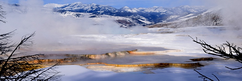
Whitehall GeoGroup, Inc. (WGI) utilizes an integrated approach to earth science in a diversity of consulting projects including minerals remoteness work, geological review of properties, geologic mapping, hydrostratigraphy, oil and gas exploration, reservoir characterization, and minerals evaluation.
Our continued efforts in research of continental sedimentation/ stratigraphic analysis have enabled WGI to provide cutting-edge expertise in these areas. We currently have projects focusing on high-elevation Tertiary sedimentation, isotopic age constraints on Tertiary strata, and the relocation of vertebrate paleontologic age-control locales.

AREAS OF EXPERTISE
(Contact whgeol@gmail.com for more information on Whitehall Geogroup, Inc.’s services.)
CONSERVATION EASEMENT MINERAL REMOTENESS EVALUATION – WGI offers field work and report preparation services for mineral remoteness uations. We have completed over 327 minerals remoteness projects covering portions of Montana, Idaho, North Dakota, and Wyoming properties for various conservation organizations and private entities.
GEOLOGICAL REVIEW OF REAL ESTATE PROPERTY – WGI provides field work and report summaries of properties for private entities in order to meet due diligence and county planning regulations.
PALEOSOL INTERPRETATIONS – A primary focus of WGI’s research is paleosol identification in continental strata. WGI’s current research is focused on calcic paleosols, particularly calcic pedocomplexes.
CONTINENTAL SEDIMENTATION/STRATIGRAPHIC ANALYSIS – WGI research is directed towards the delineation of continental sedimentation patterns by various geological/geophysical techniques, and the development of sequence stratigraphic techniques as applied to continental deposits.
An overview of WGI’s work with continental strata in southwestern Montana is shown in the following YouTube video:
GEOLOGIC MAPPING – WGI specializes in geologic mapping of Cenozoic basin fill in the western United States. We have also recently completed numerous 1:24,000 scale geologic maps for geologic baseline studies of properties throughout western and central Montana. Some of our recent projects in Montana include:
Toston-Townsend, Montana area– WGI has compiled a geologic map of the Toston-Townsend valleys, southwestern Montana. This map includes the Sixmile Creek type section, and is available at the 1:100,000 scale (metric topographic). WGI is continuing geologic mapping in this area. Our emphasis is on mapping the stratigraphy/structure of Cenozoic deposits.
Rocker-Ramsey, Montana area – WGI has recently completed a geologic map of the Rocker – Ramsey area, southwestern Montana. This map is available at the 1:100,000 scale (metric topographic), and covers part of the upper Clark Fork Superfund area.
Sage Creek – Upper Ruby – Blacktail Valleys, Montana – WGI has completed a geologic map of the Sage Creek – Upper Ruby – Blacktail valleys, southwestern Montana. This map is available at the 1:100,000 scale (metric topographic). A report accompanies this map; the report includes unpublished age dates (radiometric/vertebrate land mammal ages) and lithologic descriptions of the Cenozoic strata.
GIS EARTH SCIENCE APPLICATIONS – A recent WGI project is the compilation of vertebrate fossil sites and their associated fossil assemblages found on public lands within Beaverhead and Madison counties, Montana. The fossil site compilation is in ArcView 3.2 format, and was completed for the Bureau of Land Management Dillon Resource Office in Dillon, Montana. Project components include several 100k land grids, associated 100k land ownership grids, and fossil assemblage/ general collection database files.
HIGH RESOLUTION SEISMIC REFLECTION/ REFRACTION DATA ACQUISITION AND INTERPRETATION – WGI performs shallow seismic data acquisition/interpretation. Our work in this area has been focused on developing acquisition parameters and interpretation techniques for Cenozoic continental basin-fill.
VIRTUAL GEOLOGY FIELD TRIPS – WGI is currently developing virtual geological field trips in a multimedia cd-rom format. Our first field trip encompasses the Whitehall, Montana area. Our second virtual field trip is on Southwestern Montana Geology.
CURRENT PROJECTS
- Tertiary vertebrate paleontology and geology of the central Gravelly Range, southwestern Montana.
- Tertiary chronostratigraphy and paleosol-trace fossil associations, Pipestone Springs, southwest Montana.
- Southwestern Montana Tertiary volcanic ash and tuff age analyses, with emphasis on relationships to calcic paleosol pedocomplexes, intervalley stratigraphic correlation, vertebrate fossil paleogeography, and Eocene/Oligocene boundary delineation funded by the Museum of the Rockies, Bozeman, Montana and the Raymond M. Alf Museum, Claremont, California.
- Tertiary geology and vertebrate paleontology of the Lima-Sage Creek area, southwestern Montana.
- Relocation of Earl Douglass’s fossil vertebrate localities found during 1894-1896, Madison Bluffs, southwestern Montana.
STAFF PUBLICATIONS
Several of the recent peer-reviewed journal articles are posted on Academia.edu and Research Gate.
GEOLOGIC MAPS
Geologic Maps : Peer-Reviewed
- O’Neill, J.M., Klepper, M.R., Smedes, H.W., Hanneman, D.L., Frazer, G.D., and Mehnert, H.H., 1996, Geological map and cross sections of the central and southern Highland Mountains, southwestern Montana: U.S. Geological Survey Map I-2525.
- Hanneman, D.L., 1987, Geologic map of the Pintler Lake quadrangle,Beaverhead County, Montana: U.S. Geological Survey MF‑1931.
- Hanneman, D.L., 1987, Geologic map of the Pine Hill quadrangle, Beaverhead County, Montana: U.S. Geological Survey MF‑1930.
- Hanneman, D.L., 1984, Geologic map of the Mud Lake quadrangle, Beaverhead County, Montana: U.S. Geological Survey Map MF ‑ 1696.
- Hanneman, D.L., 1984, Geologic map of the Wisdom quadrangle, Beaverhead County, Montana: U.S. Geological Survey Map MF ‑ 1695.
PROFESSIONAL PAPERS
Professional Papers: Peer-Reviewed
- Hanneman, D.L , Lofgren, D., Hasiotis, S.T., and McIntosh, W.C., 2022, Priabonian, Late Eocene chronostratigraphy, depositional environment, and paleosol-trace fossil associations, Pipestone Springs, southwest Montana, USA: Acta Palaeontologica Polonica 67 (1): 5–20.
- Lofgren, D., Hanneman, D.L., Bibbens, J., Gerken. L., Hu, F., Runkel, A., Kong, I., Tarakji, A., Helgeson, A., Gerard, I., Li, R., Li, S., and Ji, Z., 2020, Eocene and Oligocene mammals from the Gravelly Range of southwest Montana: Honey Memorial Volume, Paludicola, v. 12, #4, p. 263-297.
- Hanneman, D.L., and Wideman, C.J., 2009, Continental sequence stratigraphy and continental carbonates, Carbonates in Continental Settings: Processes, Facies and Applications, Alonso-Zarza, A.M., and Tanner, L.H., eds., Elsevier, p.215-273.
- Hanneman, D.L., and Wideman, C.J., 2006, Calcic paleosol stacks – regional sequence boundary indicators in Tertiary deposits of the Great Plains and Western USA: Geological Society of America, Paleoenvironmental Record and Applications of Calcretes and Palustrine Carbonates, Special Paper 416, p.1-15.
- Wang, X., Wideman, B.C., Nichols, R., and Hanneman, D.L., 2004, A new species of Aelurodon (Carnivora, Canidae) from the Barstovian of Montana: Journal of Vertebrate Paleontology, v. 24, p.445-452.
- Hanneman, D.L., Cheney, E., and Wideman, C.J., 2003, Cenozoic sequence stratigraphy of northwestern USA; SEPM Cenozoic Systems of the Western United States, Raynolds, R.G. and Flores, R.M., eds., p.135-156.
- Hanneman, D.L., Wideman, C.J., and Halvorson, J., 1994, Calcic paleosols: their use in subsurface stratigraphy: American Association of Petroleum Geologists Bulletin, v. 78, p.1360-1371.
- Hanneman, D.L., and Wideman, C.J., 1991, Sequence stratigraphy of Cenozoic continental rocks: Geological Society of America Bulletin, v.103, p.1335-1345.
- Hanneman, D.L., and Wideman, C.J., 1990, Paleosols: reflectors in continental sequences: Geophysics: The Leading Edge of Exploration, v.9, p.38-40.
- Foxworthy, B., Hanneman, D.L., Coffin, D.L., and Halstead, E.C., 1987, Hydrogeologic regions ‑ Region 1, western mountain ranges: in Hydrogeology: Back, W., Rosenshein, J. S., and Seaber, P.R., eds., Decade of North American Geology, v. O‑2., p.25‑35.
- O’Neill, J.M., Ferris, D.C., Schmidt, C.J., and Hanneman, D.L., 1984, Recurrent movement along northwest trending faults, southern Highland Mountains, southwestern Montana: in A Guide to Belt Rocks: Roberts, Sheila, ed., Montana Bureau of Mines and Geology Special Publication 94, p.209‑216.
Non-Journal Articles
- Hanneman, D.L., 2013, Journeying through Cuba’s geology and culture: Earth, v. 58, no. 8, p.42-51.
- Hanneman, D.L., 2008, Geological consulting and kids: An unpredictable balancing act?: Motherhood, The Elephant in the Laboratory, Monosson, E., ed., Cornell University Press, p.79-82.
Field Guides
- Boggs, K.J.E., and Hanneman, D.L., 2014, Tectonics, Climate Change, and Evolution: Southern Canadian Cordillera: Association for Women Geoscientists Annual Field Trip, 189 p.
Abstracts
- Hanneman, D.L., Hasiotis, S., Wideman, C. J., Lofgren, D. And Mcintosh, W. C., 2021, Integrating sedimentology, ichnology, and paleopedology to reconstruct landscapes and ecosystems of the upper Eocene Pipestone Springs strata, western Montana: Geological Society of America Abstracts with Programs, 53, no. 6, doi: 10.1130/abs/2021AM-370629.
- Hanneman, D.L., Hasiotis, S., Lofgren, D. And Mcintosh, W. C., 2020, Late Eocene Chronostratigraphy, Depositional Environment, And Paleosol-Trace Fossil Associations, Pipestone Springs, Southwest Montana: Geological Society of America Abstracts with Programs, v. 52, no. 6,
doi: 10.1130/abs/2020AM-355268. - Atwater, A.L., Wang, X. Thomson, K.D., Hanneman, D.L., and Stockli, D., 2019, A new species of Paratomarctus (Carnivora, Canidae) from the middle Miocene of Montana: Society of Vertebrate Paleontology 79th Annual Meeting, Brisbane, Australia, p. 56.
- Li, L., Fan, M., and Hanneman, D.L., 2017, Stable isotope evidence (δ18O AND δD) for late Eocene–late Miocene topography and climate in the northern Rocky Mountains, southwestern Montana: Geological Society of America Abstracts with Programs, v. 49, no. 6, doi: 10.1130/abs/2017AM-299842
- Hanneman, D.L., and Lofgren, D., 2017, Vertebrate Paleontology and Geology of High Elevation Tertiary Deposits in the Gravelly Range, Southwestern Montana: Geological Society of America Abstracts with Programs, v. 49, no. 5, doi: 10.1130/abs/2017RM-293156.
- Lofgren, D., Hanneman, D.L., Bibbens, J., Kong, B., and Tarakji, A., 2017, Mammalian biostratigraphy of high elevation Tertiary strata in the Gravelly Range of SW Montana: Society of Vertebrate Paleontology Meeting Abstracts with Programs. Calgary, Alberta, Canada, p. 152.
- Hanneman, D.L., and Wideman, C.J., 2016, Cenozoic Stratigraphy in Western Montana: Current Status and A Way Forward, Geological Society of America Abstracts with Programs, v. 48, no. 7, doi: 10.1130/abs/2016AM-279878.
- Wade, D., Nielsen, C., and Hanneman, D.L., 2016, Age Constraints on Cenozoic Continental Deposits, Madison Bluffs, Southwestern Montana, Geological Society of America Abstracts with Programs, v. 48, no. 7, doi: 10.1130/abs/2016AM-282047.
- Nielsen, C., Wade, D., and Hanneman, D.L., 2016, Neogene Distributive Fluvial System Strata at the Anceney Fossil Vertebrate Locality, Southwestern Montana, Geological Society of America Abstracts with Programs, v. 48, no. 7, doi: 10.1130/abs/2016AM-281977.
- Hanneman, D.L., and Wideman, C.J., 2013, Cenozoic tectonic sequences and basin evolution in western Montana, Geological Society of America, Abstracts with Programs, v. 45, no. 7, p. 134.
- Hanneman, D.L., and Wideman, C.J., 2010, White River Group Equivalents in Montana: Geological Society of America, Abstracts with Programs, Rocky Mountain Sectional meeting, v. 42, no. 3, p.18.
- Hanneman, D.L., and Wideman, C.J., 2009, Continental sequence stratigraphy with emphasis on continental carbonates: Geological Society of America, Abstracts with Programs, v. 41, no. 7, p.123.
- HannemanL., and Wideman, C.J., 2006, Sequence Stratigraphy and Paleosols in Continental Rocks – Examples from Cenozoic Deposits of the Great Plains and Western USA: American Association of Petroleum Geologists, Abstracts, regional meeting.
- HannemanL., and Wideman, C.J., 2005, Calcic pedocomplexes delineate sequence boundaries in Tertiary strata of the Great Plains and western USA: Geological Society of America, Abstracts with Programs, v. 37, no. 7, p.139.
- HannemanL., and Wideman, C.J., 2005, Calcic Paleosols – Regional sequence boundary indicators in Cenozoic strata of southwestern Montana: American Association of Petroleum Geologists, Abstracts with Programs, Calgary, Alberta, Canada.
- Hanneman, D.L., and Wideman, C.J., 2004, Ash fall tuff marker beds within Cenozoic basin-fill of Southwestern Montana: Geological Society of America, Abstracts with Programs, p.72.
- Hanneman, D.L., Cheney, E., Wideman, C.J., 2002, Cenozoic synthems of the northwestern United States; Geological Society of America, Abstracts with Programs, p.281.
- Hanneman, D.L., Wideman, C.J., 1998, Age Reassessment of some units within the upper Cretaceous Beaverhead Group, Southwestern Montana: Geological Society of America, Abstracts with Programs, p. A292.
- Hanneman, D.L., Conaway, J., Feiveson, T.D., Hammar-Close, E., and Sneeringer, J., 1997, Cenozoic geology of a part of the Silver Bow Creek/Butte area Superfund Site, Southwestern Montana: Geological Society of America, Abstracts with Programs, p.148.
- Hanneman, D.L., Wideman, C.J., and Evanoff, E., 1996, Seismic refraction and reflection surveys of the late Paleogene Florissant Formation, Florissant Fossil Beds National Monument, Colorado: Geological Society of America, Abstracts with Programs, p.A524.
- Hanneman, D.L., and Wideman, C.J., 1996, Cenozoic geology of the Sage Creek-Blacktail area, southwestern Montana: American Association of Petroleum Geologists, Abstracts, Rocky Mountain sectional meeting.
- Hanneman, D.L., and Wideman, C.J., 1996, Continental sequence stratigraphy of Tertiary strata in the Toston-Townsend Valley, southwestern Montana: American Association of Petroleum Geologists, Abstracts, Rocky Mountain sectional meeting.
- Link, C.A., Hanneman, D.L., Wideman, C.J., and Halvorson, J., 1995, Predicting lithologic parameters using artificial neural networks: American Association of Petroleum Geologists, Abstracts with Programs, Rocky Mountain sectional meeting.
- Hanneman, D.L., Wideman, C.J., and Halvorson, J., 1995, Tertiary stratigraphy and Cenozoic structure of the Sixmile Creek Formation in the Sixmile Creek area, southwestern Montana: Geological Society of America, Abstracts with Programs, Rocky Mountain sectional meeting, p.13.
- Hanneman, D.L., Wideman, C.J., and Halvorson, J., 1992, Paleosols: their use in well log correlation and seismic stratigraphy: Geological Society of America, Abstracts with Programs, p.A230.
- Hanneman, D.L., and Wideman, C.J., 1991, Sequence stratigraphy of continental Cenozoic deposits, southwestern Montana: Geological Society of America, Abstracts with Programs, p.A181.
- Hanneman, D.L., and Wideman, C.J., 1991, Paleosols: sequence boundaries in continental rocks: American Association of Petroleum Geologists, Abstracts, Rocky Mountain sectional meeting, p.40-41.
- Hanneman, D.L., and Wideman, C.J., 1990, Cenozoic unconformities southwestern Montana: stratigraphic sequence markers: Geological Society of America, Abstracts with Programs, Rocky Mountain sectional meeting, p.
- Hanneman, D.L.,1989, Cenozoic basin‑fill sequences, southwestern Montana: Geological Society of America, Abstracts with Programs, Rocky Mountain sectional meeting, p. 89‑90.
- Hanneman, D.L., 1988, Depositional systems of Cenozoic basins, southwestern Montana: Geological Society of America, Abstracts with Programs, Rocky Mountain sectional meeting, p.A315‑316.
- Hanneman, D.L., and Wideman, C.J., 1988, Tertiary‑Quaternary basin formation, southwestern Montana: Geological Society of America, Abstracts with Programs, Rocky Mountain sectional meeting, p.419.
- Hanneman, D.L., O’Neill, J.M., and Wideman, C.J., 1987, Late Cenozoic faulting in the Highland Mountains and adjacent basins, southwestern Montana: Geological Society of America, Abstracts with Programs, Rocky Mountain sectional meeting, p.281.
- Hanneman, D.L., and O’Neill, J.M., 1986, Late Tertiary‑Quaternary collapse of a Rocky Mountain foreland uplift, southwestern Montana: Geological Society of America, Abstracts with Programs, Rocky Mountain sectional meeting, p.359.
- Hanneman, D.L., Patton, T., Tabrum, A.R., and O’Neill, J.M., 1985, Tertiary geology of the Melrose and Rocker basins, southwestern Montana: Geological Society of America, Abstracts with Programs, Rocky Mountain sectional meeting, p.223.
- Hanneman, D.L., and Nichols, R., 1981, Late Tertiary sedimentary rocks of the Big Hole basin, southwestern Montana: Geological Society of America, Abstracts with Programs, Rocky Mountain sectional meeting, p.199.