
Australian Weather
National Summary
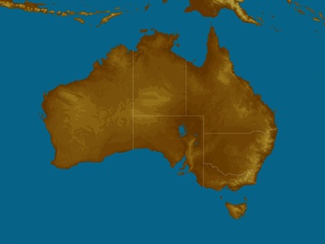
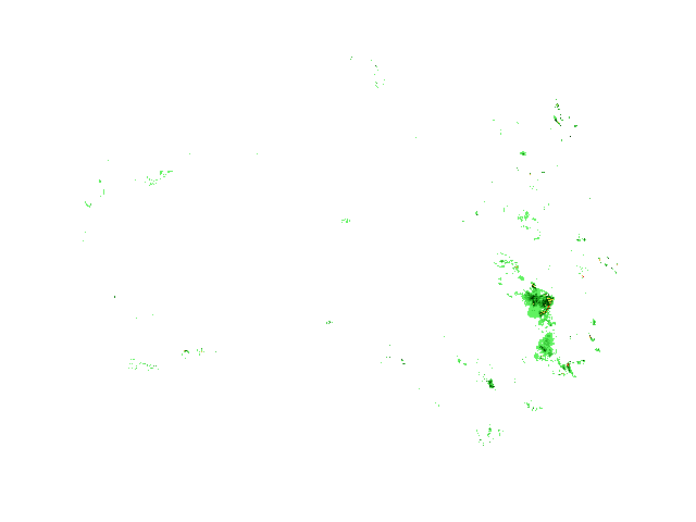
A cold front, low & troughs are producing rain, showers, gusty winds & storms in parts of TAS, VIC & NSW. Troughs over northern & southern QLD are triggering showers & storms. Onshore winds are causing a few showers in southern WA & southeast SA. Mostly clear elsewhere.
State Weather
Click for state forecasts


National Synoptic

Weather News
Cyclone Seroja payment leaves more questions than answers for Kalbarri small business
05:40 EST
Midwest residents and businesses impacted by Cyclone Seroja have been left with more questions than answers after the WA government announced a new financial support payment over the weekend.
Storm activity to intensify along Queensland coast and hinterlands from tonight, BOM warns
05:03 EST
Damaging winds, golf ball-sized hail and heavy rainfall are predicted for Queensland's northern tropics on Monday evening, with south-east Queensland expecting similar conditions on Tuesday.


Extremes and Records
| Current Extremes | Last 3 Days Extremes | Extremes This Month | |||
|---|---|---|---|---|---|
| Fri 07/05 | Sat 08/05 | Sun 09/05 | |||
|
29.6°C Broome Port, WA |
Hottest |
36.2°C Wyndham Airport, WA |
51.2°C Bellambi Pt, NSW/ACT |
51.2°C Bellambi Pt, NSW/ACT |
51.2°C Bellambi Pt, NSW/ACT |
|
-1.6°C Mt Wellington, Tas |
Coldest |
0.6°C Lake St Clair, Tas |
-1.4°C Lake Leake, Tas |
-2.9°C Ross, Tas |
-20.3°C DUMONT D URVILLE, Tas |
|
S 59km/h Mount Read, Tas |
Windiest |
77km/h Maatsuyker Island, Tas |
92km/h Maatsuyker Island, Tas |
109km/h Thredbo Top Station, NSW/ACT |
- |
|
5.6mm last hr Thredbo Top Station, NSW/ACT |
Wettest |
48.0mm Grassy Gully, NSW/ACT |
41.0mm Cocos Island Ap, WA |
50.6mm Coffs Harbour Airport, NSW/ACT |
51.0mm Coffs Harbour Airport, NSW/ACT |
| Australia's Records for May | |||
|---|---|---|---|
| Max | Min | Rain | |
| Highest 47.0°C at Bulman, NT in 2016 Lowest -6.0°C at Thredbo Top Station, NSW/ACT in 2000 |
Highest 30.5°C at Lake Cargelligo Ap, NSW/ACT in 1990 Lowest -14.2°C at Namadgi National Park, NSW/ACT in 1987 |
Highest 536.6mm at Orbost, Vic in 2017 |
|
-
Display your Local Weather here
automatically each time you visit us:

Rotates through Temperature,
Wind, Humidity and RainUse the Search Bar above
to find your Local, and go to the Local page
Click "Set My Local"
button next to the location name


