Posts

Showing posts with the label Hike

Hale'-ta Hike: Litekyan

Image
Throughout the year, Independent Guåhan organizes "Håle'-ta Hikes," aimed at bringing the community into the island's historic and culturally sacred sites, in hopes of helping them understand the need to protect them. The last hike happened earlier this year to Litekyan. We had a huge crowd of people show up. Here are some of my pictures from the day. Gefpågo na ha'åni, esta gof annok gi litråtu siha.  *************************************

Hale'-ta Hike: Pågat

Image
So far this year Independent Guåhan has organized two Hale'-ta Hikes; the first to Laso' Fouha or Fouha Rock, and the second to Hila'an. Our third hike is set for later this month to Pågat. I have written in several articles recently about how important this type of outreach has been in terms of developing community resistance to US military plans in Guam. Taking people into the areas that may be affected, contaminated or closed off to the public, and allowing them to forge their own personal and eventually, hopefully, political connections was essential, especially in the case of Pågat. This is one reason why things have been different recently with regards to Litekyan. The fact that when you take people on hikes there, you are walking not through "public" or "local" lands, but instead federal property makes it difficult for people to imagine a strong connection to the lands and their meaning. Instead it feels like more of the stolen lands, stolen

The Taotaomo'na Test

Image
If you asked me six years ago if I had any taotaomo'na experiences I would have named just one and a couple of other maybes. But after being a hiking fiend on Guam and spending a great deal of time in the jungle with a wide range of people I can honestly say I have had lots of experiences with taotaomo'na or supernatural phenomena on Guam. Some of these experiences are small and strange, faint feelings, as if there is a glitch out there somewhere and you know it is there, but just not sure where. Others have been full-blown experiences that I cannot explain, where strange, bewildering things happened, and I have seen things that I cannot explain. I always prepare my students for things that might happen and this both excites and scares them. Most people on Guam have heard of taotaomo'na stories and know people who know people where things have happened to them. But even if the stories are everywhere, this doesn't mean people have an intimate relationship to this spi

Asut na Langhet Siha

Image
I hiked to Pagat this morning and it was the perfect experience to start an arbitrary unit of time with. There were light showers throughout the hike. The skies were beautiful and blue. The waters of the freshwater cave were calming and relaxing. After weeks and months of so much chaos and pain in my life it felt like the start that I needed. This morning was a reminder that even if things seem so tough and impossible, the healing touch of sacred waters, the inviting blue of new skies and the freshness of the air mixing with rains, all of it holds the promise that things can get better.

Matai na Hilitai

Image
This was a picture from the trail at Pagat. There is no way I cannot feel philosophical about this sight. A hilitai, crushed and flattened into the earth. At a place no less which as been controversial for a variety of reasons the past few years. I find it particularly interesting since hilitai have a habit of following me when I hike. The first time I tried to catch a hilitai was at Hila'an. In the area that I call the lemmai grove, I saw one standing atop a lusong. I tiptoed as quietly as I could to try and reach it. Naturally I'm not much of a ninja and so the hilitai immediately heard me. Instead of running though, it just stared at me. Watching me get closer and closer to it. Once I was too close, it plodded off the lusong and started to crawl briskly into the jungle. I raced after it, but couldn't find it. When the rest of my friends arrived I told them about how I had almost caught a hilitai. As I spoke it started to rain. My friend b

STOP

Image
Over the past few years I have been on many hikes here on Guam. I have seen so many beautiful things on these hikes. I have found artifacts that hundreds had probably walked by, but never noticed before. I have found latte stones that may have gone unseen for centuries before I stumbled upon them, literally. I have seen sunsets sitting on rocks that seemed to be created strictly for the purpose of allowing ones eyes to swallow the sky in massive gulps. I have seen the ocean in so many types of blue at a given moment that it both looks like one massive solid color and a multitude of disagreeing blues at the same time. Throughout these hikes the history and beauty of Guam has come alive in so many ways. I feel not only a stronger connection to the present day Guam, but also to so many versions of its throughout the past. Walking amongst latte stones where Chamorros walked hundreds of years before. Exploring caves where Chamorros and Japanese soldiers huddled hiding from American bo

Si Jack

Image
Estague i che'lu-hu Si Jack yan i lahi-hu Si Akli'e'. Mambisita Si Jack giya Guahan gi i ma'pos na mes. Hu kekekombense gui' na maolekna ha move gui' tatte para este na isla. Gof apmam desde sumaga' Si Jack giya Guahan ya dos biahi ha' ha bisita desde ki ha dingu gui'. Para Guahu gof malago' yu' na u saga' mo'na guini sa' sina manhami yan i dos che'lu-hu. Gof hagas desde na manggaige ham gi i parehu na pidasun tano'.

A Moment Without Facebook

Image
I love going to Anao in Yigo. I've only been there a few times, but I really enjoy it each time I go. For those of you who haven't heard of Anao, it's north of Hanom, almost on the edge of Anderson. In order to get there you hike for about 20 mins through some jungle and then get to the cliff's edge where a trail will take you down several hundred feet to the rocky limestone shore. There are some pretty cool features once you reach the limestone shore for those who love natural beauty. There is a massive rock that some people call "the pinnacle" that sticks conspciously out of the rest of the fairly flat limestone. When I took my History of Guam and World History 2 students to Anao last week, we explored to the north and found a pretty neat cove. There was a large rock, well over twenty feet high that stuck out past the shore, and was connected by a narrow land bridge. Several of my students and I climbed up it to take pictures. I recommend visiting Anao

Pagat Point Photos

Image
 

Pagat Point

Image
This is a picture of me about to get hit by a wave. So many different cultures have ways of saying that you should never turn your back on the ocean. They say this for very good reasons. Regardless of the many ways that humans have developed to tame nature or to make it obey or serve their needs, the unknown, the limitlessness, the infinite and the alterity of the natural world persists. The ocean may look lovely and friendly one moment, but can in what appears to be just an instant, turn on you, and become violent and angry. I am standing on the lamasa or limestone shelf at Pagat Point in this picture. I have been there many times over the past year while exploring the Pagat area with Halomtano', and by this point I should have learned not to turn my back on the ocean. The first time I came to Pagat Point with Halomtano', we were hit by a massive rogue wave, which surprised us as we were walking on the shelf, slamming us against the cliffs before dragging us over the rocks

Tano'

Image
This article is from last week's Marianas Variety and so the dates are a bit off, as the hike to Ague Cove took place over the weekend. But for those of you still looking to go on some Heritage Hikes, there are two left. Hila'an is very common hike that people go on, as it is home to Shark's Pit and Lost Pond. What most people don't realize is that if you walk into the jungle just a little bit, you will not just be treated to few latte stones here and there, but you can actually find close to 100 latte . Some of them still standing, some of them still arranged as they might have been centuries ago. You can basically walk through the Ancient village of Hila'an. That hike will take place on October 30th, and start time will be at 3:30 pm at Tanguissan Beach Park. Our last hike will be to Pagat Point, which is much less known than both Hila'an and Pagat Cave. The hike for that will be on November 5th, and we'll be starting at 9 am, start point will be the Pag

Na'i Tatte, Chule' Tatte

Image
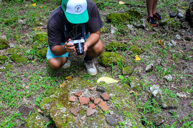
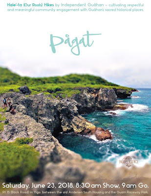
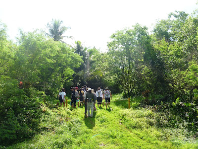
Hafa adai, We Are Guåhan is pleased to announce its fourth series of Heritage Hikes: Nå’i Tåtte, Chule' Tåtte. The title translates to "Give Back, Take Back," as this series of hikes will deal with the Department of Defense's complex history of land taking and land returns on Guam. The title he upcoming Heritage Hikes will include 2 new sites, Ague Cove and Pågat Point, as well as a Sunday afternoon hike to Hila’an Village. The hike schedule is as follows: · Saturday, October 22, 2011 – Ague Cove (Difficulty: Easy. Duration: 2 – 2.5 hours) Meet at Former FAA property (near NCS Dededo) · Sunday, October 30, 2011 – Hila'an Village (Difficulty: Very Easy. Duration: 2 – 2.5hours) Meet at Tanguisson Beach Park. · Saturday, November 5, 2011 – Pågat Point (Difficulty: Medium. Duration: 3 – 4 hours) Meet at Pågat trailhead along The Back Road. WHEN: The show-time for the Ague Cove and Pågat Point hikes is 8:45a.m. with a go-time 9:00 a.m. The show time for the

Mount Lamlam

Image
I took my UOG summer class students to Mount Lamlam for an extra credit hike over the weekend. For those of you who know me, you might already be making ominous sounds and widening your eyes preparing for an update about my struggle with that particular peak on Guam. For those of you who don't know me I won't bore you too much, but let me just say that me and Mount Lamlam have a history, a difficult, painful history of me getting lost on that hike. On a good day a hike up and down Mount Lamlam should take 2 - 3 hours depending on how fast you move. On a bad day it can take 4 - 6 hours. The extra times comes from the sword grass or bamboo being too dense that trails disappear and also can come from the fact that if your group is too large they get spread out and staggered along a winding, uneven and sometimes dangerous path slowing you down. The hike over the weekend was no different, as close to 50 of my students and their friends showed up and this led to a long day of hik