

Australian Weather


National Summary
A trough is generating showers and storms in parts of NSW, some severe, and showers in southeast QLD. Onshore winds are bringing a few showers to parts of SA, VIC and TAS. A cold front crossing southwest WA is causing a few showers. Low pressure in the tropics is causing showers.
State Weather
Click for state forecasts


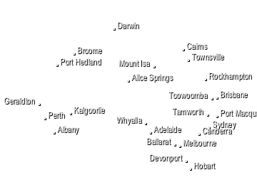
National Synoptic

Weather News
BOM and CSIRO State of the Climate 2020 shows Australia is experiencing climate change now
10:36 EDT
The Bureau of Meteorology and the CSIRO have teamed up for the latest biannual report on the climate, and the findings are clear: Australia is experiencing climate change now, and the warming trend is continuing.
Heatwave and storms forecast for Queensland, Bureau of Meteorology says
08:54 EDT
There's a good chance severe storm warnings will be issued for parts of Queensland this afternoon, ahead of stifling conditions into the weekend, the Bureau of Meteorology says.
Extremes and Records
| Current Extremes | Last 3 Days Extremes | Extremes This Month | |||
|---|---|---|---|---|---|
| Tue 10/11 | Wed 11/11 | Thu 12/11 | |||
|
41.0°C Rabbit Flat, NT |
Hottest |
43.7°C Jervois, NT |
44.8°C Urandangi, Qld |
44.7°C Wyndham Airport, WA |
45.3°C Fitzroy Crossing, WA |
|
6.1°C Thredbo Top Station, NSW/ACT |
Coldest |
0.8°C Balladonia, WA |
3.0°C Thredbo Village, NSW/ACT |
3.0°C Mt Buller, Vic |
-8.1°C Frederick Reef, Qld |
|
NW 50km/h Maatsuyker Island, Tas |
Windiest |
120km/h Edinburgh, SA |
114km/h Bradshaw, NT |
122km/h Mt Wellington, Tas |
- |
|
6.6mm last hr Dubbo Ap, NSW/ACT |
Wettest |
25.6mm The Duke, WA |
44.4mm Overnewton, NSW/ACT |
73.6mm Centre Island, NT |
74.0mm Centre Island, NT |
| Australia's Records for November | |||
|---|---|---|---|
| Max | Min | Rain | |
| Highest 48.7°C at Birdsville Police Station, Qld in 1990 Lowest -3.1°C at Thredbo Top Station, NSW/ACT in 1967 |
Highest 38.0°C at Balgo Hills, WA in 2015 Lowest -8.5°C at Thredbo Top Station, NSW/ACT in 1973 |
Highest 630.0mm at Bellenden Ker Top Stn, Qld in 1989 |
|
-
Display your Local Weather here
automatically each time you visit us:

Rotates through Temperature,
Wind, Humidity and RainUse the Search Bar above
to find your Local, and go to the Local page
Click "Set My Local"
button next to the location name

