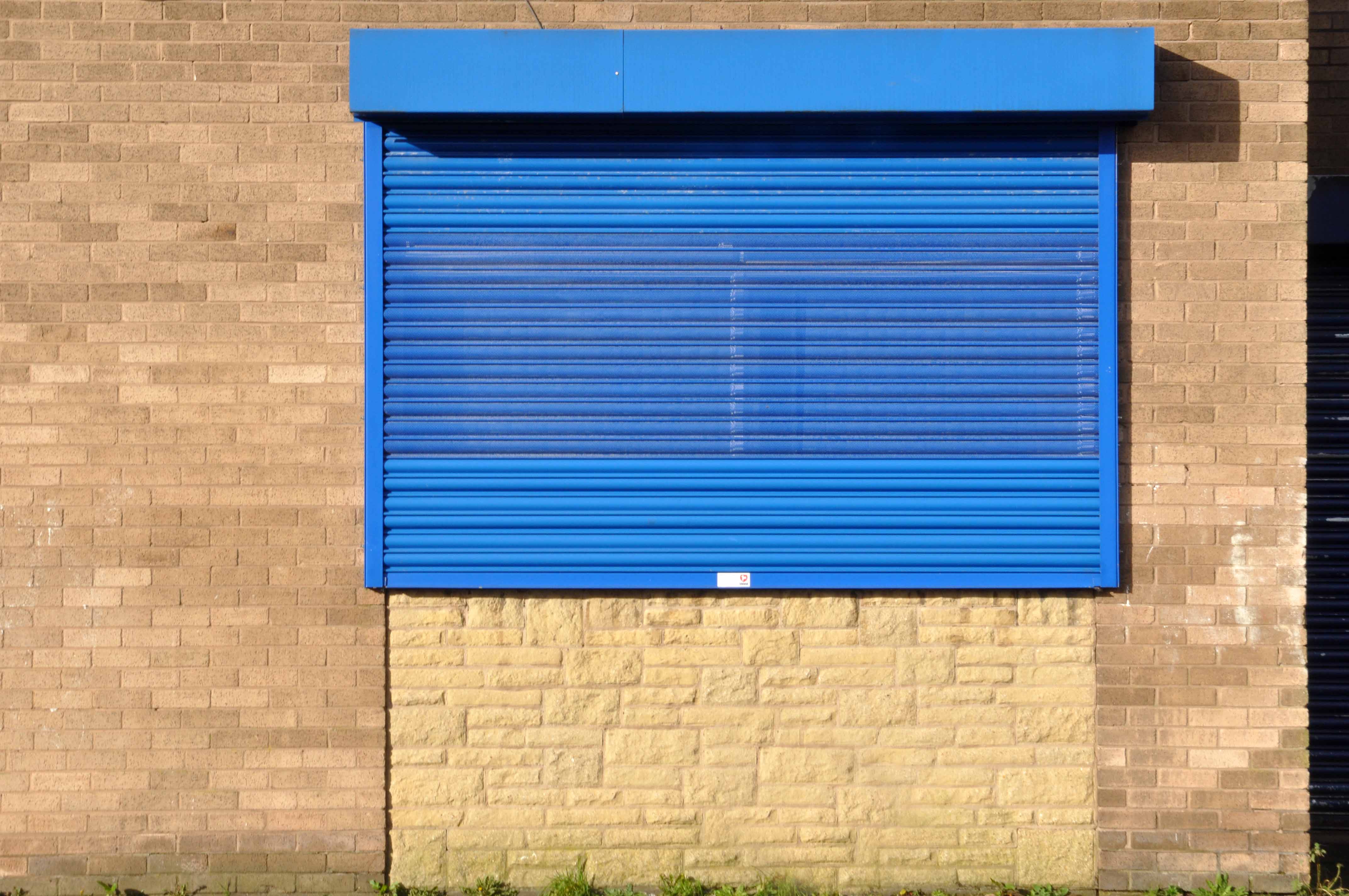
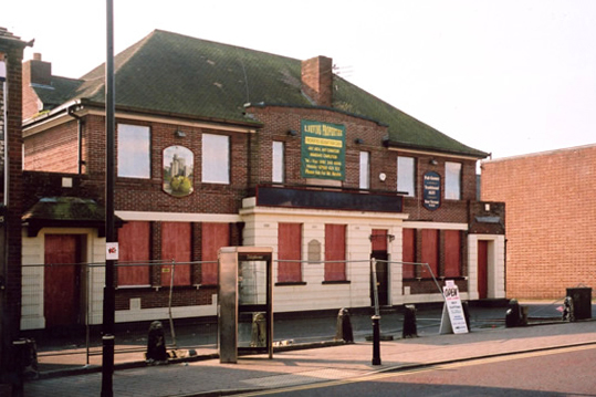
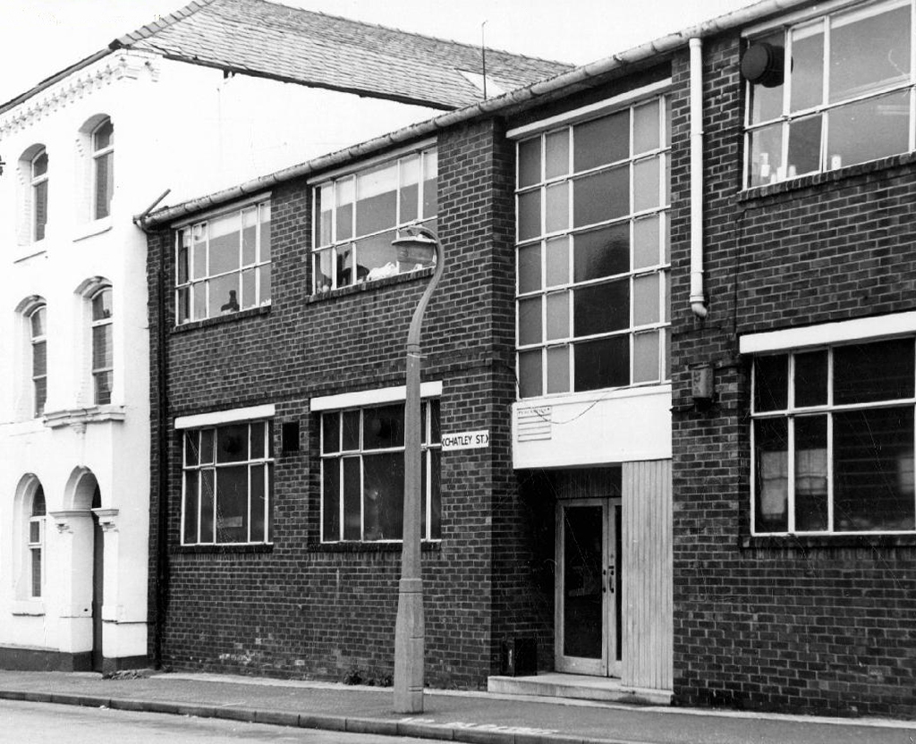
The Cheshire Lines Committee CLC operated Stockport, Timperley and Altrincham Junction Railway line from Portwood to Skelton Junction, a section of what became the Woodley to Glazebrook line.
It remained a part of the CLC, which was jointly owned from 1923 by the London and North Eastern Railway and the London Midland and Scottish Railway , until 1948 when it became part of the British Railways London Midland Region.
Closed in 1982, following the demise of the Woodhead route; the track was subsequently lifted in 1986.
in the age of steam mainline St Pancras trains and local stoppers flew by.
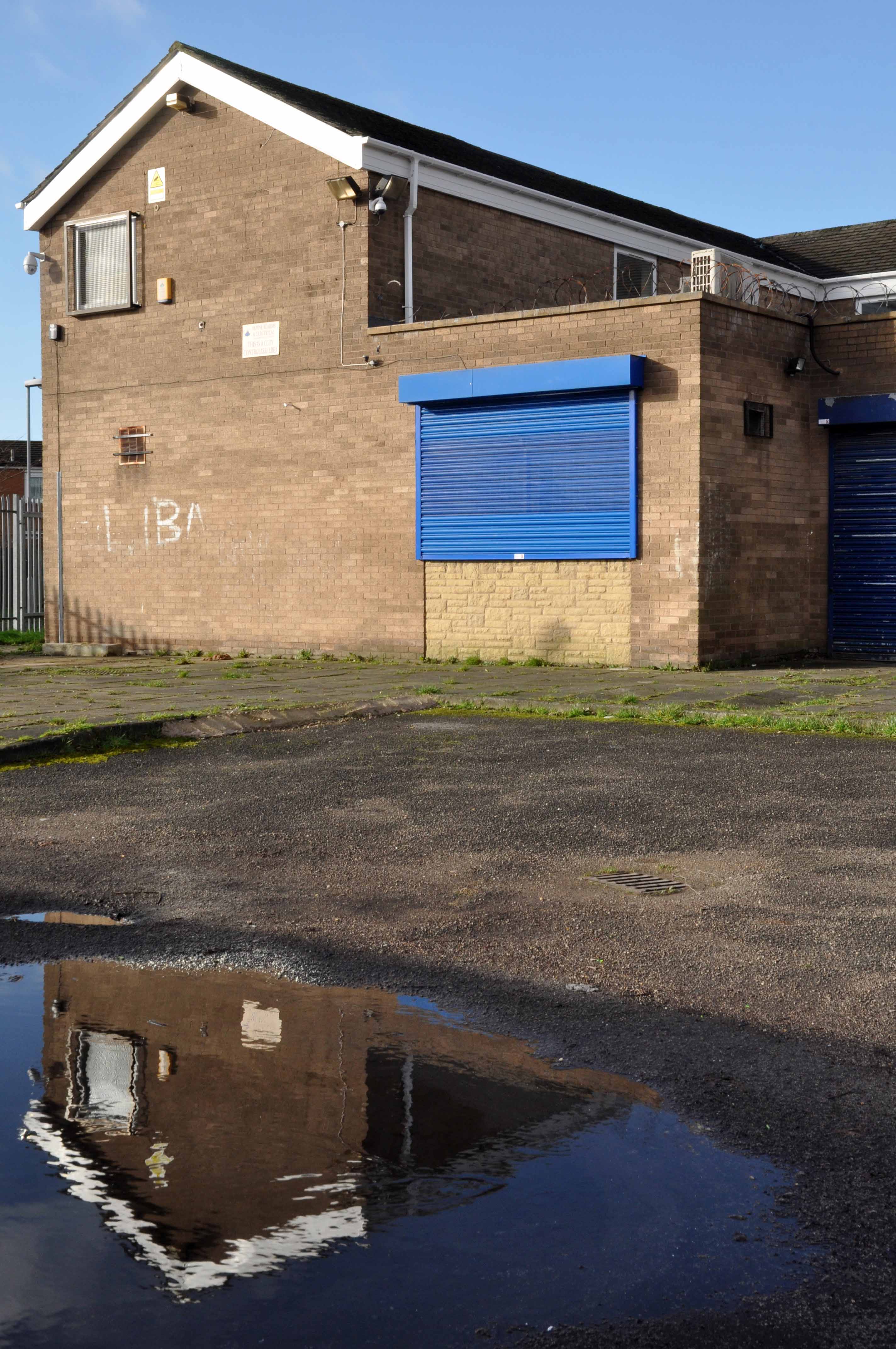
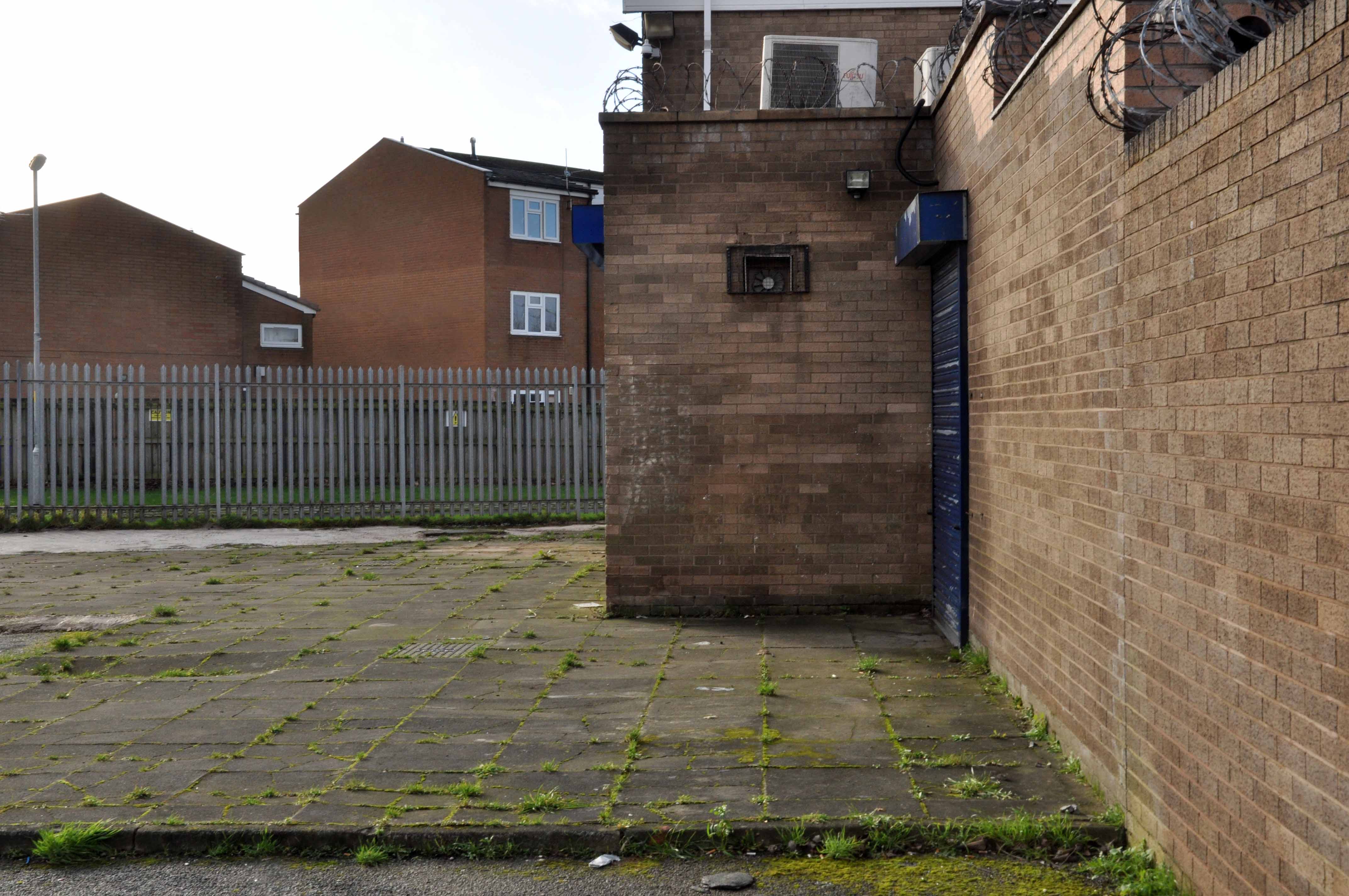
My interest lies in the small portion of track at the end of Georges Road – I worked as a Guide Bridge goods guard in and out of the scrap yard there, in the Seventies.
Now I walk past almost every day and it’s almost all gone.
The bridge which it supported now demolished, time called long ago in the long lost Gardeners Arms – originally a Bell’s Brewery pub latterly a Robinsons house.
What remains is a triangular island faced in glazed and blue engineer’s brick, topped out with trees.
I have entertained the idea of accessing the area by ladder, exploring and possibly setting up camp – though I think the proximity to an almost constant flow of traffic, would prove less than commodious.
It evokes for me an elevated affinity with Ballard’s Concrete Island.
He reached the foot of the embankment, and waved with one arm, shouting at the few cars moving along the westbound carriageway. None of the drivers could see him, let alone hear his dry-throated croak, and Maitland stopped, conserving his strength. He tried to climb the embankment, but within a few steps collapsed in a heap on the muddy slope.
So here it is as is complete with tags, signs, cracks and all.
It remains as a monument to those who built and worked on the railway.
You’re getting three for the price of one – Larry and Johnny only offered two between them.
Friday 5th September Great Yarmouth to Cromer.
Saturday 6th September Cromer to Skegness.
Sunday 7th September Skegness to Cleethorpes.
The royal we however are unable to display the fine array of snaps to which you have become accustomed – normal service will not be resumed as soon as possible.
How so you ask – I’ll tell you how so, you may recall the seafront snaps taken on Great Yarmouth prom under the cover of darkness.
Well you see, I inadvisedly rested my camera upon sandy surfaces in order to steady the shot. I subsequently discovered that sand and photographic technology are a poor pairing.
I killed my camera.
To see a world in a grain of sand, and a heaven in a wild flower, hold Infinity in the palm of your hand, and eternity in an hour.
I think not.
There’s only one thing for it – two Tesco Value disposable cameras!
With diminished means the royal we hurried on, with diminished returns in view, it is with heavy heart and sand filled socks that I present such thin gruel.
No pearls from this grit filled oyster, all chaff and no wheat – that’s me.
It was hard work editing these images – resembling archival material discovered at the bottom of a 16th century tar barrel.
They’re not even in the right order.
And I’m unsure of many of the locations.
Please accept my profound apologies, I’ll never do it again – I promise.
Appleby’s Famous Farm Ices – Main Rd Conisholme Louth LN11 7LS
This is all the information we have available, if you pop in, please ask them to get in touch with Big Barn to add more.
Stymie Bold Italic aka Profil double whammy coming right up!
Gammon is a traditional gentlemen’s hairdressers in Long Sutton, call into Gammon’s and experience the atmosphere of Long Sutton’s only male hairdressers.
We are exclusively a traditional men only salon, catering for all ages. Running a drop-in system, and with two chairs available waiting times are kept to a minimum.
At Gammon Traditional Gentleman’s Hairdressers you can also purchase a range of Electric Razors and Toiletries along with a large variety of Gifts.
Gammon Traditional Gents Hairdressers also stock fragrances for him and her that include:- Chanel, Safari, Polo, Ghost, Opium, Quorum, Tabac, Lacoste, Calvin Klein, Dolce and Gabanna, Poison, Davidoff, Iceberg Twice, Jazz, Aramis, Sergio Tacchini, Azzaro, Farenheit, Giorgio, and many more.
Welcome to Giles Bros located in Kings Lynn town centre. Established in 1921 and still trading from the same premises offering MOT’s on all makes of vehicle in the centre of King’s Lynn. If your looking for a reliable and friendly service you have come to the right place. Please feel free to look around our website and see just what we offer.
Although modern motor vehicles have changed so much since the early days our customer commitment hasn’t.
There has been a pier in Cromer since 1391, but history really relates from 1822 onwards. In this year, a 210 foot wooden jetty was built, but unfortunately it was washed away in 1843. It was then replaced with another slightly longer one, 240 foot, which lasted until 1890. This one was also destroyed by the stormy seas and the remains were consequently sold at auction for £40.
Following this, very sensibly, an iron jetty was built that was 500 foot long, together with a bandstand which was eventually extended into a pavilion.
During the war Cromer Pier was sectioned for defence purposes.
The poor Pier also had its fair share of being damaged too, which I suppose is understandable, being stuck out in the sea!
St Magaret Witton-by-Walsham one of the enchanting Norfolk churches I passed by and the only one I entered. It had provision for an unattended brew and home made cake, just the job.
The church is an elegant, well-kept, peaceful building, but it is also rather quirky. There are two splayed round windows in the lower north side of the nave it seems reasonable to think that they are genuine Saxon windows, and this is a genuine Saxon piece of wall. As is the lower part of the south wall, for both sides have long and short work ironstone blocks forming the corners with the west wall.
In the early 14th Century they began to expand the church, but rather than rebuild it they heightened the existing walls, which is why the tower and the church still make an awkward juxtaposition even today. There is a clerestory on both sides of the church, but an aisle only to the south, contemporary with the clerestory, rather than with the 15th century crowning of the tower with a bell stage and battlements.
When the Tudors extended the tower, they needed a way for people to get up to the bell stage. Rather than build a stairway inside the tower in the conventional manner, they built a stair turret inside the church, against the west wall of the nave, which is at once awkward and intriguing. Tucked in beside the stair turret is a large converted barrel organ. I remembered the late Tom Muckley observing that small villages like this usually owned just one barrel organ, which was used in the church on Sunday and then moved to the pub for the rest of the week.
This may seem sufficient to satiate the local historian’s voracious appetite for facts and general tittle tattle, but wait.
384 King’s Road was once home to pop sensation Steven Patrick Morrissey – seen here imitating himself in Elisabeth Blanchet’s photograph.
More than once this charming lad would have walked the bridge himself – on the way to goodnesses knows where.
In later life he changed his name to The Smiths and wrote a chart topping tune Still Ill name checking the Iron Bridge.
Under the iron bridge we kissed And although I ended up with sore lips It just wasn’t like the old days anymore No, it wasn’t like those days, am I still ill?
The location is now a place of pilgrimage for Morrissey’s deluded fans, who with depressing regularity, adorn the structure with their misquoted quotes.
Sun drenched faux-Californian Mr Morrissey does seem to be still ill in his own unique and unpleasant manner.
Let’s take a look at what he’s been missing.
What indifference does it make?
Self confessed Smiths sceptic Mr Mark Greer – currently incognito.
A Grade II listed country house, now divided into two dwellings. c1812. Ashlar gritstone. Hipped slate roof with leaded ridges. Various ashlar triple stacks with moulded tops. Moulded cornice and low parapet. Two storeys, central block with recessed long wing to east, orangery to west.
This Grade II listed manor house is set within 14 acres of natural grounds, together with the occupied adjoining servants’ wing, and has been sympathetically converted, retaining many original features to provide comfortable accommodation for families wishing to meet up for that special family occasion, and wi-fi is available in the living room.
Then came a pool:
Previously a private pool belonging to a country club in the 1930’s it later opened to members around 1938 who paid a small fee for its use. The pool is fed by a mountain stream and the water is reported to remain cool throughout the year. In the 1940’s/50’s locals recall the pool being open to the public where it cost a ‘shilling for children and half a crown for adults’ entry. During storms in 1947 the pool was badly damaged and reportedly ‘never the same again’ but postcards in circulation in the 1960’s provide evidence that the pool remained open at least until then.
Now it sits abandoned and hidden in the woods.
I went there in my early teens late 60’s the pool was still intact, well used and well cold. I remember chilly changing rooms with duckboards on concrete floors, a small café with pop and crisp if you had the pennies.
Most of all the simple joy of emersion in clear moorland water, on long hot summer days long gone.
Revisiting in April 2014, following a misguided scramble through brambles, it was a poignant reunion. The concrete shells of the pillars and statuary crumbling and moss covered, the waters still and occluded.
It sure it has subsequently been the scene of impromptu fashion shoots and pop promo videos, possibly a little guerrilla swimming. Though sadly it largely sits unused and unloved – let’s take a look around:
This is a film that has stayed with me for most of my life – first seen as a nipper, fascinated by the fact that it was shot in a very familiar landscape.
As years have passed I have watched and rewatched it, finally resolving to track down the local locations used in its filming.
Studying and pausing the DVD, making thumbnail sketches of frames, researching online – referring to Reelstreets.
I have previously written about the way in which the movie shaped a particular image of the North.
And examined particular areas of Manchester such as Barmouth Street.
The film generated world wide attention and remains just as popular today.
Still watched, still loved, still relevant – here are a selection of photographs I took in 2011 – cycling around Manchester, Salford and just a little closer to home in Stockport.
Timpson’s shoe shop now demolished opposite the Etihad
Phillips Park the back of the gas works in Holt Town
The Devil’s Steps Holt Town
Rochdale Canal
Ashton Canal
All Souls Church Every Street Ancoats
Piccadilly Gardens as we view the city from a moving bus.
Manchester Art gallery – where they watched the Whit Walks.
Albert Square part of the earlier bus ride.
Trafford Swing Bridge
Dock Offices
Chimney Pot Park Salford
Pendleton
Barton Aqueduct
Through my tour I have attempted to capture a sense of the settings as they are – how, if at all, the areas have changed.
There may be some minor inaccuracies or omissions which I am happy to amend.
You may wish to visit the sites yourselves, the majority of which are easily accessible, above all watch the film and appreciate that which is around you.
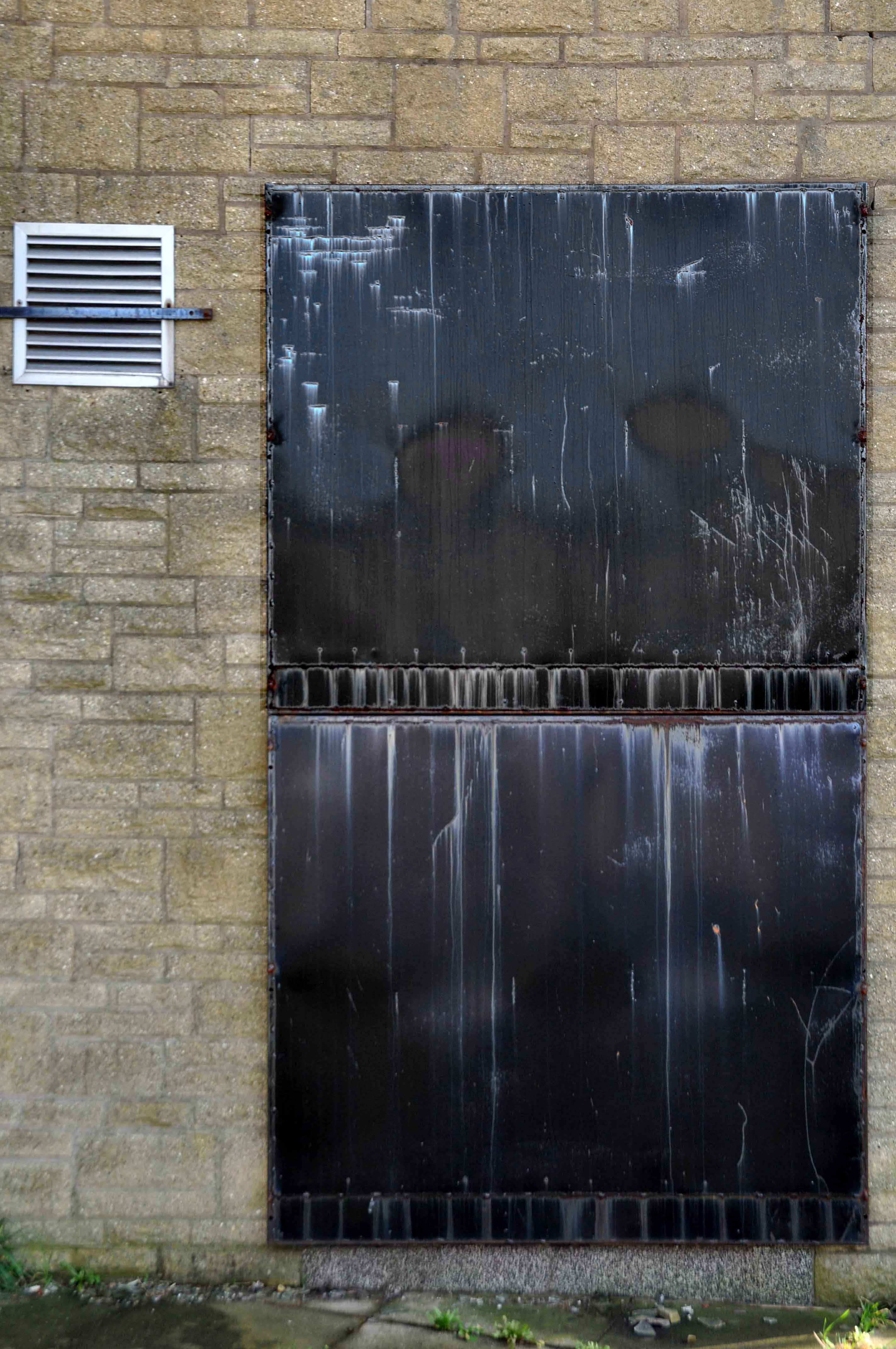
Pebbledashed over white brick. Roofs part concrete slab, part glazed behind parapet. Irregular plan, Modern Movement style. Group of blocks of varying height round tall central tower with rounded, glazed stair turret. Walls mainly sheer, with plinth and slight roof projection.
Long block on east of tower has central south projection with glazed, banded steel double door under high strip of windows beneath eaves overhang. Taller storeroom to west has similar doors in 2 recessed banded glazed bays; and abuts on south-east corner of tower. Similar double doors in base of tower. Large lower south-western canteen wing abuts on west side of tower and has banded glazing around two sides above a projecting sill. Slightly-projecting 3-bay office section to north has steel cross casements; on its return another casement and a door with hollow-chamfered jambs and flat hood. Taller bath block behind. Wave pattern on rainwater heads.
This is the youngest colliery in the neighbourhood, having commenced operations for the Ashington Coal Co Lt. in 1934. The shafts, which are situated comparatively near to the coast, are two in number, and both were sunk to the High Main seam level, which is 486 ft from the surface. The downcast No. 1 is 18 ft in diameter and is used for coal-raising on two shifts per day, and the upcast, which has a diameter of 15 ft, is used for ventilation and emergency man riding only.
The seams being worked are the High Main, the Diamond, the Main, and the Yard. Each of these seams shows practically the same nature of roof and floor as throughout the two neighbouring collieries and the distance between the seams is also comparable. They are, of course, found at slightly greater depths at Lynemouth, the Yard seam, for example, being 660 ft. below the surface near to the shafts, as compared with some 300 ft. at Ellington.
It was one of Britain’s largest collieries until it was closed in 1994.
I was cycling the coast in July 2012 and happened by, seeing the tower of the baths from an adjacent path, passing by the faded signage.
Into the raw expanse of a now empty post-industrial landscape.
And on towards the bath house.
I am not by nature an urbex urban explorer, simply an explorer.
Entering the open site, I was well aware of the significance of the building and its history – working lives that had constructed the baths, entered and left through those very same doors.
Whilst walking the length of Hessle Road, up and back – taking the air, snaps, the sights and sounds, I came upon a fine Faience tiled frontage.
I began photographing, wandering dangerously into the space between the slip road and the flyover. A shout rang out, emanating from the boozer, the landlord called me over.
“Do you want to take a look inside?”
“Yes”.
A listed interior the new landlord is working hard along with Historic England to restore the capacious rooms to their former glory, including the entrance mosaic and ceiling – images P Hampel
Inheriting a whole heap of issues and a grey parrot called Sparky.
But the boozer is now up and running serving cask ale to throngs of first class thirsty customers.
The Yorkshire Brewhouse 1904 ended mid week when we’re normally closed but we were asked to open for a group of very thirsty sailors. We moved on to Reet, another Yorkshire Brewhouse beer and thanks to the football that one has gone too. It’s back to the YBH Faithful Stout once again. I’d come quick and get it while you can.
Once two pubs the Hessle Road Inn was subsumed by the Alexandra. The area was once home to the city’s Jewish Community – the cemetery survives next door.
There are Star of David motifs incorporated into the windows, sympathetic to this local heritage.
Built around 1895, designed by Smith, Brodrick and Walker, with late C20 alterations – British Listed Buildings.
It’s a fabulous pub which deserves to thrive – pop in for a pint if you’re passing, just watch out for low flying parrots.
Holy Cross is positioned in a spectacular position among the houses on the Rollestone hillside.
Holy Cross is a church for people of all ages and stages of life.
Apart from the warm welcome at Holy Cross, you will always find something that is relevant to your age and stage in life – however old you are and whatever walk of life you come from.
It has a canted front which is triangular in shape which has a large white cross at its apex.
The interior features full height stained glass windows of the Virgin Mary and St John by John Baker Ltd.
Born in 1916, John aka Jack studied at the Central School in London and worked under James Hogan at the Whitefriars stained-glass studios before joining Samuel Caldwell junior at Canterbury Cathedral in 1948 to help reinstate the medieval glass removed for safekeeping during the Second World War.
He subsequently authored English Stained Glass; the revised edition of this work, English Stained glass of the Medieval Period , which was to become one of the most popular soft back books on English medieval glass ever published.
Apart from his conservation skills, John was also an inspired teacher at Kingston College of Art. He produced windows for a number of churches, including eleven windows for the church of the Holy Name, Bow Common Lane, Mile End; two windows and a brick sculpture for the church of Little St Peter, Cricklewood; eighteen windows for St Anne’s church, East Wittering, Sussex; two large abstract windows for Broomfield Chapel, Abbots Langley; ten large concrete and glass windows for the new parish church, Gleadless Valley, Sheffield; and twenty-two glass windows for the Convent Chapel, St Michaels, Finchley. He also created a huge Jesse window for the church at Farnham Royal. The church was demolished in 2004, but the glass is now in storage, and some of the panes will be installed in the welcome are of the new church.
His favourite works were the windows he produced for Auckland Cathedral, New Zealand – as seen above.
John Baker, born Birmingham, 11 March 1916, died Hastings, 20 December 2007.
The concrete altar is set on a raised paved podium, complemented by a silver cross and distinctive Arts and Crafts style oak chairs.
The original seating seems to be no longer in use, replaced by a newer more comfortable alternative.
There is a large carved stone font.
The main body of the steeply pitched roof space is illuminated by slotted windows.
Many thanks to the key holders and parishioners at Holy Cross, our Sheffield guide Mick Nott and Claire Thornley at Eleven Design – for making our visit possible.
Thanks also to all those who turned up on Saturday to walk a very, very wet Gleadless Valley.
Ten Acres Lane 1904 running south from Oldham Road – not quite crossing under the Ashton and Stalybridge Railway.
I was propelled by the vague memory of an Ashton Lads football match way back in the 1970s – my dad Eddie Marland managed the team in the Moston and Rusholme League.
There was land given over to recreation from 1900, the area is famed for its links to the inception of Manchester United and almost but not quite became home to FC United.
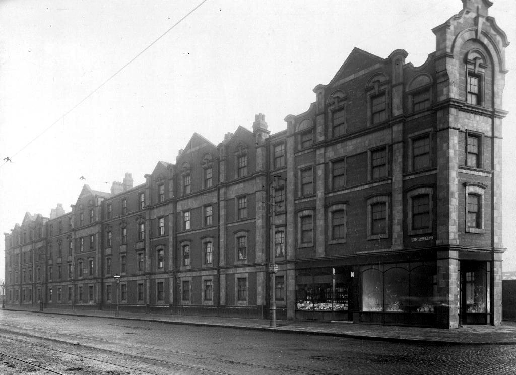
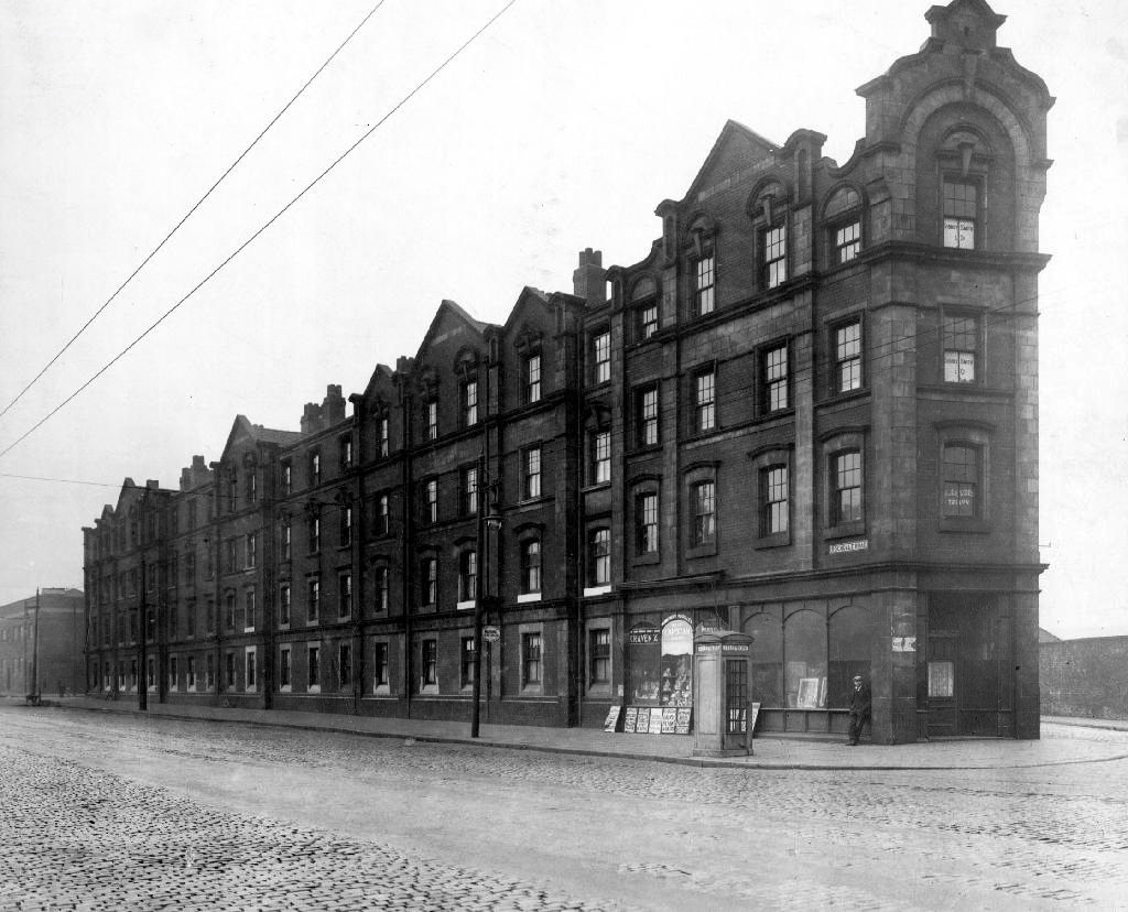
Going going gone St Paul’s Church seen here in 1972.
Victorian terraces and inter-war social housing – homes for a large industrial work force.
Many of the sights and sites above are still extant though their appearance and uses have changed along with the times. Manchester inevitably continues to from and reform for good or ill.
Sadly the old Rec the Moston and Rusholme League and my dad are all long gone – though it’s just as well to remember them all fondly, as we travel through our familiar unfamiliar city.
However the process of clearance and redevelopment radically changed and reduced the population and appearance of Great Ancoats Street and its environs.
The back to backs aren’t coming back and their occupants shifted from pillar to post along with the businesses that served them. Following years of decline Manchester takes a long hard look at itself and decides to modernise.
In 1989 an out of town inner ring road shopping centre in the architectural style de jour is built – the anonymous industrial retail hangar appears.
2018 and the nexus of the city has shifted yet again – Ancoats is designated as the hippest place on earth and has no time for an outmoded shopping experience.
All these developers have a certain sensitivity towards this history of the area without neglecting modern tastes.
So the Central Retail park awaits its fate.
There was to have been another retail complex.
Henderson Global Investors, on behalf of its flagships £1 billion Retail Warehouse Fund, has received detailed planning permission for a food store led regeneration at Central Retail Park, Manchester, investing £40 million in the scheme.
Though nothing lasts forever and the scheme came to nothing.
The latest proposal according to Place North West is for housing – with the attendant heated debate regarding affordable homes.
Of the 61 big residential developments granted planning permission by Manchester city council’s planning committee in 2016 and 2017, not one of the 14,667 planned flats or housesmet the government’s definition of affordable, being neither for social rent nor offered at 80% of the market rate.
Demolition of the former retail units would enable the development of the site by Manchester Life, the city’s joint venture with Abu Dhabi United Group. Previous site owner TH Real Estate, was unable to deliver the project, finally sold the Central Park site to the city council in November 2017.
The long awaited development of the site on Manchester’s inner ring road has edged closer, with site notices posted declaring that demolition is to start on 20 August.
As of last week the lone security guard at home in his brick cabin informs me that demolition has been delayed by the discovery of asbestos on the site.
Exeter Close/Warmington Drive Manchester Longsight M12 4AT
Once there was this.
Once there was that.
Then there wasn’t.
That’s just the way of it.
A dense web of streets awash with back to backs, jobs for all – in conditions perceived to be unfit for purpose.
Of a total of 201,627 present dwellings in Manchester, some 54,700, or 27.1 per cent., are estimated to be unfit. A comparison of slum clearance action taken by six major local authorities, Manchester, Leeds, Birmingham, Liverpool, Sheffield and Bristol, shows that for the five years ending 30th June, 1965, Manchester was top of the league, both in compulsory purchase orders confirmed and the number of houses demolished or closed.
Manchester’s figures -13,151 houses demolished or closed .
Whenever mass slum clearance was carried out, the pubs tended to remain, often for just a short time because – the story goes – demolition workers refused to touch them, as they wanted somewhere to drink during and after their shift.
This vision of municipal modernity was short lived, the estate was demolished in the 1980s and the new Coverdale Estate was constructed on the site in 1994.
The whys and wherefores of your seemingly unknowable comings and goings.
Standing alone, aloof and unloved on the corner of Rochdale Road and Sudell Street.
Something was missing.
I was missing something.
In 1813 there’s a field
In 1836 something’s there, but not it’s you.
Yet.
By 1900 the days of the two up, two downs are numbered – sanitary dwellings are the order of the day, plans are drawn up, the local council have decreed that workers dwellings are to be built.
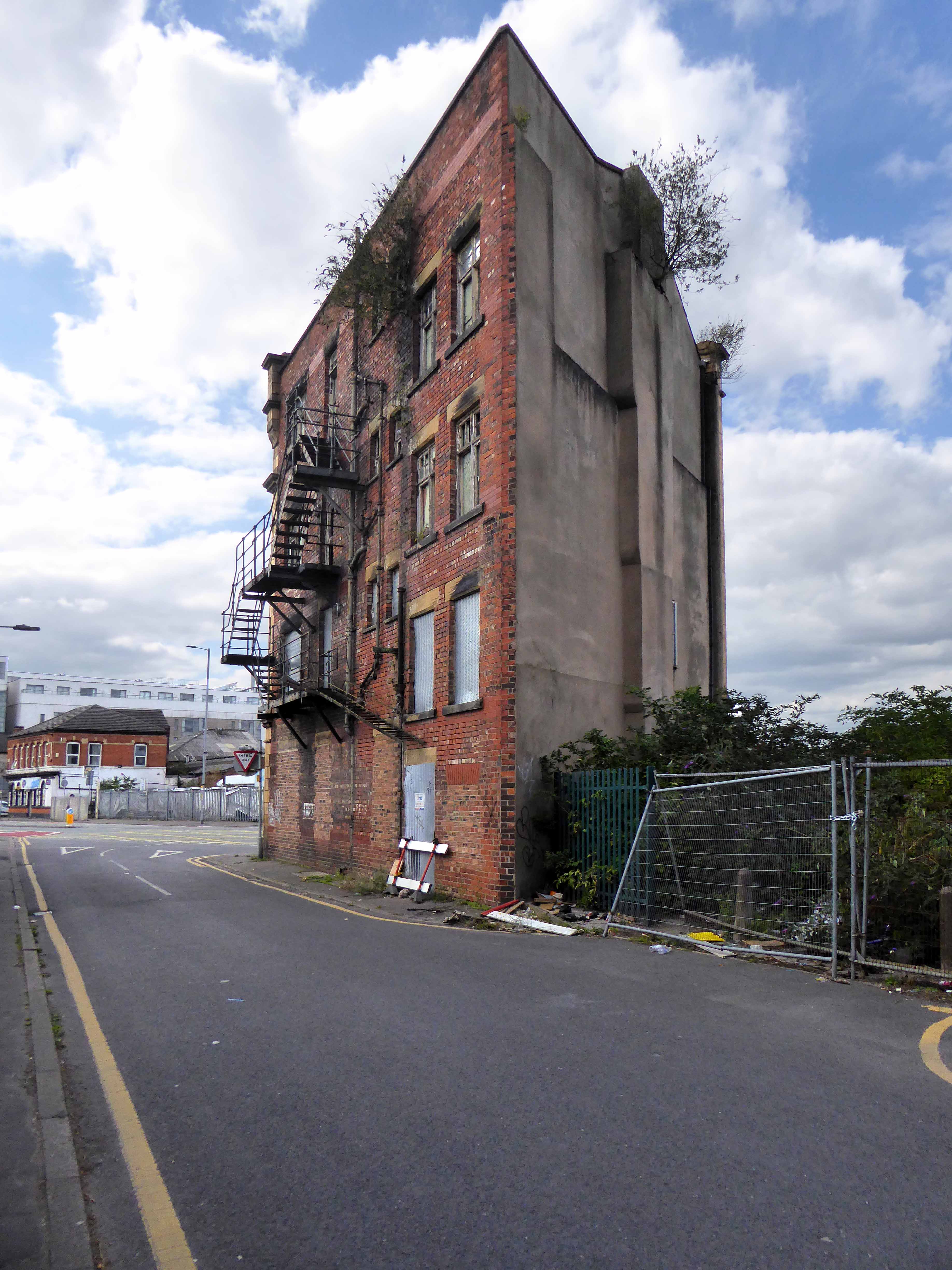
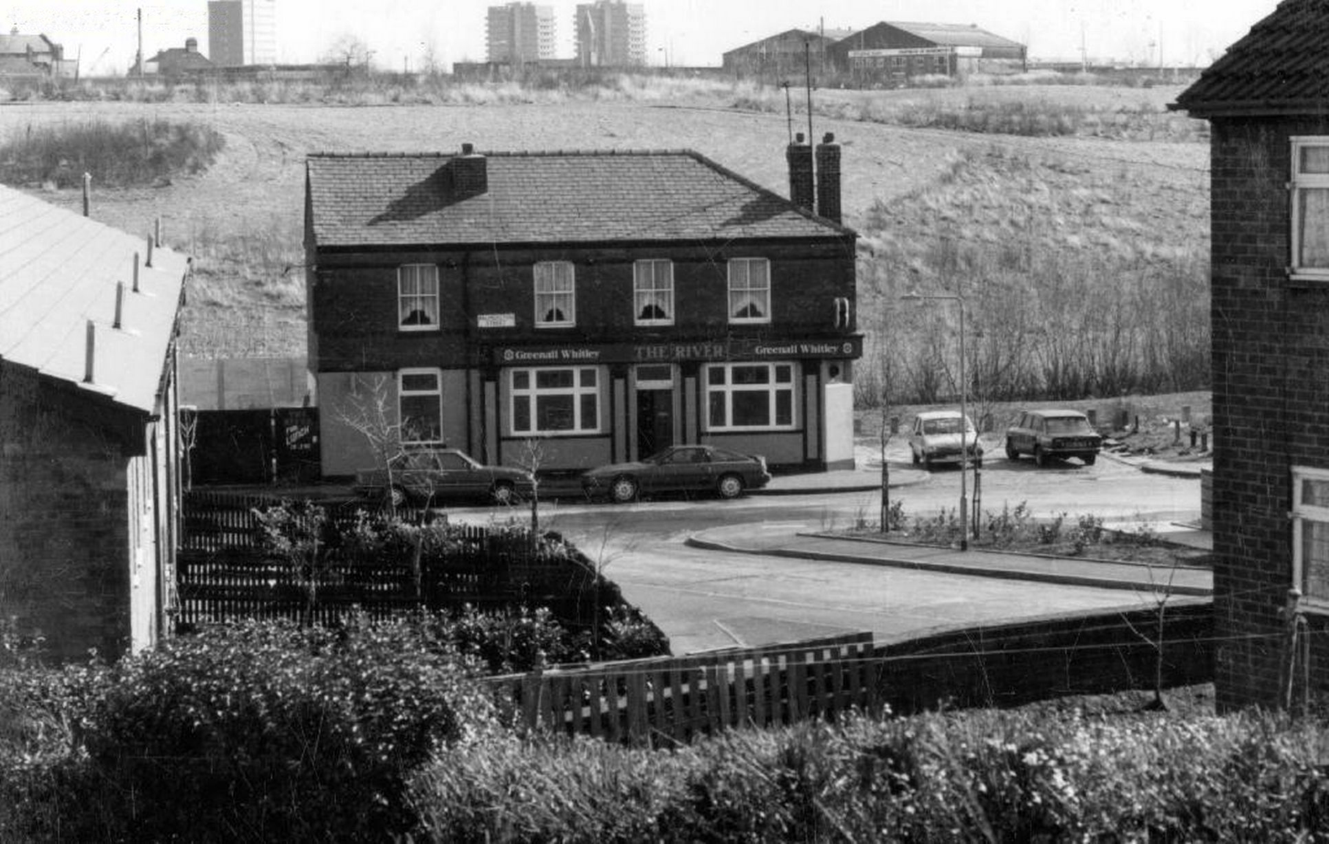
To begin at the beginning – some years ago I traced the route of the River Medlock, I chanced upon a forlorn pub called The River, all alone, desolate and boarded up, presiding over an area that I assumed, would once have supplied ample trade to a busy boozer.
I returned last week in search of some rhyme or reason, for such a seemingly sad and untimely decline.
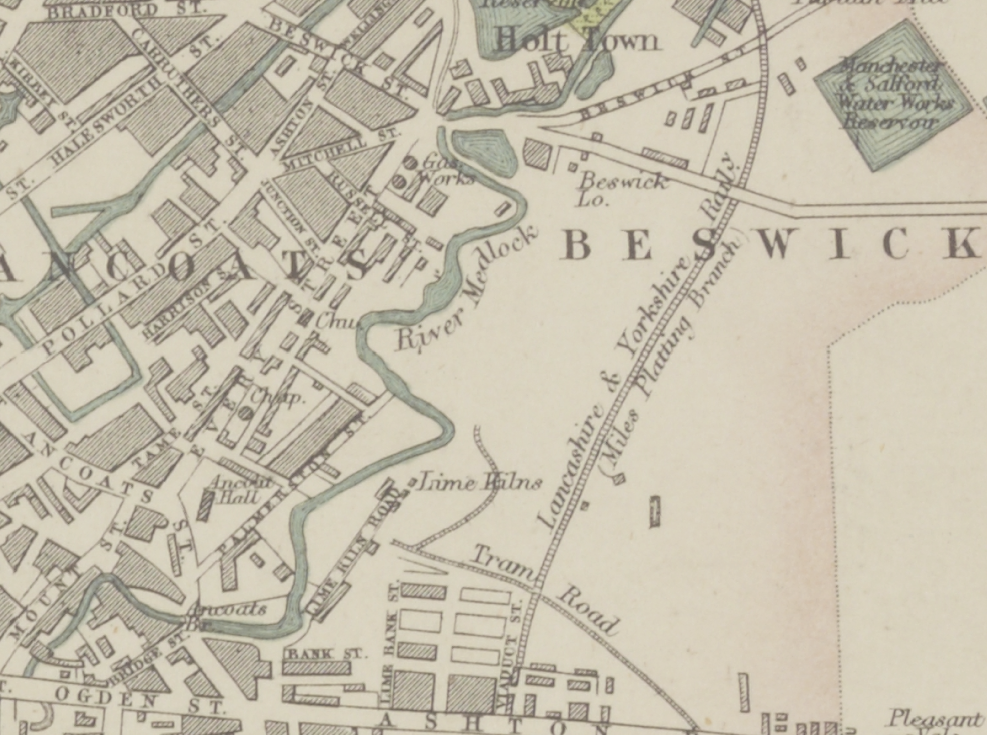
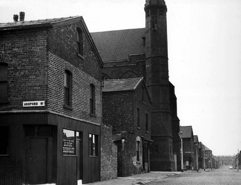
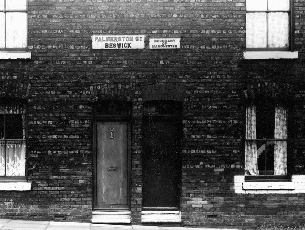
So here we are back at in Manchester 1813, the seeds of the Industrial Revolution sewn in adjacent Ancoats, the fields of Beswick still sewn with seeds, the trace of Palmerston Street nought but a rural track.
Sited on land between Great Ancoats Street and Every Street was Ancoats Hall, a post-medieval country house built in 1609 by Oswald Mosley, a member of the family who were Lords of the Manor of Manchester. The old timber-framed hall, built in the early 17th century, and demolished in the 1820s was replaced replaced by a brick building in the early neo-Gothic style.
This would become the Manchester Art Museum, and here the worst excesses Victorian Capitalism were moderated by philanthropy and social reform.
When the Art Museum opened, its rooms, variously dedicated to painting, sculpture, architecture and domestic arts, together attempted to provide a chronological narrative of art, with detailed notes, labels and accompanying pamphlets and, not infrequently, personal guidance, all underlining a sense of historical development.
Housing and industry in the area begins to expand, railways, tramways, homes and roads are clearly defined around the winds of the river.
In 1918 the museum was taken over by the city, it closed in 1953 and its contents were absorbed into the collection of Manchester City Art Gallery, as the State increasingly took responsibility for the cultural well being of the common folk.
The building was finally demolished in the 1960’s – just as the area, by now a dense warren of back to back terraces, was to see further change.
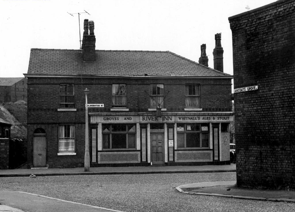
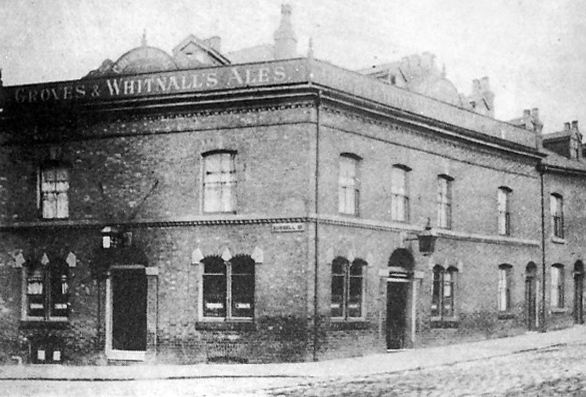
Along the way was the the River Inn, seen here with a fine Groves and Whitnall’s faience tiled frontage.
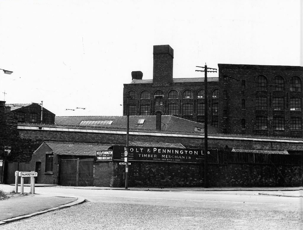
The street also offered rest, relaxation and refreshment through the Church, Pineapple and Palmerston pubs, as recored here on the Pubs of Manchester blog.
The River seen here in the 1970’s struggled on until 2007.
Further along we find the Ardwick Lads Club, further evidence of the forces of social reform, that sadly failed to survive the forces of the free market and the consequent Tory cuts in public spending and wilful Council land-banking.
The Ardwick Lads’ and Mens’ Club, now the Ardwick Youth Centre, opened in 1897 and is believed to be Britain’s oldest purpose-built youth club still in use [and was until earlier in 2012]. Designed by architects W & G Higginbottom, the club, when opened, featured a large gymnasium with viewing gallery – where the 1933 All England Amateur Gymnastics Championships were held – three fives courts, a billiard room and two skittle alleys (later converted to shooting galleries). Boxing, cycling, cricket, swimming and badminton were also organised. At its peak between the two world wars, Ardwick was the Manchester area’s largest club, with 2,000 members.
On the 10th September 2012 an application for prior notification of proposed demolition was submitted on behalf of Manchester City Council to Manchester Planning, for the demolition of Ardwick Lads’ Club of 100 Palmerston Street , citing that there was “no use” for the building in respect to its historic place within the community as providing a refuge and sporting provision to the young of Ancoats.
At the top turn of the street stood St Mary’s – the so called Lowry church.
Used as a location for the film adaptation of Stan Barstow’s A Kind Of Loving
The homes and industry attendant schools and pubs were soon to become history, all that you see here is more or less gone. Slum clearance, the post-war will to move communities away from the dense factory smoke, poor housing stock and towards a bright shiny future elsewhere.
Whole histories have subsequently been subsumed beneath the encroachment of buddleia, bramble, birch and willow.
The land now stands largely unused and overgrown, awaiting who knows what, but that’s another tale for another day.
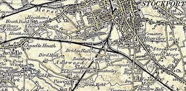
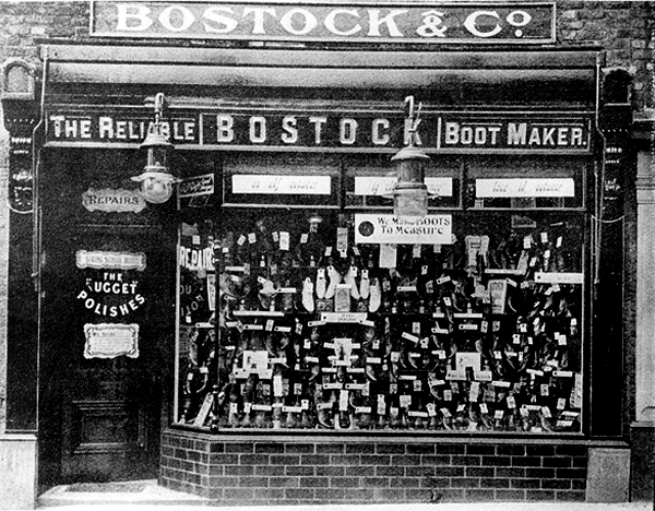
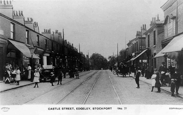
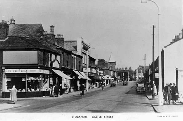
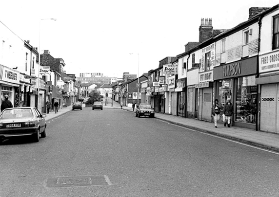
I have shuffled and shopped up and down Castle Street for some forty years or so – things have come and things have gone – and continue to do so. High streets have always been subject to so many external forces, they reshape and reform, in rhythm with the times and tides of history.
Horse drawn carriages and trams are long gone, along with the double-decker bus, people powered people rule in a pedestrianised precinct, charity begins at Barnardo’s, the Co-op has been and gone and returned, just up the way.
Two whole chapels, pubs and cinemas seem to have just disappeared.
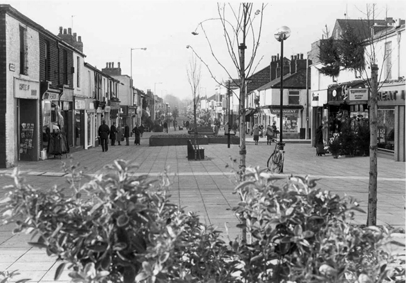
So let’s take a short trip through time and space along a short strip of Stockport’s past.
And so our journey continues, leaving behind the semi-detached haven of East Didsbury.
Once again graciously greeting Mr Henry Simon and his wondrous footbridge across the Mersey – the greenest of structures on the greyest of days.
No more fords and/or ferries, say goodbye to wet feet.
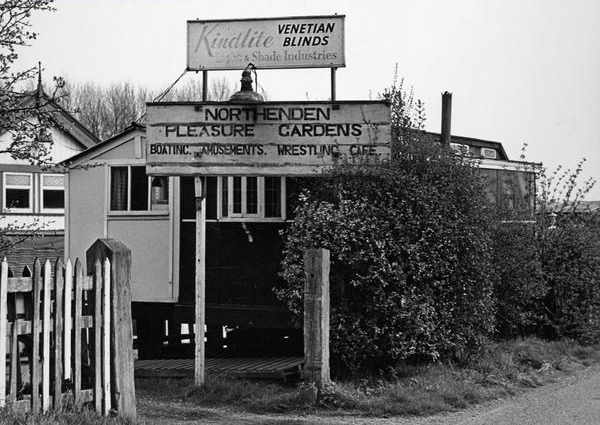
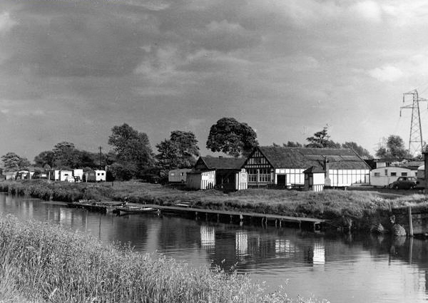
We are down by the river, a place of pleasure and practical workaday goings on – on our way to Northenden.
Northenden was mentioned as Norwordine in the Domesday Book of 1086; its name came from Anglo-Saxon Norþ-worþign – north enclosure. It was then a small farming community with a manor house and woodland.
Northenden is on a major crossing place of the Mersey on the salt road from Cheshire to Manchester. The ford was an important way into and out of and into Manchester, in 1745 Bonnie Prince Charlie’s army built a troop-bridge out of big poplar tree trunks where the B5095 now crosses the Mersey, south of Didsbury, in his abortive attempt to seize the crown of England.
The Northenden ford was unusual because its northern and southern ends were not opposite each other, but people using the ford had to wade about 500 feet along the riverbed. The Simon’s Bridge was built at the ford in 1901 to help access to Poor’s Field, and the rent from this field was used by the church to buy blankets and clothes for the needy.
Little is known of Northenden’s Saxon origins other than that it was one of the few disembarkation points on the Mersey flood plain between Stockport and Stretford. A church was recorded here in the Domesday book of 1086. The village has grown in importance since 1641, when a ferry boat for crossing the River Mersey was installed. In 1642 a ford was also constructed, hence the names Boat Lane and Ford Lane. There was a water mill and, it is rumoured, a public house. The plan form of the village was established with properties being built along the two lanes, which intersected near the church.
Little change occurred for the next two centuries until, by the mid 19th century, market gardens in and around the village supplied food for the rapidly expanding population of Manchester. The only routes to the City were via the ferry boat or the ford until, in 1862, Palatine Road was opened and provided a bridge crossing. Northenden was still a rural village and, towards the turn of the century, good quality semi-detached houses were built for clerks and managers who were able to commute to Manchester on the horse-drawn bus and the tram.
In the 1940s the new suburb of Wythenshawe was largely completed, and by then Northenden’s rural character had gone. Palatine Road was developed for shopping and other commercial uses, and slum clearance removed many of the village’s early cottages around the church.
The water mill, which had provided a flour-milling service for a wide area, survived until the 1950s. It was situated on the banks of the Mersey where the weir, to create the change in water level and power the machinery, is still in existence.
Ford Lane affords a rural route twixt suburban settlements, tree lined and river-run.
Once the province of pleasure gardens, cruisers, boaters.
And wrestlers.
The lane is home to several listed buildings – the most prominent being St Wilfrids – the oldest part of the church is the tower, the rest having been rebuilt in 1873–76 by J. S. Crowther. The new part of the church is built in sandstone from Alderley Edge, with slate roofs, and is in Perpendicular style.
The Old Rectory and Northern House both mid to late 18th century, form a group of notable homes clustered around St Wilfrids.
Also in close proximity were a number of public houses – most notably The Tatton Arms.
Built in 1873 by the Tatton family and originally known as The Boat House.
Closed in 2007 and still standing, still awaiting proposed redevelopment into an apartment complex.
The Church Inn built in 1897 closed in 2006 – burnt out left for dead eventually refurbished into flats.
The Spread Eagle built to replace an old pub of the same name, the Spread Eagle was the second estate-style boozer on Royle Green Road, and it outlasted the Jolly Carter by almost a decade – long gone, following a shooting in 2008, the site now developed as housing.
Happily The Crown is still standing and still serving – cyclists and walkers welcome!
This was once my way to work, Stockport to Northenden each and every day, the river on occasion liable to flood – foolishly I cycled the Mersey in Spate, against the current clinging to the handrail, up to my axles in the raging torrent.
That which we call a brick, by any other name would smell as sweet.
Chancing across a written reference to the Marland Brick in the bookThe Trains Now Departed, I was slightly taken aback – from wither and whence it came and went.
I was aware of the my patronymic local connection:
This most interesting surname is of Anglo-Saxon origin, and is a locational name from Marland, a minor place in the parish of Rochdale, in Lancashire. The placename itself is composed of the Olde English elements “mere”, a lake, pool, and “land”, land.
However:
There are also places called Peters Marland in Devon, recorded as “Merland” in the Domesday Book of 1086 (the site of a church dedicated to St. Peter), and Marlands in Somerset.
So our southern cousins were clay-mongers, manufacturers of fine bricks to boot.
Marland Cream brickwork is a feature of North Devon. The hard cream bricks were made at Marland Moor by a succession of companies using stoneware ball clays dug from the Petrockstowe Basin.
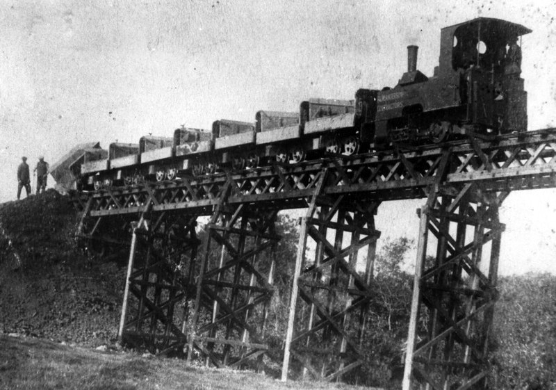
Between Great Torrington and Hatherleigh, in north Devon, lie alluvial deposits of ball clay, a particularly useful clay which first found use for pottery and clay pipes in the seventeenth century. However the remoteness of the location prevented the growth of the industry and by the nineteenth century it only met local needs for pottery and bricks.
The impetus for the industry came, perhaps, with the opening of the London & South Western Railway to Torrington in 1872 for a few years later the owner of Clay Moor, William A. B. Wren, started to exploit his land. By 1877 he had sunk several pits and erected at the Marland Brick & Clay Works kilns, cottages and stables. Clay was being taken to Torrington station behind a traction engine but over six or so miles of poor quality roads this was not very efficient.
With the coming of the railway to Torrington, in 1881 a private mineral line was built to connect to the Marland area. This led to a great increase in production and was a factor in the opening in 1925 of the North Devon & Cornwall Junction Light railway, between Torrington and Halwill Junction, which superceded the mineral line. Closing to passengers in 1965, the section between Meeth and Barnstable remained open for freight, but by the 1980’s was moribund.
There are still remnants of the Marland Works Branch visible to this day.
One of our famed family brick built achievements is the Chelfham Viaduct:
A railway viaduct built in 1896-97 to carry the Lynton and Barnstaple Railway across the Stoke Rivers valley. Designed by L&B engineer, FW Chanter, and containing over a quarter of a million Marland bricks, its eight arches – each 42 feet wide and 70 feet high – meaning that the 132-yard long viaduct is the largest narrow gauge railway structure in England.
The L&BR’s peak period came between 1902 and1913 when it carried almost 97,000 passengers a year. Yet the considerable endeavour invested in the railway was not enough to save it; as traffic dwindled, the line succumbed to closure by Southern Railways on 29th September 1935. Most of the trackbed and buildings were sold at auction in 1938. Although Chelfham Viaduct was retained, its parapets were taken down to about one foot above ballast level. In 1943, it featured in a film, The Flemish Farm, representing the Franco-Belgian border.
The structure was granted a Grade II listing on 25th February 1965. In 2000, in partnership with the Railway Heritage Trust and the Lynton & Barnstaple Railway Trust, British Railways Board completed a programme of remedial works.
Then later today, casting my mind back to my 2105 cycle tour from Weston Super Mare via Ilfracombe and Plymouth and onward to Hastings, I remembered a former chance encounter.
I had been here before, blissfully unaware of the local family connections along the Tarka Trail – thick as a Devon cream-tea coloured brick.
So when I eventually return to the area to fully explore our family heritage, I shall be sure to doff my cycling cap and smile whilst passing the warm cream expanses of Marland Brick.
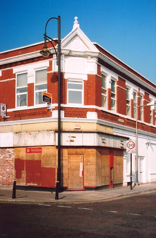
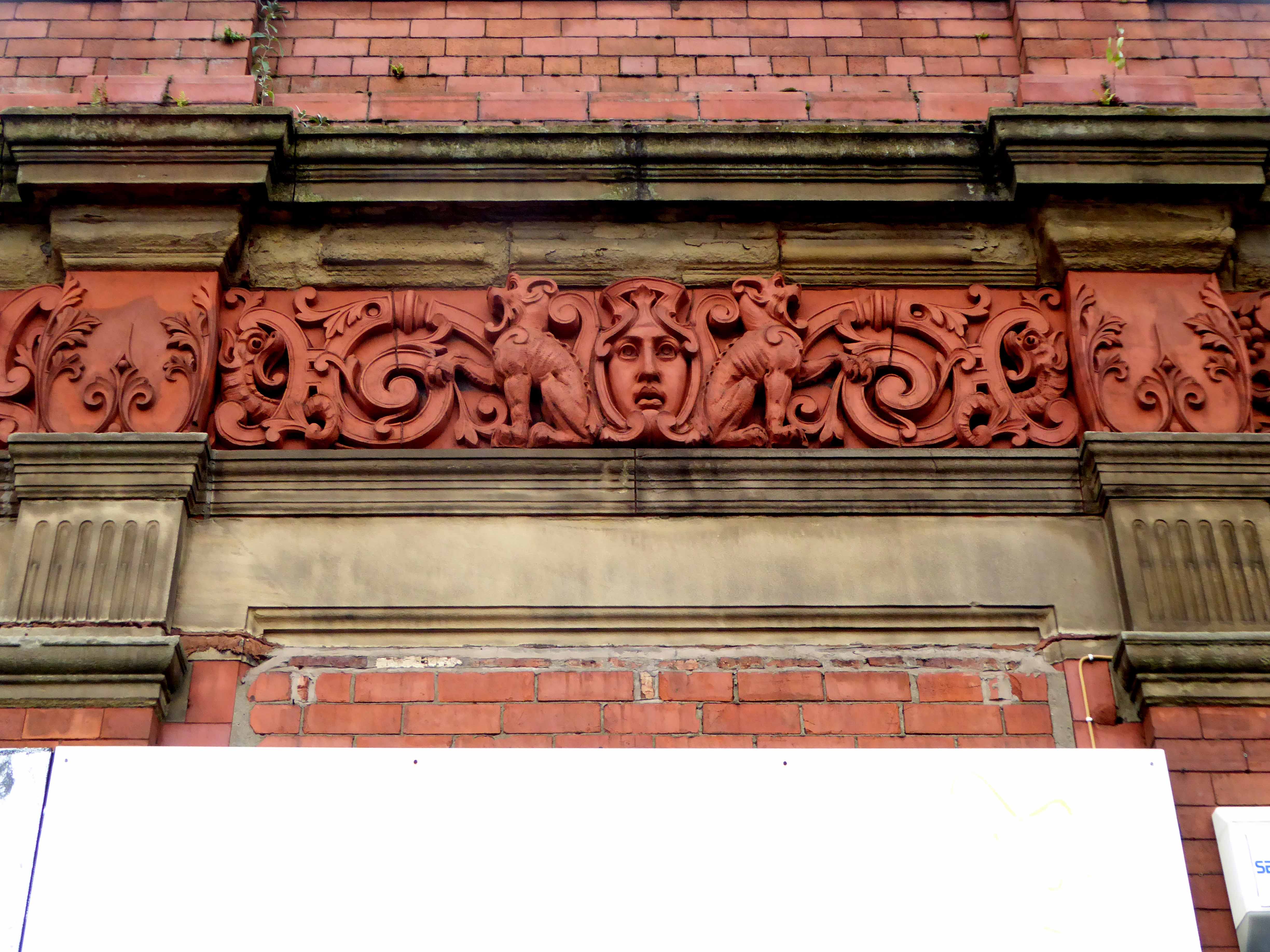
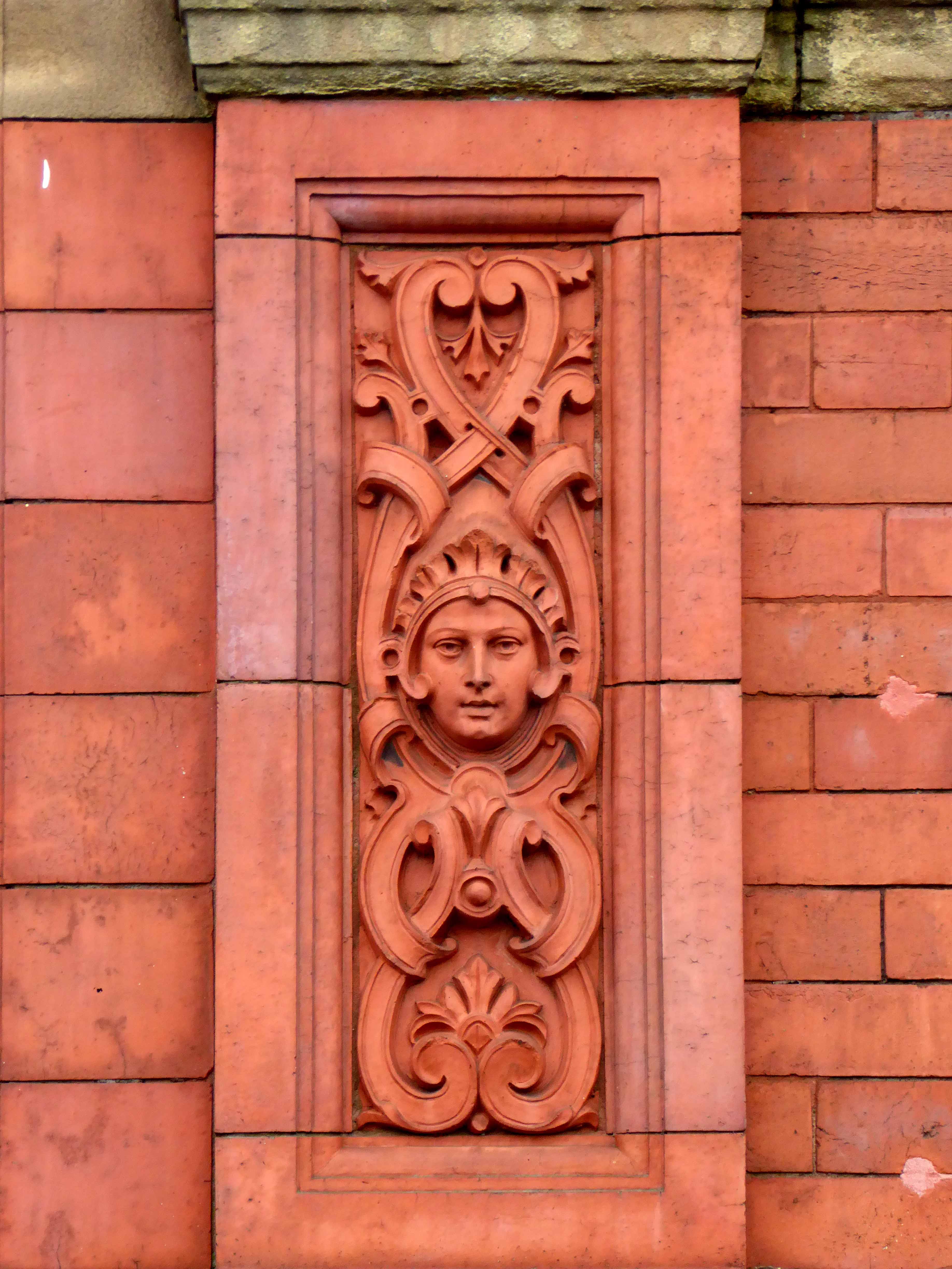
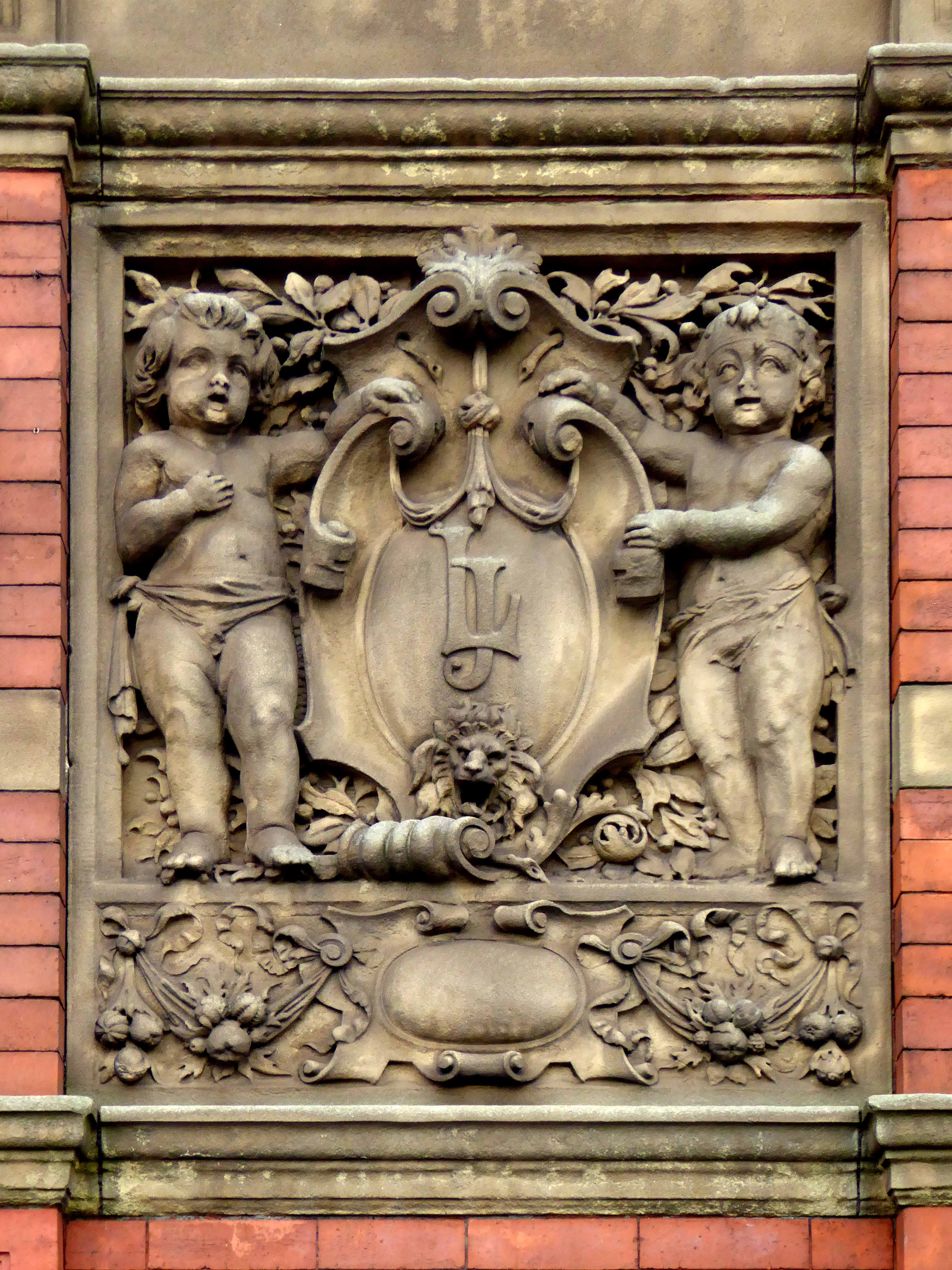
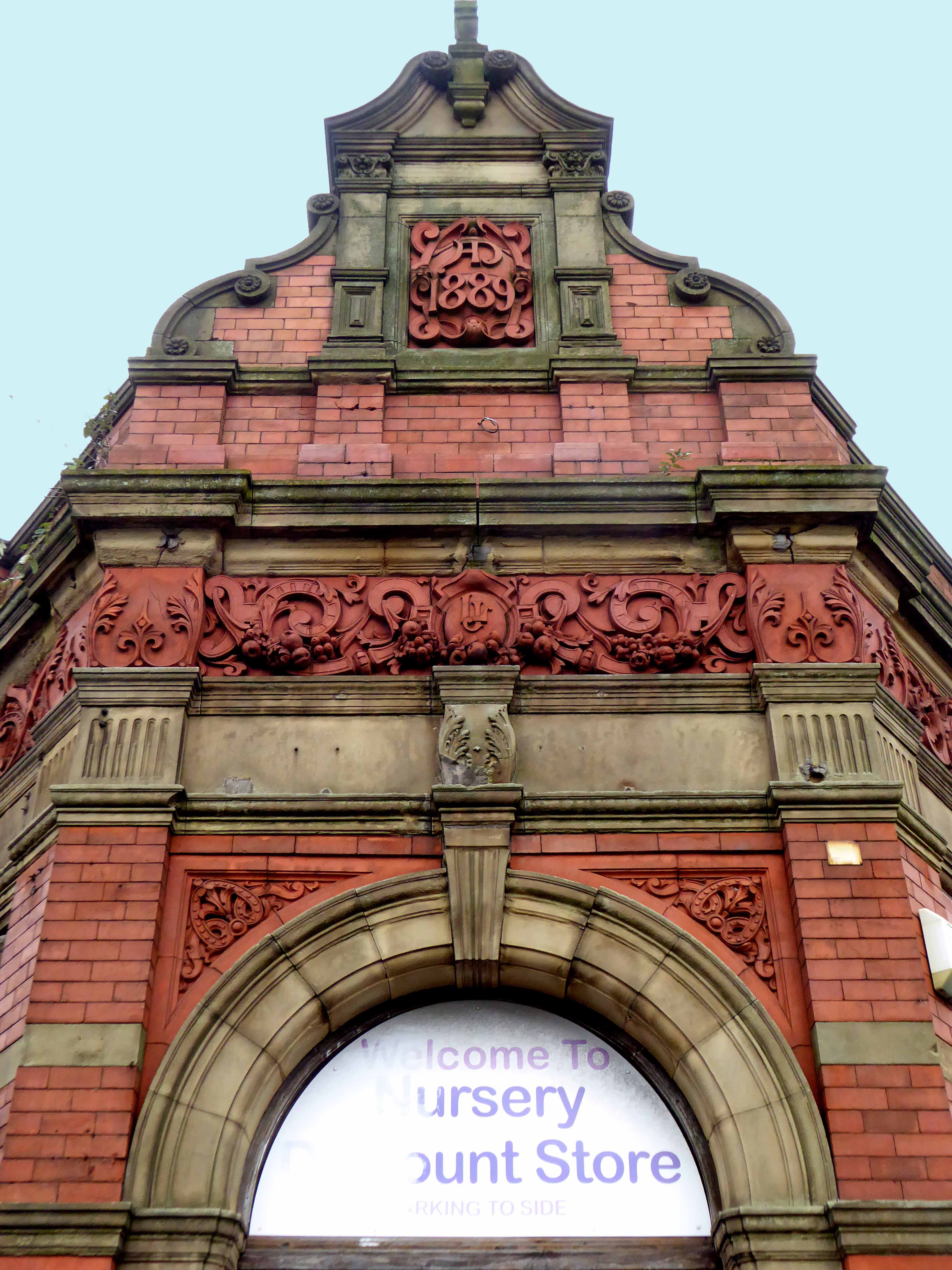
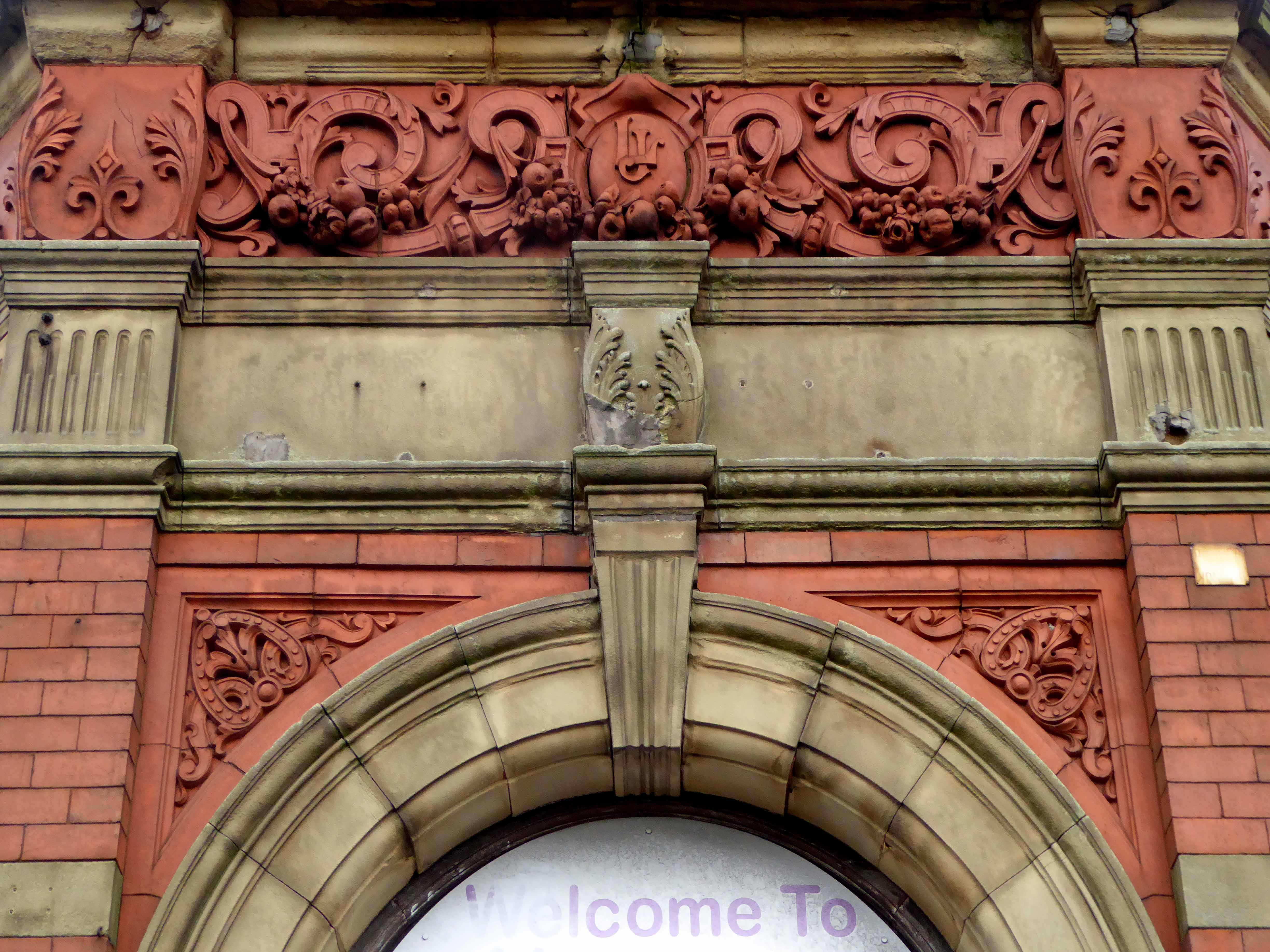
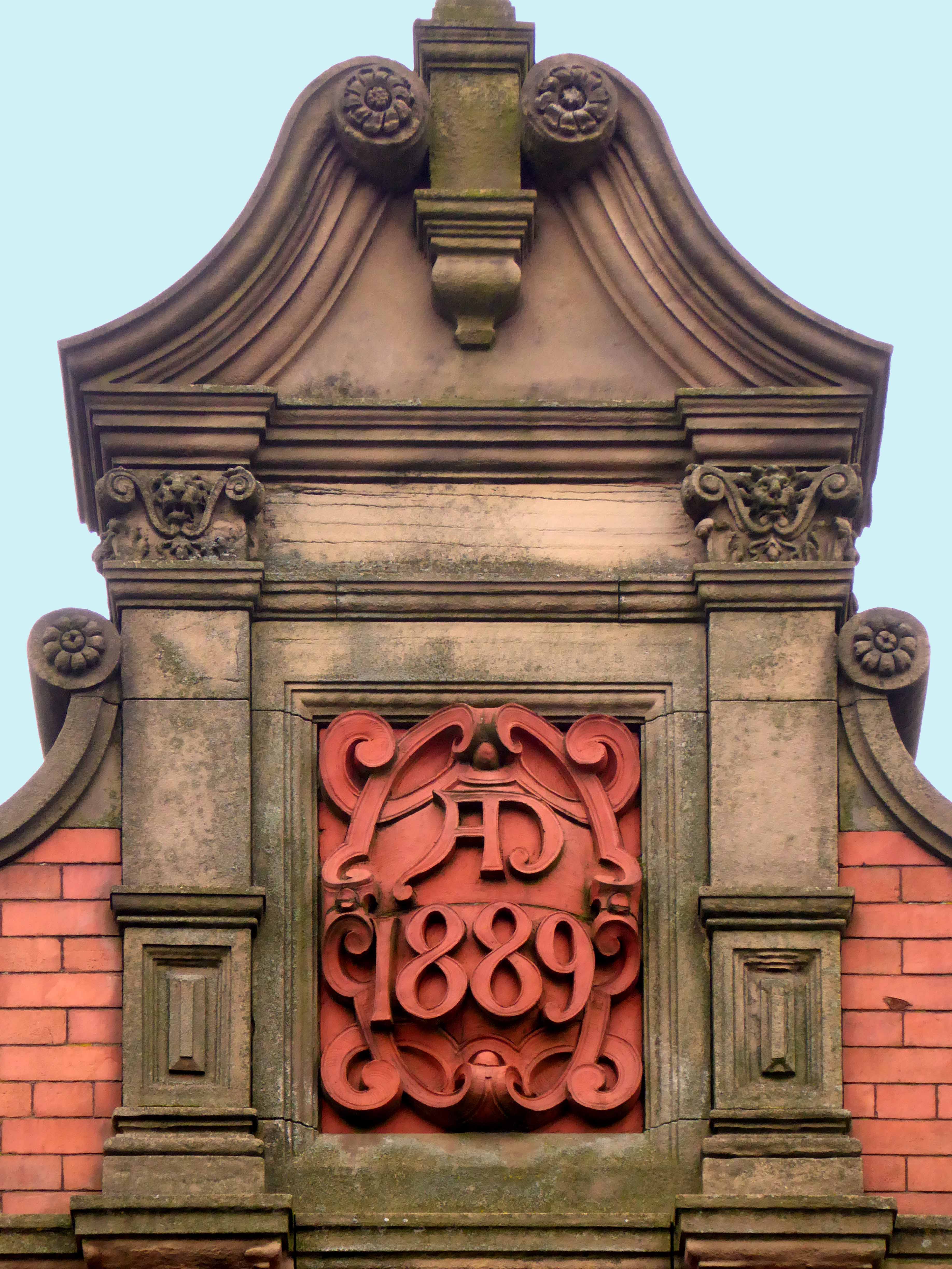
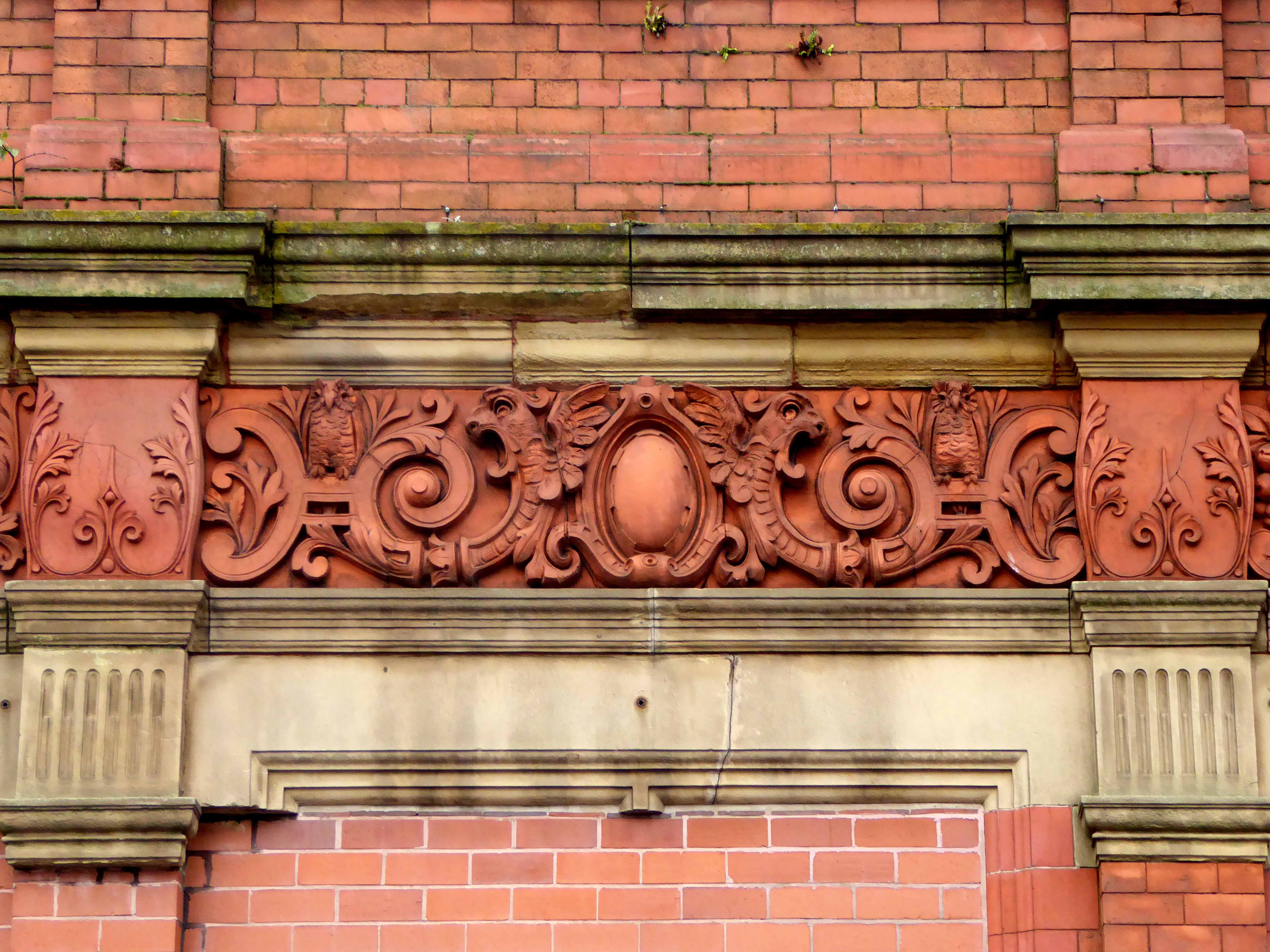
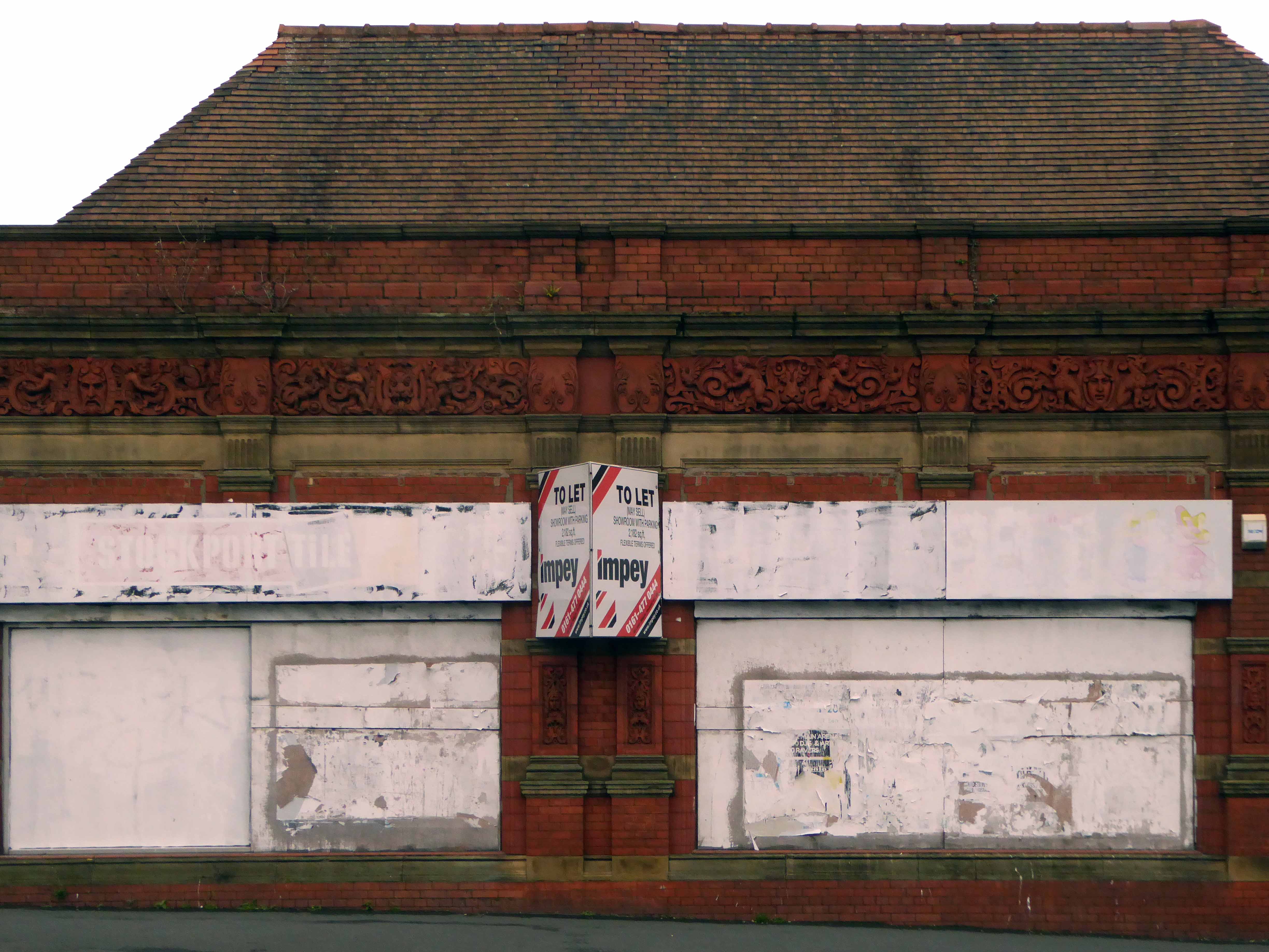
Commercial premises or showroom. Dated 1889. Red brick with stone dressings and terracotta decorative details, tiled roof. Rectangular building of 4 x 3 bays with canted corner entrance. Jacobean style. Single storey articulated by pilasters supporting a sculptured frieze. Doorway with arched head and fanlight. One, two and three-light mullion and transom windows to the Parsonage Street front. The Wellington Road front has two large plateglass windows divided by paired pilasters. The windows have removed two pilasters. Cornice, panelled parapet, aedicule with console supporters, swan – neck pediment and date over the doorway. Tall hipped roof. Very prominently sited and under restoration at the time of inspection.
This is a building of some substance, decorated with terracotta work of the highest order, a striking yet diminutive landmark to the north of the town. Situated on a once busy commercial site, where it would have been surrounded by a plethora of retail, industrial and residential property.
My research has shown that its earliest recorded use was under the ownership of JE Jones manufacturing agent for ropes and cords, allied to the local hatting and cotton trades in 1907. Subsequently the base of John Roberts in 1910 – leather merchant, manufacturing belts, strapping and laces – the company also had premises nearby at 138 Heaton Lane.
It has latterly been in use as Topp’s Tiles, Gordon Ford and Little Amigos Discount Nursery Store – it is currently empty, shuttered and unloved on off at a rent of £1,833 per calendar month from Rightmove.
As Stockport continues to invest in and develop its town centre, it remains a more than somewhat sorry beacon of decline, an indicator that all too often architecture of local and historic importance, seems to have little or no place, in this thrusting modern milieu.
If passing, pause and reflect on the sense of permanence that imbues this building, in an all too impermanent world.
The Strangeways family themselves are certainly recorded in antiquity at the site, although the name appears differently over time; Strongways in 1306, Strangewayes in 1349 and Strangwishe in 1473. In the late 1500s in records at Manchester Cathedral the surname is spelt Strangwaies.
Before panopticon prisons entered the public imagination, and incarceration was the order of the day for the disorderly, it was all fields around here – with the odd house or baronial hall.
Swire’s map of 1824
Strange days, over time the prison is built, the assizes appears and disappears and tight groups of tired houses cluster around the incipient industry. The fiefdom’s of old become tie and tithe to successions of industrial plutocrats.
Broughton Street 1910 – Photograph J Jackson
Kelly’s map of 1920
The area becomes the centre of the city’s rag trade, a large Jewish Community, the largest outside of London, grows up around Strangeways, Cheetwood and Cheetham Hill – houses, mills, wholesale, retail, warehouse, ice palace, beer-house, brewery. The area is home to several of Joe Sunlight’s inter-war industrial developments – his Jewish family were named Schimschlavitch, his father a cotton merchant. The family emigrated to England in 1890 and settled in Manchester.
So much for Joe Soap – the area was also the location for local lads, KarlMarx, and Marks & Spencer.
Derby Street 1901 – 1924
Further developments took place with the building of the Cheetwood Industrial Estate – a postwar group of flat-rooved, blocky brick and concrete utilitarian units.
So let’s take a look at the ever so strange streets of Strangeways, in that period of change during the latter part of the Twentieth Century, when manufacturing, retail, repair and distribution were almost, just about to disappear in a puff of globalisation, economic depression and Thatcherism. Where Jack and Jill the lads and lasses, traded, ducked, dived, wheeler dealed from Cortinas, Transits and low milage, one owner, luxuriously leather-seated and walnut-dashed Jags. A vanishing or vanished world, where however briefly – Manchester went architecturally mod.
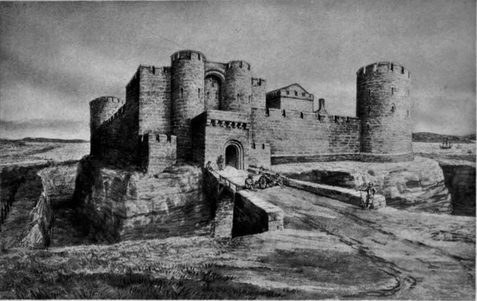
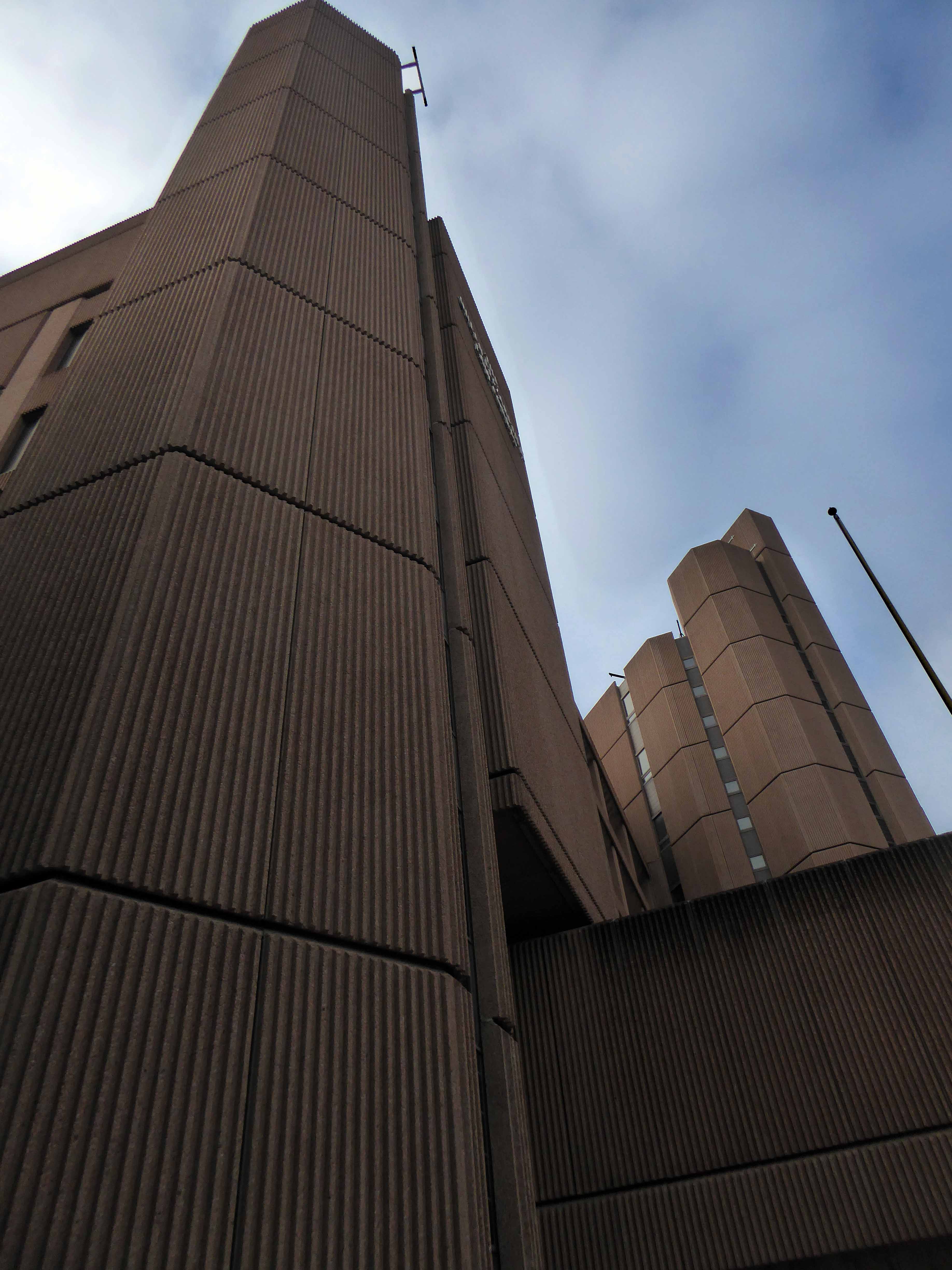
And so castles made of sand, Fall in the sea, eventually.
Once there was a battle here, several actually, and battles mean castles, possibly.
Erected in the between 1232 and 1235, inevitably through the passage of time, blows were exchanged, the Banastre Rebellion of 1315, and later in 1689 Prince Rupert was battered by King Billy, and so on until it was eventually demolished in 1726. A series of churches ensued, finally to be supplanted by the arrival of an amusingly statuesque Queen Victoria, replete with plaque.
In 1976 excavation of the south side of Castle Street was conducted before the construction of the Crown Courts building, which was built in the style of a castle.
What goes around comes around, ending up largely square in Derby Square.
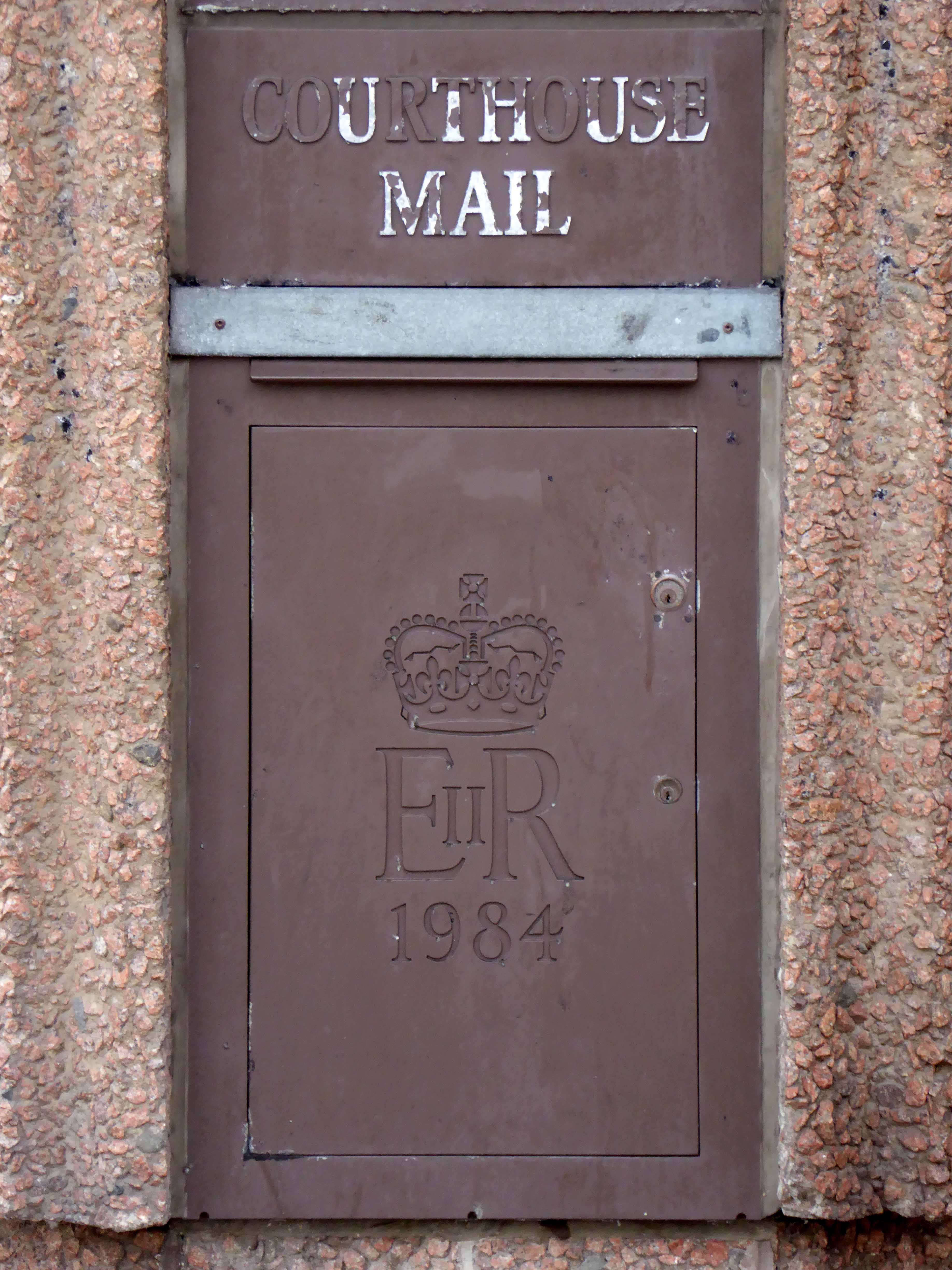
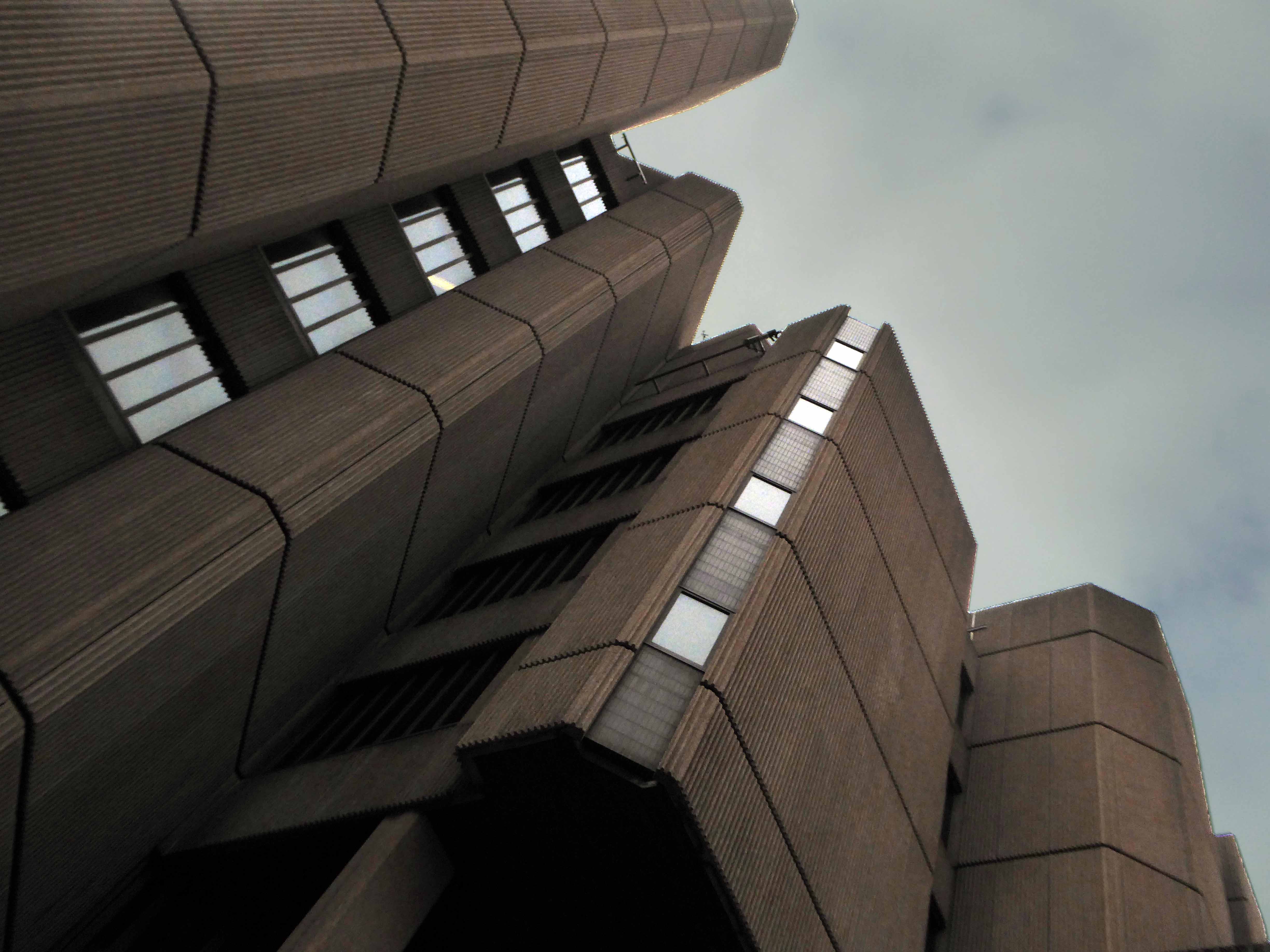
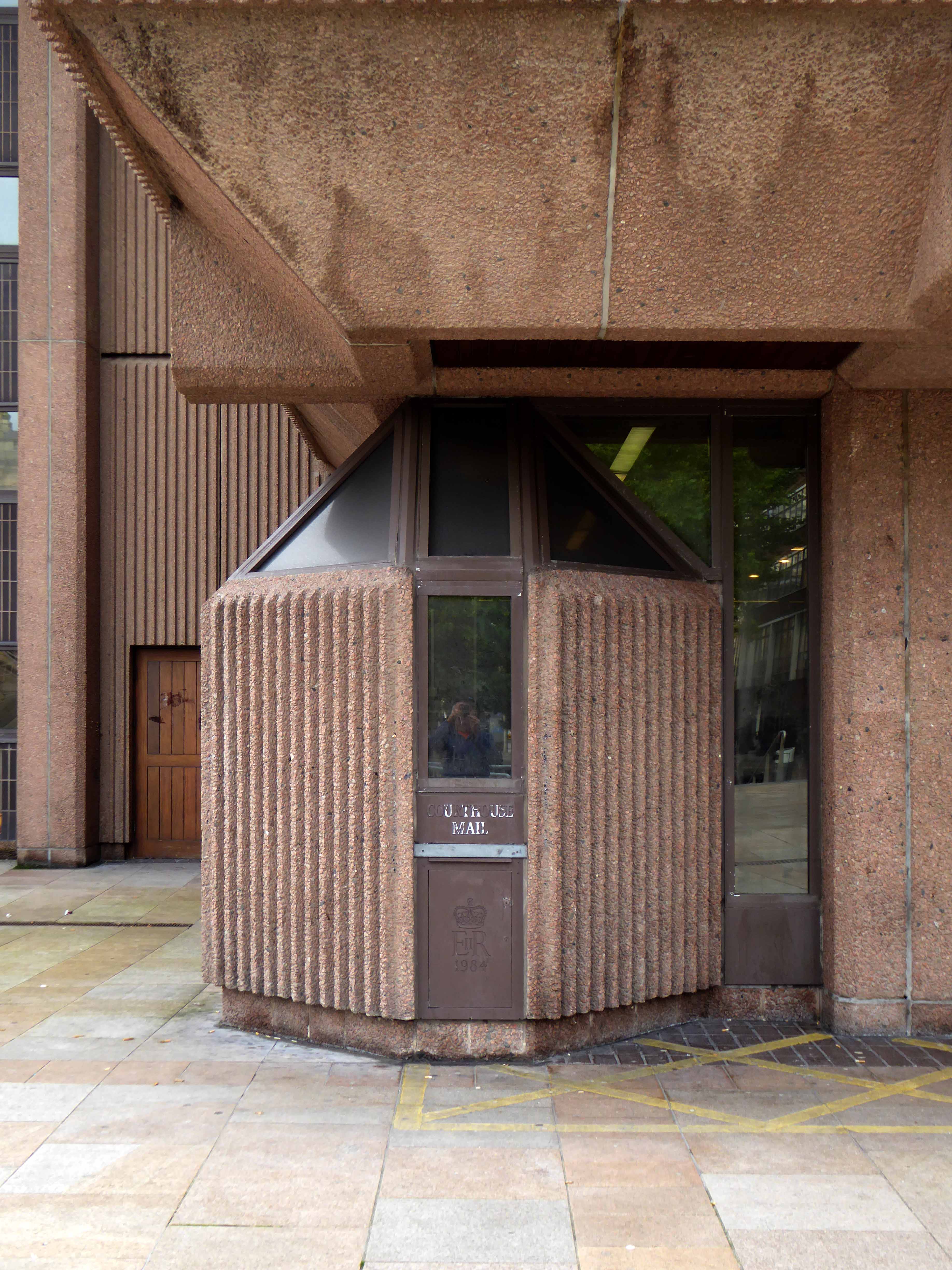
And lo and so it came to pass, new law courts were erected upon the site begun in 1973, opened in 1984. Architects were Farmer and Dark, who were also responsible for the Fawley Power Station.
And the Cornwallis Building at the University of Kent.
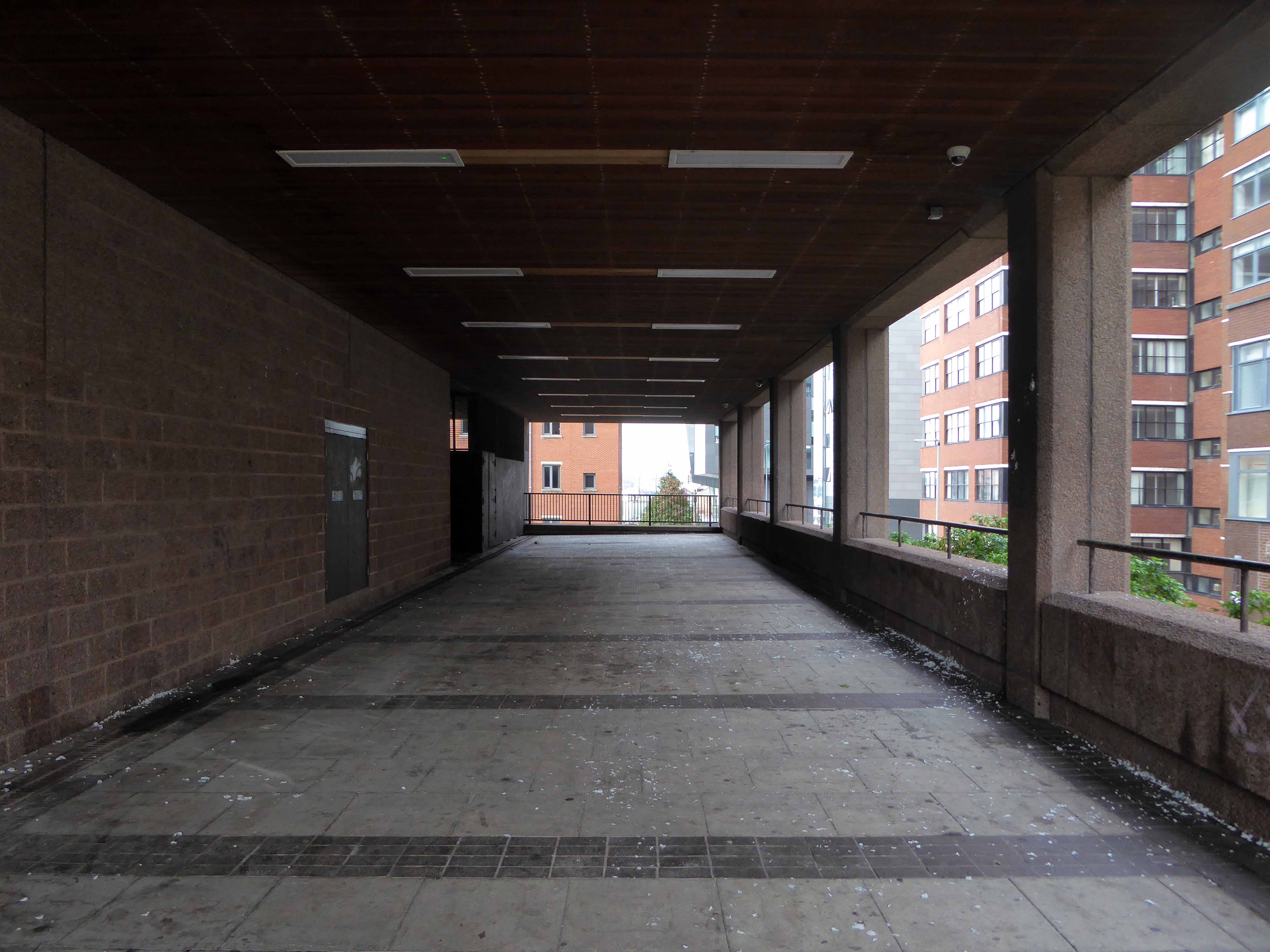
I passed by there yet again last Saturday, still maintaining a restrained ambivalence regarding this monolithic concrete and sand pseudo-castle. Less than, and larger than the sum of its parts. The quirky detailing and awkward geometry, producing a somewhat confused, yet imposing scheme, an ossified pinkish ribbed construct from another age.