
Perth 256km Radar/Lightning
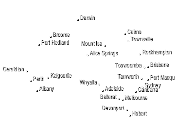
- WA radars
- Albany
- Broome
- Carnarvon
- Dampier
- Esperance
- Geraldton
- Giles
- Halls Creek
- Kalgoorlie
- Learmonth
- Newdegate
- Perth
- Port Hedland
- South Doodlakine
- Watheroo
- Wyndham
- nearby radars
- South Doodlakine
- Watheroo
- Newdegate
- Albany
 heavy
heavyAbout Weatherzone Radar
 Distance and latitude/longitude coordinates are displayed when you mouse over the map. The
origin for distance measuring is indicated by a red dot and defaults to either your location, if specified and in range, or the location
of the radar/the centre of the map. The origin may be changed by clicking elsewhere on the map.
Distance and latitude/longitude coordinates are displayed when you mouse over the map. The
origin for distance measuring is indicated by a red dot and defaults to either your location, if specified and in range, or the location
of the radar/the centre of the map. The origin may be changed by clicking elsewhere on the map.
The colours and symbols used on the radar and satellite maps are described on our legend page. View legend »
Radar Details
Western Australia
LocationSerpentine Airfield (Yangedi Rd North, Hopelands) Radar TypeEEC TVDR2500C C Band, 5 centimetre wavelength Typical Availability24 hours
Perth (Serpentine) Weather Watch radar has good coverage in all directions. Intense thunderstorm or cold fronts can be seen up to 250 kilometres away, however at this distance the radar is sensing the structure of the system well above the ground and may give a misleading view of the actual surface rainfall intensity of the system. The radar is susceptible to anomalous propagation (AP) for distances up to 60 kilometres along the coastline and seaward of it. The AP appears as an area of low intensity echoes. A local phenomenon which has been observed occasionally is that of false mirror echoes approaching the radar from the southeast as an intense cold front approaches from the south west. Heavy rain directly over the radar site can cause attenuation of all signals. Path attenuation can also occur when the radar beam passes through intense rainfall, with the returned signals from cells further along that path reduced.
Now Temperature
At Gold Coast S…
14:50 EST
20°C
10°C
Sunny
Weather News
NSW South Coast residents warned flash flooding will get worse as wild weather continues
12:54 EST
Residents on the New South Wales South Coast hit by flash flooding have been warned conditions will get worse today.
Heavy rain soaks southeast NSW
12:17 EST
A low pressure trough over the New South Wales coast has delivered torrential rain to parts of the Illawarra and South Coast on Saturday, with more on the way.
