See images from Himawari-8 in the new satellite viewer
This demonstration product is most suitable for people
with
fast internet connection and high data allowance.
Low-definition satellite images
Satellite View Selection
Animate
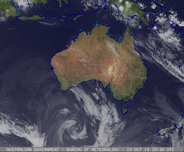
06:30 AEST on Thursday 24 October 2019 | Cloud/surface composite, Australia

Infrared image courtesy of the Japan Meteorological Agency. Blue Marble surface image courtesy of NASA.
IDY28000
Australian Government Bureau of Meteorology
Bureau National Operations Centre

Satellite Notes for the 1800UTC Chart
Issued at 6:06 am EDT Thursday on 24 October 2019


An upper trough and surface low pressure trough is generating middle level cloud
through inland Western Australia and eastern Northern Territory.

A cold front lies across the Bight and into the Southern Ocean with a band of
middle level cloud ahead of the cold front and low level cumulus cloud in the
cold airmass behind the cold front.

A moist onshore trade wind flow is causing areas of patchy low cloud along the
Queensland coastal areas and the upper level subtropical jet stream is producing
high level cloud over the Coral Sea and across the Tropical North Queensland
coast.


