

Australian Weather
National Summary
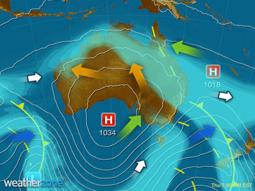
Brisk winds behind a cold front are generating a few showers to VIC and TAS. A trough is triggering the odd shower over the northeast tropics. A cold front clipping southwest WA will bring a few showers. Unseasonably warm and dry winds remain across the northwest.
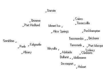
State Weather
Click for state forecasts


National Synoptic
Weather News
Insects boom after rain destroys pasture growth for drought-affected Queensland graziers
07:20 EST
Sunburnt paddocks cracked and veined from years of drought have finally started to show signs of life in outback Queensland.
How to save water at home during water restrictions and beyond
18:16 EST
"Every drop counts" has been the cliched mantra used by water experts, and for good reason, ahead of restrictions being reintroduced across Sydney, the Blue Mountains and the Illawarra from this weekend.
What you need to know about the Indian Ocean Dipole
15:40 EST
Australians could be hearing a lot about the Indian Ocean Dipole (IOD) during the coming months.


Extremes and Records
| Current Extremes | Last 3 Days Extremes | Extremes This Month | |||
|---|---|---|---|---|---|
| Tue 28/05 | Wed 29/05 | Thu 30/05 | |||
|
28.5°C Coconut Island, Qld |
Hottest |
36.0°C West Roebuck, WA |
36.0°C Bidyadanga, WA |
34.0°C Carnarvon Ap, WA |
39.7°C Mandora, WA |
|
-1.3°C Thredbo Top Station, NSW/ACT |
Coldest |
-4.9°C Liawenee, Tas |
-6.7°C Thredbo Top Station, NSW/ACT |
-10.0°C Glen Innes Ap, NSW/ACT |
-10.0°C Glen Innes Ap, NSW/ACT |
|
SSW 74km/h Cape Grim, Tas |
Windiest |
140km/h Hogan Island, Vic |
122km/h Hogan Island, Vic |
103km/h Mt Wellington, Tas |
- |
|
0.4mm last hr Coldstream Comparison, Vic |
Wettest |
63.4mm Perisher Valley, NSW/ACT |
36.6mm Scotts Peak Dam, Tas |
61.0mm Mt Read, Tas |
940.0mm Woolbrook, NSW/ACT |
| Australia's Records for May | |||
|---|---|---|---|
| Max | Min | Rain | |
| Highest 47.0°C at Bulman, NT in 2016 Lowest -6.0°C at Thredbo Top Station, NSW/ACT in 2000 |
Highest 30.5°C at Lake Cargelligo Ap, NSW/ACT in 1990 Lowest -14.2°C at Namadgi National Park, NSW/ACT in 1987 |
Highest 536.6mm at Orbost, Vic in 2017 |
|
-
Display your Local Weather here
automatically each time you visit us:

Rotates through Temperature,
Wind, Humidity and RainUse the Search Bar above
to find your Local, and go to the Local page
Click "Set My Local"
button next to the location name


