
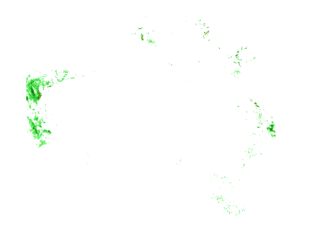
Darwin 256km Radar/Lightning
- NT radars
- Alice Springs
- Darwin
- Darwin Airport
- Gove
- Katherine
- Warruwi
- nearby radars
- Darwin Airport
- Katherine
- Warruwi
 heavy
heavyAbout Weatherzone Radar
 Distance and latitude/longitude coordinates are displayed when you mouse over the map. The
origin for distance measuring is indicated by a red dot and defaults to either your location, if specified and in range, or the location
of the radar/the centre of the map. The origin may be changed by clicking elsewhere on the map.
Distance and latitude/longitude coordinates are displayed when you mouse over the map. The
origin for distance measuring is indicated by a red dot and defaults to either your location, if specified and in range, or the location
of the radar/the centre of the map. The origin may be changed by clicking elsewhere on the map.
The colours and symbols used on the radar and satellite maps are described on our legend page. View legend »
Radar Details
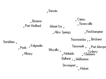
Northern Territory
LocationSE of Darwin Airport Radar TypeWSR 74 C Band Typical Availability24 hours
The Berrimah radar is located on a rise with the dish antenna tower mounted approximately 50 metres above the surrounding topography. It has a good coverage in all directions up to a range of 250 km with the following two exceptions: (a) some local masking of echoes at low elevations to the east; (b) some signal blockage to the north-northeast due to several HF transmitter towers. Heavy rain over the radar site will cause attenuation of all signals. Path attenuation also occurs when the radar beam passes through an intense thunderstorm cell; the returned signal from cells further along that path will be reduced. Because the beam width of this particular radar is only 0.9 degrees, it may 'undershoot' high level storms and rain echoes may appear less intense than actual rainfall rate. During the dry season from May to September, when low level atmospheric temperature inversions are more prevalent, images may display areas of relatively strong (Level 2 or 3) permanent echoes. These tend to be reflections from coastal features; commonly from Gunn Point and the Cobourg Peninsular northeast of the radar, and from the nearside coastline of the Tiwi Islands to the north. Also during this time of the year, a false image of the Timor coastline may sometimes be seen extending northwest from Bathurst Island. This phenomenon is due to second skip returns at multiples of the radar's maximum range.
Now Temperature
At Gold Coast
18:00 EST
24°C
29°C
Possible shower


Weather News
Heatwave grips Queensland as Roma and Brisbane suffer an unending run of scorchers
18:20 EDT
Severe heatwave conditions along the length of the Queensland coast have brought a record-breaking run of high temperatures to the southern inland town of Roma and unrelenting searing weather to Brisbane.
Fire, floods, dust and snow — how is this all happening at the same time?
18:11 EDT
There are fires in NSW, a heatwave in south-east Queensland, the dust is still settling on Sydney and Canberra, and it snowed in Tasmania overnight.
Townsville rental prices skyrocket after flooding crisis, families struggle to find homes
17:28 EDT
Some home rentals in Townsville are going for more than double their normal asking price as locals fight it out for rapidly dwindling housing stock.
