Fairfax Media Network

Snow & Ski Weather

windy with snow
Mt Buller
-41
windy with snow
Mt Hotham
-50
windy with snow
Perisher
-71
windy with snow
Thredbo
-5-2
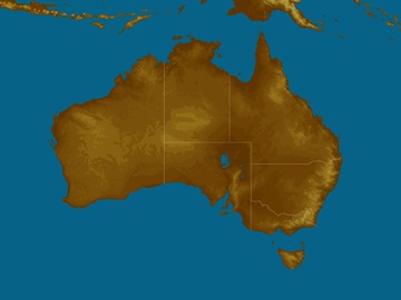
Shading indicates areas above forecast snow level
Friday's snow level is 700m
Snow forecast down to: 700m
Chance of precip.: 100 Visibility: Poor
Likely snow: 10-20cm Wind: Strong NW/SW

Snow Resort Cams - Weather now

Alpine forecast

The snow season has finished for the year. Forecasts will re-commence in the fortnight before the start of the 2018 season. Until then the below forecast will not be quality controlled.

  Weather Prob. of precip Likely snow Snow level Wind Visibility  
Thu
May 10
Rain tending to snow early. Wind 100% 5-10cm 900 Strong NW Fair snow forecast chart
Fri
May 11
Snow. Windy 100% 10-20cm 700 Strong NW/SW Poor snow forecast chart
Sat
May 12
Mix of rain, snow, sleet. Windy 95% 5-10cm 1500 Strong SW Fair snow forecast chart
Sun
May 13
Early showers. Snow on peaks 80% <2cm 1600 Fresh S Fair snow forecast chart
Mon
May 14
Chance snow in east. Dry in west 40% <2cm 1900 SE Good snow forecast chart
Tue
May 15
Frost patches. Mostly sunny day 20% Nil S to W Excellent snow forecast chart
Wed
May 16
Frost patches. Mostly sunny day 20% Nil SW Excellent snow forecast chart
Thu
May 17
Frost patches. Cloud increasing 20% <2cm SW Excellent snow forecast chart
Fri
May 18
Late showers. Snow on peaks 50% <2cm 1700 NW Good snow forecast chart
Sat
May 19
Snow showers. Snow on peaks 60% <2cm 1700 NW/SW Fair snow forecast chart
Sun
May 20
Early showers. Snow on peaks 10% <2cm 1800 SW Excellent snow forecast chart
Mon
May 21
Late shower 40% <2cm SW/NW Good snow forecast chart
Tue
May 22
Showers. Snow on peaks 70% <2cm 1700 W Good snow forecast chart
Wed
May 23
Showers, mostly later. Snow on peaks 70% <2cm 1800 NW Fair snow forecast chart

Now Temperature

At Darwin Ap

20:20 CST

Tonight

23°C

Tomorrow

34°C

Mostly sunny

mostly_sunny

Weather News

BOM predicts snow as low as 800m as Australian ski fields get first dumps of the year

18:22 EST

Winter coats, beanies and slippers have been dusted off across parts of New South Wales and Victoria today as temperatures plummeted and some regions were blanketed in snow, thanks to a cold front that is bringing icy polar air with it.

Flood and wind watch for Tasmania as severe weather rolls over state

15:56 EST

Tasmanians are bracing for heavy rain, strong winds, possible flooding and snow across Thursday and Friday.

Warm May days in the west

14:39 EST

Unseasonable warmth will affect parts of Western Australia in the coming days.