
Archives
-

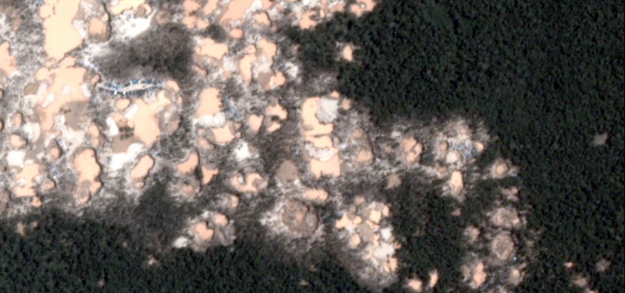
MAAP #60: Gold Mining Increases in Buffer Zone of Tambopata National Reserve
In the previous MAAP #50, we presented an analysis of the extent of gold mining deforestation in the southern Peruvian Amazon as of September 2016. Here, we partially update the data for the area within the buffer zone of Tambopata National Reserve.* We document the increase... -

MAAP 59: Power of “Small Satellites” from Planet
The company Planet is pioneering the use of high-resolution “small satellites” (Image 59a). They are a fraction of the size and cost of traditional satellites, making it possible to produce and launch many as a large fleet. Indeed, Planet now operates 149 small satellites,... -

MAAP #58: Link between Peru’s Flooding and Warm Coastal Waters
In previous articles MAAP #56 and MAAP #57, we presented a series of striking satellite images of the recent deadly floods in northern Peru. Satellites provide additional types of data critical to better understanding events such as extreme flooding. Here, we present two... -

MAAP #57: High Resolution Satellite Images of the Flooding in Peru
In the previous MAAP #56, we showed a series of satellite images of the deadly floods that recently hit northern Peru. In this report, we show a series of new, very high resolution satellite images (50 cm) of the flooding. They show, in... -

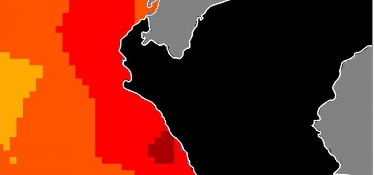
MAAP #56: Major Flooding in Northern Peru from Coastal El Niño
Intense rainfall is causing severe and deadly flooding along the northern coast of Peru. The cause is likely “coastal El Niño,” a phenomenon produced by abnormal ocean warming along the equatorial coast of the Pacific Ocean. Image 56 shows a preliminary estimate of the...
Synthesis
-
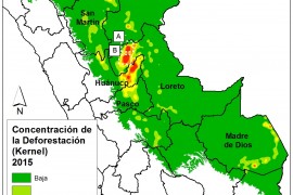
MAAP SYNTHESIS #2: PATTERNS AND DRIVERS OF DEFORESTATION IN THE PERUVIAN AMAZON
We present our second synthesis report, building off our first report published in September 2015. This synthesis is largely based on the 50 MAAP reports published between April 2015 and November 2016. The objective is to synthesize all the information to date regarding... -

MAAP #32: Large-scale vs. Small-scale Deforestation in the Peruvian Amazon
In the previous MAAP #25 and MAAP #26, we illustrated deforestation hotspots in the Peruvian Amazon for the periods 2012-2014 and 2015*, respectively. Here in MAAP #32, we present a complementary analysis based on the size of deforestation events. Graph 32a shows the comparative results of... -
MAAP #26: Deforestation Hotspots in the Peruvian Amazon, 2015
Thanks to the newly launched GLAD alerts (developed by the University of Maryland and Google1, and presented by Global Forest Watch), we now have weekly access to high-resolution forest loss data across Peru. Here in MAAP #26, we analyze the first batch of... -

MAAP #25: Deforestation Hotspots in the Peruvian Amazon, 2012-2014
Deforestation continues to increase in the Peruvian Amazon. According to the latest information from the Peruvian Environment Ministry , 2014 had the highest annual forest loss on record since 2000 (177,500 hectares, or 438,600 acres per year). 2013 and 2012 had the third...
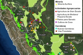
Mining News
-

MAAP #20: New Airstrip in Coca-growing Area within Bahuaja Sonene National Park (Puno, Peru)
MAAP #10 detailed the extensive deforestation between 2000 and 2014 (538 hectares or 1,329 acres) in the Colorado sector of Bahuaja Sonene National Park, an important protected area in the southern Peruvian Amazon. Additionally, we described how this sector has a high density of coca plantations,... -

Mining News Watch #18
Mining News Watch #18 covers the time period July 31st- October 31, 2015 Top Stories There have been three police raids in Madre de Dios this summer in an attempt to stop illegal gold mining in the region. The Amazon Conservation Association released high-resolution images...