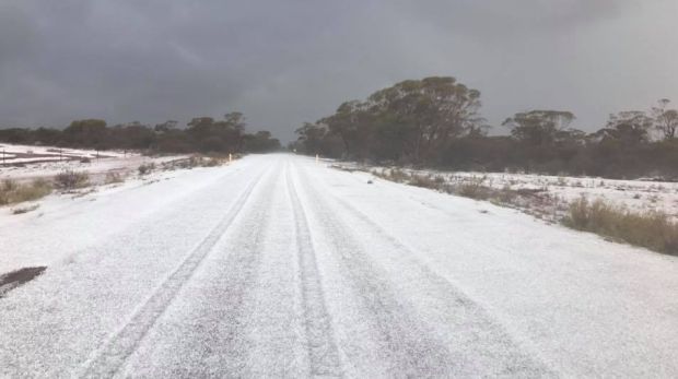
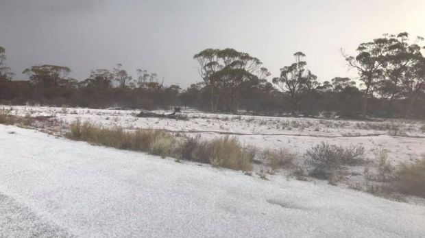
The Wheatbelt mining town of Koolyanobbing has experienced a spectacular hail storm, transforming it into a wintry dreamscape.
Incredible photos of the aftermath of Thursday morning's storm have surfaced on Facebook, and show thick layers of ice on the ground in scenes more reminiscent of a ski field than the Australian outback.

Ronnie Canning, who posted the photos to facebook and has worked at the local iron ore mine for ten years, said he hadn't seen anything like it.
"It all happened pretty quick to tell you the truth, it escalated quite quickly. It all happened within about ten minutes, so it was quite loud and noisy really," Mr Canning said.

"It missed our camp, or as you call it the town site, but it hit the Koolyanobbing air strip, which is about four kilometres out on the road towards Southern Cross.
"So it was only a band of about 1 kilometre by about 4 kilometres that it actually hit."
Mr Canning said although the area had experienced a "very wet summer", the weather hadn't otherwise been abnormal.
Neil Bennett from the Bureau of Meteorology said although the wild weather was "not overly unusual" it was "always spectacular when it happens."
"During the summer months we can get some spectacular thunder storms through Eastern parts of the wheat belt going into that area. It's the result of a weather system that produced a lot of good falls – this is over a fairly broad area, especially through the Esperence area and across the coast into Bremer Bay," Mr Bennett said.
He said the area had been experiencing heavy rainfall lately.
"A thunderstorm has formed in a fairly broad cloud band which has produced some heavy falls through the South-East district and also along the South coast as well."
"We saw falls in excess of 50 millimetres in some places on the South Coast, Bremer Bay for example had over 55mm in the 24 hours up to 9:00am yesterday morning, and then there were also some very heavy falls during the day yesterday for Esperence as well."
He said Esperence, which received 45 millimetres of rain, had experienced its heaviest fall since the 8th of July 2014, and its heaviest May day fall since 2013.
Mr. Bennett said it was not uncommon for thunderstorms to produce hail.
"There was a lot of rain around, but imbedded within that band would have been some thunderstorms, and as we saw, if you've got a system of thunderstorms moving in one after the other then the hale can be quite heavy, or even just a single thunderstorm can produce some heavy falls of hale in a short period of time."
He dismissed the idea that snow had fallen in the area.
"It couldn't have been snow, it's too warm so it would have been a hail storm."