Loughrigg Fell from Ambleside
Loughrigg Fell just on the outskirts of Ambleside is a superb vantage point for the surrounding fells. For one so short in stature it makes up for any lacking in height by having fantastic views all around and an interesting, complicated top.
Starting in the popular town of Ambleside this walk takes you over the top of Loughrigg Fell, along the airy Loughrigg Terrace and the permissive path to Rydal Cave. The return to Ambleside is along the quiet Under Loughrigg road.
Rydal Cave is a man made quarry which in its heyday of the 19th century produced high quality roofing slates. Whilst access to the cave is not difficult and many people do cross the stepping stones to its interior, be aware that occasionally blocks do fall from the ceiling!
Parking in Ambleside is reasonably plentiful although it does get busy at holiday times. There is the main car park above the town centre on the A591 towards Rydal. And for longer stays the Miller Field car park at the bottom end of town is large and often has space when the other has filled up. There are a couple of smaller car parks dotted around too.

Loughrigg Fell
This walk takes you to the top of the following hills: Loughrigg Fell; and includes 1 Wainwright, 1 Marilyn, and 1 Birkett.
If you need accommodation we have details of 78 properties offering rooms near the start of this walk. Here are some examples:
 |
4 45 Calgarth, White Cross Bay Tourist Board Assessed Cottage Tourist Board Assessed Cottage  £442-1064 per week £442-1064 per week4.8km (3.0 miles) away, sleeps 6 |  |
4 Merewood Country House Hotel, Windermere £89-217 per night £89-217 per night3.6km (2.2 miles) away |  |
3 Elterwater Hostel, Nr Ambleside Visit England Assessed Hostel or Bunkhouse£18-25 per bed5.0km (3.1 miles) away |
|
|


Walk height profile
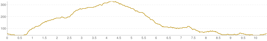
height in metres, distance in kilometres - note that gradients are usually exaggerated
Route Description
| 1 |
Facing the Tourist Information Centre at the top of the town centre outside which you will find a stone pillar on a three stepped octagonal base with 1651 carved into the top of it, turn left. Immediately in front of the Climbers Shop turn left again to head south west, pass Blacks and the lower entrance to Gaynor Sports on the left hand side. Take the first turning on the right, Millans Park road next to Zefferilis, and then immediately left into Vicarage Road to head down towards the prominent church spire. Follow the lane past the schools, church, and on into Rothay Park. Continue ahead through the park, over the small footbridge spanning the River Rothay and then left over the stone packhorse bridge.
Turn right along Underloughrigg Road to cross the cattle grid, and in less than 100m (110 yards) turn left signposted "public bridleway". This tarmac lane immediately heads steeply up the hill.
 Ambleside Post Office and Tourist Information Centre  Miller Bridge, Ambleside  Bridleway to Miller Brow |
| 2 |
Follow the lane past Brow Head Farm, Miller Brow, and Deer Hows, to eventually reach the gate onto the open fell. Go through the gate and bear right to leave the track and follow the wall round to the right for just a few metres. There is a small knoll to your left. As the wall then bears right again to double back on itself you bear left on a path to round the knoll. As you do the obvious main path appears climbing the fellside almost directly ahead aiming for a small notch in the skyline. This is one of the keys to climbing Loughrigg. A junction of paths lies below to your left.
 Ambleside to Little Loughrigg bridleway  The Fairfield Horseshoe  Loughrigg from the fell gate  Loughrigg, with paths converging to the central notch |
| 3 |
Continue roughly ahead on the path which skirts odd little boggy patches, and where the path splits keep heading for the notch. Climb to a col below a cairn and bear right and then left around a boggy patch with sometimes multiple small tarns. The trig point on the summit should come into view slightly left and still much higher.
 Ambleside and Wansfell Pike  Heading up to the southern cairn on Loughrigg  Loughrigg Fell with trig point far left |
| 4 |
There are many paths criss-crossing the bumpy plateau top. Here you need to keep in mind where the summit trig point is. As long as you do that the actual path to get there doesn't really matter. Occasionally a path split provides a little hint as to which is the most busy, and therefore the most direct line. Keep aiming for the trig point.
 Knolls and little paths on Loughrigg Fell  All paths converge to the trig point on Loughrigg  Loughrigg Fell trig point |
| 5 |
From the summit trig point, bear right, heading north-west, aiming for the deep notch of Dunmail Raise. A path appears dropping down the ridge. Follow the path down, at times it requires clambering down short sections of rock, but there are no difficulties at all. As the 'motorway' of Loughrigg Terrace comes into view the path becomes stone pitched. Beware of this pitching in wet weather. It is old and done at a time when the practise was to simply stick the stones down at the same angle as the terrain. Consequently it can be easy to slip in descent. Continue down to Loughrigg Terrace.
 Elterwater and Wetherlam  The Langdale Pikes from Loughrigg Fell  Path to Loughrigg Terrace in line with Dunmail Raise  Grasmere, with the notch of Dunmail Raise |
| 6 |
Reaching the terrace turn right. Traverse the fellside until nearing the obvious end point, bear right onto a path crossing the shoulder of a small knoll below Ewe Crag - this is the only path bearing right. Climb the shoulder and down the other side to the permissive path to Rydal Cave. Follow the track to the cave.
 Loughrigg Terrace  Below Ewe Crag on Loughrigg Fell  Rydal Cave |
| 7 |
With your back to the cave, bear right and left descending on the increasingly rough track through zigzags and beside the wall enclosing Jobson Close to the left. Keep right on the track, don't descend to the water's edge. Continue to the gate at the end of the track, go through into the walled lane. Follow the tarmac road down past the cottages and Cote How to Pelter Bridge. Do not cross the bridge but turn right onto the Under Loughrigg road. Follow this quiet country lane back to Miller Bridge. Turn left to cross the bridge into Rothay Park. Continue through the Park back into the town centre.
 Rydal Water and Nab Scar  Pelter Bridge  Under Loughrigg road  Under Loughrigg road |
A walk by Elizabeth Oldham
If you like this walk then why not try one of our other nearby walks:
Unless otherwise stated the text in this walk is the copyright of Hug Solutions Ltd trading as The Hug and the photographs are the copyright of Elizabeth Oldham. Hill data is derived from Database of British and Irish hills which is licensed under a Creative Commons Attribution 3.0 Unported License. Maps contains Ordnance Survey data © Crown copyright and database right 2011 and paths © OpenStreetMap Contributors,CC-BY-SA, 2011