
Sydney's latest summer heatwave will crest around the middle of Tuesday but any ebbing in temperatures won't last long with another hot spell building.
The Bureau of Meteorology lifted its forecast top for the city to 38 degrees, a level exceeded by noon when the temperatures reached 39.3 degrees.
More Environment News Videos

- Video duration
- 00:24
How to stay cool in a heatwave
How to stay cool in a heatwave
Sydney-siders share their tips for dealing with the record temperatures.
Up Next
Heatwave, fire ban as students return to school

- Video duration
- 01:28

- Video duration
- 01:28
Heatwave, fire ban as students return to ...
Heatwave, fire ban as students return to school
Students face an uncomfortable start to the school year as hot and dry conditions will persist this week, according to Weatherzone senior meteorologist Rob Sharpe.
Up Next
Kurri Kurri bushfire downgraded

- Video duration
- 02:05
- Video duration
- 02:05
Kurri Kurri bushfire downgraded
Kurri Kurri bushfire downgraded
A 26-year-old man is being questioned by police as firefighters contain the bushfire in Kurri Kurri.
Up Next
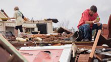
Georgia storms: At least 11 dead in US state
- Video duration
- 01:11

- Video duration
- 01:11
Georgia storms: At least 11 dead in US ...
Georgia storms: At least 11 dead in US state
Severe weather in the southeastern US states have killed at least 11 people and injured dozens more, with further extreme weather warnings issued by the National Weather Service.
Up Next
The state of our climate in 2016

- Video duration
- 04:41

- Video duration
- 04:41
The state of our climate in 2016
The state of our climate in 2016
Australia is already experiencing an increase in extreme conditions from climate change - and it's projected to get worse.
Up Next
Shark switches to asexual breeding

- Video duration
- 01:31

- Video duration
- 01:31
Shark switches to asexual breeding
Shark switches to asexual breeding
The loss of its mate triggers a female leopard shark to begin having babies asexually, a "really big surprise" for Queensland researchers.
Up Next
This vegan burger 'bleeds'

- Video duration
- 02:25

- Video duration
- 02:25
This vegan burger 'bleeds'
This vegan burger 'bleeds'
A butcher, a cardiologist, a vegan and a technology reporter try the Impossible Burger, a plant-based hamburger that "bleeds," made by Silicon Valley start-up Impossible Foods.
Up Next
Nutella maker fights back on palm oil claims

- Video duration
- 01:15

- Video duration
- 01:15
Nutella maker fights back on palm oil ...
Nutella maker fights back on palm oil claims
The multibillion-dollar palm oil industry is under pressure in Europe after authorities listed the edible oil as a cancer risk, has found a vocal ally in the food sector, the maker of Nutella.
How to stay cool in a heatwave
Sydney-siders share their tips for dealing with the record temperatures.
Earlier, the mercury topped 30 degrees at Sydney's Observatory Hill by 8am after another unusually mild night with a minimum of 25.4 degrees - almost 7 degrees above the January average.
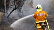
A total fire ban is also in force for the greater Sydney and Hunter regions for Tuesday.
Related Content

A slew of heat records are set to be rewritten for the month, with the city easily having its hottest January in terms of mean and minimum temperatures.
Tuesday's maximum will be enough for January's average maximum temperature to set a new high mark, exceeding the 29.5 degrees set all the way back in 1896, Rob Sharpe, a meteorologist with Weatherzone, said.
Penrith and Badgerys Creek touched 40 degrees soon after 10.30 am, the bureau said. Richmond hit 42 degrees about half an hour later, making it a record seventh day above 40 degrees in January, and backing up Monday's 43.8-degree scorcher.
Relief won't be too far off, with a cool change due to sweep in from the south by early afternoon.

"We'll see a sudden drop in temperatures by around lunchtime," Mr Sharpe said. For western suburbs, though, it's likely to be only a "slow descent" compared with the eastern parts of the city, he said.

There's also a chance of thunderstorms and showers in the Blue Mountains and western suburbs ahead of the change.
"It's quite a shallow change," Mr Sharpe said, noting that the mountain ranges are likely to block much of it from reaching inland parts of the state that have had searing heat for days.
Because the change is so weak, temperatures during the day and night are likely to remain above average for another week.
The bureau is forecasting most of NSW will remain in at least a low-intensity heatwave for days to come, with severe conditions covering the eastern parts of the state for the three days from Friday:

On current forecasts, the city is expected to have maximums of at least 28 degrees for the next seven days, making it 10 in a row.
If that threshold is reached, it will be the longest run of such days for the city for any time of the year in records going back to 1858. The previous longest run were the nine days between February 3-11 in 1949, according to the bureau.
2016 was Sydney's hottest year on record. With last month the city's second-hottest December and now January going one better, this summer is well on course to be Sydney's warmest.
The extended heat is having various impacts, including lifting Sydney's water usage to levels not seen since the drought of the early 2000s.
The city consumed 2.182 billion litres of water on Monday, the most since January 29, 2003, Sydney Water said.
"To illustrate the intense summer conditions this year, the average water demand for January so far is 1.762 billion litres per day, which is 19 per cent higher than the 10-year historical average demand" for the month, Peter Hadfield, Sydney Water spokesman, said.
Follow Peter Hannam on Twitter and Facebook.
Weatherzone is owned by Fairfax Media, publisher of this website.