Moreton Bay coral discovery mapped out by scientists seeking better protection for reef
Updated
 Photo:
New coral has been discovered in parts of Moreton Bay as part of a two-year study. (Supplied: Gary Cranitch/Queensland Museum)
Scientists have discovered and mapped out new parts of the coral reef system in Moreton Bay with the hope the work will help inform decisions to better protect it.
The area's secret spots were revealed during the most detailed reef mapping ever done of the south-east Queensland coastal region.
 Photo:
Scientists want the new maps updated regularly. (Supplied: Dr Chris Roelfsema/University of Queensland)
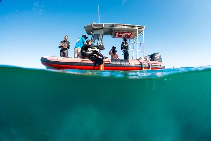
A team of 19 Reef Check Australia volunteers spent two years exploring the reef system, making some surprising discoveries.
"On Goat Island, not far from where the ferry travels to go to North Stradbroke Island, there's quite a lot of coral there which most people would be really surprised to know," Reef Check Australia's Jennifer Loder said.
She said the mapping project, that also involved the Healthy Waterways organisation, provided the clearest picture so far of what was beneath the surface of the busy boating playground.
"You're looking at these sites on a map going, maybe there's something there. Then you dive over the side to have a look and all of a sudden are greeted with these coral habitats that you totally didn't expect," she said.
The region hosts more than 60 species of coral — more than some of the world's most popular dive sites.
'You will see hard corals, soft corals, branching and massive'
The volunteers handed their diving data to mapping experts at the University of Queensland (UQ) who used existing maps and new, clearer satellite images to detail what was living where.
"In some places you will see mud. But in other places you will see hard corals, soft corals, branching and massive," UQ's Chris Roelfsema said.
 Photo:
Reef Check Australia volunteers surveyed Moreton Bay's reefs for two years. (Supplied: Gary Cranitch/Queensland Museum)
Ms Loder said the timing of the work was important as development pressure and population growth built on Moreton Bay's borders.
"South-east Queensland reefs are impacted by sediment and nutrients and fishing pressure, as well as acute events such as floods."
Scientists hope the mapping will help inform conservation decisions to protect the small but important reef system.
"By understanding what's there in more detail you can better plan with that. You can better see what's gaining or what you lose," Dr Roelfsema said.
The researchers called for more time and money to be spent on Moreton Bay's reefs.
"While places like the Great Barrier Reef deservedly have a really big focus on monitoring, these relatively unknown coral habitats are kind of forgotten about to some extent," Ms Loder said.
Scientists want the maps updated regularly and monitoring done every year.
Queensland's Environment Minister Steven Miles said the assessment would help shape efforts on land to protect Moreton Bay.
"The amount of sediment flowing into the Brisbane River each year is something like 5,000 dump trucks' worth," Mr Miles said.
"So everything we can do to reduce that sediment running out into the bay gives those coral reefs a better chance of survival."
 Photo:
A nudibranch discovered at Goat Island, Moreton Bay. (Supplied: Dr Chris Roelfsema/University of Queensland)
Topics: oceans-and-reefs, environment, marine-biology, biology, science-and-technology, cape-moreton-4025, brisbane-4000, qld
First posted


