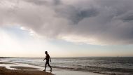
Melbourne has had its hottest day of the summer so far, a 38.2 degree scorching peak that was reached shortly before 6pm on Wednesday.
While Thursday will be cooler, with a forecast maximum of 30 degrees, Melburnians won't get real relief from the current humid and hot conditions hitting the city until Friday evening.
More Victoria News Videos
Melbourne weather: hot and steamy
A deep low pressure system has moved across Australia, bringing with it winds and humidity.
After a forecast maximum of 28 degrees on Friday, conditions are expected to become less humid on Friday evening and remain like that on Saturday. A top of 24 degrees is forecast for Saturday, with partly cloudy, dry conditions.
While Melbourne had a windy, baking hot and generally dry day on Wednesday, the south-west of the state received sustained rainfall from the system that smashed Uluru on Boxing Day, creating a series of stunning waterfalls on the rock.
A weaker version of the system brought 36.2 millimetres of rain to Portland, and significant falls to Cape Nelson (35.8 mm) and Warrnambool (22.4 mm).
Melbourne however, received just 1.4 millimetres of rain. Melbourne's top temperature for the day of 38.2 degrees, and for summer thus far, was recorded at 5.45pm.
Beren Bradshaw from the Bureau of Meteorology said the maximum temperature for the city came later in the day than normal. "Mostly, we see our maximum about 4pm," she said.
The highest temperature recorded anywhere in the Melbourne metropolitan area was at Avalon, with 39.8 degrees. Hopetoun in the Mallee recorded the state's highest temperature, 40.3 degrees, shortly after 6.30pm.

The unsettled weather also brought gusty winds, with peak gusts of 107 km/h at Mount Hotham, 91 km/h at Hopetoun, and 87 km/h at both Tullamarine and Aireys Inlet.
The hot and humid conditions will continue in Melbourne on Thursday, with a top temperature of 30 degrees forecast. The Bureau of Meteorology is also forecasting a high chance of showers and the chance of thunderstorms for Melbourne, with possible heavy falls. Rainfall of 8 to 25 millimetres is expected.

The Bureau issued a "severe weather warning" for people in the Mallee, Northern Country, North Central and North East forecast districts, and for parts of the East Gippsland, Mallee, South West, West and South Gippsland and Wimmera forecast districts late on Wednesday afternoon.
It said damaging winds of 60 to 70 km/h were expected on Thursday, with peak gusts of around 110 km/h over elevated areas in Gippsland and north-eastern Victoria.
The warning also said: "Heavy rain which may lead to flash flooding is forecast to develop early Thursday morning in the North East district and eastern parts of the Northern Country district. 24 hour rainfall totals of 100mm are possible, especially if thunderstorms develop Thursday afternoon. Thunderstorms developing Thursday afternoon elsewhere in the warning area may also result in localised heavy rain which may lead to flash flooding."
And it said that Melbourne, Mildura, Bendigo, Shepparton, Seymour, Maryborough, Ballarat, Geelong, Wodonga and Wangaratta could receive heavy rainfall.
Ms Bradshaw said the weather on Thursday for Victoria would be affected by a low pressure system now in the Great Australian Bight.
"As the low and it's associated front comes through the state there's quite a bit of instability and moisture, and we are expecting a greater risk of thunderstorm potential across most of the northern parts of the state for tomorrow. And there is the potential of seeing some heavy rainfall leading to flash flooding with that system," she said.


