Margaret River Weather
Margaret River Forecast
| Tonight | 17°C |
|---|---|
| Tomorrow | 30°C |
Now
18.4°C
Updated at 22:40 WST
Southwest for Monday
Clear. Winds SE/SW 15 to 25 km/h tending E/SE 15 to 20 km/h in the late evening.
Tuesday
Sunny. Winds E/NE 15 to 25 km/h becoming light in the morning then becoming SE/SW 20 to 30 km/h in the middle of the day.
Currently at Witchcliffe
24-hour graph| Temperature | 18.4°C |
|
|
|---|---|---|---|
| Dew Point | 16.2°C |

|
|
| Feels Like | 18.4°C | ||
| Relative Humidity | 87% | ||
| Wind |
|
ESE 3km/h |
|
| Wind Gusts | 6km/h | ||
| Pressure | 1014.1hPa |
|
|
| Fire Danger | 1.3 | ||
| Rain since 9am/last hr | 0.0mm / - | ||
Sun on Mon
more| Sunrise | 05:12 WST | |
|---|---|---|
| Sunset | 19:35 WST |
Nearby Now
| Busselton | 24.9°C |
|---|---|
| Cape Naturaliste | 24.5°C |
| Cape Leeuwin | 20.0°C |
| Bunbury | 24.4°C |
Fire Danger Rating
| HIGH |
Next 12 hours in Margaret River
48-hour forecast12am
3am
6am
9am
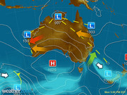
Southwest Weather Warnings
view allNational Forecast
Margaret River 7-day Weather Forecast
| Summary | Mon Jan 2 |
Tue Jan 3 |
Wed Jan 4 |
Thu Jan 5 |
Fri Jan 6 |
Sat Jan 7 |
Sun Jan 8 |
|||||||
|---|---|---|---|---|---|---|---|---|---|---|---|---|---|---|
|
Sunny |
Sunny |
Mostly sunny |
Late shower |
Possible shower |
Cloudy |
Mostly sunny |
||||||||
| Maximum | 31°C | 30°C | 30°C | 25°C | 22°C | 24°C | 26°C | |||||||
| Minimum | 14°C | 17°C | 15°C | 14°C | 12°C | 12°C | 12°C | |||||||
| Chance of Rain | 5% | 5% | 20% | 50% | 30% | 5% | 5% | |||||||
| Rain Amount | < 1mm | < 1mm | < 1mm | < 1mm | < 1mm | < 1mm | < 1mm | |||||||
| UV Index | Extreme | Extreme | Extreme | Extreme | Extreme | |||||||||
| Frost Risk | Nil | Nil | Nil | Nil | Nil | Nil | Nil | |||||||
| 9am | 3pm | 9am | 3pm | 9am | 3pm | 9am | 3pm | 9am | 3pm | 9am | 3pm | 9am | 3pm | |
| Wind Speed | 14 km/h |
15 km/h |
6 km/h |
22 km/h |
16 km/h |
18 km/h |
11 km/h |
30 km/h |
28 km/h |
28 km/h |
14 km/h |
22 km/h |
21 km/h |
24 km/h |
| Wind Direction |
E |
SSW |
NNE |
SSW |
S |
SW |
W |
W |
SW |
SSW |
S |
SSW |
S |
S |
| Relative Humidity | 47% | 39% | 40% | 45% | 57% | 48% | 66% | 65% | 55% | 52% | 54% | 50% | 58% | 49% |
| Dew Point | 13°C | 14°C | 13°C | 16°C | 15°C | 16°C | 15°C | 17°C | 9°C | 11°C | 10°C | 12°C | 12°C | 14°C |
Margaret River Sun & Moon Times
| Tuesday | Next occurrence | |||||||||
|---|---|---|---|---|---|---|---|---|---|---|
| First light | Sunrise | Sunset | Last light | Moon phase | moon rise | moon set | First quarter | Full moon | Last quarter | New moon |
04:44 WST |
05:13 WST |
19:35 WST |
20:04 WST |
|
Tue 09:47 WST |
Tue 22:52 WST |
Fri Jan 6 |
Thu Jan 12 |
Fri Jan 20 |
Sat Jan 28 |
Witchcliffe Past 5 Days
this month| Minimum | Maximum | Rainfall | |
|---|---|---|---|
| Mon Jan 2 |
12.4°C | 32°C | 0.0mm |
| Sun Jan 1 |
8.8°C | 25.9°C | 0.0mm |
| Sat Dec 31 |
12.5°C | 23.4°C | 0.2mm |
| Fri Dec 30 |
12.7°C | 22.1°C | 0.0mm |
| Thu Dec 29 |
14.3°C | 23.2°C | 0.0mm |
Witchcliffe Year To Date
Witchcliffe Almanac
full climatology-
Display your Local Weather here
automatically each time you visit us:

Rotates through Temperature,
Wind, Humidity and RainUse the Search Bar above
to find your Local, and go to the Local page
Click "Set My Local"
button next to the location name


Weather News
Top End floods cut off NT communities as severe weather warning issued
20:16 EDT
Two Top End communities have been cut off by floodwaters, while the weather bureau has said more could be affected as the worst of the heavy rain is yet to come.
Widespread storms lashing Qld and northern NSW
16:10 EDT
Storms are once again rumbling through New South Wales and parts of Queensland, bringing an impressive lightning show, gusty winds and heavy rain.
NT Top End drenching increasing flooding
15:05 EDT
A new year begins but the weather stays the same in the Northern Territory's Top End - heavy rain and flooding.

