New South Wales/ACT Weather
New South Wales/ACT Forecast
-
Saturday Hot in far west. Warm in east. Cooler in southeast. A few showers/storms, mainly west & southeast.
-
Sunday Hot in the west. Warm in east. Coastal sea breezes. Showers/storms in west & southeast. Dry northeast.
-
Monday Hot in the west. Warm in east. Coastal sea breezes. Showers/storms in west & southeast. Dry northeast.
-
Tuesday Rain in the southwest, dry in the northeast. Hot in the north & east, grading mild south & west.
NSW/ACT Extremes and Records
| Current Extremes | Last 3 Days Extremes | Extremes This Month | |||
|---|---|---|---|---|---|
| Wed 16/11 | Thu 17/11 | Fri 18/11 | |||
|
35.6°C Bourke Ap |
Hottest |
33.0°C Mungindi |
37.1°C Menindee |
39.0°C Wilcannia Ap |
39.0°C Wilcannia Ap |
|
15.2°C Thredbo Top Station |
Coldest |
0.3°C Perisher Valley |
5.9°C Armidale |
6.0°C Tenterfield |
-5.4°C Thredbo Top Station |
|
S 38km/h Nobbys Head |
Windiest |
68km/h Windy Point |
83km/h Thredbo Top Station |
66km/h Thredbo Top Station |
- |
| no rain last hr | Wettest |
4.0mm Uki |
5.0mm Cape Byron |
0.2mm Cape Byron |
0.2mm Moree Ap |
| New South Wales/ACT's Records for November | |||
|---|---|---|---|
| Max | Min | Rain | |
| Highest 46.8°C at Wanaaring in 2009 Lowest -3.1°C at Thredbo Top Station in 1967 |
Highest 33.3°C at White Cliffs Ap in 2009 Lowest -9.4°C at Charlotte Pass in 1968 |
Highest 371.0mm at Coffs Harbour in 2009 |
|
New South Wales/ACT Weather Forecasts
- list type
- Forecasts
- observations
- daily summaries
- rainfall bulletin
- monthly summaries
|
Station (ungroup by district) |
Forecast | Min | Max | Chance of rain | Rain amount | Frost risk | 9am | 3pm | |||
|---|---|---|---|---|---|---|---|---|---|---|---|
| Wind | RH | Wind | RH | ||||||||
| °C | °C | km/h | % | km/h | % | ||||||
| Mostly sunny |
19 | 25 | 20% | < 1mm | Nil | S 25 | 65 | SSE 30 | 63 | ||
| Mostly sunny |
12 | 31 | 20% | < 1mm | Nil | N 7 | 63 | - | - | ||
| Mostly sunny |
15 | 31 | 5% | < 1mm | Nil | N 15 | 64 | NE 18 | 52 | ||
| Mostly sunny |
19 | 24 | 50% | < 1mm | Nil | SW 17 | 66 | S 27 | 63 | ||
| Cloudy |
17 | 23 | 40% | < 1mm | Nil | S 22 | 73 | SSE 24 | 77 | ||
| Cloudy |
12 | 24 | 10% | < 1mm | Nil | - | - | - | - | ||
| Mostly sunny |
9 | 29 | 10% | < 1mm | Nil | WNW 10 | 55 | SE 15 | 35 | ||
| Late shower |
13 | 27 | 60% | 1-5mm | Nil | NNW 17 | 50 | NW 16 | 42 | ||
| Mostly sunny |
13 | 30 | 70% | 1-5mm | Nil | N 4 | 59 | NW 19 | 33 | ||
| Mostly sunny |
11 | 21 | 40% | < 1mm | Nil | NW 12 | 59 | WNW 22 | 47 | ||
| Mostly sunny |
12 | 33 | 5% | < 1mm | Nil | NNW 5 | 48 | SSW 10 | 21 | ||
| Possible thunderstorm |
16 | 34 | 30% | < 1mm | Nil | NNE 13 | 43 | NNW 11 | 23 | ||
| Cloudy |
17 | 35 | 50% | < 1mm | Nil | S 16 | 53 | SSW 12 | 19 | ||
| Mostly sunny |
16 | 32 | 40% | < 1mm | Nil | S 4 | 58 | WSW 11 | 20 | ||
| Mostly sunny |
22 | 38 | 5% | < 1mm | Nil | NNE 18 | 21 | ENE 15 | 12 | ||
| Mostly sunny |
19 | 34 | 20% | < 1mm | Nil | SSE 26 | 48 | SE 19 | 24 | ||
-
Display your Local Weather here
automatically each time you visit us:
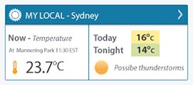
Rotates through Temperature,
Wind, Humidity and RainUse the Search Bar above
to find your Local, and go to the Local page
Click "Set My Local"
button next to the location name


Weather News
Late-spring heat gripping NSW
14:59 EDT
New South Wales is baking today as temperatures soar more than 10 degrees above average in some areas.
Double heat for Sydney
19:26 EDT
Two rounds of hot weather during the next week will pack out beaches and pools across the Sydney Basin.
Central Melbourne gets a tree change in readiness for hotter climate
19:09 EDT
Central Melbourne's streetscape is set for a marked change over the decades to come.