Australian Weather

National Summary
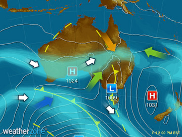
A trough sweeping over the southern parts of WA is bringing squally showers and a few thunderstorms. A cold front crossing SA is producing patchy showers and isolated storms. A troguh lingering over central QLD is triggering a few thundery showers.
State Weather
Click for state forecasts


Weather News
Cattle feedlot numbers fall, but remain above average
18:00 EST
Good rain and record high cattle prices continue to impact on the number of cattle on feed across Australia.
Western Australian weather forecast improved with first of three new radars
16:44 EST
The first of three doppler weather radars due to be rolled out in Western Australia's grain growing region has been completed and is expected to significantly improve weather forecasting.
Second front to hit southwest tonight
15:13 EST
Australia's southwest is bracing for the second round of blustery showers and storms this evening, with some areas under warning for damaging winds.


Extremes and Records
| Current Extremes | Last 3 Days Extremes | Extremes This Month | |||
|---|---|---|---|---|---|
| Sun 04/09 | Mon 05/09 | Tue 06/09 | |||
|
32.4°C Argyle Ap, WA |
Hottest |
37.0°C Bradshaw, NT |
37.6°C Middle Point, NT |
38.6°C Wyndham Ap, WA |
39.0°C Wyndham Ap, WA |
|
2.3°C Thredbo Top Station, NSW/ACT |
Coldest |
-3.4°C Armidale, NSW/ACT |
-1.0°C Thredbo Village, NSW/ACT |
-5.8°C Liawenee, Tas |
-6.8°C Liawenee, Tas |
|
NNE 70km/h Mt Read, Tas |
Windiest |
116km/h Mt Wellington, Tas |
116km/h Mt Wellington, Tas |
109km/h Maatsuyker Is, Tas |
- |
|
1.2mm last hr Christmas Island Ap, WA |
Wettest |
36.0mm Kununurra Ap, WA |
18.0mm Mt Read, Tas |
30.0mm Newcastle, NSW/ACT |
30.0mm Newcastle, NSW/ACT |
| Australia's Records for September | |||
|---|---|---|---|
| Max | Min | Rain | |
| Highest 43.1°C at West Roebuck, WA in 2003 Lowest -6.2°C at Mt Buller, Vic in 1995 |
Highest 29.7°C at Wyndham, WA in 2005 Lowest -16.7°C at Charlotte Pass, NSW/ACT in 1970 |
Highest 370.3mm at Burdekin, Qld in 1890 |
|
-
Display your Local Weather here
automatically each time you visit us:

Rotates through Temperature,
Wind, Humidity and RainUse the Search Bar above
to find your Local, and go to the Local page
Click "Set My Local"
button next to the location name


