Melbourne will feel as cold as zero degrees in coming days, as storms causing thunder, hail and snow come charging towards south-eastern Australia.
A damaging cold front, coupled with a freezing air mass behind it, is expected to smash Victoria, New South Wales, Tasmania and South Australia by Tuesday evening.

More News Videos

- Video duration
- 01:43
Damaging winds in Melbourne

- Video duration
- 00:30
Arrest over Dane Swan's pub fire

- Video duration
- 02:37
Locals confront jewellery thieves in Coburg

- Video duration
- 03:33
How does the Regional Rail Link operate?

- Video duration
- 00:07
CCTV: Coburg sexual assault

- Video duration
- 01:48
CCTV: Power tools stolen

- Video duration
- 00:59
Docklands building forecasts the weather

- Video duration
- 01:22
Unstable weather patterns continue Wednesday
Damaging winds in Melbourne
Melbourne braces for north westerly winds of up to 100km/h.


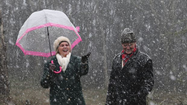
The cold air mass will also deliver snow as low as 300 metres by Wednesday – and perhaps even lower locally.
This low level for snow means that areas such as the Yarra Ranges, the Otways, the Strzelecki Ranges, Mount Macedon, Marysville and Mount Dandenong will see some white stuff by Tuesday.
Victoria's State Emergency Service is warning Victorians to drive safely through the wet and slippery conditions, and to "be on the lookout for unexpected hazards like black ice and fallen trees".

Thunderstorms, lingering cold air during the week
"We are likely to see thunderstorms develop from the west on Tuesday and a very cold air mass so some small hail is likely with the showers as well from Tuesday through to Wednesday afternoon," forecaster Rod Dickson warned.
Later in the week, the cold air is expected to linger.
"There will be some pretty chilly mornings after that, close to zero over a large part of inland Victoria later in the week but maximum temperatures will return to mid-teens," he said.

It is expected to drop to an early morning low of five degrees in Melbourne on Wednesday, he said.
"It's certainly going to be a cold period later this week but there are some more settled conditions on the way for next weekend."
Snow is on its way to Melbourne
Will it snow at your place Tuesday? Icy blast coming, snow down to 300m #snow #vicweather https://t.co/zdLTMNeQmT pic.twitter.com/gpjHXIvMCE
— BOM Victoria (@BOM_Vic) July 10, 2016
The forecast of snow down to just 300 metres on Wednesday means areas of higher ground close to Melbourne will experience falling snow.
"The air mass is certainly cold enough for it to snow there ... so any showers overnight Tuesday and early Wednesday could potentially fall as snow in those areas," Mr Dickson said.
With snow down so low could there be a dusting on top of Eureka Tower? At 292 metres could it get close?
According to bureau forecaster Tom Fejes it would be unlikely due to the warmth from surrounding buildings, but he concedes it is also "not completely impossible".
The ski resorts, of course, will get huge dumpings throughout the week.
- With Emily Woods