Earl Douglass and the Tertiary Geology of Southwest Montana’s Madison Bluffs

Most vertebrate paleontologists probably think of the spectacular dinosaur finds near Jensen, Utah, when the name Earl Douglass is mentioned. Douglass’s discovery of a partial Apatosaurus near Jensen in 1909  did spark the beginning of his long career with finding more dinosaur material in what we now know as Dinosaur National Monument. But Douglass began his quest for fossil vertebrates while he was in southwestern Montana – several years before he was summoned by the Carnegie Museum of Natural History’s director William Jacob Holland to find dinosaurs.

From the spring of 1894 to 1896, Douglass taught at a one-room school in the lower Madison Valley of southwestern Montana. The school house was located in the lower Madison Valley, directly west of the area known as the Madison Bluffs. These bluffs contain strata that range in age from probably as old as Eocene through the late Miocene. The strata are continental units that include alluvial fan to fluvial trunk stream deposits.

The school house near the Madison Bluffs, southwestern Montana, that Earl Douglass taught at from 1894-1896.

The school house near the Madison Bluffs, southwestern Montana, that Earl Douglass taught at from 1894-1896.

The Madison Bluffs consist of Tertiary fluvail/alluvial fan strata of probably Eocene to late Miocene age.

The Madison Bluffs consist of Tertiary fluvial/alluvial fan strata of probably Eocene to late Miocene age. The Madison Buffalo Jump State Park is located at the northwest edge of this photo.

During his tenure at the lower Madison Valley school, Douglass spent much of his spare time exploring the Madison Bluffs. At the beginning of his teaching contract in 1894, he had very little knowledge of vertebrate paleontology and of the area geology. He initially considered the Madison Bluff beds as Cretaceous in age. But when he found a “tooth very much like a Protohippus” (Earl Douglass journal entry on May 12, 1894), Douglass knew that the beds were younger in age. As time passed, he began to find a significant quantity of fossil vertebrate mammal material within the bluff’s deposits. Consequently, he immersed himself into reading about comparative anatomy so he could readily identify the fossil material. Douglass eventually used his collected fossil material for his 1899 Master’s thesis at the University of Montana – ostensibly the first Master’s degree awarded by the University.

horse jaw from douglass madbluff

Douglass kept journals of his time in the lower Madison Valley, and often detailed both the area geology as well as his fossil finds. Alan Tabrum and volunteers from the Carnegie Museum of Natural History have transcribed many of his journal entries from southwestern Montana. I’ve included two portions of journal entries to illustrate his finding of a horse jaw from the bluffs (above diagram) and one of Douglass’s drawings of “Big Round Top” (an area in the bluffs near the one-room school house) as compared to that same area today in a photo that I took about a week ago.

earldouglass_bigrt

It’s not difficult to understand how Earl Douglass became enthralled with the geology and paleontology of the Madison Bluffs. In addition to the fossil vertebrates, the bluffs contain many other fascinating geological features. Towards the central part of the bluffs (immediately south of the Madison Buffalo Jump State Park), calcic paleosol stacks mark the boundary between most likely Eocene and Miocene strata. The calcic paleosol stacks contain at least two generations of soil profiles (typically minus the A and upper part of the B horizons). Rootlets and burrows are commonly associated with these paleosols.

Volcanic tuffs also occur within the bluff’s strata, which is really handy for those of us who like isotopic age control for southwestern Montana Tertiary deposits. The tuffs could potentially help age constrain the paleosol stacks and sedimentation within the so far non-fossil bearing part of the bluffs. And with the help of the New Mexico Geochronology Lab, a group of us are working on just that aspect of Madison Bluff geology.

Calcic paleosol stacks in the central part of the Madison Bluffs, southwest Montana.

Calcic paleosol stacks in the central part of the Madison Bluffs, southwest Montana.

Roots within the calcic paleosols found at the Madison Bluffs.

Roots within the calcic paleosols found at the Madison Bluffs.

Burrows at the base of a calcic paleosol.

Burrows and roots at the base of a calcic paleosol.

Gray tuff found below calcic paleosol stacks.

Gray tuff found below the calcic paleosol stacks.

Iceberg Lake Glacier, Glacier National Park – Hiking Through A Changing Landscape

Iceberg Lake is situated in the Many Glacier area of Glacier National Park. The hike is about a 10 mile round trip and gains about 1275 feet in elevation. The trail winds through prime grizzly bear habitat, so be sure to hike with a group, make lots of noise, and carry bear spray. When I hiked the trail back in September, many returning hikers told our group about a grizzly sow and two cubs that were roaming around by Iceberg Lake. The bears actually walked by the lake shore while my group and many others were at the lake, but there were no harmful encounters. However – just this past week, in this same general area, a sow grizzly with 2 sub-adult cubs (I’m guessing that this is the same set of bears that walked by my group at Iceberg Lake) was surprised by a lone hiker and the sow grabbed and shook the hiker. The hiker used his bear spray escaped with puncture wounds to his lower leg and a hand. So – some words of caution about about hiking in bear country!

The Iceberg Lake Trail

A part of the Iceberg Lake Trail - note the u-shape valley sculpted by glacial processes.

A part of the Iceberg Lake Trail – note the u-shape valley sculpted by glacial processes.

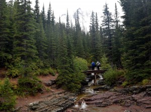
The trailhead to Iceberg Lake is behind the cabins near the Swiftcurrent Motor Inn. The first part of the hike, about 1/4 mile, gains about 185 feet. After that initial elevation gain, the trail’s elevation gain moderates. Ptarmigan Falls is about 2.5 miles from the trailhead, and a short way above this is a footbridge that crosses Ptarmigan Creek. The rocky area near the footbridge is a great place for a snack break. Another 1/10 mile beyond the footbridge is the Iceberg Lake Trail junction. The Ptarmigan Trail continues towards the right and goes to Ptarmigan Tunnel and Ptarmigan Lake.Take the other trail branch to continue on to Iceberg Lake. A good trail hike summary for the Iceberg Lake Trail is found at the website “Hiking in Glacier”.

Footbridge over Ptarmigan Creek - good  place for a snack break.

Footbridge over Ptarmigan Creek – good place for a snack break.

Nearing Iceberg Lake as the snow and sleet continue to fall.

Nearing Iceberg Lake as the snow and sleet continue to fall.

The popularity of the trail was clear to me when even on a rainy, sleety, and snowy day,I passed many people on the trail. My group did a leisurely hike, stopping at several places to look at the geology alongside the trail and to do a snack stop by the Ptarmigan Creek footbridge both on the way up and back. It took us about 5 hours for the round trip. That put us back just in time to have a much enjoyed dinner at the Swiftcurrent Motor Inn.

Ah - the trail's end at Iceberg Lake!

Ah – the trail’s end at Iceberg Lake!


The Iceberg Glacier: Recession from 1940 to the Present

Comparisons of the Iceberg Glacier from 1940 to 2015. The photo on the left is a circa 1940 Hileman photo. GNP Archives; the center photo is a 8/14/2008 photo by Lisa McKeon, USGS, and the photo on the right is a 9/6/2015 photo by Debra Hanneman.

Comparisons of the Iceberg Glacier from 1940 to 2015. The photo on the left is a circa 1940 Hileman photo (GNP Archives) the center photo is a 8/14/2008 photo by Lisa McKeon, USGS, and the photo on the right is a 9/6/2015 photo by Debra Hanneman. Click on the photo to enlarge it in a new window.

The Iceberg Glacier is shown in the above photo set beginning in 1940 (this is the photo on the left, which is a Hileman photo from the Glacier National Park Archives) and ending with the 9/6/2015 photo on the right, which I took during my hike to Iceberg Lake. In the 1940 photo, the glacier terminus is quite thick and extends into the basin. By 2015, there is not much left of the glacier. Even with a comparison between the center 2008 photo by Lisa McKeon and my 2015 photo, one can see that much more bedrock is exposed. The older photos are also posted on the US Geological Survey’s Repeat Photography Map Tour Website. For those interested in glacial recession within Glacier National Park, the Repeat Photography website is a valuable resource. The Repeat Photography project is summarized on the USGS website –

This project began in 1997 with a search of photo archives. We used many of the high quality historic photographs to select and frame repeated photographs of seventeen different glaciers. Thirteen of those glaciers have shown marked recession and some of the more intensely studied glaciers have proved to be just 1/3 of their estimated maximum size that occurred at the end of the Little Ice Age (circa 1850). In fact, only 26 named glaciers presently exist of the 150 glaciers present in 1850.

Trail Geology

Sheet sands interbedded with muds in Proterozoic Grinnell Formation.

Jeff Kuhn points out sheet sands interbedded with muds in Proterozoic Grinnell Formation.

Much of the Iceberg Lake Trail winds through the Grinnell Formation, which is a Proterozoic geologic unit within the Belt Supergroup. As Callan Bentley has succintly said of the Belt Supergroup rocks in Glacier National Park:

The rocks exposed firstly from the top down are old sedimentary rocks of the Belt Supergroup. It is called “Belt” after Belt, Montana, and “supergroup” because it is immense. These rocks were deposited in a Mesoproteozoic (1.6-1.2 Ga) sea basin, and show little to no metamorphism despite their age.

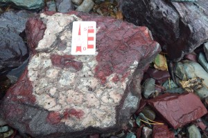
Rip-up clasts in Proterozoic Grinnell Formation.

Rip-up clasts in Proterozoic Grinnell Formation.

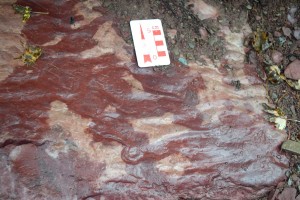
I was lucky to be hiking with Jeff Kuhn from Helena, Montana, who has done much work with Belt Supergroup rocks in the Glacier Park to Whitefish Range areas. Jeff stopped us at several locations along the trail to look more closely at features within the Grinnell Formation. In general, the Grinnell Formation consists of sandstone and argillite and is approximately 1740-2590 feet thick. It has a deep brick-red color owing to its contained hematite and because it was deposited in a shallow oxygen-rich environment. Sedimentary features that are consistent with the shallow water depositional interpretation include mudstone rip-up clasts, mudcracks, and ripple marks.

Mudcracks preserved in the Proterozoic Grinnell Formation.

Mudcracks preserved in the Proterozoic Grinnell Formation.

All told, it was a hike well worth doing, even if you are not a geology enthusiast!

Ripples preserved in the Proterozoic Grinnell Formation.

Ripples preserved in the Proterozoic Grinnell Formation.


A Different Look At The Burgess Shale – The Stanley Glacier Burgess Shale Hike, Kootenay National Park, British Columbia, Canada

The Middle Cambrian Burgess Shale and its contained fossils are legendary to earth scientists. These fossils are by far the best record of Cambrian animal fossils. The importance of the Burgess Shale fossils is also linked to their excellent preservation. The fossils include many soft bodied animals in addition to those with hard parts – an extremely rare occurrence for fossil assemblages.

I finally hiked to the Walcott Quarry on Fossil Ridge near Field, B.C., last year, just to better understand the context of the Burgess Shale. It was well worth the effort (it is a long, and as other hikers phrased it – a gut-busting hike). Before my Walcott Quarry hike, I’d read that Kootenay National Park just started hosting hikes to Burgess Shale type faunas (BST) in the Stanley Glacier area. It only took a good dinner and a beer after the Walcott Quarry hike to decide that I’d do the Stanley Glacier Burgess Shale hike.

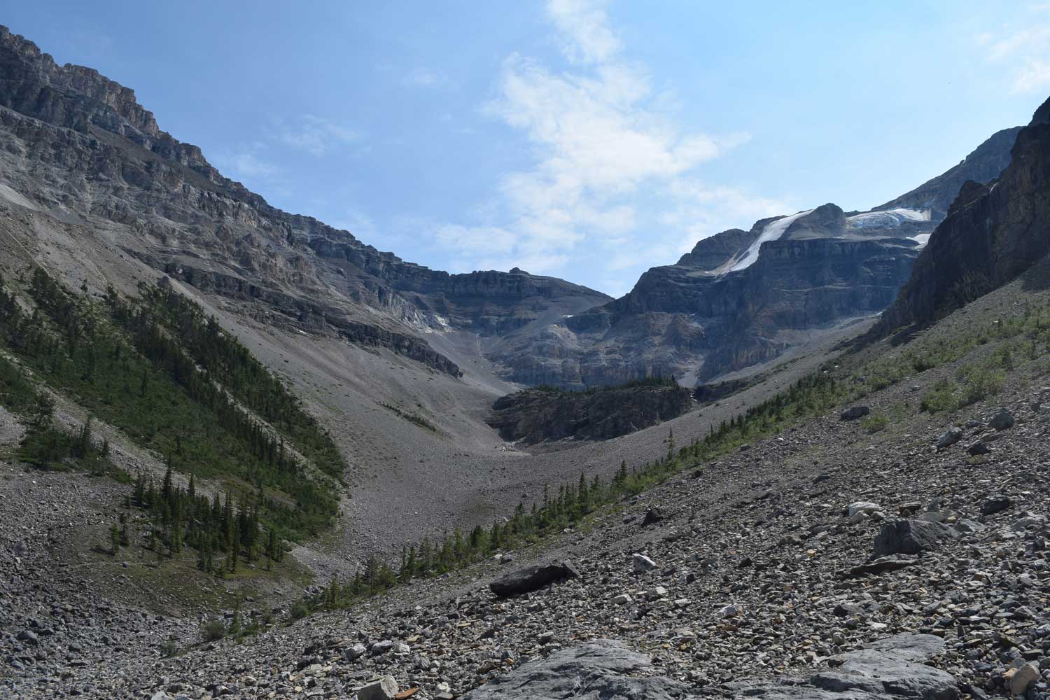
Stanley Glacier Valley, Kootenay National Park - the view is looking west from the upper talus slopes.

Stanley Glacier Valley, Kootenay National Park – the view is looking west from the upper talus slopes.

Stanley Glacier BST fossils (approximately 505 million years in age) are about 40 km southeast of the Field, B.C. (Yoho National Park) locales. Recent work in both the Marble Canyon and the Stanley Glacier areas of Kootenay National Park yielded noteworthy additions to understanding the BST fossils and their depositional environments. BST fossils found in the Marble Canyon area include 25 new species of organisms; 8 new species are now recorded for the Stanley Glacier BST fossils. Of more interest to me (being a sedimentologist), is that the depositional environment in the Kootenay National Park area differs from that of the Field, B.C. area. Although the Burgess Shale fossils are found within the Stephen Formation in both areas, there is a marked difference in this rock unit from one area to the other area. Around Field, B.C., the Stephen Formation is the “thick or basinal” (about 276 to 370 meters thick) Stephen and it resulted from deposition at the base of the older Cathedral Formation Escarpment (a submarine cliff) via turbidity flows. In the Stanley Glacier area, the Stephen Formation is relatively “thin” (about 33 meters thick) and is probably the result of deposition at the distal edge of a marine platform (Caron and others, 2010; Gaines, 2011). The stratigraphic placement of the Burgess Shale rock units also differs from the Field, B.C. area to the Stanley Glacier area. Based upon the presence certain trilobites and stratigraphic evidence (Caron and others, 2010), the “thin” Stephen Formation at Stanley Glacier is stratigraphically above the Field, B.C. Burgess Shale localities.

The Cambrian rock units on the south wall of the Stanley Glacier area. The Stephen Formation is the unit that contains the Burgess Shale type fossils. The lockbox location is the hike’s end.

With that small bit of Burgess Shale background, I’ll get back to the actual hike up the Stanley Glacier valley to the Stephen Formation talus slopes and outcrop. The hike is hosted by Kootenay National Park and is about 10 km for the round trip. The elevation gain is about 450 meters. The first part of the hike is through glacial material and a fire-swept lodgepole pine forest. Forest fires burned through this area most recently in 1968 and in 2003. Luckily for paleontologists, the fire bared many slopes and definitely helped in locating BST fossil beds. A little more than halfway through the hike, one breaks out of the trees onto the talus slopes of Stanley Glacier’s valley. The hike continues over the talus slope to a very large boulder. Several BST fossil specimens are locked in a box kept behind this boulder. Our guide gives an informative talk about the lockbox fossils and we have much time to pick around the talus slope for more fossils.

Burgess Shale type fossil specimens are kept in a lock box behind the large rock. These specimens are the focus of an informative talk by the Kootenay National Park hike guide.

Burgess Shale type fossil specimens are kept in a lockbox behind the large rock located on the talus slope. These specimens are the focus of an informative talk by the Kootenay National Park hike guide.

In 1989, an expedition party from the Royal Ontario Museum (ROM) located fossils from Stephen Formation talus in this area (Rigby and Collins, 2004: Sponges of the Middle Cambrian Burgess Shale and Stephen Formations, British Columbia; Royal Ontario Museum Contributions in Science 1: 1–155.). Caron and others (2010) also document that some of their fossil assemblage material came from the talus slope, so it’s worth some time to look around (Caron and others, 2010 GSA Data Repository).

Talus slopes beneath the Cambrian Stephen Formation are prime areas for Burgess Shale type fossils.

Talus slopes beneath the Cambrian Stephen Formation are prime areas for Burgess Shale type fossils.

Keep in mind that this is within a Canadian National Park, so do not keep any of the fossil material. The quarry that has been worked recently in this area (the quarry was initially worked in 2008 by ROM earth scientists) is yet beyond the hike’s end point, near the southwest edge of the cirque.

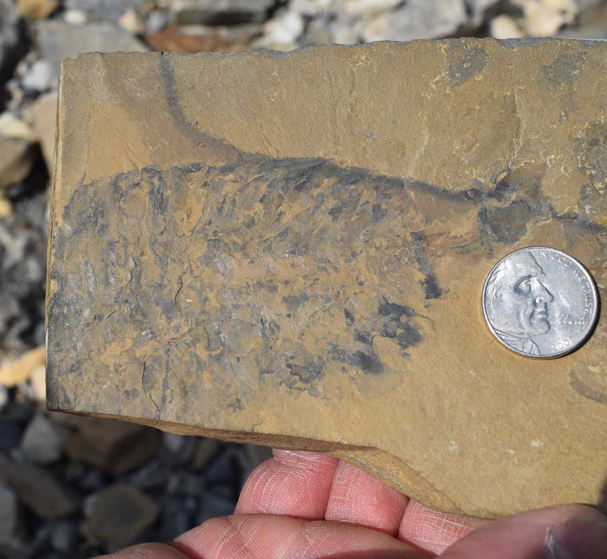
Stanley Glacier BST shelly fauna includes characteristic Cambrian taxa such as hyolithids, brachiopods, and trilobites. Soft-bodied BST creatures such as the necktobenthic or nektonic arthropods and proto-arthropods Stanleycaris hirpex n. gen., n. sp., Tuzoia retifera, and Sidneyia inexpectans also are part of the BST fauna. Trace fossils are plentiful on some bedding surfaces. These include trails, shallow burrows, and arthropod trackways.

Tuzoia - a fossil arthropod specimen from the lockbox collection.

Tuzoia – a fossil arthropod specimen from the lockbox collection.

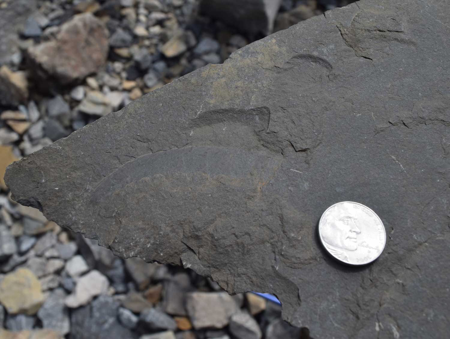
Sidneyia - a fossil arthropod from the lockbox collection.

Sidneyia – a fossil arthropod from the lockbox collection (this specimen is actually from Marble Canyon).

Sponge spicules - from the fossil lockbox collection.

Sponge spicules – from the fossil lockbox collection.

Haplophrentis - an enigmatic tubular fossil known as a hyolith. This fossil is from the lockbox collection.

Haplophrentis – an enigmatic tubular fossil known as a hyolith. This fossil is from the lockbox collection.

Anomolarcaris claw - from the lockbox collection.

Anomalorcaris claw – from the lockbox collection.

Feeding traces - from the talus slope near the lockbox.

Feeding traces – from the talus slope near the lockbox.

The Gravelly Range, Southwestern Montana: High Elevation Tertiary Rocks

The Gravelly Range is located in southwest Montana, about 10 miles southwest of Ennis, Montana. Much of the range is covered by the Beaverhead-Deerlodge National Forest. The Axolotl Lakes Wilderness Study Area, managed by the Bureau of Land Management, is in the northern part of the Gravelly Range.

Gravelly Range - looking east over Paleozoic rocks to the Madison Range in the far distance.

Gravelly Range – looking east over Paleozoic rocks to the Madison Range in the far distance.

Our field group was interested in looking at Tertiary rocks, so we headed for the Black Butte – Lion Mountain area, the more south-central part of the range. A cold front had just swept through western Montana a few days prior to my field trip. That storm left some snow up on the range crest – yep, that’s right, snow in July. But it did melt off fast and it left vegetation along the Gravelly Range road (the main road that stretches along much of the top of the range’s extent) extremely lush. So it was a gorgeous drive from the Lyon Bridge crossing on the Madison River up to Lion Mountain and Black Butte. And as Black Butte is the highest peak in the Gravelly Range at 10,542 feet in elevation, it was not difficult to find our destination.

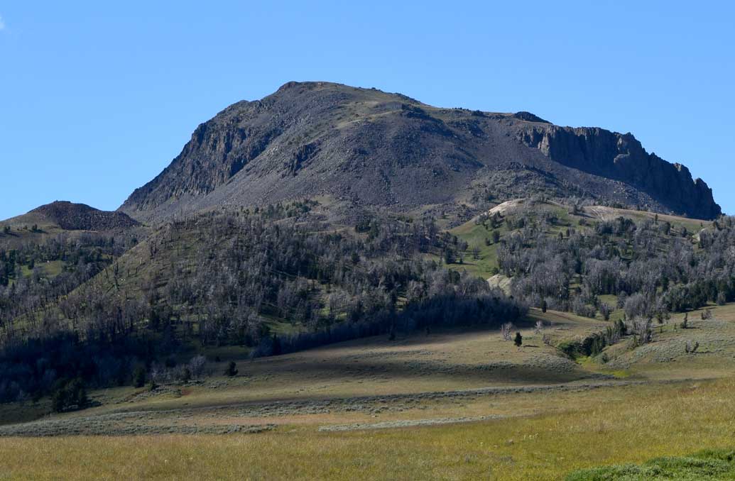
Black Butte, at 10,542 feet  in elevation, is the highest peak in the Gravelly Range.

Black Butte, at 10,542 feet in elevation, is the highest peak in the Gravelly Range. Eruptions at Black Butte have a radiometric age date by whole-rock K-Ar of 22.9 Ma.

East side of Lion Mountain as seen from Wolverine Basin. Alkaline basalt caps Lion Mountain, with a K-Ar age date of 30.8 Ma.

East side of Lion Mountain as seen from Wolverine Basin. Alkaline basalt caps Lion Mountain, and has a K-Ar age date of 30.8 Ma.

The Tertiary rocks of interest to us were primarily the Tertiary strata exposed on the west side of Lion Mountain. Fossil fauna from these strata have a North American Land Mammal Age of Whitneyan, and are approximately 29 to 32 million years in age. Carnivore, rodent, insectivore, and rabbit are some of the fauna of the fossil assemblage collected here by past workers.

The west side of Lion Mountain with Tertiary strata exposed under the 30.8 Ma basalt cap.

The west side of Lion Mountain with Tertiary strata exposed under the 30.8 Ma basalt cap.

It was a good workout to reach the top of Lion Mountain, but really was well worth the effort. The Tertiary strata had plenty of features to keep a sedimentologist like myself busy. And the views – just spectacular! To top off the trip – it was obvious that someone had been there before us because we found an aluminum ladder stashed is the trees near the top of the Tertiary exposures. None of us availed ourselves of its use, but maybe next time it will come in handy!

A ladder stashed in the bushes near the top of Lion Mountain. The Snowcrest Range is shown in the distance on the left hand side of the photo. Black Butte pops over the ridge in the photo's upper right.

A ladder is stashed in the trees near the top of Lion Mountain. The Snowcrest Range is shown in the distance on the left hand side of the photo. Black Butte pops over the ridge in the photo’s upper right.


Black River Recreational Trail – Watertown To Black River, New York: A Brief Excursion Into The Middle Ordovician Black River Group

If you’re in the Watertown – Black River area of western upstate New York and feel like a quick hike – and make that one with some easily accessible geology, then look for the Black River Trail. The New York State Park’s Black River Recreation Trail is located adjacent to the picturesque Black River which flows through a part of the middle Ordovician Black River Group. The trail is 3.5 miles in length and runs along an abandoned portion of the NY Central Railroad corridor between Watertown and the village of Black River. More information on directions to the trailhead is available at: http://blackriverny.com/place/black-river-trail/.

The Black River has historically been a regional hydropower source. Consequently, in addition to interesting geology, you’ll see infrastructure that is the result of the river’s energy-related history. Brookfield Renewable Energy has a hydropower plant on the north side of the river, near the northern trailhead. Abandoned paper mill structures are on Poors Island, southeast of the village of Black River. To see this part of the Black River, extend the hike by continuing right out of the Black River Trail’s parking lot along Route 3, turn left onto Remington Street, again turn left at the stop sign, and at the bottom of the hill (before crossing the bridge) turn right onto Poors Island.

The Black River has historically been a source of hydropower.

The Black River has historically been a source of hydropower.

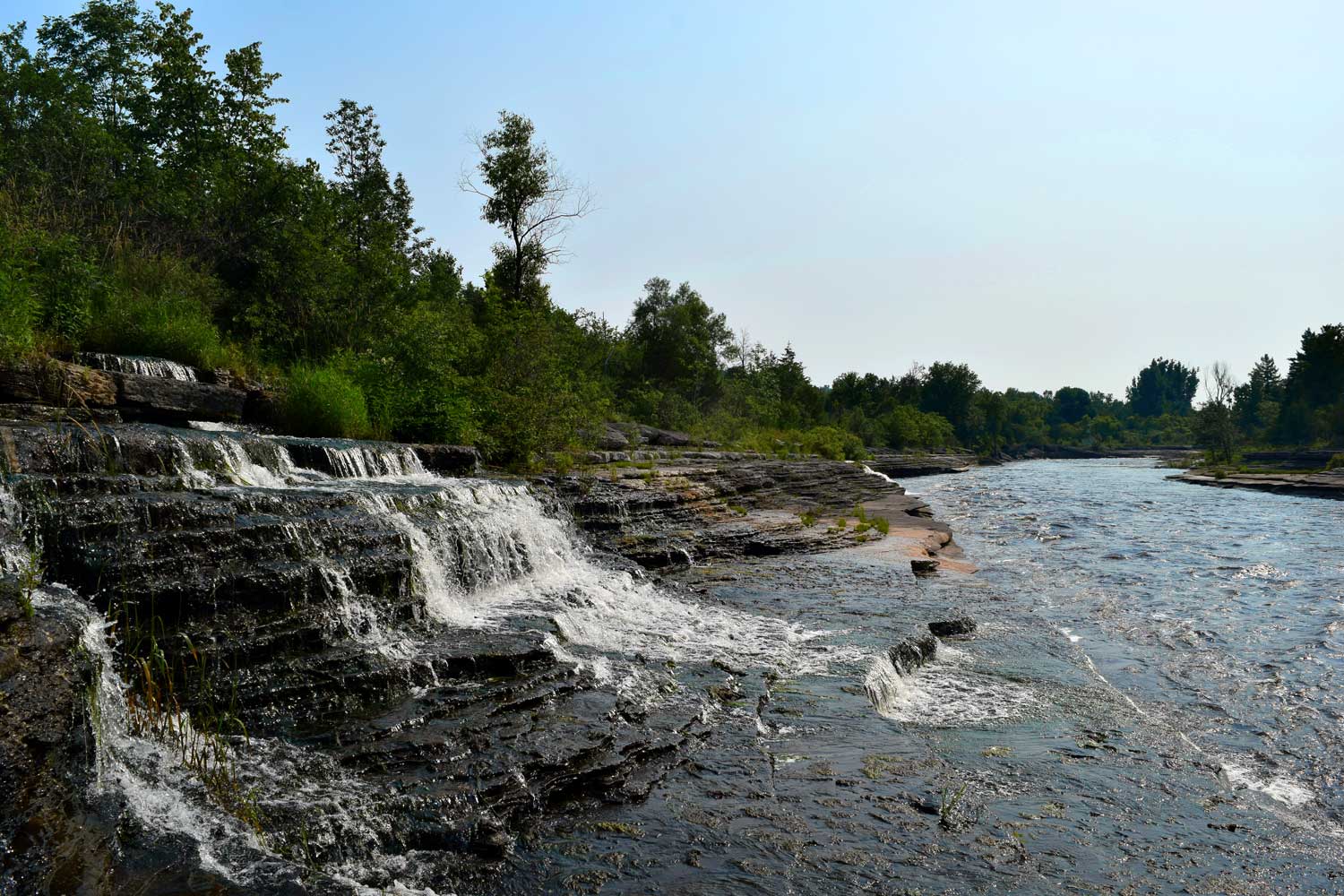
The middle Ordovician Black River Group that outcrops along the Black River Trail contains mainly carbonate rocks. Black River Group rocks in this area are separated into two formations – the Lowville and the Chaumont. The Lowville Formation is a medium-light to light gray, generally thinly bedded, micritic limestone. The Chaumont Formation overlies the Lowville Formation and contains more massively bedded limestone and basal chert. Water cascades over the limestone beds at several places along the river, making the hike an extremely scenic experience!

Black River Group rocks host several small waterfalls along the Black River Trail.

Black River Group rocks host several small waterfalls along the Black River Trail.

For those of you who are more interested in the geology, here’s a couple references that I found helpful:

1. Uplift of the Tug Hill Plateau in northern New York State, 2010, by Wallach and Rheault – available at Research Gate: Tug Hill Uplift

2. Johnsen, J.H. 1971. The limestones (Middle Ordovician) of Jefferson
County, New York. New York State Museum and Science
Service, Map and Chart Series No. 13.

3. New York State Geological map kml: NY State Geology kml


Geological Travels In Cuba

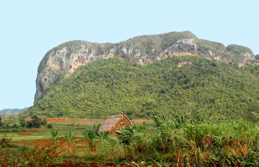
A part of the Vinales Valley in western Cuba – a UNESCO World Heritage Site.

If you’ve ever thought about Cuban geology, now may be the time to get serious about actually going to Cuba and looking at it. As a U.S. citizen, it’s been extremely difficult to legally go to Cuba. I went there in March of 2013 as part of an Association for Women Geoscientists’s geological field trip that we did through the travel company Insight Cuba. It was a very good trip. Our geological guide was Manuel Iturralde, a retired curator from the National Museum of Natural History in Havana and current President of the Cuban Geological Society. Manuel’s knowledge of Cuba’s geology is immense and consequently the geology part of the trip was amazing. But – because I am a U.S. citizen, my travel at that time was done under the U.S. trade embargo on Cuba, initially imposed in 1960. That meant to be fully legal I had to travel to Cuba via a licensed “people-to-people” travel agency. The people-to-people visits involve booking a full-time schedule of educational exchange activities for each traveler that will bring about a “meaningful interaction” between the travelers and Cubans – and hence the time for geology is limited. Additionally, the places one can go in Cuba were also limited. For example, U.S. citizens could not visit “tourist” areas, and thus areas of geological interest such as most beach geology was off limits during my tour.

President Obama’s 12/17/2014 announcement on easing of Cuba travel restrictions may well help out those interested in seeing Cuban geology. According to the White House Fact Sheet – Charting A New Course on Cuba -, “general licenses will be made available for all authorized travelers in 12 existing categories”, two of which – professional research and professional meetings and educational activities – will help for improving the quality of travel for earth scientists. However, I talked with a person from Insight Cuba today about the new travel requirements, and they said, “a traveler still needs to get a license from OFAC (U.S. Office of Foreign Assests Control), and it still might take about 2 months to get the license”. Unfortunately, in the Insight Cuba rep’s opinion, not much has yet changed for travel to Cuba. I guess we’ll just have to wait and see on what transpires with this in the near future.

But – as I said earlier in this blog, it still may be a good time to think about geology-based travel to Cuba. Manuel Iturralde recently emailed me an announcement for The Cuban Society of Geology’s VI Cuban Convention on Earth Sciences and Exhibition of Products, Services and New Technologies – GEOEXPO 2015 – May 4 – 8, 2015, in Havana. This should be a excellent convention and good way to be introduced to Cuba’s geology.

Just to mention a couple other earth science resources for potential travelers:

  • 2013/2014 Yearbook of the Cuban Society of Geology (Volume 1, No. 1, 2013. ISSN 2310-0060, Scientific Journal of Geosciences, Havana – now this is the July 2014 version) is online. As described from the website:

    This version of the Cuban Digital Library of Geosciences brings together some 3700 references, 2091 in digital format, most of the published contributions, unpublished lesser extent, the existence of which the authors are aware. The topics cover the various branches of Earth Sciences, with emphasis on geology, geophysics and mining Cuba, or in any way relevant to the best knowledge of Cuban territory, although centrally relate to other geographies. These contributions include books, monographs and scientific articles, a few summaries and maps dating from 1535. Some very important unpublished documents are referenced as are available at the National Bureau of Mineral Resources (ONRM), the Centre National Geological Information ( CNIG ), the map library and collection of science in the National Library José Martí; and library (1989), Institute for Geophysics, University of Texas at Austin. In the year 2012 was published a list of Information Centers Geosciences across the country and how to access them.

  • Journeying Through Cuba’s Geology and Culture: This is a brief article that I wrote for the “Travels in Geology” section of Earth magazine (published July/August 2013) about my trip through western and central Cuba with the Association for Women Geoscientists in March 2013.


One of the towering limestone hills locally known as “mogotes” of the Pinar del Río Province in far western Cuba. This mogote is known as Abra de Ancón and it is famous for the site where Manuel Fernández de Castro first found Jurassic marine invertebrate fossils in the late 1800’s.

One of the towering limestone hills locally known as “mogotes” of the Pinar del Río Province in far western Cuba. This mogote is Abra de Ancón and it is famous for the site where Manuel Fernández de Castro first found Jurassic marine invertebrate fossils in the late 1800’s.

IPCC Hones Its Language on Climate Change

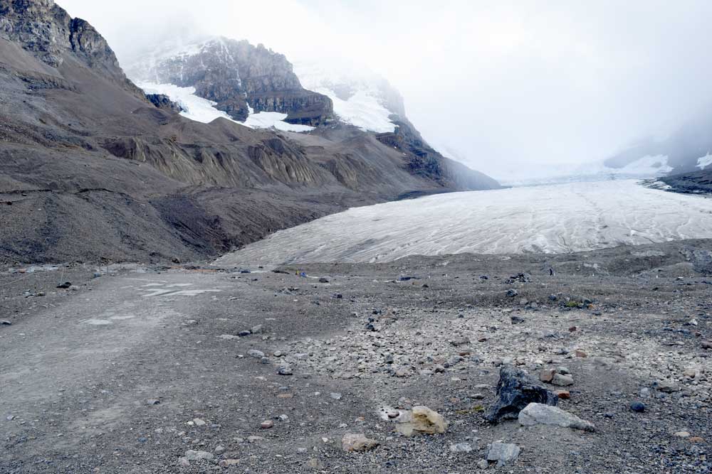
The Athabasca Glacier, a part of the Columbia Icefields in Alberta, Canada, is receding on an average of 16 feet per year.

The Athabasca Glacier, a part of the Columbia Icefields in the Rocky Mountains of Alberta, Canada, has receded 0.93 miles (1.5 km) over the last 125 years.

Yesterday the Intergovernmental Panel on Climate Change (IPCC) released its latest Synthesis Report (SYR5) – a summary of the IPCC’s Fifth Assessment Report (AR5) on the state of knowledge on climate change. The big news with the SYR5’s release is the change in language used within the report – words like “unequivocable” and “clear” now replace the earlier usage of “probable” and “likely” when describing global warming and the role that human activity has played in the temperature increase. Text from the SYR5 underscores this major language shift:

 “Warming of the climate system is unequivocal, and since the 1950s, many of the observed changes are unprecedented over decades to millennia. The atmosphere and ocean have warmed, the amounts of snow and ice have diminished, and sea level has risen.”

…and

“Human influence on the climate system is clear, and recent anthropogenic emissions of greenhouse gases are the highest in history.”

The SYR5 summarizes IPCC’s three other major reports on various facets of climate change that were released in 2013-2014. These reports are all available from the IPCC website:

  • Climate Change 2013 – The Physical Science Basis;
  • Climate Change 2014 – Impacts, Adaptations, and Vulnerability; and
  • Climate Change 2014 – Mitigation of Climate Change.

The Carbon Brief 11/2/2014 blog gives a listing and good, brief descriptions of what else is noteworthy in the SYR5. Here’s a quick recap on their list:

  • Global warming continues unabated
  • Human influence on warming is clear
  • Ocean acidification, sea level rise, glacial ice decline
  • IPCC’s new carbon budget
  • Consequences of inaction – climate change impacts
  • Low carbon transition – costs and savngs

Canadian Rockies AWG Field Trip – A Summary

The AWG 2014 Canadian Rockies Field Trip took place from August 28 to September 7, 2014, with a Calgary-area geology pre-trip for early arrivals on August 27.  The main part of the field trip commenced with a mid-morning departure on the 28th from Calgary, and we all headed west along Canada Highway 1 to Lake Louise. After spending two days in the Lake Louise area, we drove north to the Columbia Icefields. A few of us continued further north the next day, on an side trip to Jasper. From the Icefields we toured south to Field, British Columbia, over to Revelstoke, and ended our British Columbia time in Fernie. We then drove east, back into Alberta, and spent time at Dinosaur Provincial Park near Brooks and at the Royal Tyrrell Museum of Palaeontology in Drumheller. The trip ended with our group once more back in Calgary, Alberta.

There were 22 people as full-time field-trippers and two more people on the trip during the Icefields to Field, B.C. part of the trip. Two of the full-time trip participants were students and one of the additional, part-time trip participants, was a student. All of the students on the field trip are from Mount Royal University in Calgary and are students of our field trip leader, Katherine Boggs. Paul Hoffman and Mindy Brugman also helped out for a day or so during the trip. Marcia Knadle and Debra Hanneman did the trip budget and logistics. We had a great field trip guidebook, thanks largely to Katherine Boggs’ efforts. The field trip guidebook, “Tectonics, Climate Change, and Evolution: Southern Canadian Cordillera” will be on sale at the AWG online store soon.

Some of us took to the water and canoed around Moraine Lake near Lake Louise, Alberta. Moraine Lake is located within the valley known as the “Valley of the Ten Peaks” which was once featured on the Canadian twenty dollar bill.

Some of us took to the water and canoed around Moraine Lake near Lake Louise, Alberta. Moraine Lake is located within the valley known as the “Valley of the Ten Peaks” which was once featured on the Canadian twenty dollar bill.

Katherine Boggs talks to the field trip crew about area geology at a stop along the Icefields Parkway in Alberta.

Katherine Boggs talks to the field trip crew about area geology at a stop along the Icefields Parkway in Alberta.

Our intrepid field crew hikes the Athabasca Glacier, one of the six major glaciers of the Columbia Icefield.

Our intrepid field crew hikes the Athabasca Glacier, one of the six major glaciers of the Columbia Icefield.

Paul Hoffman explains features of the Neoproterozoic Old Fort Point Formation near Jasper, Alberta.

Paul Hoffman explains features of the Neoproterozoic Old Fort Point Formation near Jasper, Alberta.

Some of the field trip group took the arduous hike up to the famous Walcott Quarry that is developed within the Cambrian Burgess Shale near Field, British Columbia.

Some of the field trip group took the arduous hike up to the famous Walcott Quarry that is developed within the Cambrian Burgess Shale near Field, British Columbia.

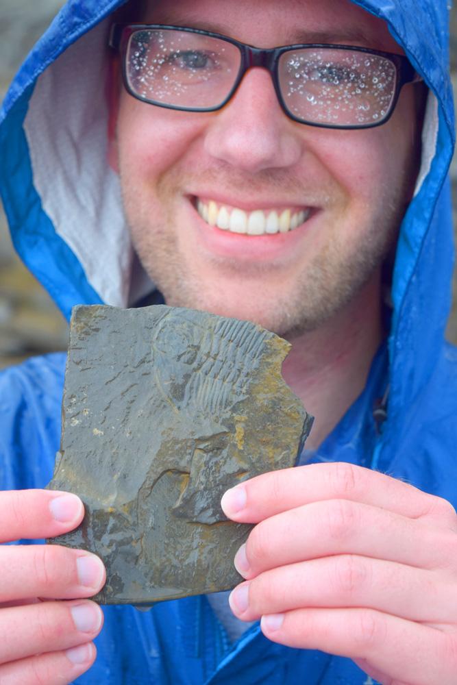
A member of our field trip group shows us one of the Burgess Shale’s trilobites from the Walcott Quarry.

A member of our field trip group shows us one of the Burgess Shale’s trilobites while at the Walcott Quarry.

One of the trip’s frequent rainy days – but we still had fun by the Kicking Horse River at its confluence with the Columbia River, near Golden, British Columbia.

One of the trip’s frequent rainy days – but we still had fun by the Kicking Horse River at its confluence with the Columbia River, near Golden, British Columbia.

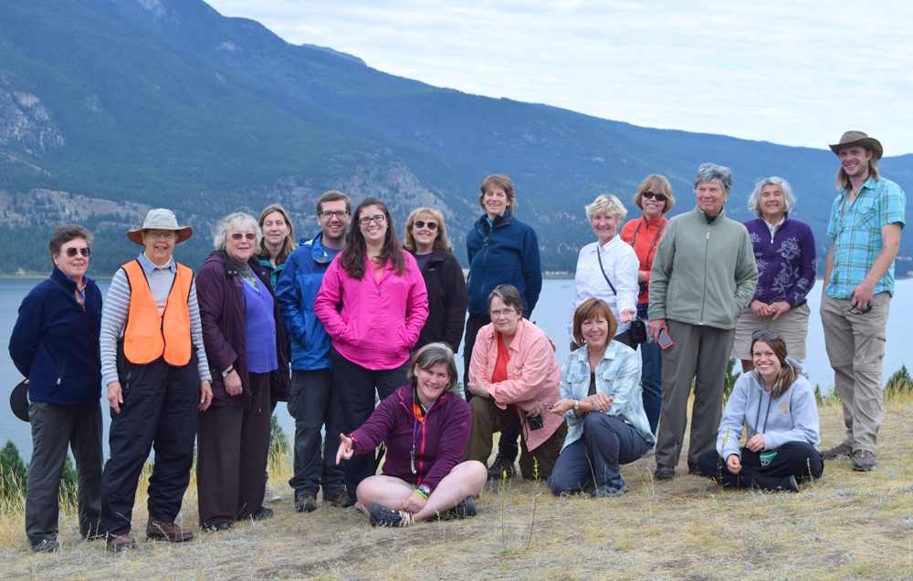
Our field trip group poses by Columbia Lake, which forms the headwaters for both the Columbia and Kootenay rivers, and lies within the enigmatic Rocky Mountain Trench near Canal Flats, British Columbia.

Our field trip group poses by Columbia Lake, which forms the headwaters for both the Columbia and Kootenay rivers, and lies within the enigmatic Rocky Mountain Trench near Canal Flats, British Columbia.

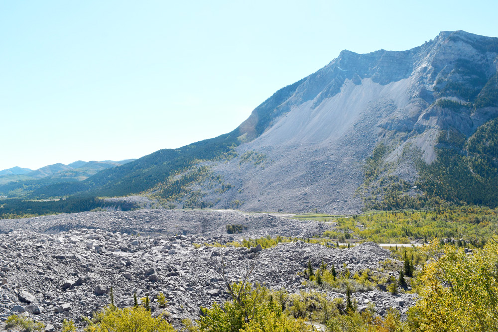
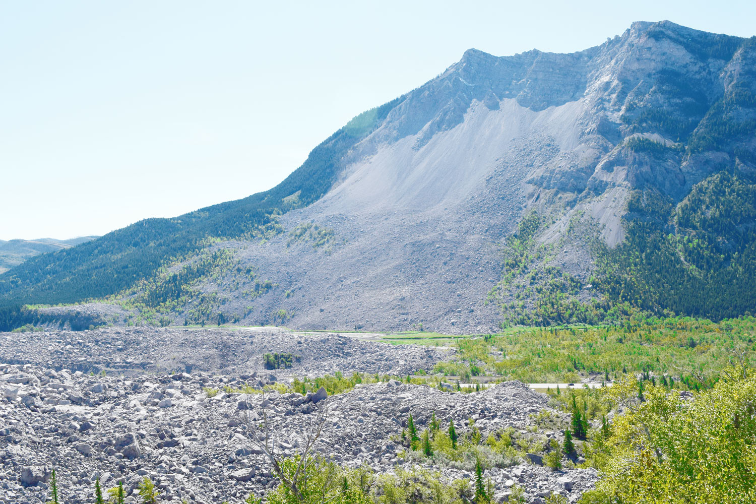
The Frank Slide was a must-stop as we drove along the Crowsnest Highway near Blairmore, Alberta. The slide happened on April 29, 1903, when about 82 million tons of limestone fell off of Turtle Mountain.

The Frank Slide was a must-stop as we drove along the Crowsnest Highway near Blairmore, Alberta. The slide happened on April 29, 1903, when about 82 million tons of limestone fell off of Turtle Mountain.

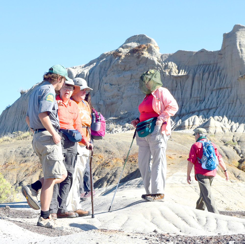
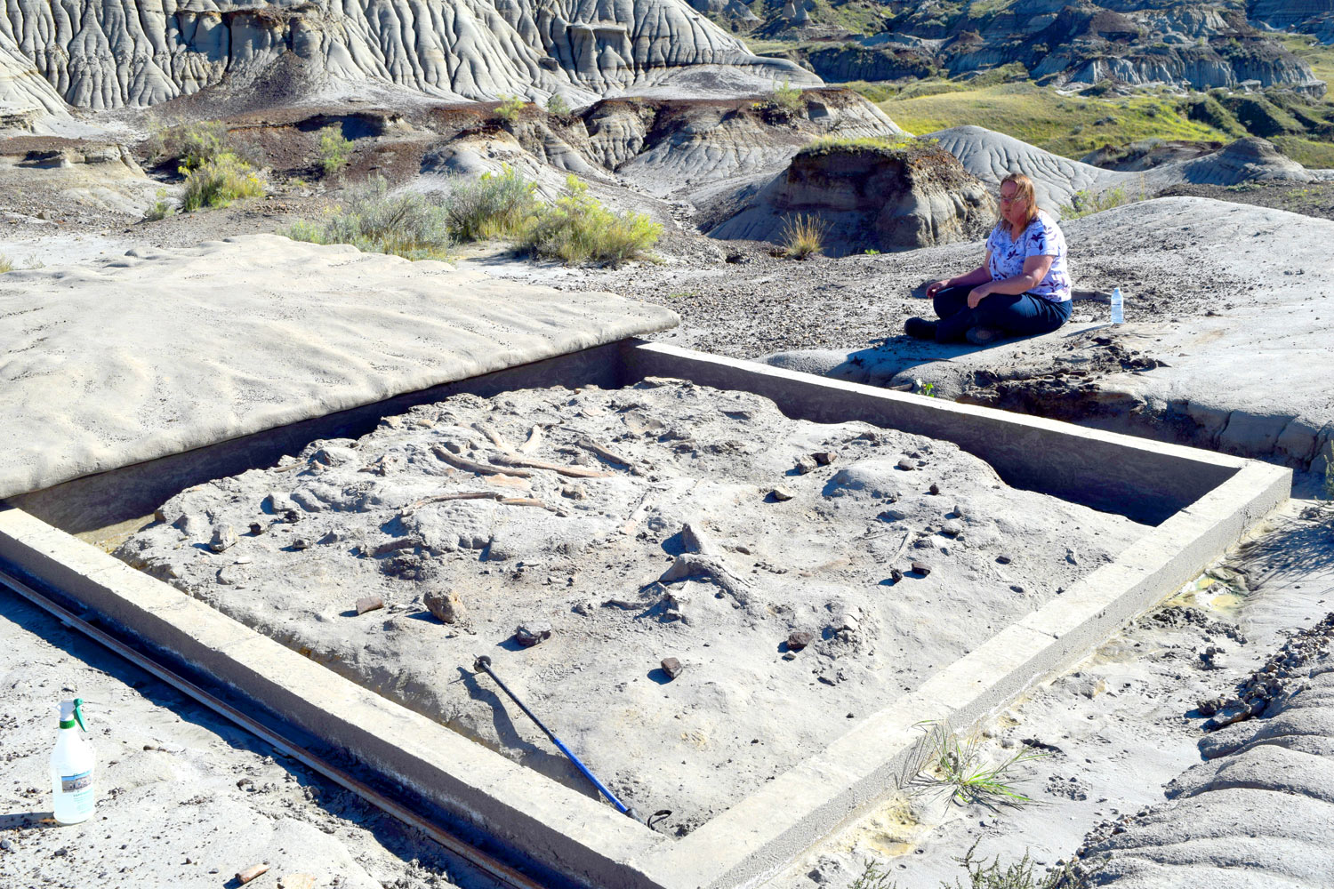
Part of our field trip group discusses Centrosaur Bone Bed 43 during our guided hike at Dinosaur Provincial Park, Alberta.

Part of our field trip group discusses Centrosaur Bone Bed 43 during our guided hike at Dinosaur Provincial Park, Alberta.

Notes From the Field – The Rest of the 2014 AWG Geology Field Trip

The 2014 AWG Canadian Rockies Geology Field Trip did actually end last Sunday (9/7) and we did indeed make it back to Calgary largely unscathed. As many of you probably know, when lodging amenities state that WiFi is included, it most likely means that one can check email – not post blogs with photos of any size, or maybe not even post blogs without photos. Anyways, we did run out of somewhat viable WiFi in our remaining travels. So – this blog is a brief summary of what other adventures awaited us on the road from Revelstoke, B.C. to Fernie, B.C., and then eastward to Dinosaur Provincial Park near Brooks, Alberta, and finally to the amazing Royal Tyrrell Museum at Drumheller, Alberta.

Dutch Creek Hoodoos at mouth of Dutch Creek along Highway 93/95 south to Cranbrook, B.C.. The hoodoos are calcite-cemented Quaternary deltaic foresets deposited at edge of Glacial Lake Invermere.

Dutch Creek Hoodoos at mouth of Dutch Creek along Highway 93/95 south to Cranbrook, B.C.. The hoodoos are calcite-cemented Quaternary deltaic foresets deposited at edge of Glacial Lake Invermere.


View southeastward of the Rocky Mountain Trench along Highway 93/95 South where Columbia Lake forms the headwaters to both the Columbia and Kootenay Rivers.

View southeastward of the Rocky Mountain Trench along Highway 93/95 South where Columbia Lake forms the headwaters to both the Columbia and Kootenay Rivers.


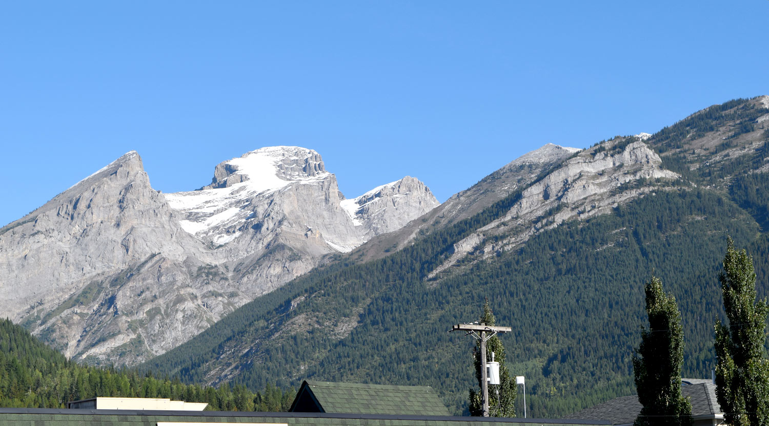
The Three Sisters as viewed from Fernie, B.C.. All the rock units are upside down, with the Devonian Palliser Formation comprising the top of the far left "sister" and the Mississippian Rundle Formation overlying the Triassic Spray River Group (in the lower right of photo and occurring mostly in tree-covered slopes) via the Hosmer Thrust.

The Three Sisters as viewed from Fernie, B.C.. All the rock units are upside down, with the Devonian Palliser Formation comprising the top of the far left “sister” and the Mississippian Rundle Formation overlying the Triassic Spray River Group (in the lower right of photo and occurring mostly in tree-covered slopes) via the Hosmer Thrust.


The Frank Slide, located east of the towns of Coleman and Blairmore, Alberta, in the Crowsnest Pass area. The slide occurred on 4/29/1903. when 82 million tons of limestone fell off Turtle Mountain, burying part of the town of Frank, Alberta.

The Frank Slide, located east of the towns of Coleman and Blairmore, Alberta, in the Crowsnest Pass area. The slide occurred on 4/29/1903. when 82 million tons of limestone fell off Turtle Mountain, burying part of the town of Frank, Alberta.


Dinosaur Provincial Park near Brooks, Alberta - the darker colored unit, the Dinosaur Park Formation sits atop the lighter colored, Oldman Formation. Both units are placed within the Cretaceous (Campanian) Belly River Group.

Dinosaur Provincial Park near Brooks, Alberta – the darker colored unit, the Dinosaur Park Formation sits atop the lighter colored, Oldman Formation. Both units are placed within the Cretaceous (Campanian) Belly River Group.


Centrosaur bone bed located near the central part of Dinosaur Provincial Park. Our group had an amazing guided tour to this bone bed which occurs in the Dinosaur Park Formation.

Centrosaur bone bed located near the central part of Dinosaur Provincial Park. Our group had an amazing guided tour to this bone bed which occurs in the Dinosaur Park Formation.


Finally - the Royal Tyrrell Museum at Drumheller, Alberta. The museum has fantastic displays, and of course I spent much time in their Burgess Shale faunal reconstruction display!

Finally – the Royal Tyrrell Museum at Drumheller, Alberta. The museum has fantastic displays, and of course I spent much time in their Burgess Shale faunal reconstruction display!


Notes From The Field – Revelstoke to the Okanagan

Finally we had a mostly sunny day! We began the day with a tour of the Revelstoke Dam. This dam was one of the last Canadian dams built within the Columbia River watershed. The dam area is really interesting because just across the highway from the dam is the Columbia River Fault zone – a Early to Middle Eocene crustal-scale, east-dipping, extensional fault zone that follows the Columbia River Valley near Revelstoke. Now that was a bit disconcerting for me as I looked at the zone while standing on the top of the dam structure. Our group split up after the dam tour, and I went with the group to the Okanagan Valley. Among our stops were: 1. Three Valley Lake for a look at the hanging wall of the Monashee decollment, Craigellachie, where the last spike of the Canadian Pacific Railway was set in 1885, and the Okanagan-Eagle River Fault zone. Below are some of the day’s photos….

Revelstoke Dam spillway

Revelstoke Dam spillway


Mass wasting in rocks cut by the Columbia River Fault Zone near the Revelstoke Dam.


Rocks of the Three Valley assemblage – pelitic gneisses and mica schists – are cut by mafic dikes.

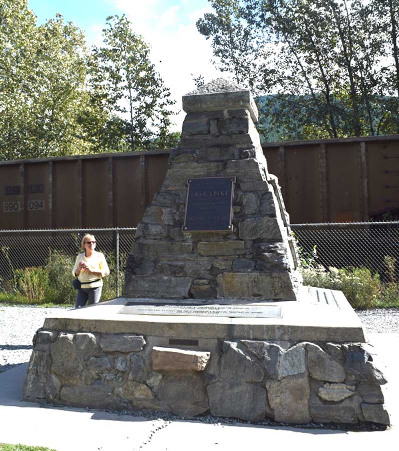
The last spike cairn at Craigellachie.

The last spike cairn at Craigellachie. Note the coal train in the background going by the cairn.


Quest for the Eagle River fault zone.