IIRSA and the Manta-Manaus Corridor
The Initiative for the Integration of Regional Infrastructure in South America (IIRSA) is a throw-back to the days of big development schemes and the dreams of southern country governments (and northern lending institutions) for the energy, infrastructure, and communications integration of South America. IIRSA in fact is some 510 projects, a hodge-podge of dams, roads, power plants, waterways, and multi-modal corridors connecting them all.
One of IIRSA's central projects is known as the Manta-Manaus corridor, which is designed to connect the port city of Manta on Ecuador's Pacific coast with Manaus, a bustling river port in western Brazilian, essentially creating a cross-continental alternative to the Panama Canal. The corridor is multi-modal, consisting of a series of projects that include ports, roads, airports, and a waterway.
There are major environmental and indigenous rights concerns about all aspects of the corridor. Short-term right of way (ROW) issues—the effects of actual construction on the place and people—are many, including the attempt to dredge one of the Amazon's most mighty and wild rivers. But it's the project's overall long-term impact that raises the largest concerns. The goal of Manta-Manaus is to improve imports and exports between Asian markets and the Amazon. Opening up a channel into the heart of the Amazon for products to and from China, the world's second largest economy, would only exacerbate existing drivers of rainforest deforestation, and potentially create a more economically convenient transportation option for illegally logging timber, agro-fuels, soy, and spur further oil and gas exploration in some of the Amazon's most remote areas.
While parts of the Manta-Manaus mega-project are underway, such as roads between Manta and the Andes, and a new airport in Tena, the major linchpin of the project is the Napo River between the Amazonian town of Coca and northern Peru. The Napo is the northern border of Ecuador's heralded Yasuni National Park, and is an untamed, powerful river whose banks and route dramatically change throughout the year. In order to make the river navigable for large barges and containers ships moving heavy machinery and products, the Napo would have to be dredged, something Ecuador's military oceanographic institute says is impossible year round. The river may be navigable with dredging at best three months per year, calling into question much of the economic justification for the project. Other questions remain as to whether the route will indeed be shorter, and more cost effective, than the Panama Canal. Some experts are calling this the latest Latin America boondoggle, as the "if you build it, they will come" mentality of the banks and governments has little concrete evidence to back the project's touted benefits to the region.
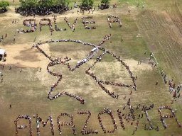
IIRSA and the Manta-Manaus have become tainted words throughout the Amazon, as indigenous groups like COICA and others denounce the projects as threats to their territories. In Ecuador, the Kichwa federation representing many who live along the Napo River, have declared outright opposition to the project and have refused to participate in an IDB-funded pre-feasibility study examining the social and environmental elements of increased commercial integration between Ecuador and Peru, including a preliminary analysis of the river's navigability. Though the IDB claims the study has nothing to do with Manta-Manaus and IIRSA and is merely a result of the 2001 peace accords signed between both countries, the study will obviously have major implications for the corridor, and can clearly be considered the first phase of the project.